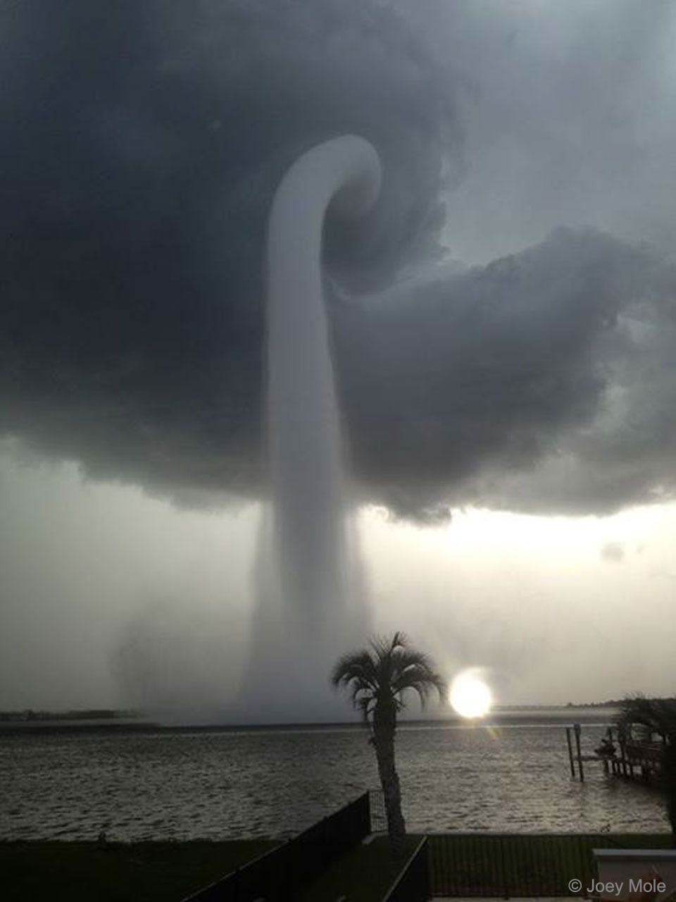
This dramatic image shows a waterspout formed off the coast of Florida. Waterspouts come in two varieties: tornadic and fair-weather. Both types can be dangerous to anyone caught up in them, though the tornadic variety, which are usually associated with severe thunderstorms, is generally worse. Tornadic waterspouts can form top-down from a thunderstorm or when a tornado moves from land to water. Fair-weather waterspouts, on the other hand, typically form from the bottom, in a similar fashion to dust devils and other fair-weather vortices. (Image credit: J. Mole; via APOD)
Tag: meteorology

Mammatus Clouds

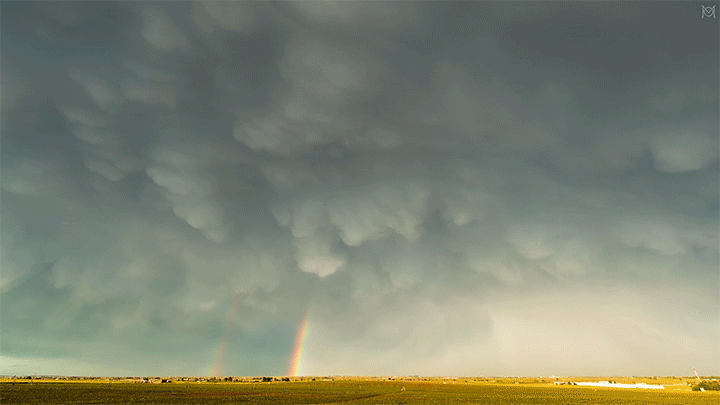

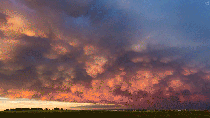
Mammatus clouds are a relatively rare and dramatic variety. One advantage of living in Colorado is that I see them somewhat often, especially during our stormy springs and summers. This video by Mike Olbinski features a dramatic skyscape of mammatus clouds (here in Colorado, natch) at sunset.
Although they’re often associated with stormy weather, there’s no widely accepted theory as to how mammatus clouds form. Their lobe-like protrusions form from cold, sinking air, but this is about as far as theories agree. It’s even unclear what their relation to extreme weather may be since these short-lived cloud formations can appear around, before, or even after such weather. (Image and video credit: M. Olbinski)
A Year From Geostationary Orbit
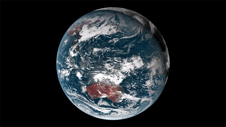

Our planet is a complex fluid dynamical system, and one of the best ways to watch nature at work is through timelapse. This short film takes us through an entire year, from December 2015 to December 2016, as viewed from a geostationary weather satellite centered over Oceania.
The imagery is rather hypnotic, with clouds swirling day and night across the full field of view. Watch closely, though, and you’ll see a lot of neat phenomena from typhoons forming in the Pacific to wave clouds streaming from the islands of Japan. You can also see clouds blossoming (especially during the day) over the humid rainforests of Oceania.
There are neat non-fluids phenomena, too, like a total solar eclipse and the permanent sunlight of Arctic and Antarctic summers. What do you notice? (Image and video credit: F. Dierich)
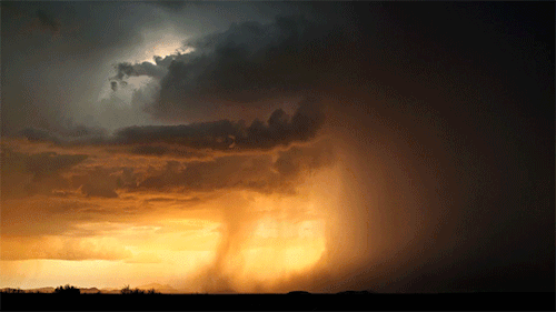
“Stormscapes 4”


Frightening as they can be in the moment, storms have a power and majesty all their own. I’ve never seen a better way to capture that than through timelapse, and photographer Nicolaus Wegner offers a great one in “Stormscapes 4″. I particularly like how his frame captures the motion of storms and how they shear, rotate, and billow as they evolve. With a quick glance upward, it’s easy to miss that motion, even if it is fundamental to these storms. Sit back and enjoy. (Video and image credit: N. Wegner)

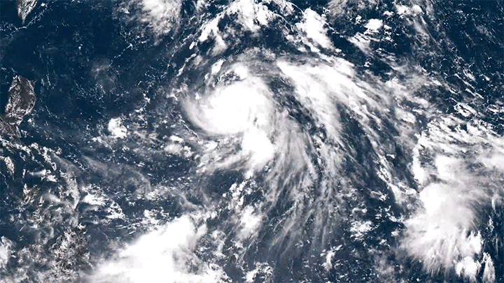
Swirling Vortex
So much of fluid dynamics comes down to finding the right way to observe a flow. This image of a swirling tropical system was captured by an astronaut aboard the International Space Station in April 2019. The low sun angle at the time makes the shadows stretch long across the cloud tops, giving them greater definition as well as a tint of sunset color. As drastic as the system looks from this angle, it was a short-lived vortex that never made landfall, so it was never officially named. (Image credit: Expedition 59 Crew; via NASA Earth Observatory)

Wave Clouds in the Front Range
Last Sunday night metro Denver was treated to a rare sight: clouds resembling breaking waves formed near sunset. These are Kelvin-Helmholtz clouds, and the comparison to ocean waves is apt, since the same physics is behind both. Winds were unusually calm near the ground Sunday night, but strong winds blew at the altitude just above the lower cloud layer. That velocity difference created strong shear where the two air layers met. With the cloud layer in place to differentiate the slower-moving air from the faster, we can what’s normally invisible: how the two air layers mix.
The Denver Post has several more views of the wave clouds from around the area, and you can learn lots more about the Kelvin-Helmholtz instability here. (Image credit: R. Fields; via the Denver Post)

“Transient 2”

Where cold and warm air meet, our atmosphere churns with energy. From the turbulence of supercell thunderclouds to the immense electrical discharge of lightning, there’s much that’s breathtaking about stormy skies. Photographer Dustin Farrell explores them, with a special emphasis on lightning, in his short film, “Transient 2″.
As seen in high-speed video, lightning strikes begin with tree-like leaders that split and spread, searching out the path of least resistance. Once that line from cloud to ground is discovered, electrons flow along a plasma channel that arcs from sky to earth. The estimated temperatures in the core of this plasma reach 50,000 Kelvin, far hotter than the Sun’s surface. It’s this heating that generates the blue-white glow of a lightning bolt. The heating also expands the air nearby explosively, producing the shock wave we hear as a crash of thunder. (Images and video credit: D. Farrell et al.; via Colossal)

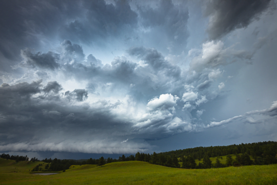
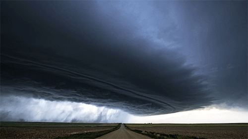
Waves on a Supercell
This Colorado supercell thunderstorm features an unusual twist. Notice the sawtooth-like protrusions along the outer cloud wall. These are Kelvin-Helmholtz waves, like these fair-weather clouds we’ve seen before, but instead of occurring vertically, they project horizontally! That implies that the invisible layer of air just outside the cloud wall is moving faster than the wall itself. That creates shear along the outer edge of the cloud wall and causes these waves to form. This is the first time I’ve ever seen this sort of thing. What an awesome photo! (Image credit: M. Charnick; submitted by jpshoer)

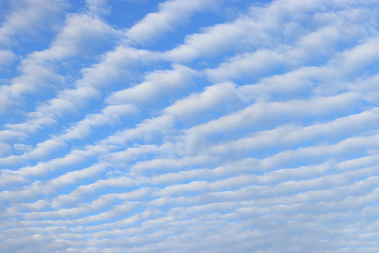
Striped Clouds
Living near the Rocky Mountains, it’s not unusual to look up and find the sky striped with lines of clouds. Such wave clouds are often formed on the lee side of mountains and other topography. But even in the flattest plains, you can find clouds like these at times. That’s because the internal waves necessary to create the clouds can be generated by weather fronts, too.
Imagine a bit of atmosphere sitting between a low-pressure zone and a high-pressure zone. This will be an area of convergence, where winds flow inward and squeeze the fluid parcel in one direction before turning 90 degrees and stretching it in the perpendicular direction. The result is a sharpening of any temperature gradient along the interface. This is the weather front that moves in and causes massive and sudden shifts in temperature.
On one side of the front, warm air rises. Then, as it loses heat and cools, it sinks down the cold side of the front. The sharper the temperature differences become, the stronger this circulation gets. If the air is vertically displaced quickly enough, it will spontaneously generate waves in the atmosphere. With the right moisture conditions, those waves create visible clouds at their crests, as seen here. For more on the process, check out this article over at Physics Today. (Image credit: W. Velasquez; via Physics Today)
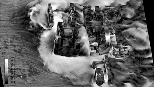
Urban Centers During Hurricanes
As the climate warms, many urban centers are facing stronger and more frequent storms. Some, like New York City, are using numerical simulations to better understand the interactions of their complicated urban geometries with hurricane force winds.
Above you see a simulation showing predicted wind speeds in a Lower Eastside neighborhood. The incoming wind speed (from the left) is roughly 60 m/s (~134 mph), but the speeds around and between buildings are as much as 2 times higher than that. That means that, even if a storm is Category 3 or 4, there will be areas of a neighborhood that receive sustained winds well beyond the range of a Category 5 hurricane. Urban planners need this sort of data both for devising building requirements and for understanding what storm conditions warrant mandatory evacuations for residents. (Video and image credit: X. Jiang et al.)