Tag: meteorology

  • AI-Based Weather Forecasting Has Blind Spots

    AI-Based Weather Forecasting Has Blind Spots

    Traditional weather forecasting models are physics-based and rely on supercomputers. Practically speaking, this means that they start from the basic governing equations (like the Navier-Stokes equations) and use approximations to model aspects of the problem in order to make the physics solvable, given constraints on time, computational power, spatial resolution, and so on.

    So-called AI models approach the problem differently, training a model on past weather conditions in order to predict future weather. In some respects, this approach is very successful; AI-based models require less computational infrastructure to run and, in recent years, have greatly improved their predictions of everyday weather.

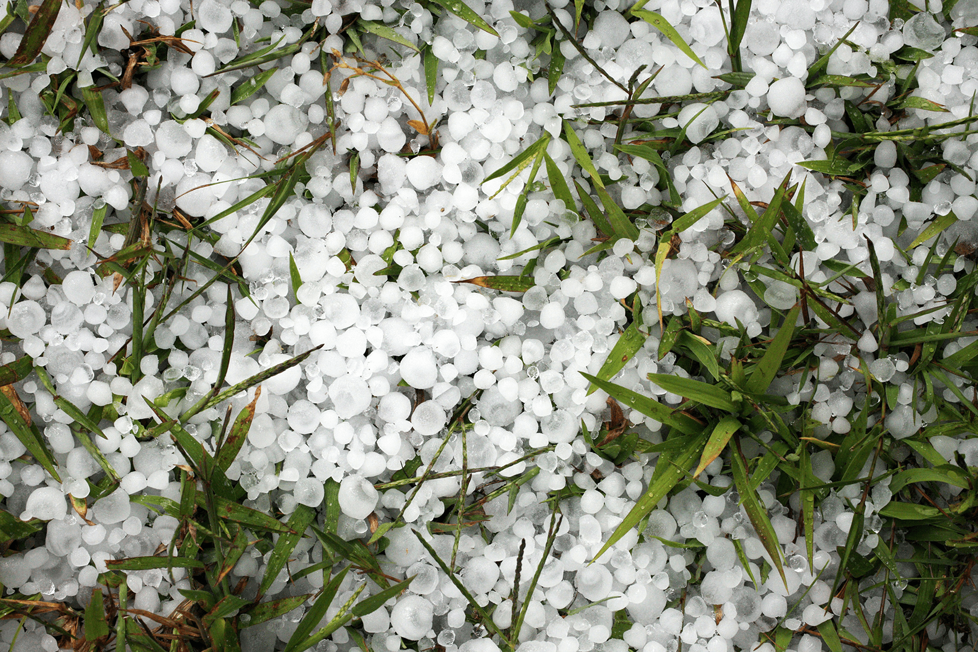
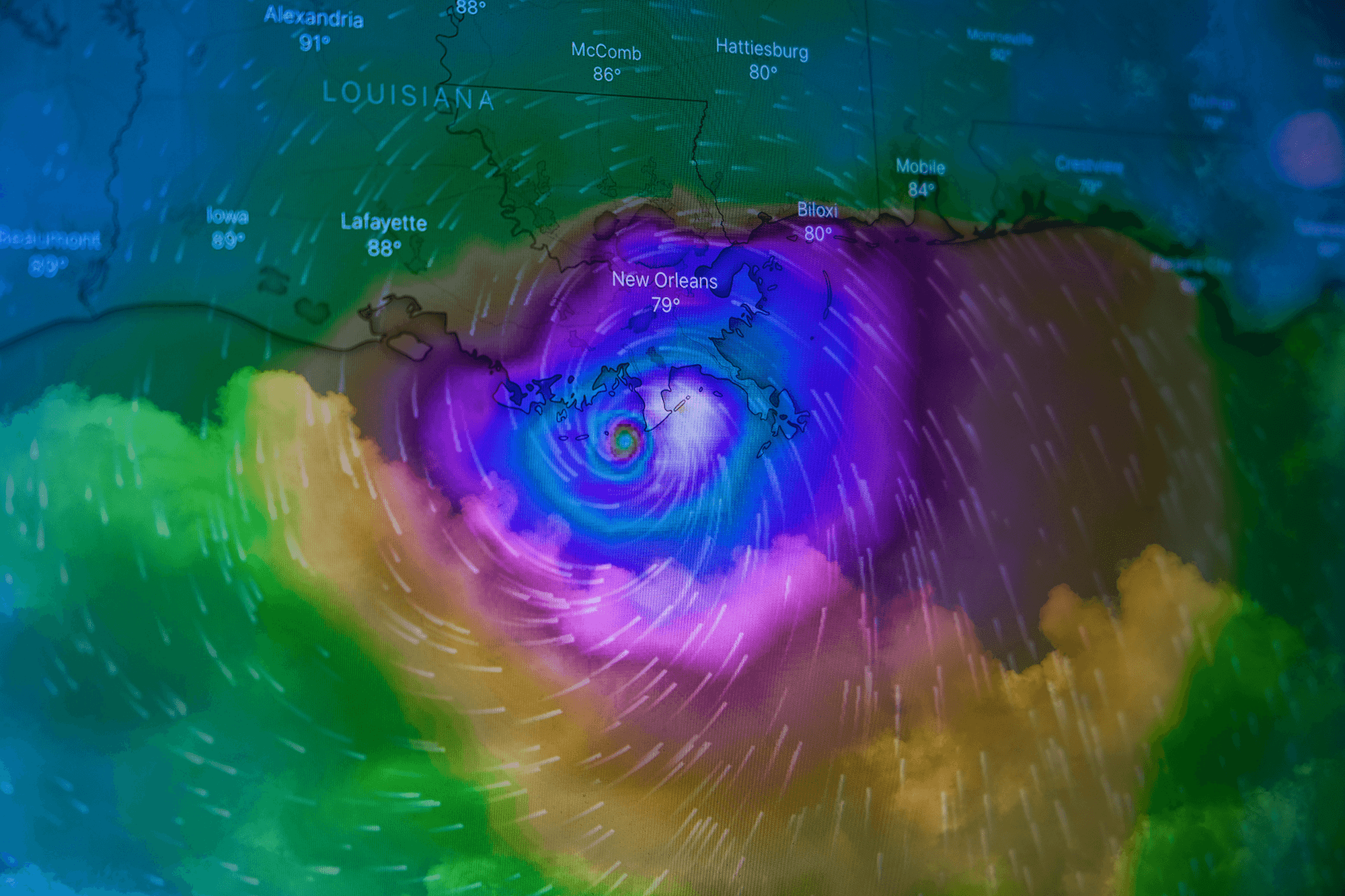
    However, these AI models do poorly when predicting extreme weather events, because their training data contain relatively few examples of these events. They show limited ability to extrapolate their predictions to more extreme events. But these events–like the unprecedented 2021 heatwave in the Pacific Northwest or many of the Category 5 hurricanes we’ve seen in the last decade–are happening increasingly often due to climate change. Those events will keep happening, more frequently, as warming continues. Physics-based models can predict and forecast these events in ways that AI-based models fail to because they are limited by their trained experiences.

    Researchers are working to find ways to better equip AI-based models with more physical sense, but, as these models proliferate, it’s important for their users (and those of us using their forecasts) to know what their current weaknesses are. (Image credit: B. McGowan; research credit: Y. Sun et al.; see also S. Nath and T. Palmer; via Gizmodo)

    Fediverse Reactions
  • Featured Video Play Icon

    “The Haboob”

    Haboobs are a dust storm driven by the strong winds at the forefront of weather fronts and thunderstorms. Those powerful winds pick up dust in arid and semi-arid landscapes, creating billowing, turbulent clouds that appear downright apocalyptic.

    This particular haboob formed in Arizona in August 2025 and was caught in timelapse by photographer and storm chaser Mike Olbinski. The visuals–as always–are incredible. Definitely watch to the very end, as the haboob advances on the runway at Sky Harbor Airport. The tension is palpable as you watch flights line up and try to make it off the ground before the haboob swallows them. (Video and image credit: M. Olbinski)

    Fediverse Reactions
  • Featured Video Play Icon

    Recreating Atmospheric Rivers

    During the winter months, those of us living in the mid-latitudes sometimes experience atmospheric rivers. Formed from the interaction of cold winter storms with warm, moist tropical air, atmospheric rivers can deliver intense rainfall across long distances. In this video, the UCLA SpinLab team shows how you can recreate the effect with a relatively simple and affordable DIYnamics apparatus. (Video and image credit: UCLA SpinLab)

  • Sprites and ELVES

    Sprites and ELVES

    Although we are most familiar with the white, branching lightning caused by electrical discharge between clouds and the ground, there are many types of lightning. This fortuitous image captures two: tentacled red sprites and ring-like ELVES. Sprites extend upward from the top of a thunderstorm, in a large but weak flash that lasts only seconds. ELVES appear as a rapidly-expanding disc, thought to be caused by an energetic electromagnetic pulse moving into the ionosphere. They were first discovered in footage from a 1992 Space Shuttle mission. (Image credit: V. Binotto; via APOD)

    Fediverse Reactions
  • Albuquerque: Balloonist Paradise

    Albuquerque: Balloonist Paradise

    Albuquerque, New Mexico’s unique weather characteristics make it a popular destination for hot-air balloonists. While balloonists can control their altitude by warming or venting the air in their balloon, their horizontal travel comes at the mercy of the wind. (Just ask the erstwhile Wizard of Oz.) What makes Albuquerque special is a combination of topography, dry air, and altitude. Together, these features create the “Albuquerque box,” a circulation that gives south-flowing drainage winds below north-flowing prevailing winds.

    The key to the box’s flow is a temperature inversion, where cooler, denser air is trapped near the surface and lighter, warmer air sits above. This typically occurs after a night of clear skies when much of the ground layer’s warm gets radiated away to space — something that’s easily done in high, dry altitudes.

    Temperature inversions like this don’t last very long, though; by late morning, the sun’s warmth will dismantle the Albuquerque box. Still, it is a frequent enough occurrence, especially in the stable atmospheric conditions common in the autumn, that the city hosts an International Balloon Fiesta every October. (Image credit: B. Bos; via Physics Today)

    Fediverse Reactions
  • Dusty Clouds Make More Ice

    Dusty Clouds Make More Ice

    Even when colder than its freezing point, water droplets have trouble freezing–unless there’s an impurity like dust that they can cling to. It’s been long understood in the lab that adding dust allows water to freeze at warmer temperatures, but proving that at atmospheric scales has been harder. But a new analysis of decades’ worth of satellite imagery has done just that. The team showed that a tenfold increase in dust doubled the likelihood of cloud tops freezing.

    Since ice-topped clouds reflect sunlight and trap heat differently than water-topped ones, this connection between dust and icy clouds has important climate implications. (Image and research credit: D. Villanueva et al.; via Eos)

    Fediverse Reactions
  • Aboard a Hurricane Hunter

    Aboard a Hurricane Hunter

    For decades, NOAA has relied on two WP-3D Orion aircraft–nicknamed Kermit and Miss Piggy–to carry crews into the heart of hurricanes, collecting data all the while. Every ride aboard a Hurricane Hunter is a bumpy one, but some flights are notorious for the level of turbulence they see. In a recent analysis, researchers used flight data since 2004 (as well as a couple of infamous historic flights) to determine a “bumpiness index” that people aboard each flight would experience, based on the plane’s accelerations and changes in acceleration (i.e., jerk).

    The analysis confirmed that a 1989 flight into Hurricane Hugo was the bumpiest of all-time, followed by a 2022 flight into Hurricane Ian, which was notable for its side-to-side (rather than up-and-down) motions. Overall, they found that the most turbulent flights occurred in strong storms that would weaken in the next 12 hours, and that the bumpiest spot in a hurricane was on the inner edge of the eyewall. That especially turbulent region, they found, is associated with a large gradient in radar reflectivity, which could help future Hurricane Hunter pilots avoid such dangers. (Image credit: NOAA; research credit: J. Wadler et al.; via Eos)

    Fediverse Reactions
  • Inside Hail Formation

    Inside Hail Formation

    Conventional wisdom suggests that hailstones form over the course of repeated trips up and down through a storm, but a new study suggests that formation method is less common than assumed. Researchers studied the isotope signatures in the layers of 27 hailstones to work out each stone’s formation history. They found that most hailstones (N = 16) grew without any reversal in direction. Another 7 only saw a single period when upwinds lifted them, and only 1 of the hailstones had cycled down-and-up more than once. They did find, however, that hailstones larger than 25mm (1 inch) in diameter had at least one period of growth during lifting.

    So smaller hailstones likely don’t cycle up and down in a storm, but the largest (and most destructive) hailstones will climb at least once before their final descent. (Image credit: D. Trinks; research credit: X. Lin et al.; via Gizmodo)

    Fediverse Reactions
  • Atmospheric Rivers Raise Temperatures

    Atmospheric Rivers Raise Temperatures

    Atmospheric rivers are narrow streams of moisture-rich air running from tropical regions to mid- or polar latitudes. Though relatively short-lived, they are capable of carrying — and depositing — more water than the largest rivers. But researchers have found that their impact is not measured in water content alone. Instead, a survey of 43 years’ worth of data shows that atmospheric rivers also bring unusually warm temperatures. In some cases, the authors found surface temperatures near an atmospheric river climbed to as high as 15 degrees Celsius above the typical. On average, temperatures were about 5 degrees Celsius higher than expected for the region’s climate.

    Several factors raise those temperatures — like the heat released when rising vapor meets cooler air and condenses into liquid — but the biggest effect came from carrying warm tropical temperatures to (usually) cooler regions. (Image credit: L. Dauphin/NASA; research credit: S. Scholz and J. Lora; via Physics Today)

    Fediverse Reactions
  • Derecho-Induced Skyscraper Damage

    Derecho-Induced Skyscraper Damage

    Derechos are short-lived, intense wind storms sometimes associated with thunderstorms. Last spring, such a storm passed through Houston, leaving downtown skyscrapers with more damage than a hurricane with comparable wind speeds. Now researchers believe they know why a derecho’s 40 meter per second winds can badly damage buildings built to withstand 67 meter per second hurricane winds.

    In surveying the damage to Houston’s skyscrapers, the team noted that broken windows were concentrated in areas that faced other tall buildings. In a wind facility, the team explored how skyscrapers interfered with each other, based on their separation difference. They looked both at conditions that mimicked a hurricane’s winds as well as the downbursts — strong downward wind bursts — that are found in derechos.

    The researchers found that downbursts in between nearby buildings caused extremely strong suction forces along a building’s face — even compared to the forces seen with higher hurricane-force winds. Currently, these buildings are designed for hurricane-like conditions, but the team suggests that — at least in some regions — designers will need to take into account how downburst wind patterns affect a skyscraper, too. (Image credit: National Weather Service; research credit: O. Metwally et al.; via Ars Technica)

    Fediverse Reactions