Tag: meteorology

  • How Squall Lines Form

    How Squall Lines Form

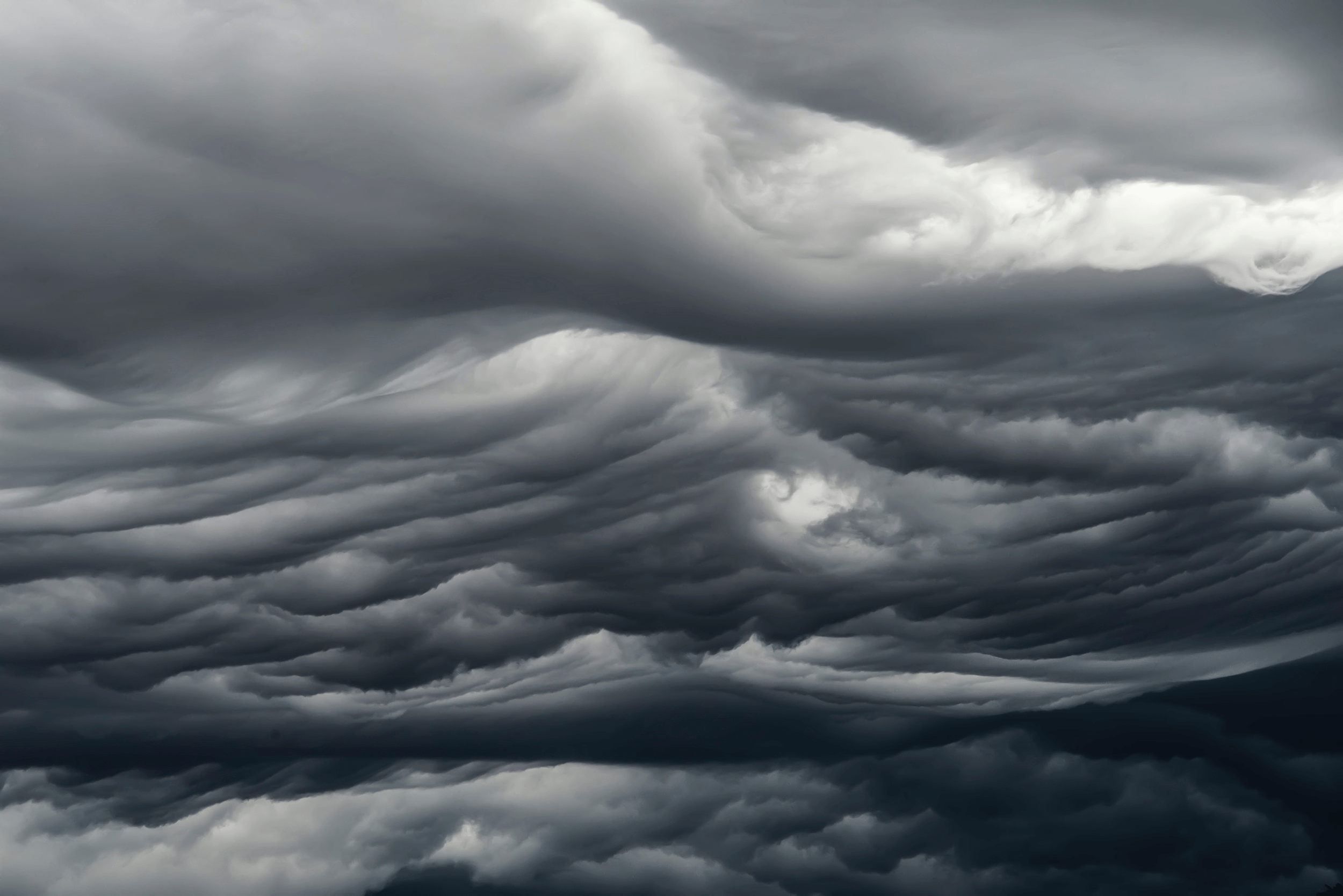
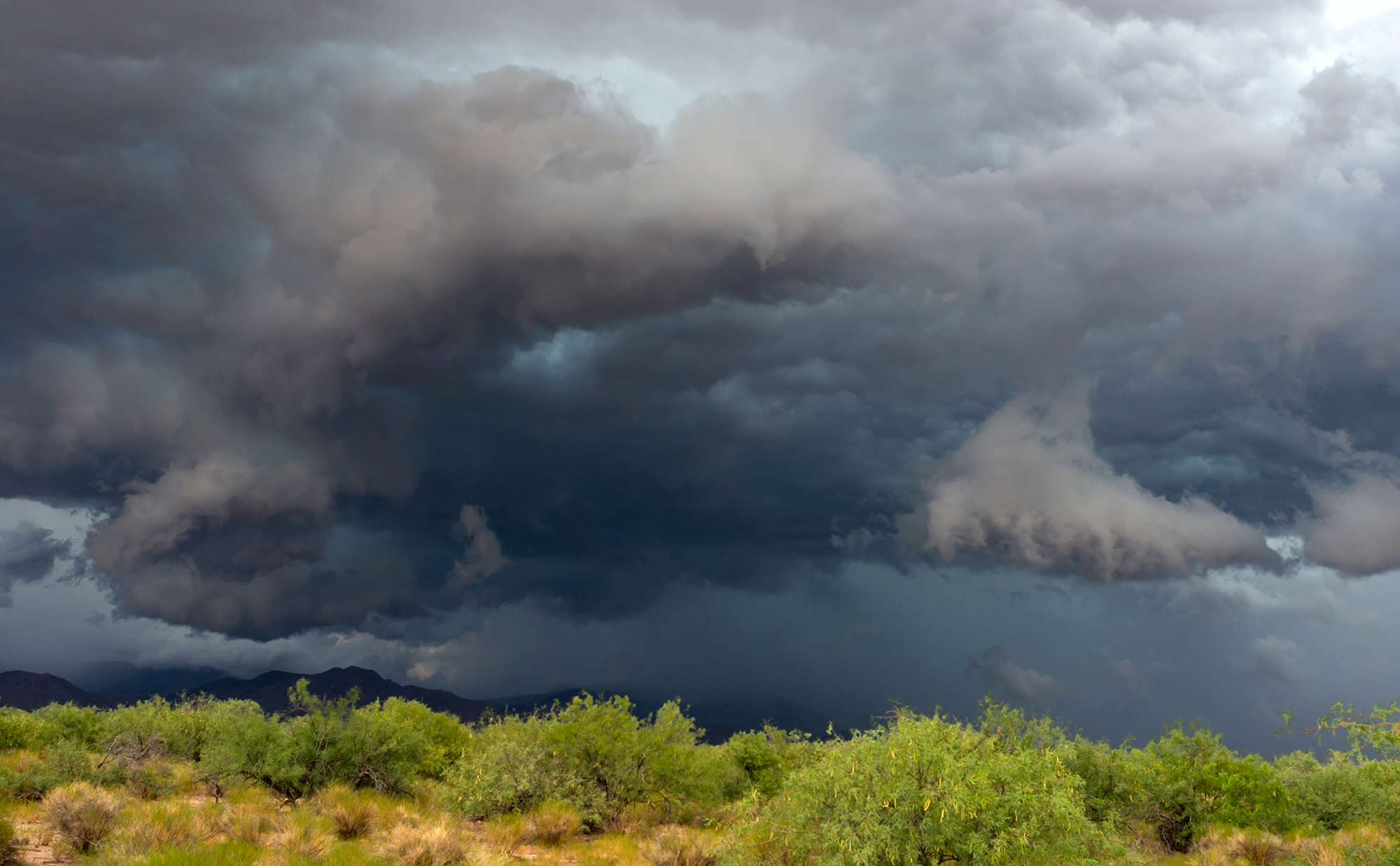
    Summertime in the middle U.S. means thunderstorms, many of which can form long lines of storms known as squall lines. Complex convective dynamics feed such storms. Here is an illustration of one part of a squall’s lifecycle:

    Illustration of squall line formation.
    As rain falls and evaporates, it fuels the formation of a cold pool of air below the cloud. Incoming wind (gray arrows) blocks the cold pool from spreading. In turn, the cold pool acts as a ramp that redirects this warm, moist air upward. The vertical variation in wind speed (wind shear, shown with pink arrows) creates a positive vorticity. Together with the negative vorticity in the cold pool, this induces a vorticity dipole that lifts air and moisture, feeding the growing line of storms.

    As it falls, rain evaporates, cooling air near the ground and forming a cold pool. If incoming winds block the cold pool from spreading, the pool will act instead as a ramp that redirects the wind upward, carrying any warmth and moisture up into the storm cloud. Wind shear — a vertical variation in wind strength with altitude — creates positve vorticity that opposes the negative vorticity inherent to the cold pool. Together these two regions of opposing vorticity lift more air and moisture into the squall, generating more clouds and more rainfall. (Image credit: top – J. Witkowski, illustration – C. Muller and S. Abramian; see also C. Muller and S. Abramian)

  • Featured Video Play Icon

    “Níłtsą́”

    Living in the central and western United States, it’s easy to dismiss summer weather as just another storm, but the truth is that this region sees some of the most majestic and spectacular thunderstorms in the world. And no one captures that grandeur better than storm-chasing photographer Mike Olbinski. His latest film is named for the Navajo word for rain and features over 12 minutes of the best storms from 2021 and 2022. Towering turbulent clouds grow by convection, lightning splits the night sky, and microbursts pour down from above. As always, it’s a stunning depiction of the power of atmospheric fluid dynamics. (Image and video credit: M. Olbinski)

  • Predicting Heat Waves

    Predicting Heat Waves

    The United States, Europe, and Russia have all seen deadly, record-breaking heat waves in recent years, largely in areas that are ill-equipped for sustained high temperatures. A new paper presents a theory that predicts how hot these heat waves can get and what mechanism ultimately breaks the hot streak.

    Heat waves start when an area of high-pressure air forms over land, with an anticyclone circulating around it. Air at the center of the zone warms and rises, and if the anticylone can’t move, temperatures will just keep rising. Despite the heat, there is still moisture in the rising air of a heat wave. The authors found that if that moist air can reach an altitude where the atmospheric pressure is 500 hPa (a typical altitude of 5-7 km), then the maximum daily temperature will stop rising. At that altitude, the moist air can condense into rain, and, even if that rain evaporates before reaching the ground, it is enough to cool temperatures.

    The key variable in the theory is the atmospheric temperature at 500 hPa, something that meteorological models are able to predict well up to three weeks in advance. That means this theory should enable meteorologists to give advanced warning of high temperatures, helping communities prepare. (Image credit: T. Baginski; research credit: Y. Zhang and W. Boos; via APS Physics)

  • Ominous Mammatus

    Ominous Mammatus

    Mammatus clouds are fairly unusual and often look quite dramatic. Most clouds have flat bottoms, caused by the specific height and temperature at which their droplets condense. But mammatus clouds have bubble-like bottoms that are thought to form when large droplets of water or ice sink as they evaporate. Although they can occur in the turbulence caused by a thunderstorm, mammatus clouds themselves are not a storm cloud. They appear in non-stormy skies, too. The clouds are particularly striking when they’re lit from the side, as in the image above. (Image credit: J. Olson; via APOD)

  • Nacreous Clouds

    Nacreous Clouds

    Iridescent clouds shine bright over this Finnish sunset. These colorful clouds are nacreous clouds, also known as mother-of-pearl clouds. Formed from ice crystals during frigid conditions in the lower stratosphere, these clouds are most visible before dawn and after sunset, when their high altitude catches sunlight while the lower atmosphere doesn’t. These rare clouds form mostly in high latitudes during winter. While they appear similar to other iridescent clouds that occur all over the world, nacreous clouds are far brighter and more vivid. (Image credit: D. Lehtonen; via APOD)

  • Cellular Clouds

    Cellular Clouds

    Though tough to make out from the surface, our oceans are often covered by cell-shaped clouds stretching thousands of kilometers. This satellite image shows off two such types of marine stratocumulus cloud. Open-celled clouds appear as thin wisps of vapor around an empty middle; in these clouds, cool air sinks through the center while warm air rises along the edges. Open-celled clouds are good rain producers.

    On the flip side, closed-cell clouds have a vapor-filled center and breaks in the cloud cover along each cell’s edge. These clouds don’t produce much rain, but they do lift warm, moist air through their middles and let cool air sink along their edges. Closed-cell clouds tend to last much longer than their open-celled counterparts; they can stick around for half a day, whereas open-celled clouds break up in only a couple hours. (Image credit: J. Stevens; via NASA Earth Observatory)

  • Cloud Streets

    Cloud Streets

    Parallel lines of cumulus clouds stream over the Labrador Sea in this satellite image. These cloud streets are formed when cold, dry winds blow across comparatively warm waters. As the air warms and moistens over the open water, it rises until it hits a temperature inversion, which forces it to roll to the side, forming parallel cylinders of rotating air. On the rising side of the cylinder, clouds form while skies remain clear where the air is sinking. The result are these long, parallel cloud bands. (Image credit: J. Stevens; via NASA Earth Observatory)

  • Featured Video Play Icon

    Making Hurricanes

    With oceans warming, there’s more energy available to intensify hurricanes. And while our weather models have gotten better at predicting where hurricanes will go, they’re less good at predicting hurricane intensity, largely because capturing real data from storms is so difficult and dangerous. To address that shortfall, engineers build facilities like the one seen here, which simulates hurricane wind and water conditions so that scientists can study their interaction and better understand storm physics. Check out the full Be Smart video for a tour of the facility and a look at their work. (Image and video credit: Be Smart)

  • Asperitas Formation

    Asperitas Formation

    In 2017, the World Meteorological Organization named a new cloud type: the wave-like asperitas cloud. How these rare and distinctive clouds form is still a matter of debate, but this new study suggests that they need conditions similar to those that produce mammatus clouds, plus some added shear.

    Using direct numerical simulations, the authors studied a moisture-filled cloud layer sitting above drier ambient air. Without shear, large droplets in this cloud layer slowly settle downward. As the droplets evaporate, they cool the area just below the cloud, changing the density and creating a Rayleigh-Taylor-like instability. This is one proposed mechanism for mammatus clouds, which have bulbous shapes that sink down from the cloud.

    When they added shear to the simulation, the authors found that instead of mammatus clouds, they observed asperitas ones. But the amount of shear had to be just right. Too little shear produced mammatus clouds; too much and the shear smeared out the sinking lobes before they could form asperitas waves. (Image credit: A. Beatson; research credit: S. Ravichandran and R. Govindarajan)

  • Featured Video Play Icon

    “Haboob: A Decade of Dust”

    From the right vantage point, an approaching dust storm — known as a haboob — can look downright apocalyptic. In this compilation of clips a decade in the making, photographer Mike Olbinski shows these storms in all their terrifying majesty. I love seeing how the cloud front overhead densifies as the dust below advances. Without these wide perspectives, it’s hard to appreciate an approaching haboob. When one blew through Denver a few years ago, I never saw it coming. My first clue was the tree in front of my office window whipping wildly back and forth just before the sky turned brown! I much prefer Olbinski’s versions. Congratulations, Mike, on a decade of haboob-chasing! (Image and video credit: M. Olbinski; submitted by jpshoer)