Tag: sedimentation

  • Two Views of Ocean Eddies

    Two Views of Ocean Eddies

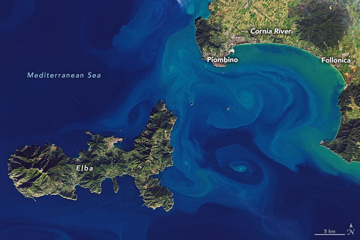
    Colorful, sediment-laden eddies swirl off the Italian coast in this satellite image. These small-scale eddies — less than 10 km in diameter — can be short-lived and are often difficult to capture in numerical models, but remote sensing can help scientists better understand their impact on oceanic mixing, especially when we capture more than one view of the same event.

    The image below shows the same eddies in an infrared (thermal) view. The resolution on this instrument is not as fine as the natural color one, but we can still make out some of the same swirling motions. It’s also worth comparing the features we don’t see in both images. For example, the Cornia River discharges in infrared as a bright, white plume of cooler water, but it’s barely visible in the color-image, suggesting that the river is not contributing much sediment to the bay. (Image credit: USGS; via NASA Earth Observatory)
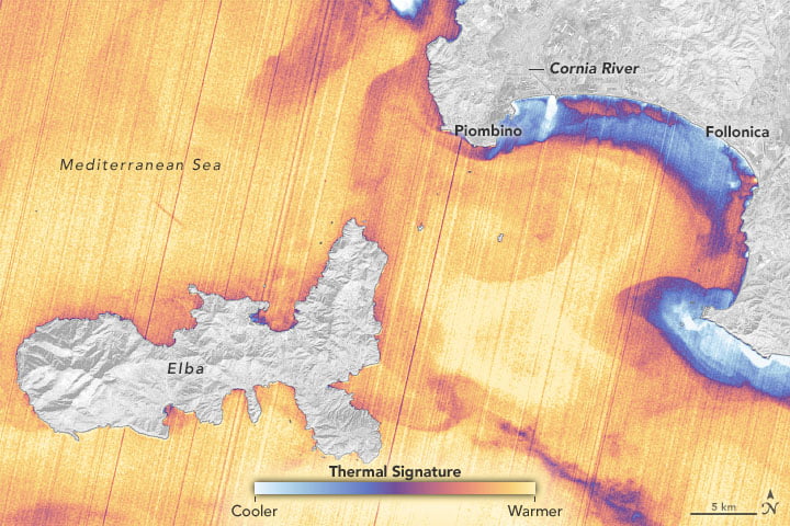
    Infrared satellite image of waters off the coast of Italy.
  • Speeding Sedimentation

    Speeding Sedimentation

    Did you know that particles settle faster in an inclined container instead of a vertical one? This sedimentation phenomenon is known as the Boycott effect, after the researcher who first described it. Boycott noticed that red blood cells settled out of samples faster when the test tubes were inclined.

    The inclined walls give particles a much larger area to settle on. As the particles gather on the wall, it creates a buoyant, particle-free layer of fluid above. That fluid quickly rises to the top of the container, helping to push the sediment further toward the bottom. As you can see in the video below, the Boycott effect drastically reduces settling time. (Video and image credit: C. Kalelkar)

  • Featured Video Play Icon

    Renewing the Colorado River

    The Glen Canyon Dam lies on the Colorado River, upstream of the Grand Canyon. Because the dam blocks sediment from upstream, the region’s only sediment sources are two tributary rivers downstream of the dam. Periodically, the Bureau of Reclamation releases high flows from the dam in order to mimic the seasonal floods that existed on the river before the dam was built. These surge flows pick up hundreds of thousands of tonnes of sediment from the tributary rivers and push it downstream, creating and renewing sand bars and beaches along the Colorado. (Video and image credits: Bureau of Reclamation, 1, 2)

  • Unifying Sediment Transport Theory

    Unifying Sediment Transport Theory

    On windy days, streaks of snowflakes snake in the air above a mountaintop snowfield. And when snorkeling in the surf, you can watch the inbound waves sculpt underwater ripples in the sand. Both are examples of sediment transport, and scientists have struggled to understand why the physics of these grains seems to differ between air and water. We observe certain behaviors, like saltation, in air and very different behaviors for grains underwater.

    One of the key differences is how much erosion occurs for a given amount of shear. In air, the relationship is linear; double the shear stress and you double the sediment transport rate. But in water, the relationship is nonlinear, meaning a small change in the shear stress can have a much larger effect on the rate of transport.

    A new study suggests that these differences are really only skin deep. Through detailed simulations, the researchers showed that what really matters is the energy dissipation caused by collisions between grains. Whether the medium is air or water, there are two important regions in the flow: the bed region where particles experience little movement, and the overlying region where grains are energized and lifted by the flow. In this framework, the researchers found no difference in how energy is dissipated, regardless of the medium.

    So why do measured sediment transport rates vary between air and water? The authors concluded that the relationship between shear and transport rate is, indeed, nonlinear. It’s just that the wind here on Earth is too weak to reach that nonlinearity. (Image credit: snow – wisconsinpictures, sand – J. Chavez; research credit: T. Pähtz and O. Durán; via APS Physics; submitted by Kam-Yung Soh)

  • Arctic Swirls

    Arctic Swirls

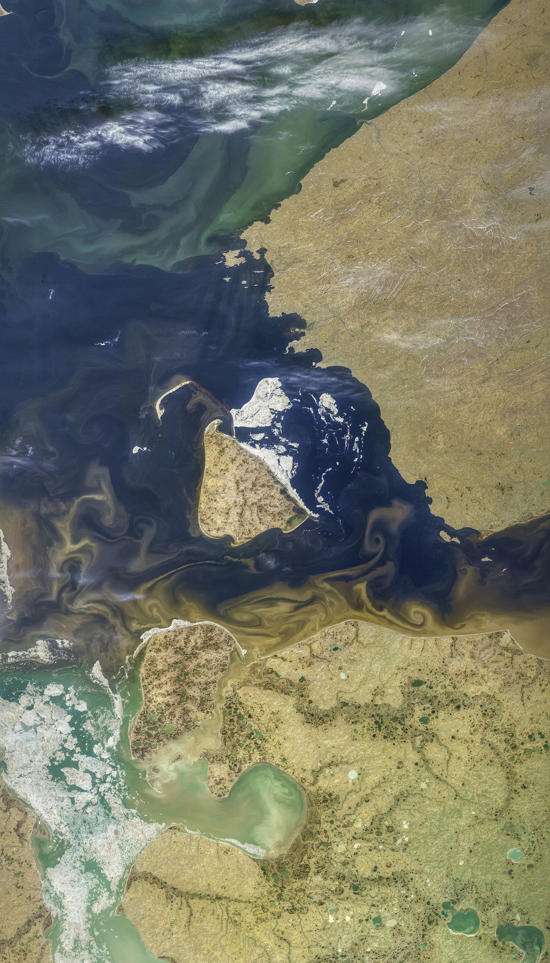
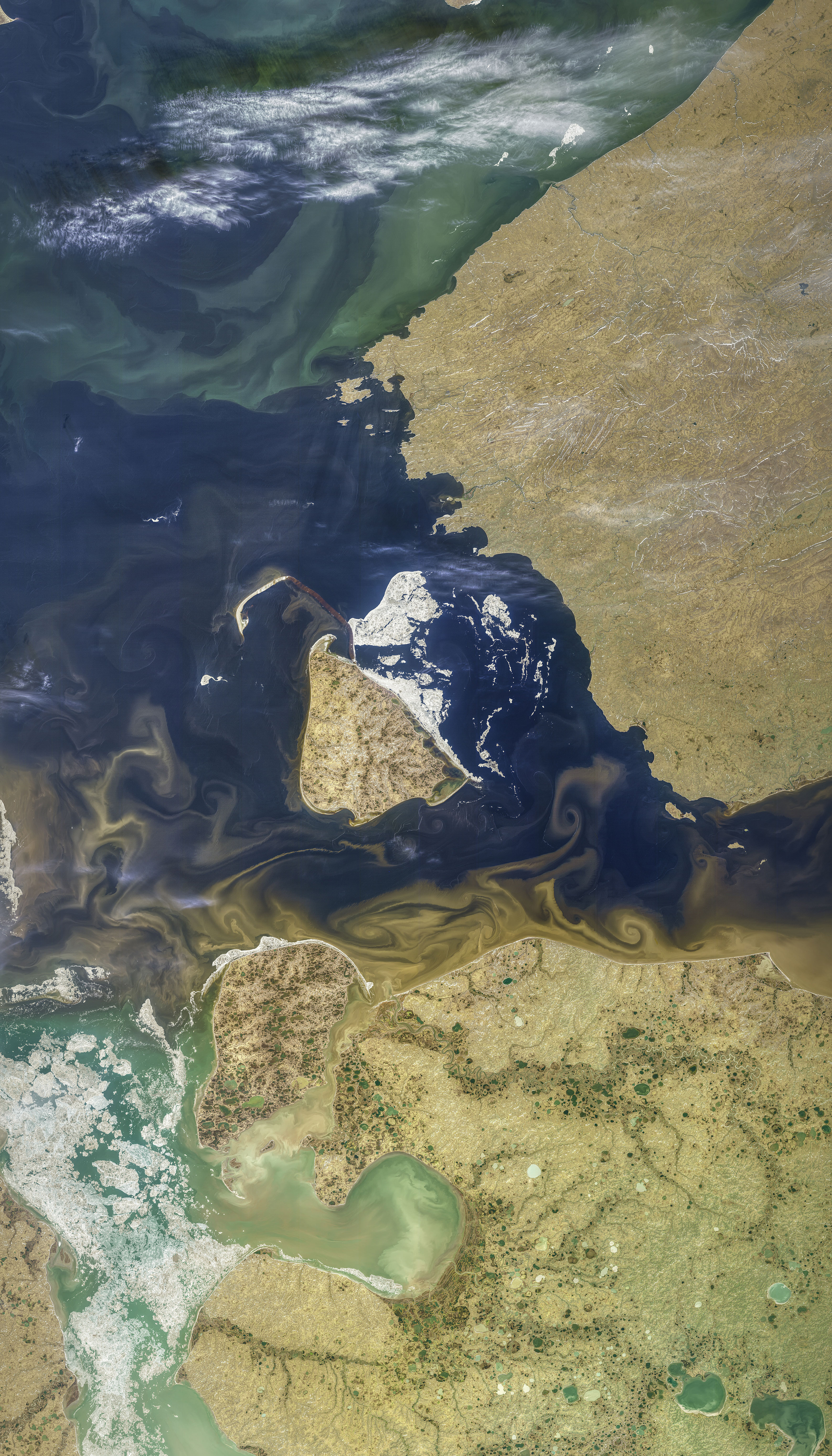
    These colorful swirls show sediment and organic matter carried into the Arctic Ocean. Like dyes or tracer particles in a lab experiment, this run-off reveals the complicated patterns of mixing where freshwater and salt water mix. Delicate as they appear, these eddies are tens of kilometers across. Zoom in on the full resolution image to really appreciate the details, like the feathery edges between layers. (Image credit: N. Kuring; via NASA Earth Observatory)
  • Forming a Waterfall

    Forming a Waterfall

    Many factors can affect a waterfall’s formation – changes in bedrock structure, tectonic shifts, and glacial motion, to name a few. But a new study suggests that some waterfalls may be self-forming. Using a lab-scale experiment, researchers created a homogeneous “bedrock” out of polyurethane foam, which they eroded with a combination of constant water flow and particulates. Even without external perturbations, the flow carved out a series of steps.

    As a pool deepened, particles built up inside, armoring the bed against further erosion. But further downstream, the chute continued to erode, steepening the area between them until a waterfall formed. On the timescale of the experiment, the waterfalls lasted only 20 minutes or so, but that’s equivalent to up to 10,000 years in geological time. (Image credit: M. Huey; research credit: J. Scheingross et al.; via EOS News; submitted by Kam-Yung Soh)

  • Titan’s Dust Storms

    Titan’s Dust Storms

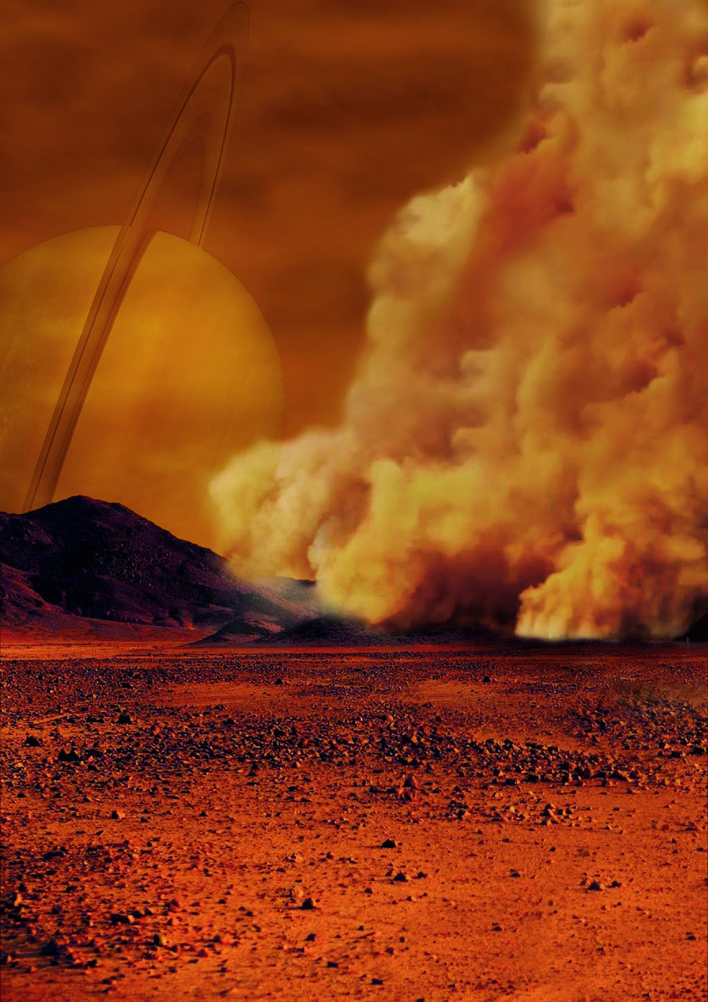
    Earth and Mars are well-known for their dust storms, but a new source of extraterrestrial dust storms is joining them: Saturn’s moon Titan. Titan already shares unusual similarities to Earth: it is the only other place known to currently have stable liquid bodies at its surface. On Earth, water makes up our lakes and oceans; on Titan, it’s methane.

    The evidence that Titan may also have dust storms dates from several Cassini flybys in 2009 and 2010. Cassini observed short-lived infrared bright spots in a dune-covered equatorial region. After considering several other possible sources for these temporary bright spots, researchers concluded that the most likely explanation was dust clouds suspended by high winds. This suggests that the dune fields on Titan are still actively changing, just like those on Earth and Mars! (Image credit: artist’s concept for Titan dust storm – NASA/ESA/IPGP/Labex UnivEarthS/University Paris Diderot; research credit: S. Rodriguez et al.; submitted by jpshoer)

  • Featured Video Play Icon

    Bringing Beavers Back

    It’s easy sometimes to forget just how drastically humans alter landscapes. Before European fur trappers came to North America, its waterways were ruled by beavers, one of nature’s most impressive engineers. Now researchers, ranchers, and conservationists are installing beaver dam analogs (BDAs) in streams and creeks to help bring back the beavers and their benefits.

    Initially, the BDA starts as several human-driven posts with willow bark woven between. These structures help slow the water, which refills floodplains, deposits sediment, and can help recharge the water table. Beavers augment the structures and build new ones, helping bring complexity and fertility back to devastated waterways.

    The benefits have been multifold. In waterways re-engineered through BDAs, native trout species have flourished, sage grouse nesting is recovering, water tables have climbed by a meter (thereby reducing irrigation costs), and seasonal streams have had their flow extended. It sounds like an exciting story, both for conservation and agriculture. Check out the full story here. (Video credit: Science; see also their full article)

  • Featured Video Play Icon

    Sandy Wrinkles

    Water flowing back and forth over sand quickly forms a field of dune-like wrinkles. On the upstream side, the flow is a little faster, and it picks up grains of sand. When the flow slows on the downstream side of a bump, the sand gets deposited. In this way, small bumps in the sand continue growing larger. A similar process between wind and sand forms enormous dunes here on Earth and on Mars. These smaller water-driven wrinkles are very common in tidal areas and in sandy creeks. They can even build up and break down such that they create periodic waves that surge down the stream. (Image and video credit: amàco et al.)

  • Colorful Erosion

    Colorful Erosion

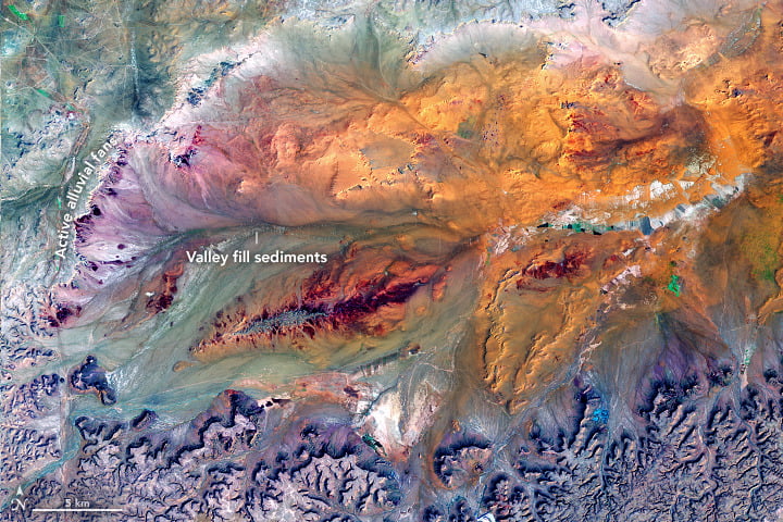
    Wind, water, and gravity are great sculptors of our world. This false-color satellite image shows the Ga’ara Depression in Iraq, which formed some 300 million years ago beneath a shallow sea. The steep cliffs along the southern edge of the depression continue moving southward as they’re eroded by wind and run-off. When infrequent but intense rains pour down the channels of the southern cliffs, it carves away sediment which the water carries onward. In the flatter basin, these sometimes-rivers slow and spread out, eventually dropping the sediment they carry into sandbars. The build-up of sandbars causes the slower-moving water to shift its course back-and-forth over time, creating the alluvial fans seen along the southern and western borders. (Image credit: J. Stevens, via NASA Earth Observatory)