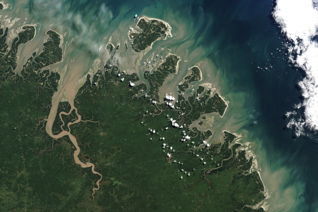
Pale sediments are carried out to sea by the rivers of the Mergui Archipelago of Myanmar. Dark blue ocean waters mix with the sediment, creating turbulent swirls in this natural color satellite image. With the sediment comes valuable nutrients for plant life in the ocean, which can prompt the formation of phytoplankton blooms. (Photo credit: Michael Taylor/Landsat/NASA)
Tag: sedimentation

Simulating Floods
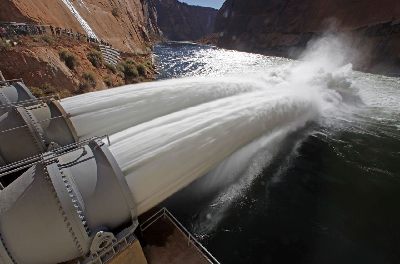
Last week officials opened the Glen Canyon Dam’s bypass tubes to release a simulated flood on the Colorado River, which runs through the Grand Canyon. This is the first of several planned “high-flows” intended to imitate the positive effects of natural floods on the area. Officials hope the increased water flow will help deposit sediment along the Grand Canyon’s walls at heights unreachable at the lower water levels. This sediment transport should help restore the natural sandbars and beaches that serve as breeding grounds for native fish. The floods will also clear vegetation from the riverside camping spots utilized by tourists. (Photo credit: Reuters/Bob Strong; submitted by Bobby E.)

How Dams Affect Rivers
This video shows how the installation of a dam can affect river flow and sediment transport. Before the dam is added, the flow is shallow and the sediment transport is uniform. The installation of the dam creates deep subcritical flow upstream and supercritical flow downstream. This means that wave information–like ripples–can propagate upstream on the subcritical side; on the supercritical side, the wave velocity is lower than the flow velocity and ripples cannot propagate upstream. This is analogous to sub- and supersonic flow in air. The critical flow over the dam is analogous to a shock wave. The lower velocity upstream of the dam is unable to carry sediment downstream and transport essentially ceases until the sediment builds up to a height where the depth of the water above the dam is roughly equal to that below the dam and sediment transport resumes, scouring the downstream supercritical section. Around 0:40, a gate is closed on the downstream side (off frame), creating a hydraulic jump. In the final section of the video, after sediment has built up on both sides of the dam, the downstream gate is re-opened and the jump reforms as sediment is blown out below the dam. (Video credit: Little River Research and Design, with funding from the Missouri Department of Natural Resources)

Stirred Up Sediment
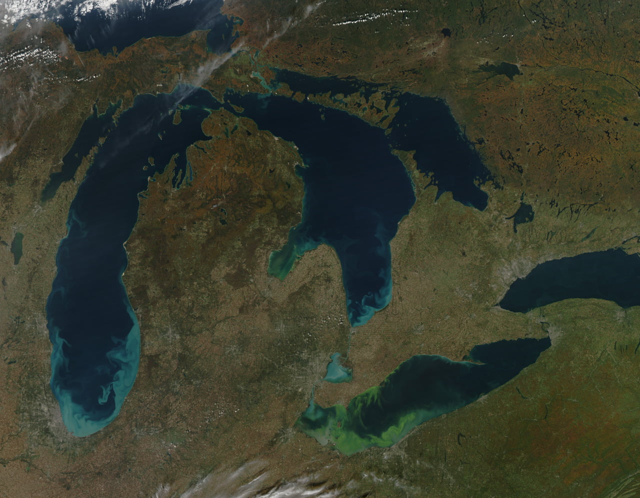
Swirls of blue in the Great Lakes mark locations of recent autumn storms whose winds have stirred up sediment in the lakes. The silt and quartz sand acts as a tracer particle, making visible the circulation patterns of the lakes. In contrast, the green streaks mark locations of calmer winds and warmer temperatures where algae blooms have grown. Note the fundamental dissimilarity in their structures. Blue eddies turn over and mix in a fashion reminiscent of convective instabilities while the green blooms are far more uniform in structure. #

Brazilian Barrier Islands
Barrier islands are in a constant state of flux due to the currents, tides, and winds that surround and shape them. This satellite image of islands off the Brazilian coast shows meandering waterways and the mixing of sediment from the land into the sea. Often, secondary flows are responsible for shaping of these sorts of geographic features. #

Microgravity Marangoni
Astronauts are preparing an experiment on the Marangoni effect, in which a variation in surface tension can cause mass flow, for flight aboard the International Space Station. The effect, also responsible for causing tears of wine, will benefit from study in microgravity because competing effects like gravity-induced sedimentation and buoyant convection will be negligible. Astronaut Ron Garan reports more on the upcoming experiment on the Fragile Oasis blog.