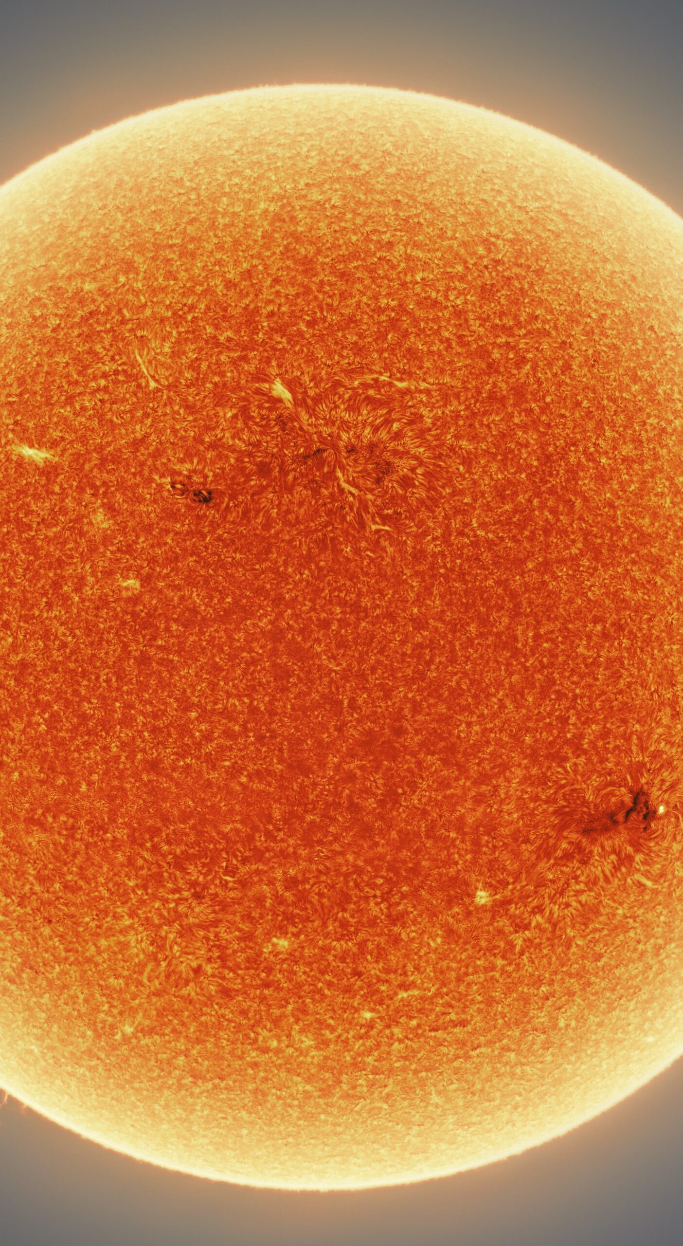
The sun‘s surface and atmosphere are endlessly dynamic, with magnetic lines, plasma, and convection creating a constant churn. In this photo by astrophotographer Eduardo Schaberger Poupeau, a curving question-mark-like filament appears above the sun’s surface. Even with decades of high-resolution data from recent solar probes, we struggle to understand the complex physics that feed structures like these. (Image credit: E. Poupeau; via 2023 Astronomy POTY)
Tag: convection

How Squall Lines Form
Summertime in the middle U.S. means thunderstorms, many of which can form long lines of storms known as squall lines. Complex convective dynamics feed such storms. Here is an illustration of one part of a squall’s lifecycle:

As rain falls and evaporates, it fuels the formation of a cold pool of air below the cloud. Incoming wind (gray arrows) blocks the cold pool from spreading. In turn, the cold pool acts as a ramp that redirects this warm, moist air upward. The vertical variation in wind speed (wind shear, shown with pink arrows) creates a positive vorticity. Together with the negative vorticity in the cold pool, this induces a vorticity dipole that lifts air and moisture, feeding the growing line of storms. As it falls, rain evaporates, cooling air near the ground and forming a cold pool. If incoming winds block the cold pool from spreading, the pool will act instead as a ramp that redirects the wind upward, carrying any warmth and moisture up into the storm cloud. Wind shear — a vertical variation in wind strength with altitude — creates positve vorticity that opposes the negative vorticity inherent to the cold pool. Together these two regions of opposing vorticity lift more air and moisture into the squall, generating more clouds and more rainfall. (Image credit: top – J. Witkowski, illustration – C. Muller and S. Abramian; see also C. Muller and S. Abramian)

“Níłtsą́”


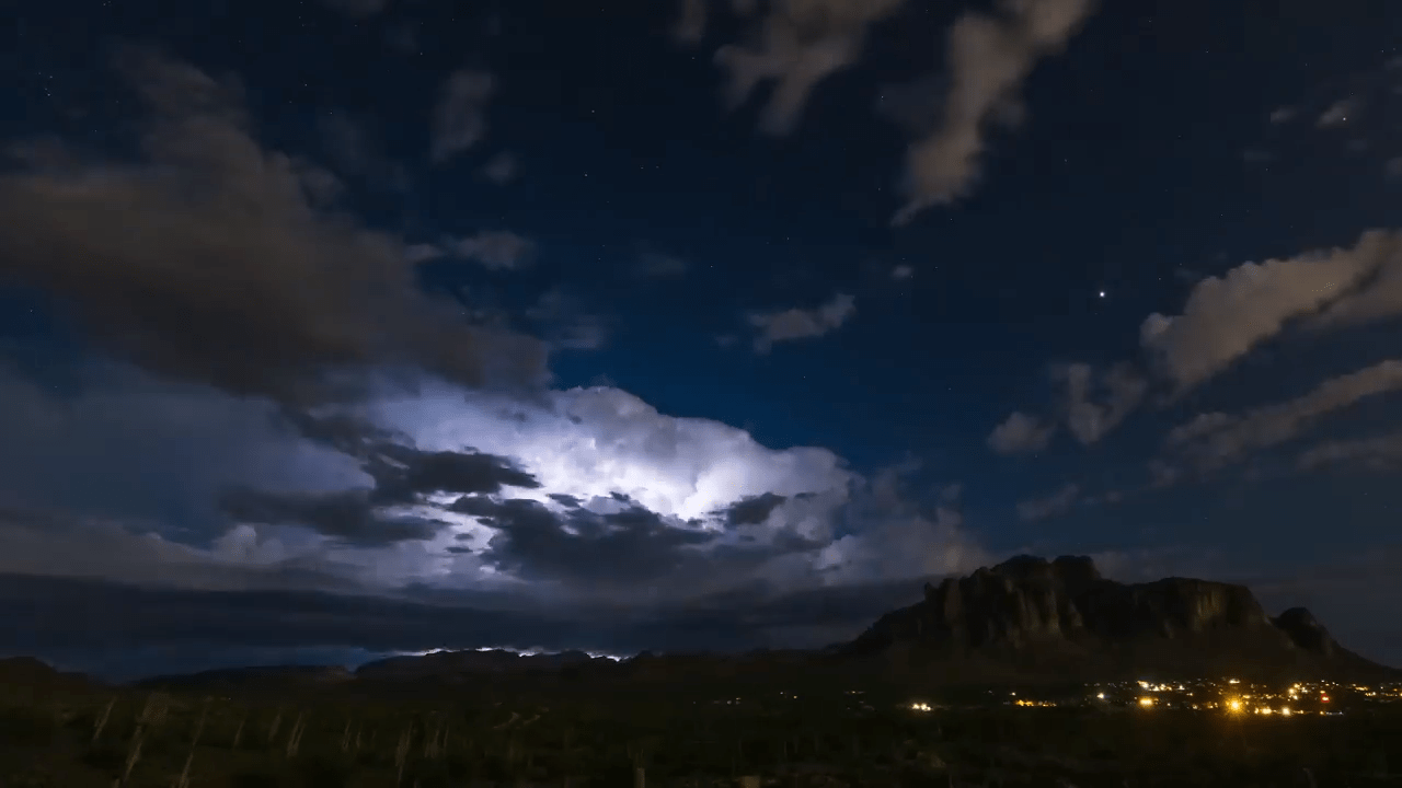
Living in the central and western United States, it’s easy to dismiss summer weather as just another storm, but the truth is that this region sees some of the most majestic and spectacular thunderstorms in the world. And no one captures that grandeur better than storm-chasing photographer Mike Olbinski. His latest film is named for the Navajo word for rain and features over 12 minutes of the best storms from 2021 and 2022. Towering turbulent clouds grow by convection, lightning splits the night sky, and microbursts pour down from above. As always, it’s a stunning depiction of the power of atmospheric fluid dynamics. (Image and video credit: M. Olbinski)

Predicting Heat Waves
The United States, Europe, and Russia have all seen deadly, record-breaking heat waves in recent years, largely in areas that are ill-equipped for sustained high temperatures. A new paper presents a theory that predicts how hot these heat waves can get and what mechanism ultimately breaks the hot streak.
Heat waves start when an area of high-pressure air forms over land, with an anticyclone circulating around it. Air at the center of the zone warms and rises, and if the anticylone can’t move, temperatures will just keep rising. Despite the heat, there is still moisture in the rising air of a heat wave. The authors found that if that moist air can reach an altitude where the atmospheric pressure is 500 hPa (a typical altitude of 5-7 km), then the maximum daily temperature will stop rising. At that altitude, the moist air can condense into rain, and, even if that rain evaporates before reaching the ground, it is enough to cool temperatures.
The key variable in the theory is the atmospheric temperature at 500 hPa, something that meteorological models are able to predict well up to three weeks in advance. That means this theory should enable meteorologists to give advanced warning of high temperatures, helping communities prepare. (Image credit: T. Baginski; research credit: Y. Zhang and W. Boos; via APS Physics)

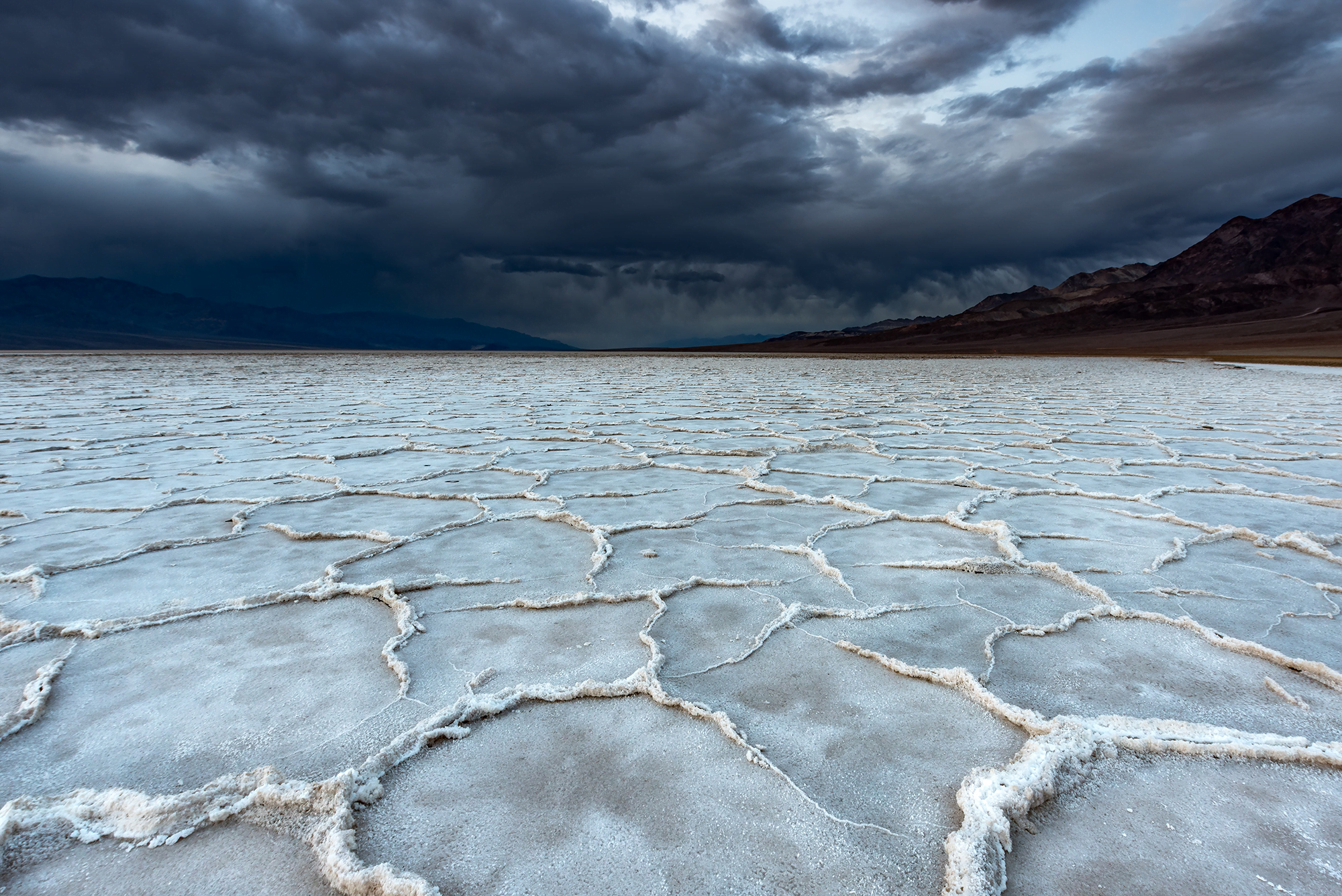
Explaining Salt Polygons
Around the world, salt playas are criss-crossed with meter-sized polygons formed by ridges of salt. The origins of these structures — and the reason for their consistency across different regions of the world — have been unclear, but a new study shows that salt polygons form due to convection happening in the soil underground.
Through a combination of numerical modeling, simulation, lab-scale experiment, and field work, the team revealed the mechanism underlying salt polygons. Areas that form polygons have much greater rates of evaporation than precipitation, and, as water evaporates, these areas draw groundwater from nearby. Salt gets carried with this groundwater.
With strong evaporation, the lake bed forms a highly-concentrated layer of salty water near the surface. Convection cells form, with some regions drawing less saline water upward, while denser, saltier water sinks in other areas. The subsurface convection lines up exactly with the surface structures. The interior regions of polygons are areas where less salty water rises, and salt instead concentrates along the edges of polygons, where saltier water sinks below the surface while evaporation draws solid salt to the surface.

This snapshot shows a numerical simulation of the subsurface convection and surface evaporation that lead to salt polygon formation. Low salinity areas are yellow, while high salinity ones are black. At the surface, blue regions have the maximum upward flow and red regions have the maximum downward flow. The dark, highly saline fingers under the surface align to the red areas on the surface, indicating areas where salty water is sinking. It’s a beautiful result that matches the size, shape, and development time observed for salt polygons in the real world. The team even excavated below salt polygons in Death Valley to confirm that the salt content below ground matched their model’s patterns. Since salt playas are a major source for dust and aerosols that affect climate, their work will be an important factor in future climate modelling. (Image credit: feature – T. Nevidoma, simulation – J. Lasser et al.; research credit: J. Lasser et al.; via APS Physics; submitted by Kam-Yung Soh)
Chemical Flowers


These “flowers” blossom as two injected chemicals react in the narrow space between two transparent plates. The chemical reaction produces a darker ring that develops a streaky outer edge due to competition between convection and chemical diffusion.
To show how gravity affects the instability, the researchers repeated the experiment on a parabolic flight. In microgravity conditions, no instability formed. That’s exactly what we’d expect if convection (i.e. flow due to density differences) is a major cause. No gravity = no convection. In contrast, under hypergravity conditions, the instability was initially spotty before developing streaks. (Image and video credit: Y. Stergiou et al.)

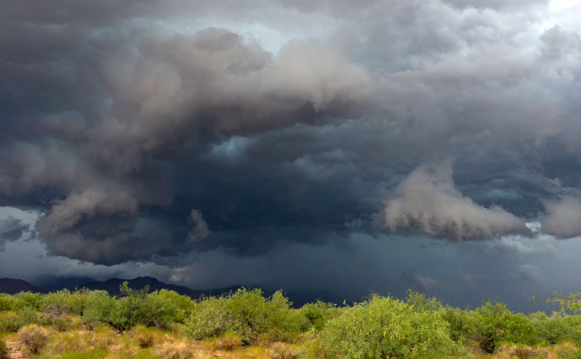
Stormy Skies


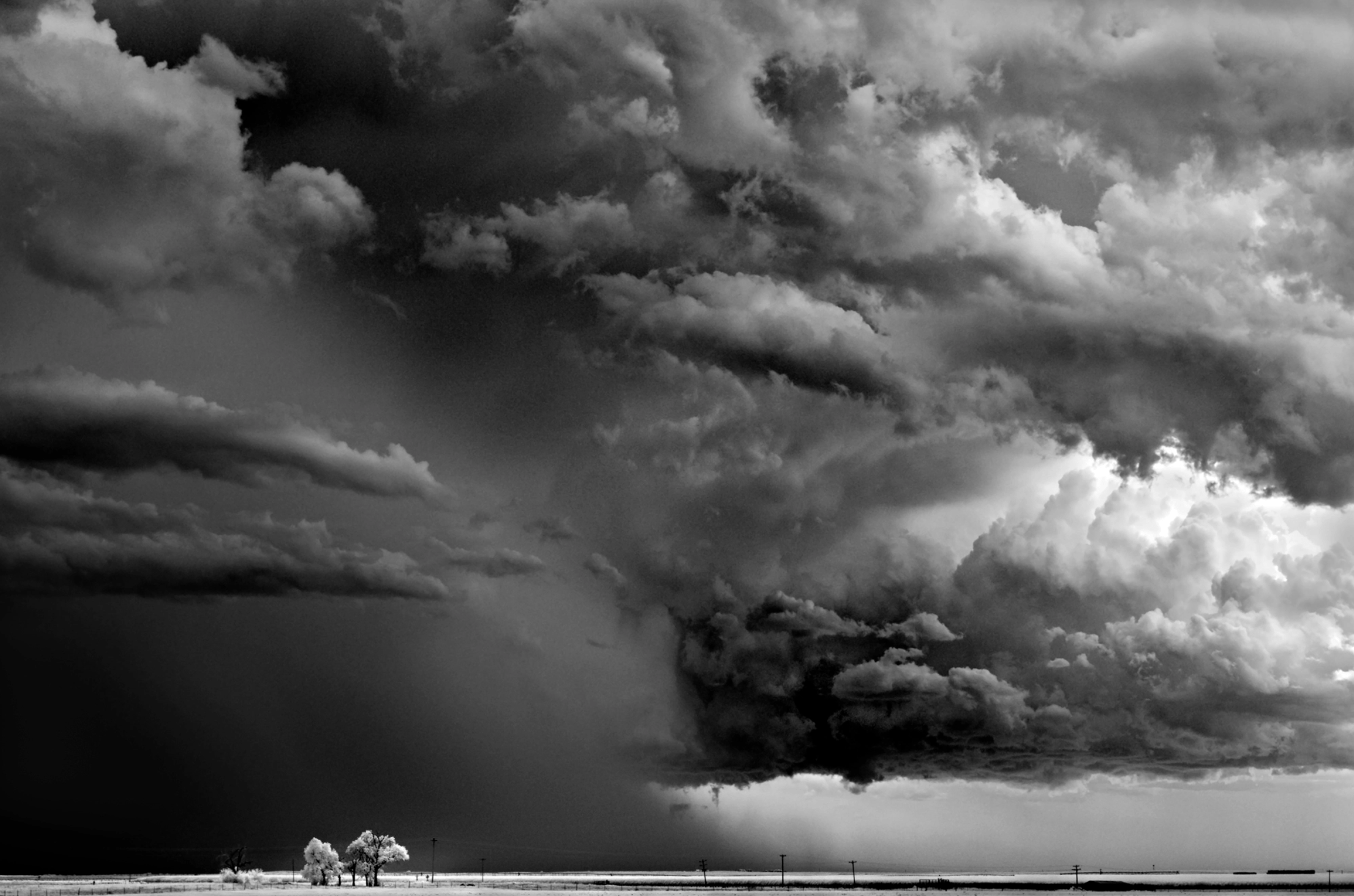


Photographer Mitch Dobrowner captures the majestic and terrifying power of storms in his black and white images. Towering turbulence, swirling vortices, and convective clouds abound. See more of his work at his website and Instagram. (Image credit: M. Dobrowner; via Colossal)
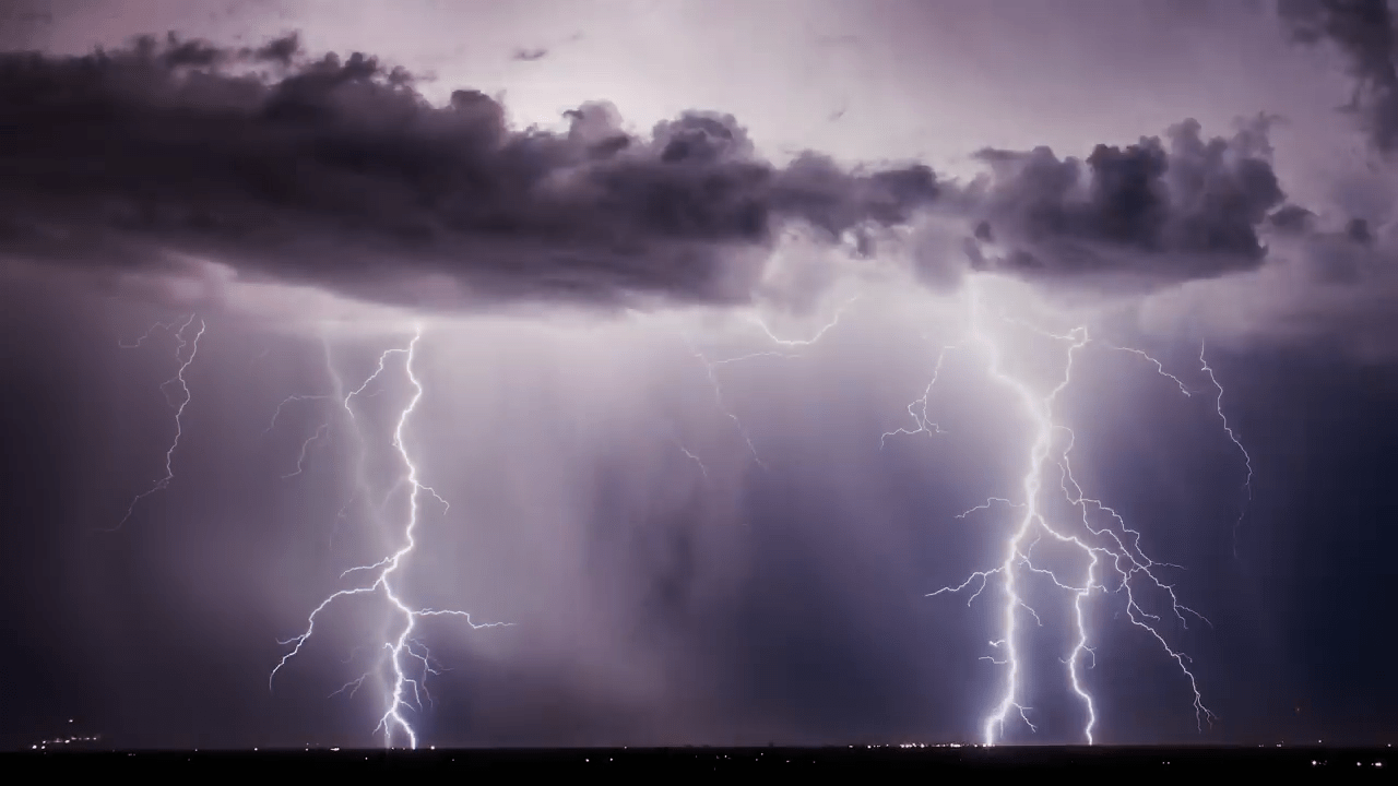
“Reverent”


Today, enjoy this moody black-and-white short film of storm timelapses. Photographer Mike Olbinski is a master of this subject. I never tire of watching his towering convective supercell thunderstorms or his picturesque microbursts. The lightning-lit clouds in the latter half of the film are particularly spectacular (assuming you do not have sensitivities to flashing lights). And there are a few haboobs and a tornado in there for good measure, too. (Image and video credit: M. Olbinski)
When Bubbles Don’t Die


In a pure liquid, most bubbles pop almost immediately. But with a simple ingredient — a little heat — bubbles can live almost indefinitely. The mechanism is revealed in this video when the researchers use an infrared camera to watch a bubble on a heated pool. The top of the bubble is cooler than the rest of the liquid, forming colder, denser droplets that slide down. But the cooler liquid also has a higher surface tension, which draws warm liquid up the bubble, replenishing it. The result is a stable bubble that simply carries on. (Image and video credit: S. Nath et al.)

“Fire and Fusion”

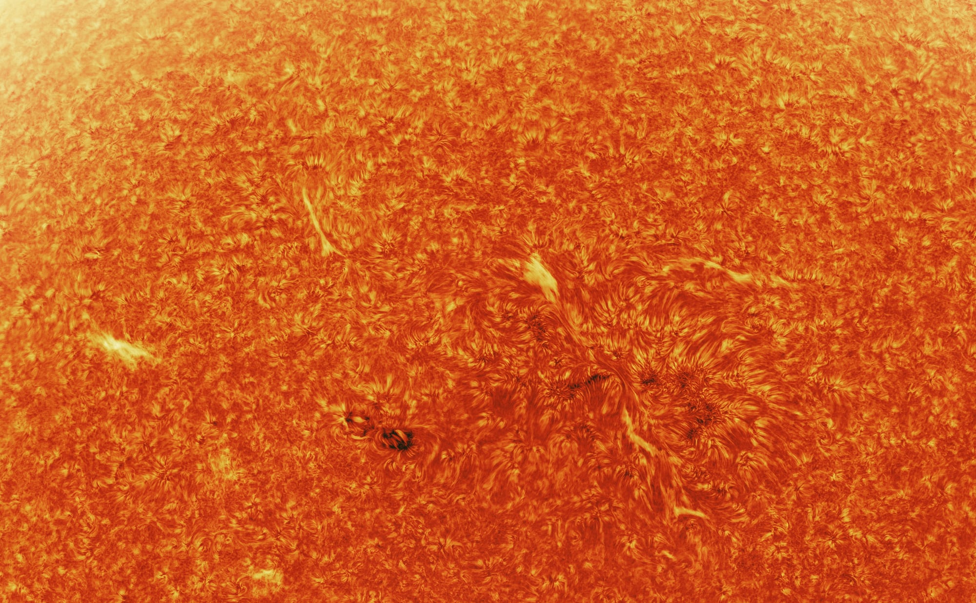


Photographer Andrew McCarthy constructed this spectacular 300-megapixel image of our sun by compositing thousands of individual images. Sunspots, coronal mass ejections, and feathery convective swirls abound. Check out his site for prints of this and other celestial images! (Image credit: A. McCarthy; via Colossal)