Tag: clouds

  • Featured Video Play Icon

    “Monsoon IV”

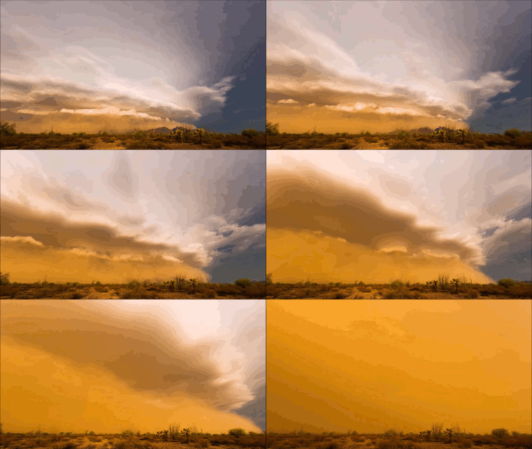
    It’s a cliché to claim that the sky is bigger in the American West, but the wide, open views in that region do offer a very different perspective on weather. Photographer Mike Olbinski’s works give viewers a taste of that perspective of far-off thunderstorms, towering anvil clouds, and massive downpours in the distance. At the same time, many of his sequences illustrate the birth and death of these massive storms. As warm, moist air rises, a puffy cumulus cloud (below) swells upward as fresh moisture condenses. When it reaches a thermal cap and can rise no further, precipitation begins to fall, dragging surrounding air with it. This is the mature stage of a storm, when both updrafts and downdrafts exist simultaneously.

    Eventually, the storm’s power begins to wane as the downdrafts cut off the updrafts that feed the storm. Sometimes this occurs in a massive downdraft where cool air sinks straight down and, upon encountering the ground, spreads radially outward. In dry regions, this outward burst of ground-level winds can pick up dirt, dust, and sand, forming a wall-like haboob (below) that advances past the remains of the storm. Watch the entire video to see some examples in their full glory! (Video and image credit: M. Olbinski, source; via Rex W.)
    image
  • Oceans of Clouds

    Oceans of Clouds

    One of the most amazing things about fluid dynamics, in my opinion, is that the same rules apply across an incredible array of situations. The equations of motion are the same whether your fluid is water, air, or honey. Your flier can be a Cessna airplane or a fruit fly; again, the equations are the same. This is part of the reason that patterns in flows are repeated whether in the laboratory or out in nature – and it’s the reason why a timelapse of fog clouds can look just like ocean waves. Ultimately, the physics is the same; clouds just move slower than ocean waves! (Image credit: L. Leber, source; via James H.)

  • Lenticular Clouds

    Lenticular Clouds

    Lenticular clouds are peculiar enough that, for years, they’ve been mistaken for other things – often UFOs. These lens-shaped clouds tend to form near mountainous terrain, where air gets forced up and over the topology. If there’s a drop in temperature as the air rises, water can condense out to form the cloud. Once the air sinks, it warms enough that condensation is no longer possible. The result is a cloud that appears to stand still even though the air is moving. In reality, the cloud is constantly reforming from the moisture of incoming air. Lenticular clouds can form as a single layer, or they can form stacks like the one pictured above in Boulder, Colorado. They may seem odd, but they’re actually fairly common. If you live near hills or mountains, keep an eye out for them!  (Image credit: @bayouowl; via Ilya L.)

  • Creating Clouds

    Creating Clouds

    Despite their ubiquity and importance, we know surprisingly little about how clouds form. The broad strokes of the process are known, but the details remain somewhat fuzzy. One challenge is understanding how nucleation – the formation of droplets that become clouds or rain – works. A recent laboratory experiment in an analog cloud chamber suggests that falling rain drops may help spawn more rain drops.

    The experiment takes place in a chamber filled with sulfur hexafluoride and helium. The former acts like water in our atmosphere, appearing in both liquid and vapor forms, while the latter takes the place of dry components of our atmosphere, like nitrogen. The bottom of the chamber is heated, forming a liquid layer of sulfur hexafluoride, seen at the bottom of the animation above. The top of the chamber is cooled, encouraging sulfur hexafluoride vapor to condense and form droplets that fall like rain. A top view of the same apparatus during a different experiment is shown in this previous post.

    When droplets fall through the chamber, their wakes mix cold vapor from near the drop with warmer, ambient vapor. This changes the temperature and saturation conditions nearby and kicks off the formation of microdroplets. These are the cloud of tiny black dots seen above. Under the right conditions, these microdroplets grow swiftly as more vapor condenses onto them. In time, they grow heavy enough to fall as rain drops of their own. (Image credits: P. Prabhakaran et al.; via APS Physics; submitted by Kam-Yung Soh)

  • Jupiter’s Atmosphere

    Jupiter’s Atmosphere

    Jupiter’s atmosphere is fascinatingly complex and stunningly beautiful. This close-up from the Juno spacecraft shows a region called STB Spectre, located in Jupiter’s South Temperate Belt. The bluish area to the right is a long-lived storm that’s bordering on very different atmospheric conditions to the left. Shear from these storms moving past one another creates many of the curling waves we see in the image. These are examples of the Kelvin-Helmholtz instability, which generates ocean waves here on Earth, creates spectacular clouds in our atmosphere, and is even responsible for waves in galaxy clusters. Check out some of the other amazing images Juno has sent back of our solar system’s largest planet. (Image credit: NASA/JPL-Caltech/SwRI/MSSS/R. Tkachenko; via Gizmodo)

  • Review: “ABCs From Space”

    Review: “ABCs From Space”

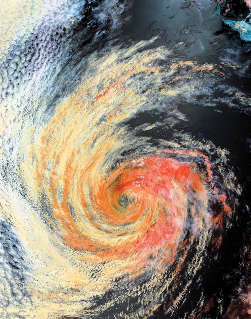
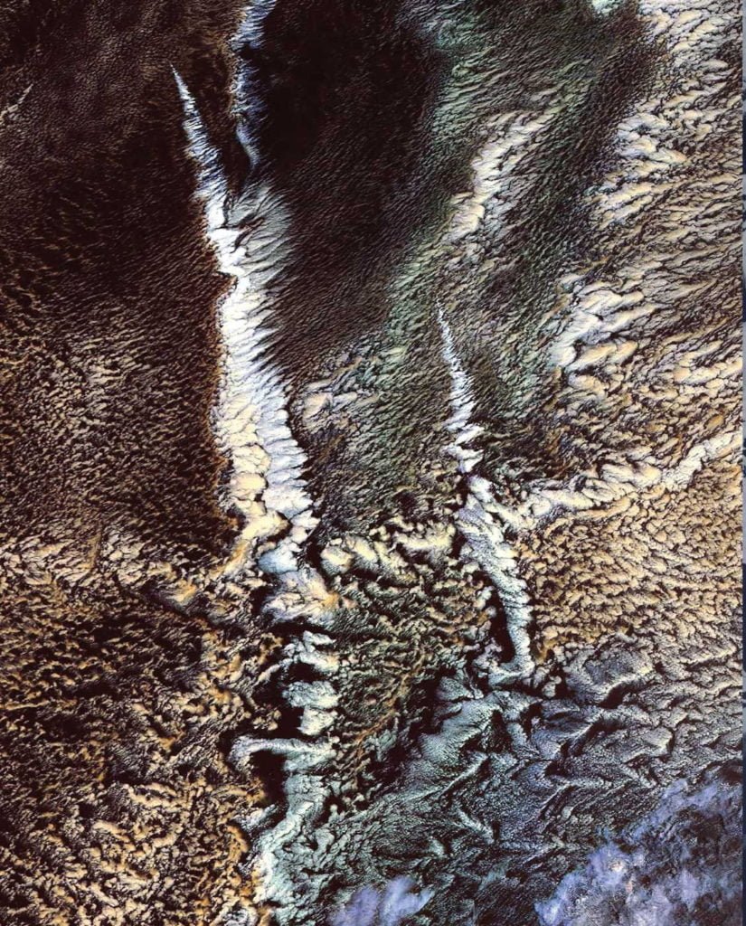
    For me, one of the most fun aspects of studying science is seeking out examples of it in the world around us. Adam Voiland – who writes for NASA Earth Observatory, one of FYFD’s favorite sources for excellent fluids in action – takes this a step further with his children’s book “ABCs From Space: A Discovered Alphabet”. Voiland has sought out satellite imagery from around the world to illustrate all twenty-six letters, creating a lovely book for budding scientists of all sorts.

    Each letter has its own full-page image with no added text, like the G and H shown above. Younger children will have fun identifying and tracing out each letter. The back of the book provides more detail for older kids and adults, including brief descriptions of where and what each image shows, a map of all image locations, and some FAQs about satellite imagery and the geology, meteorology, and earth science on display. There are enough specifics to satisfy casual interest, but I suspect that science-inclined adults will find the book a fun springboard for more in-depth discussions with curious kids.

    Fluid dynamics itself makes a solid showing in the book. Several letters are formed by vortices (like G above) and various types of clouds, including the ship track clouds (like H) that form when water condenses on aerosols released by ship exhaust. There are also meandering rivers, creeping glaciers, and erosion features among the letters.

    I’m often asked about resources for teaching kids about fluid dynamics, and Voiland’s book is a great option for introducing that subject, as well as many other fields of science. (Image credits: A. Voiland/Simon & Schuster)

    Disclosure: I received a review copy of this book but was not otherwise compensated by the author or publisher. All opinions are my own. Additionally, this post contains affiliate links. Purchases made using these links do not cost you anything extra but may provide FYFD with a commission. Thanks!

  • Featured Video Play Icon

    “Pursuit”

    Photographer Mike Olbinski has released yet another breathtaking timelapse film of weather over the Great Plains. This one has a little bit of everything: storms, tornadoes, incredible cloud formations, and even sunny days. Olbinski’s work is a reminder that there’s a constant beautiful drama playing out over our heads if we just take the time to watch. Under blue skies, condensation and turbulence are building towering mountains, and even when the sky is gray, it can be churning like the ocean just over your head. The U.S. Great Plains may be home to particularly dramatic examples of this behavior (thanks largely to the atmospheric influence of the Rocky Mountains), but these same phenomena are going on all the time overhead. (Video and image credits: M. Olbinski)

    image
  • Featured Video Play Icon

    “Fractal”

    Timelapses are a wonderful way to capture the power and majesty of storms like the supercell thunderstorms featured in Chad Cowan’s “Fractal”. The video contains snapshots from six years’ worth of storms over the US’s Great Plains. The highlights include some spectacular mammatus clouds (0:30) and excellent billowing cloud formation (1:27) with turbulence every bit as towering as that of a volcanic plume. June is one of the best months for amazing storms in the Great Plains, largely thanks to the atmospheric mixing that occurs over the Rocky Mountains. If you have the opportunity to witness these amazing natural displays, enjoy it, but be safe! (Video credit: C. Cowan; image via Colossal)

  • Tendrils of Fog

    Tendrils of Fog

    Fog snakes its way from the ocean into the Strait of Juan de Fuca in this animation constructed from satellite imagery. The strait lies between Vancouver Island and the Olympic Peninsula in the Pacific Northwest. Fogs like this form when skies are clearer and heat from the surface is able to escape upward. The surface air then cools and condenses into fog. Steady winds pushed fog into the strait over the course of about 9 hours. There’s a remarkable level of detail in the satellite images, taken by the new GOES-16 satellite that launched in late 2016. Notice the ragged wave front as the fog stretches eastward and the shock-wave-like lines behind it in the strait. Both result from interactions between the fog cloud and the shape of the land masses it’s encountered. (Image credit: NASA Earth Observatory)

  • Featured Video Play Icon

    Asperitas Sunset

    Asperitas clouds, previously known as undulatus asperatus, are the most recently recognized cloud type. These clouds make the sky look like the ocean rolling in waves. Photographer Mike Olbinski, on a recent storm chase earlier this month, caught these spectacular asperitas clouds near sunset. The clouds’ effect is unusual under normal circumstances and completely surreal with this lighting. Check out the video for the full effect. Olbinski caught the clouds on the outskirts of a dying storm cell. That’s a common place to see these formations; despite their ominous appearance, they do not develop storms and are more often seen as storms are ending. (Video and image credit: M. Olbinski; h/t to Paul vdB)