Tag: condensation

  • Featured Video Play Icon

    A Year From Geostationary Orbit

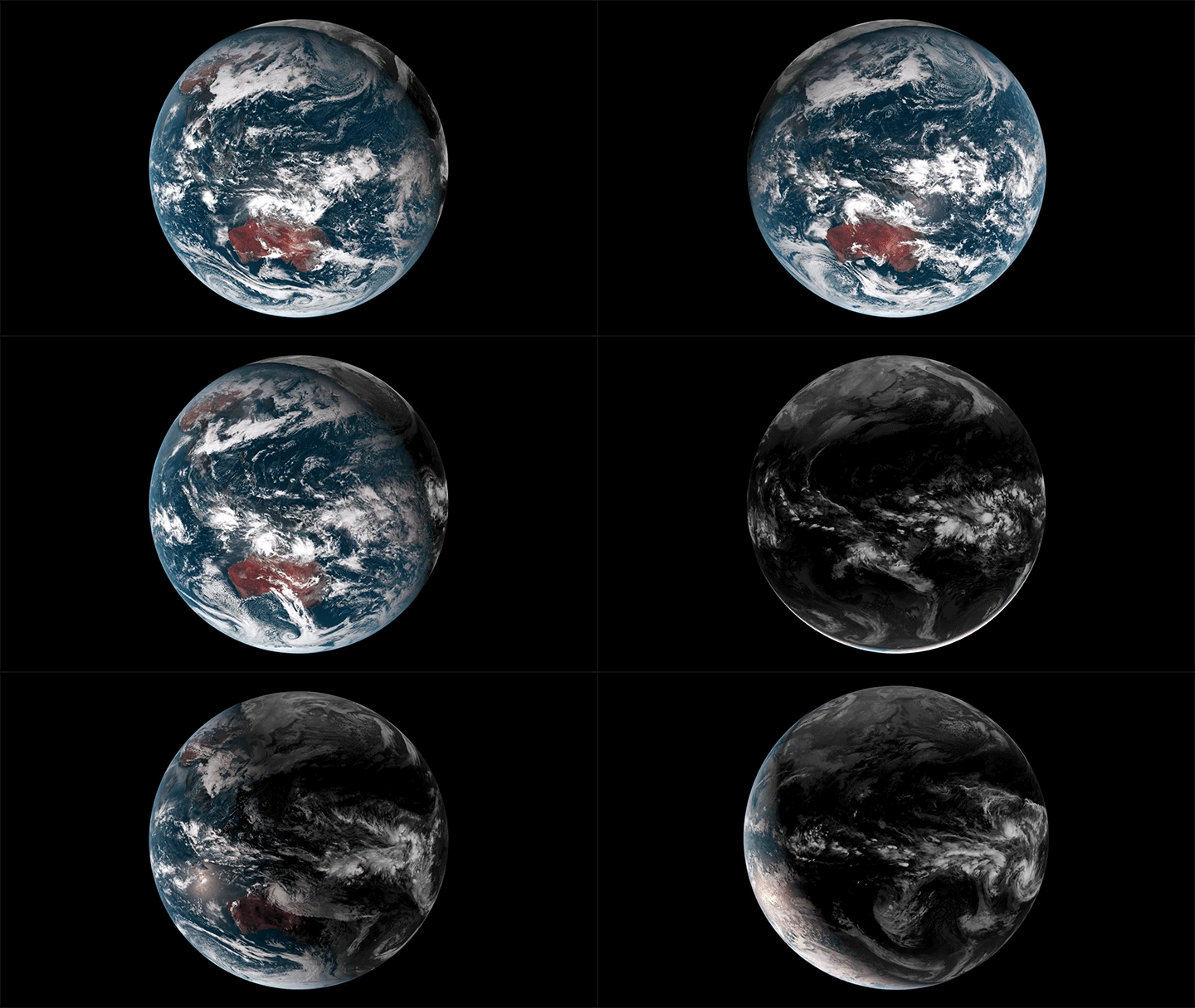
    Our planet is a complex fluid dynamical system, and one of the best ways to watch nature at work is through timelapse. This short film takes us through an entire year, from December 2015 to December 2016, as viewed from a geostationary weather satellite centered over Oceania.

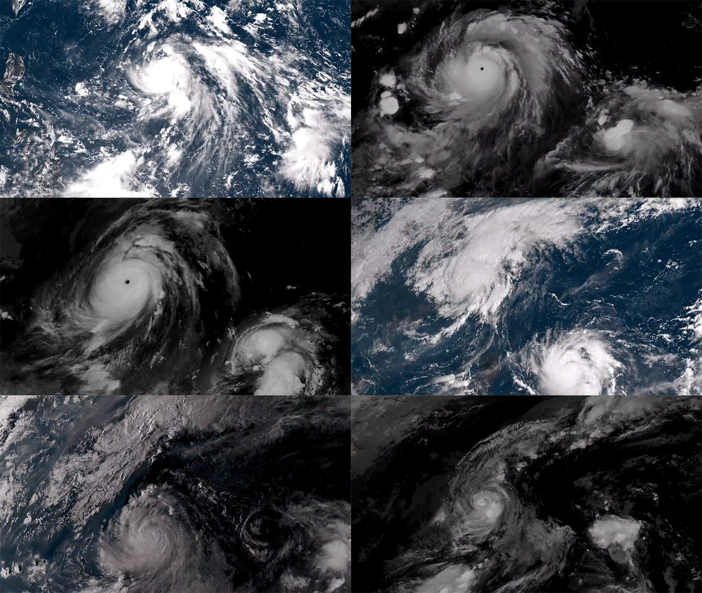
    The imagery is rather hypnotic, with clouds swirling day and night across the full field of view. Watch closely, though, and you’ll see a lot of neat phenomena from typhoons forming in the Pacific to wave clouds streaming from the islands of Japan. You can also see clouds blossoming (especially during the day) over the humid rainforests of Oceania.

    There are neat non-fluids phenomena, too, like a total solar eclipse and the permanent sunlight of Arctic and Antarctic summers. What do you notice? (Image and video credit: F. Dierich)

  • Featured Video Play Icon

    “Vorticity 2”

    There’s no better way to appreciate our atmosphere than through timelapse, and photographer Mike Olbinski is a master at capturing the beauty and power of nature at work through this medium. In “Vorticity 2″, he highlights two full seasons of storm chasing in an incredible seven-and-a-half minutes. Prepare yourself for dramatic cloudscapes, torrential rains, and even twin tornadoes. This one deserves a watch on the biggest screen you have available. (Image and video credit: M. Olbinski; via Colossal)

  • Collecting Dew

    Collecting Dew

    In areas of the world where fresh water is scarce, one potential source is dew collection. Scientists have been working in recent years on making overnight dew collection more efficient. The challenge is that drops won’t begin to slide down an inclined surface until they are large enough for gravity to overcome the surface tension forces that pin the drop. Most efforts have focused on reducing the critical size where drops begin to slide through surface treatments and chemical coatings. 

    A recent study, however, uses a different tactic. Instead of aiming to reduce the critical drop size, these researchers built a grooved surface designed to encourage drops to grow faster. By helping the droplets coalesce quickly, their surface (right side) is able to start shedding droplets much faster than a smooth surface (left side). Under test conditions, the grooved surface was shedding droplets after only 30 minutes, whereas the smooth surface shed its first drops after 2 hours. (Image and research credit: P. Bintein et al.; see also APS Physics)

  • Seeing the Song

    Seeing the Song

    We can’t always see the flows around us, but that doesn’t mean they’re not there. Audobon Photography Award winner Kathrin Swaboda waited for a cold morning to catch this spectacular photo of a red-winged blackbird’s song. In the morning chill, moisture from the bird’s breath condensed inside the vortex rings it emitted, giving us a glimpse of its sound. (Image credit: K. Swaboda; via Gizmodo; submitted by Joseph S and Stuart H)

  • Condensing Halos

    Condensing Halos

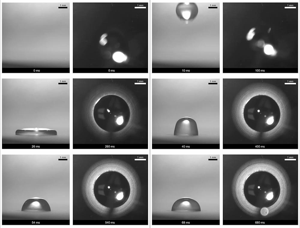
    Drops that impact a very hot surface will surf on their own vapor, and ones that hit a very cold surface will freeze almost immediately. But what happens when the temperature differences aren’t so extreme? Scientists explored this (above) by dropping room-temperature water droplets onto a cool surface – one warmer than the freezing point but cooler than the dew point at which water condenses. 

    They found that impacting drops formed a triple halo of condensate (right).  The first and brightest ring forms at the radius of the drop’s maximum extent during impact. The second band forms from water vapor that leaves the droplet at impact. As that vapor cools, it condenses into a second band. The final, dimmest band forms as the droplet stabilizes and cools. It’s the result of water vapor near the droplet continuing to cool and condense. (Image and research credit: Y. Zhao et al.; via Nature News; submitted by Kam-Yung Soh)

  • Featured Video Play Icon

    Rivers in the Sky

    The water cycle is quite a bit more complicated than what we learn in elementary school, and the environment around us contributes to that cycle in invisible but vital ways. In this video, Joe Hanson of It’s Okay to Be Smart pulls back the veil on this in the context of the Amazon river basin and how the Amazon rainforest itself creates an atmospheric river that carries more water than its namesake river.

    Trees release water into the air almost constantly as they transpire. And to trigger that water to fall as rain, trees can release other compounds that serve as a nucleus around which raindrops can form. The condensing raindrops form clouds, which lower the air pressure and create winds, thereby creating an atmospheric river flowing from the Atlantic back up the Amazon River. That stream carries rain that feeds the rainforest and the Amazon River, continuing the cycle. (Video and image credit: It’s Okay to Be Smart)

  • Growing Droplets

    Growing Droplets

    The moisture in clouds eventually condenses into droplets that grow into raindrops and fall. Some steps in this process are well understood, but others are not. In particular, scientists have struggled with the problem of how droplets grow from about 30 microns to 80 microns, where they’re big enough to start falling and merging.

    Laboratory experiments and numerical simulations (below) have shown that turbulence can help drive small water drops together. When droplets are tiny and light, they simply follow the air flow. But when they’re a little heavier, turbulent eddies (seen in orange below) act like miniature centrifuges, flinging larger water droplets (shown in cyan below) out into clusters, where they’re more likely to collide with one another.

    Although this effect has been seen in experiments and simulation, it’s been difficult to capture in clouds themselves. But a new set of test flights (above) confirms that this mechanism is present in the wild as well! (Image credit: UCAR/NCAR Earth Observing Laboratory, P. Ireland et al., source; research credits: M. Larsen et al., P. Ireland et al.; via APS Physics; submitted by Kam-Yung Soh)

    image
  • Pyrocumulus on the Horizon

    The Cranston wildfire in California is intense enough that it’s creating its own weather. This timelapse video shows the formation and growth of a pyrocumulus cloud, also associated with volcanoes, over the wildfire. In both instances, the extreme heat causes a massive column of hot, turbulent air to rise. Because ash and smoke are carried upward as well, there are many places for any moisture in the atmosphere to nucleate, forming the cloud we see. In timelapse, the roiling nature of the air’s motion is especially apparent. This turbulence can be dangerous, as it may contribute to high winds and even lightning, both of which can spread the fire further. (Video credit: J. Morris; via James H.)

  • Collecting Fog

    Collecting Fog

    In some parts of the world, fog is a major source of freshwater, but collecting it is a challenge. Most systems use a wire mesh to capture and collect droplets, but the process is highly inefficient, pulling only 1-3% of droplets from the fog. Researchers found that this is due largely to aerodynamic effects. The presence of the wire deflects droplets around it (bottom left). To solve this, engineers introduced an electric charge into the fog. The subsequent electric field actually pulls droplets to the wires (bottom right). When applied to a mesh (top), the efficiency of fog capture improves dramatically. 

    The technique can also be used to capture water vapor that would otherwise escape from the cooling towers of power plants. The MIT researchers who developed the technique will conduct a full-scale test at the university’s power plant this fall. They hope the technique will recapture millions of gallons of water that would otherwise drift away from the plant. (Image credits: MIT News, source; image and research credits: M. Damak and K. Varanasi, source)

  • Wave Clouds

    Wave Clouds

    Stripe-like wave clouds can often form downstream of mountains. This satellite image shows such clouds in the South Pacific where rocky mountains jut 600 meters (2,000 ft) above the sea. This disrupts air flowing east by forcing it to move up and over the island topography. The air does not simply settle back down on the other side, though. It must come back into equilibrium with its surroundings in terms of density and temperature. While doing so it will travel up and down along a wavy path. As it reaches the crest of the wave, humid air cooling condenses and forms a cloud. At troughs, the air warms and the condensation disappears. This creates the stripey cloud pattern in the mountain’s wake, which fades out as the atmospheric gravity waves die out. (Image credit: NASA/J. Schmaltz; via NASA Earth Observatory)