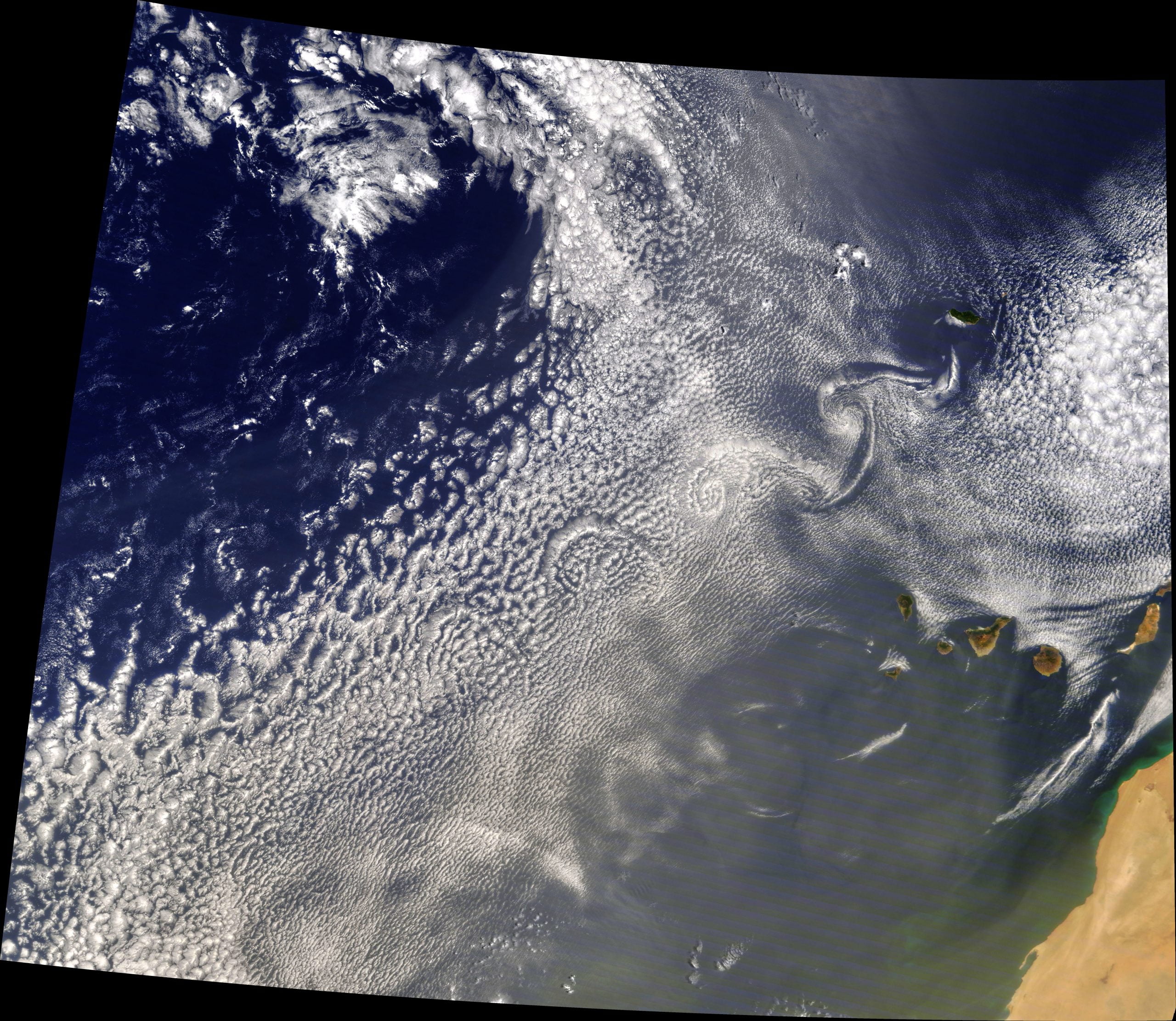
When winds flow past a solitary peak, like an island in the ocean, they’re disrupted into a series of counter-rotating curls. That’s what we see here stretching to the southwest of Madeira Island. The official name for this flow is a von Karman vortex street, and it can be found anywhere from a soap film to a starship. (Image credit: J. Stevens; via NASA Earth Observatory)
Tag: satellite image

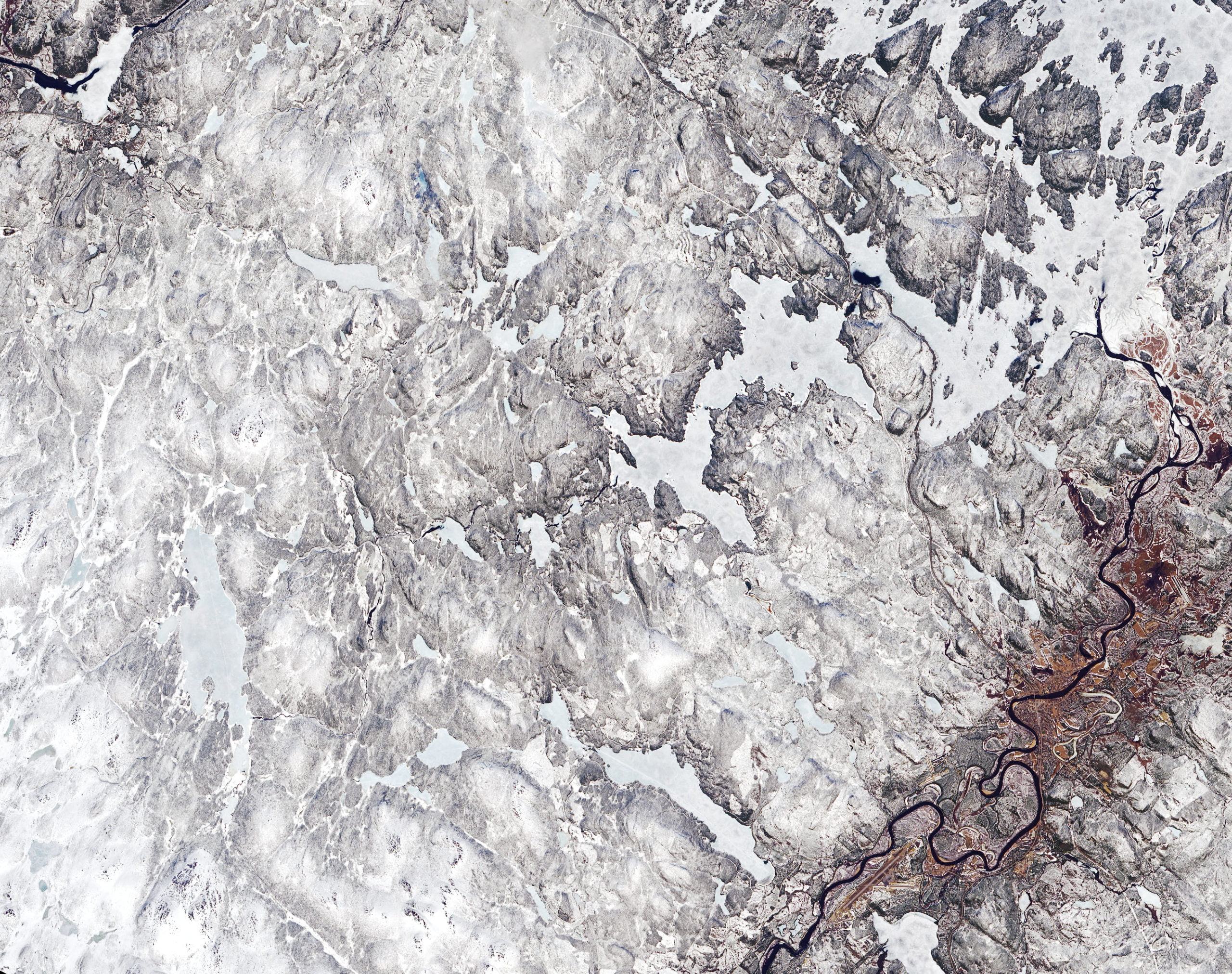
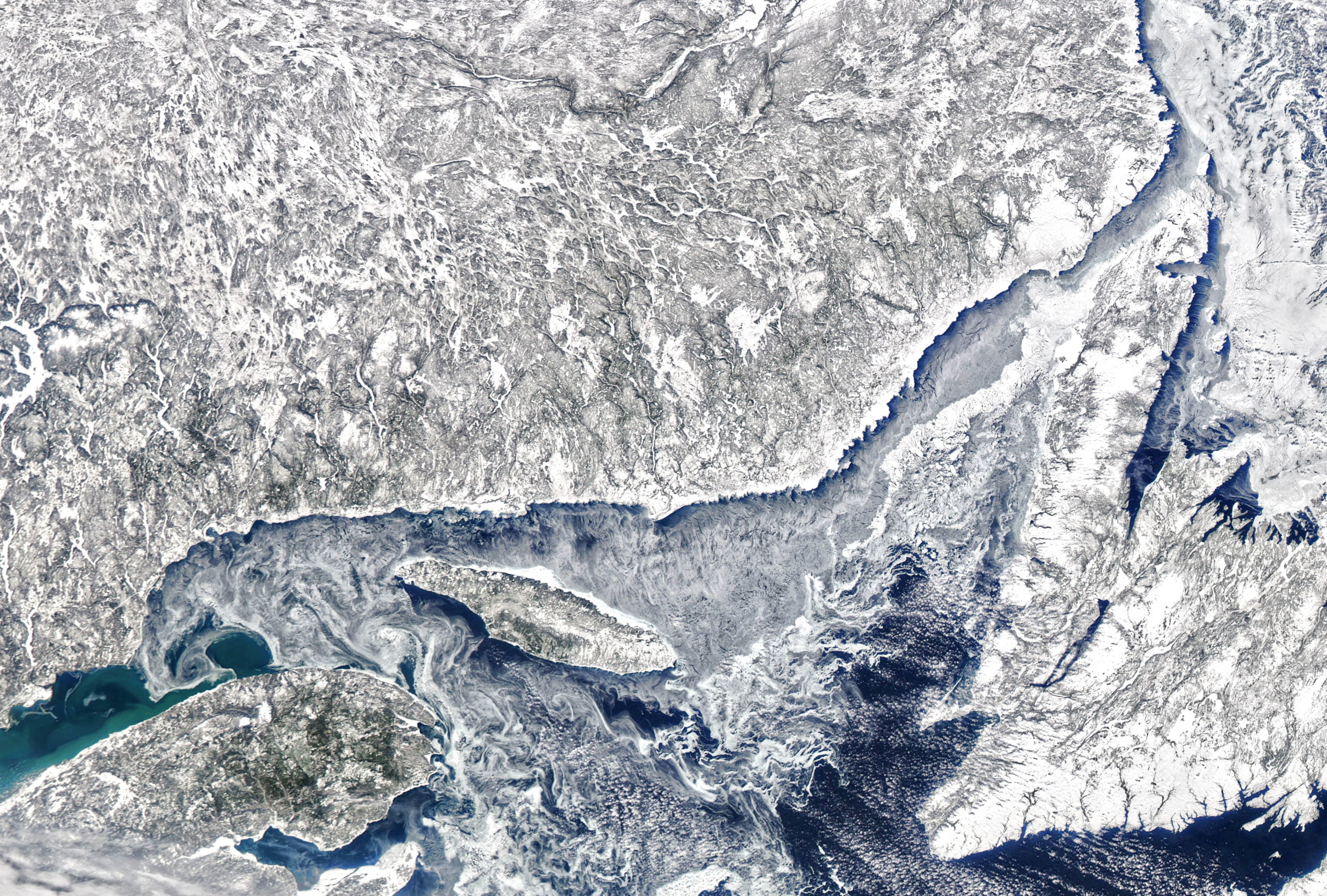
Meandering
The banks of rivers are in constant flux, a pattern most easily captured from above. This satellite image shows a section of the Ivalo River in Finland, swollen with snowmelt after a winter of historic snowfalls. From above we see some of the river’s previous paths. This meandering is a natural result of secondary flows where rivers bend. The water carves away sediment from the outer bank and deposits it on the inner one, exaggerating every curve until the river cuts itself off, leaving behind a sinuous lake detached from the river’s new course. For an interesting (though non-physical) look at meandering, check out this procedural system for generating maps of rivers (thanks to Kam-Yung Soh for sharing). (Image credit: J. Stevens; via NASA Earth Observatory)

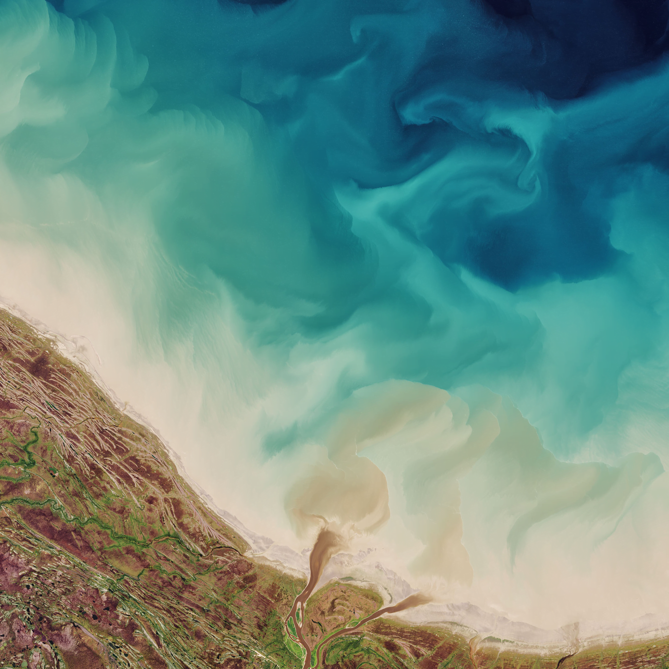
Hudson Bay Watercolors
Rivers sweep fresh water and sediment into the Hudson Bay in this satellite image. Dark brown plumes mark the mouths of several coastal rivers as they add to the cyclonic sediment flow around the bay and out the Hudson Strait. Paler swirls, like strokes of watercolors, mark turbulent mixing between the sediment-filled shallows and the deep blue waters of the bay. (Image credit: J. Stevens/USGS; via NASA Earth Observatory)

Green Swirls and Dark Streaks

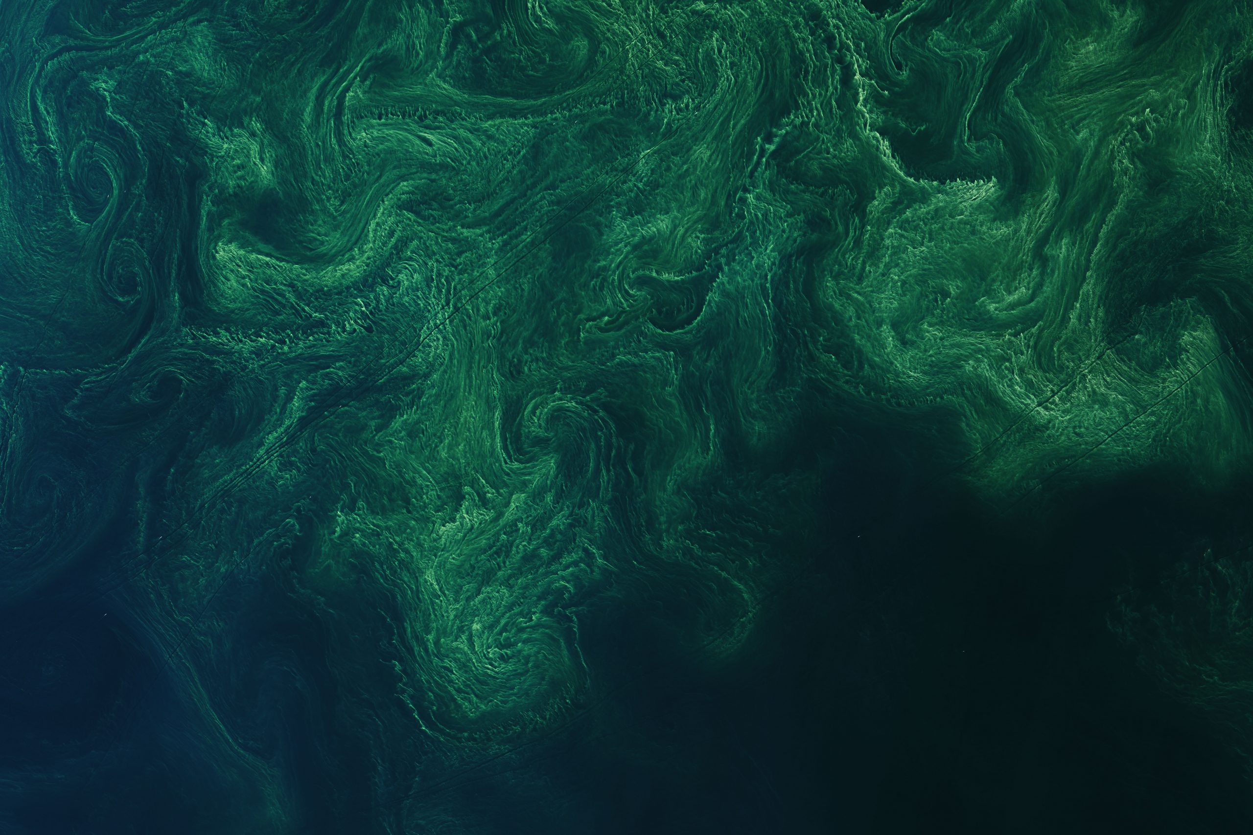

Green phytoplankton blooms swirl through the currents of the Baltic Sea in this satellite image. Individual phytoplankton are microscopic, which makes them excellent tracer particles in the flow; together, they make the ocean’s motion visible. Look closely and you’ll see dark streaks across the images showing where ships’ wakes are disrupting the bloom. (Image credit: J. Stevens/USGS; via NASA Earth Observatory)

A Colorful Portrait of Flow
This gorgeous, natural-color image shows Lake Balkhash in southeastern Kazakhstan. In early March, the ice on the lake was beginning to break up, revealing glimpses of swirling sediment below the water’s surface. In contrast, the smaller lakes and ponds of the surrounding area remained frozen amidst the wintery browns of the nearby desert and wetlands. (Image credit: J. Stevens/USGS; via NASA Earth Observatory)

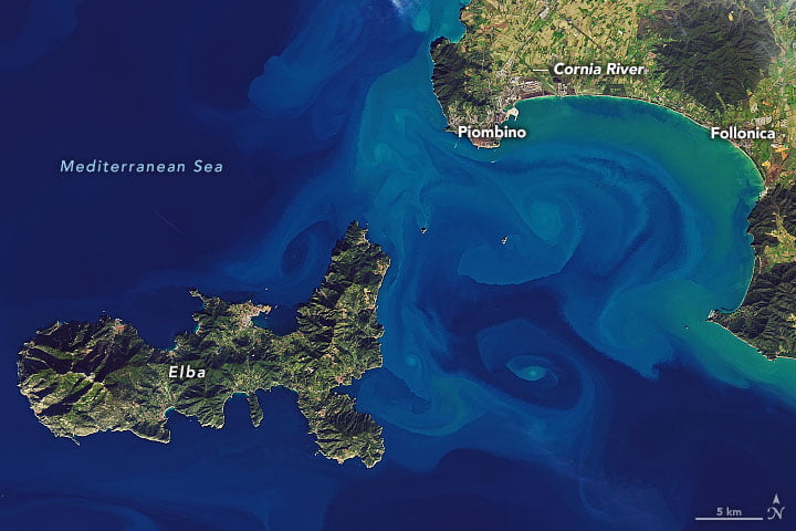
Two Views of Ocean Eddies
Colorful, sediment-laden eddies swirl off the Italian coast in this satellite image. These small-scale eddies — less than 10 km in diameter — can be short-lived and are often difficult to capture in numerical models, but remote sensing can help scientists better understand their impact on oceanic mixing, especially when we capture more than one view of the same event.
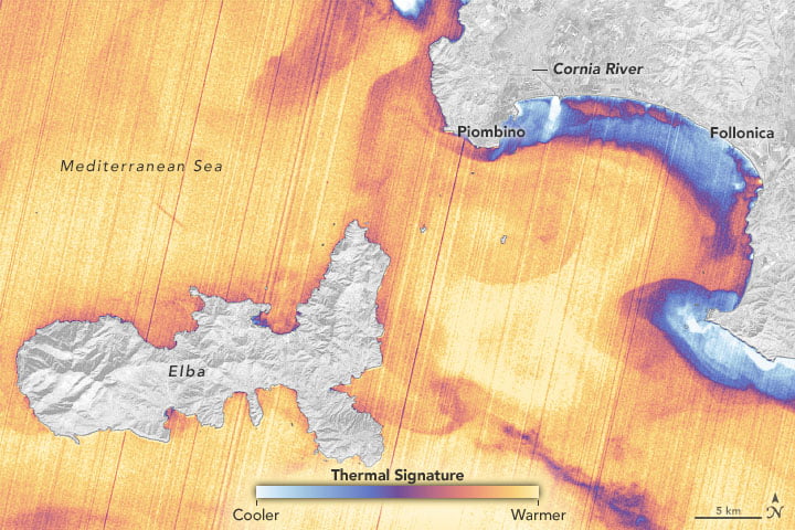
The image below shows the same eddies in an infrared (thermal) view. The resolution on this instrument is not as fine as the natural color one, but we can still make out some of the same swirling motions. It’s also worth comparing the features we don’t see in both images. For example, the Cornia River discharges in infrared as a bright, white plume of cooler water, but it’s barely visible in the color-image, suggesting that the river is not contributing much sediment to the bay. (Image credit: USGS; via NASA Earth Observatory)
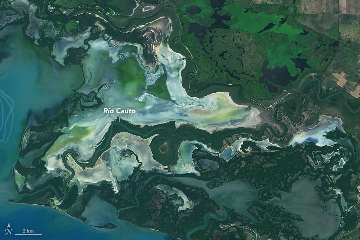
Sediment and Coral
As rivers wash sediment toward the sea, they carve elaborate deltas like that of the Rio Cauto in Cuba. Over time these sediments build up marshes, swamps, lagoons, and other wetlands that provide critical habitat and flood control. Sediment also washes into the bay, where it interacts with the coral reefs (light green lines on the lower left) and the species that live there. (Image credit: L. Dauphin/USGS; via NASA Earth Observatory)


Colorful Tides
This false-color satellite image — the recent winner of NASA Earth Observatory’s Tournament Earth 2020 — shows sands and seaweed off the coast of the Bahamas. Ocean currents and tides eroded these elaborate fluted designs in much the same way that winds sculpt desert dunes. The overlap in form is no accident; as seen in recent work, researchers are finding that both air and water move granular materials like sand according to the same rules. (Image credit: S. Andrefouet; via NASA Earth Observatory)

Icy Swirls
Rafts of sea ice follow swirling eddies in this satellite image of the Gulf of St. Lawrence. Just as with phytoplankton blooms and sediment, this thin sea ice can be moved by wind and currents to reveal hidden flow patterns. Experimentalists use many similar diagnostics that introduce bubbles, particles, smoke, and other tracers into flows to visualize motion that’s otherwise invisible. (Image credit: J. Stevens/NOAA/NASA; via NASA Earth Observatory)

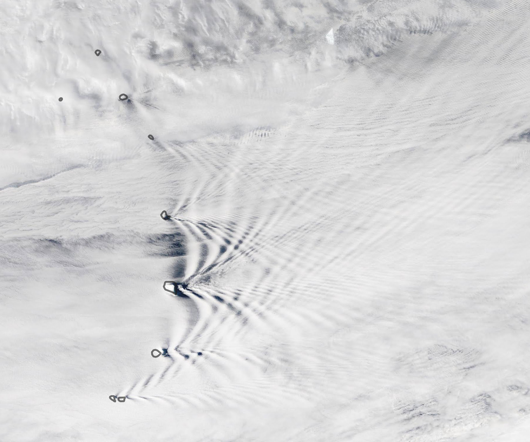
Crisscrossing Wave Clouds
Crisscrossing lines of wave clouds mark the wake of the Sandwich Islands in this satellite image. The tallest islands in the chain thrust rocky peaks more than 1000 meters above sea level, disrupting winds flowing across the ocean. Incoming air is forced up and over the mountain, which puts it at odds with the surrounding air at that height.
Due to differences in temperature and density, the disrupted air will continue to rise and sink periodically as it flows onward. At some heights it will cool enough to condense its water vapor into clouds, and at others, it will warm enough to lose any cloud cover. This is what creates the bands of clouds we see behind each individual island. (Image credit: L. Dauphin/NASA; via NASA Earth Observatory)