Not every experiment turns out as expected. Photographer Julien Looten expected to capture the Milky Way arching across the sky above this French chateau. But the photo’s most striking feature is instead the airglow suffusing the sky. The psychedelic colors result from air high in Earth’s atmosphere getting excited by sunlight and producing a faint glow of its own. Such airglow is common, though not always easily seen. If you watch videos from the ISS, you may notice the orange arc of airglow over the atmosphere. (Image credit: J. Looten; via APOD)
Tag: atmospheric science

“Níłtsą́”


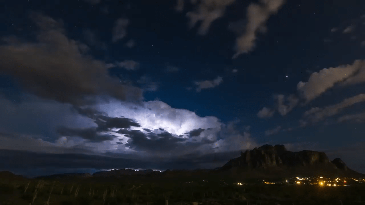
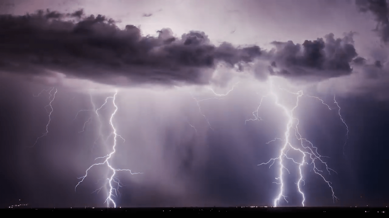
Living in the central and western United States, it’s easy to dismiss summer weather as just another storm, but the truth is that this region sees some of the most majestic and spectacular thunderstorms in the world. And no one captures that grandeur better than storm-chasing photographer Mike Olbinski. His latest film is named for the Navajo word for rain and features over 12 minutes of the best storms from 2021 and 2022. Towering turbulent clouds grow by convection, lightning splits the night sky, and microbursts pour down from above. As always, it’s a stunning depiction of the power of atmospheric fluid dynamics. (Image and video credit: M. Olbinski)

Predicting Heat Waves
The United States, Europe, and Russia have all seen deadly, record-breaking heat waves in recent years, largely in areas that are ill-equipped for sustained high temperatures. A new paper presents a theory that predicts how hot these heat waves can get and what mechanism ultimately breaks the hot streak.
Heat waves start when an area of high-pressure air forms over land, with an anticyclone circulating around it. Air at the center of the zone warms and rises, and if the anticylone can’t move, temperatures will just keep rising. Despite the heat, there is still moisture in the rising air of a heat wave. The authors found that if that moist air can reach an altitude where the atmospheric pressure is 500 hPa (a typical altitude of 5-7 km), then the maximum daily temperature will stop rising. At that altitude, the moist air can condense into rain, and, even if that rain evaporates before reaching the ground, it is enough to cool temperatures.
The key variable in the theory is the atmospheric temperature at 500 hPa, something that meteorological models are able to predict well up to three weeks in advance. That means this theory should enable meteorologists to give advanced warning of high temperatures, helping communities prepare. (Image credit: T. Baginski; research credit: Y. Zhang and W. Boos; via APS Physics)

Ominous Mammatus
Mammatus clouds are fairly unusual and often look quite dramatic. Most clouds have flat bottoms, caused by the specific height and temperature at which their droplets condense. But mammatus clouds have bubble-like bottoms that are thought to form when large droplets of water or ice sink as they evaporate. Although they can occur in the turbulence caused by a thunderstorm, mammatus clouds themselves are not a storm cloud. They appear in non-stormy skies, too. The clouds are particularly striking when they’re lit from the side, as in the image above. (Image credit: J. Olson; via APOD)

Nacreous Clouds
Iridescent clouds shine bright over this Finnish sunset. These colorful clouds are nacreous clouds, also known as mother-of-pearl clouds. Formed from ice crystals during frigid conditions in the lower stratosphere, these clouds are most visible before dawn and after sunset, when their high altitude catches sunlight while the lower atmosphere doesn’t. These rare clouds form mostly in high latitudes during winter. While they appear similar to other iridescent clouds that occur all over the world, nacreous clouds are far brighter and more vivid. (Image credit: D. Lehtonen; via APOD)

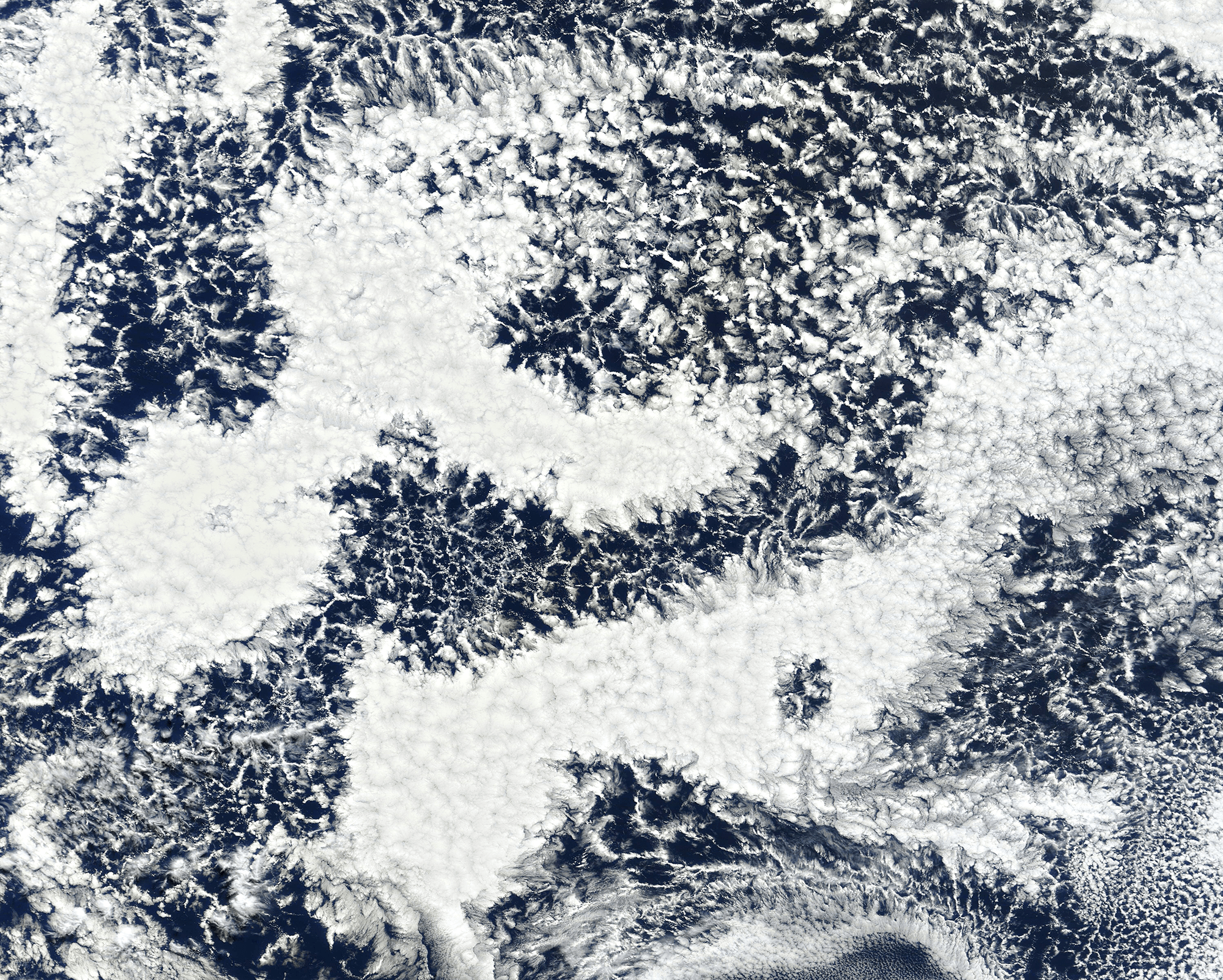
Cellular Clouds
Though tough to make out from the surface, our oceans are often covered by cell-shaped clouds stretching thousands of kilometers. This satellite image shows off two such types of marine stratocumulus cloud. Open-celled clouds appear as thin wisps of vapor around an empty middle; in these clouds, cool air sinks through the center while warm air rises along the edges. Open-celled clouds are good rain producers.
On the flip side, closed-cell clouds have a vapor-filled center and breaks in the cloud cover along each cell’s edge. These clouds don’t produce much rain, but they do lift warm, moist air through their middles and let cool air sink along their edges. Closed-cell clouds tend to last much longer than their open-celled counterparts; they can stick around for half a day, whereas open-celled clouds break up in only a couple hours. (Image credit: J. Stevens; via NASA Earth Observatory)

Rippling Airglow
Though we rarely notice it, our sky is always aglow. Washed in solar radiation, the oxygen and nitrogen molecules at high altitude get broken apart during the daytime and recombine at night, producing a luminescent glow that forms a uniform backdrop against the sky. In this image, the airglow forms a bull’s-eye-like set of rings, thanks to atmospheric gravity waves left behind by a thunderstorm. (Image credit: J. Dai; via APOD)

Stabilizing Jupiter’s Polar Storms
Four years ago, Juno discovered an octagon of eight cyclones at Jupiter’s northern pole and a similar five cyclone structure at its southern pole. Since then, both polygons have remained intact. What keeps the storm systems so stable is still an open question, but a recent observational study using Juno measurements found that an anticyclonic ring sits between the central and outer cyclones. In line with a previous theoretical study, this ring structure helps shield and stabilize the storm system.
The underlying convective mechanisms of the storm remain a mystery, though, as the current study is limited in resolution to a scale of about 200 kilometers. (Image credit: NASA/JPL-Caltech/SwRI/ASI/INAF/JIRAM; research credit: A. Ingersoll et al.; via Gizmodo)

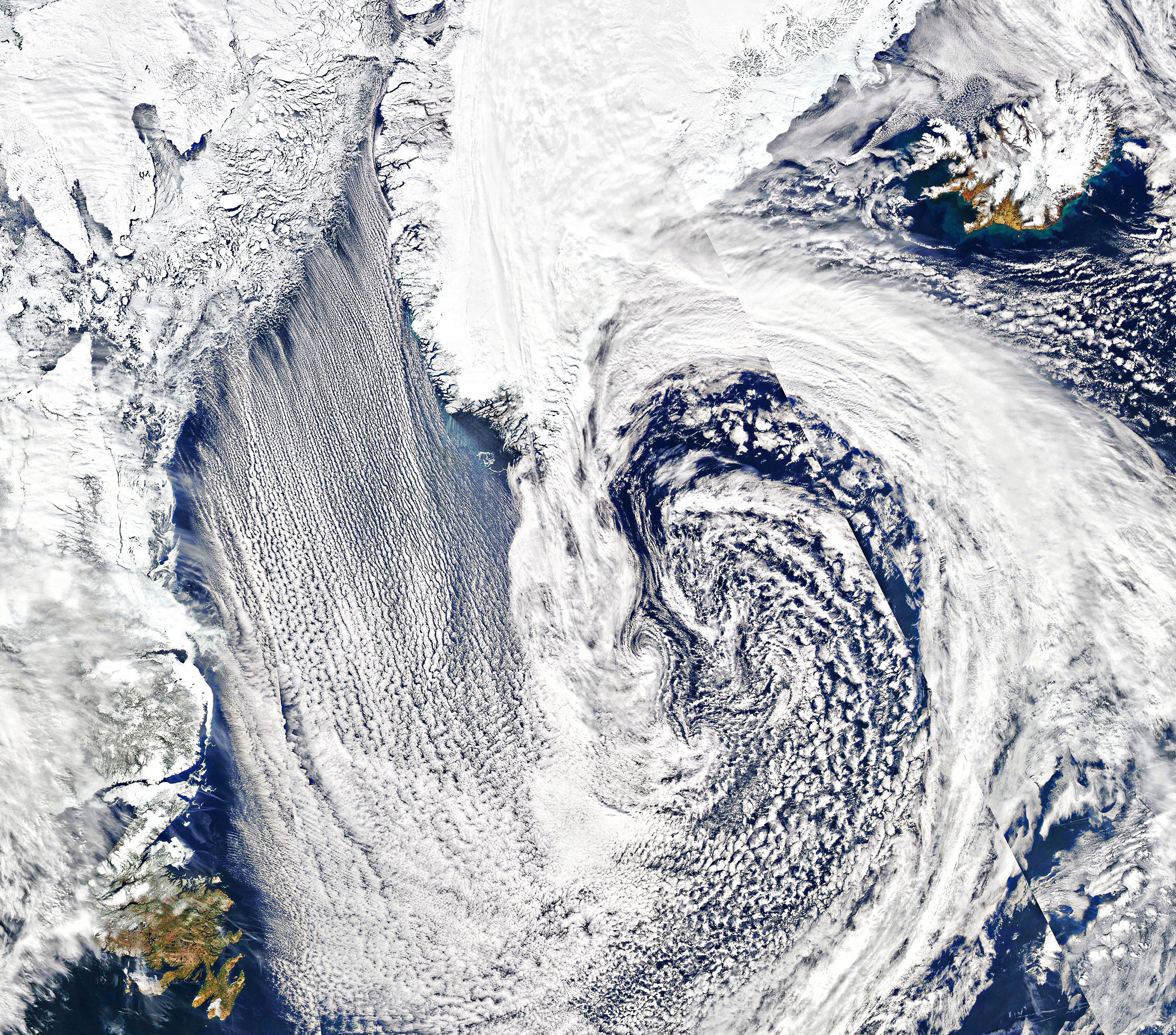
Cloud Streets
Parallel lines of cumulus clouds stream over the Labrador Sea in this satellite image. These cloud streets are formed when cold, dry winds blow across comparatively warm waters. As the air warms and moistens over the open water, it rises until it hits a temperature inversion, which forces it to roll to the side, forming parallel cylinders of rotating air. On the rising side of the cylinder, clouds form while skies remain clear where the air is sinking. The result are these long, parallel cloud bands. (Image credit: J. Stevens; via NASA Earth Observatory)

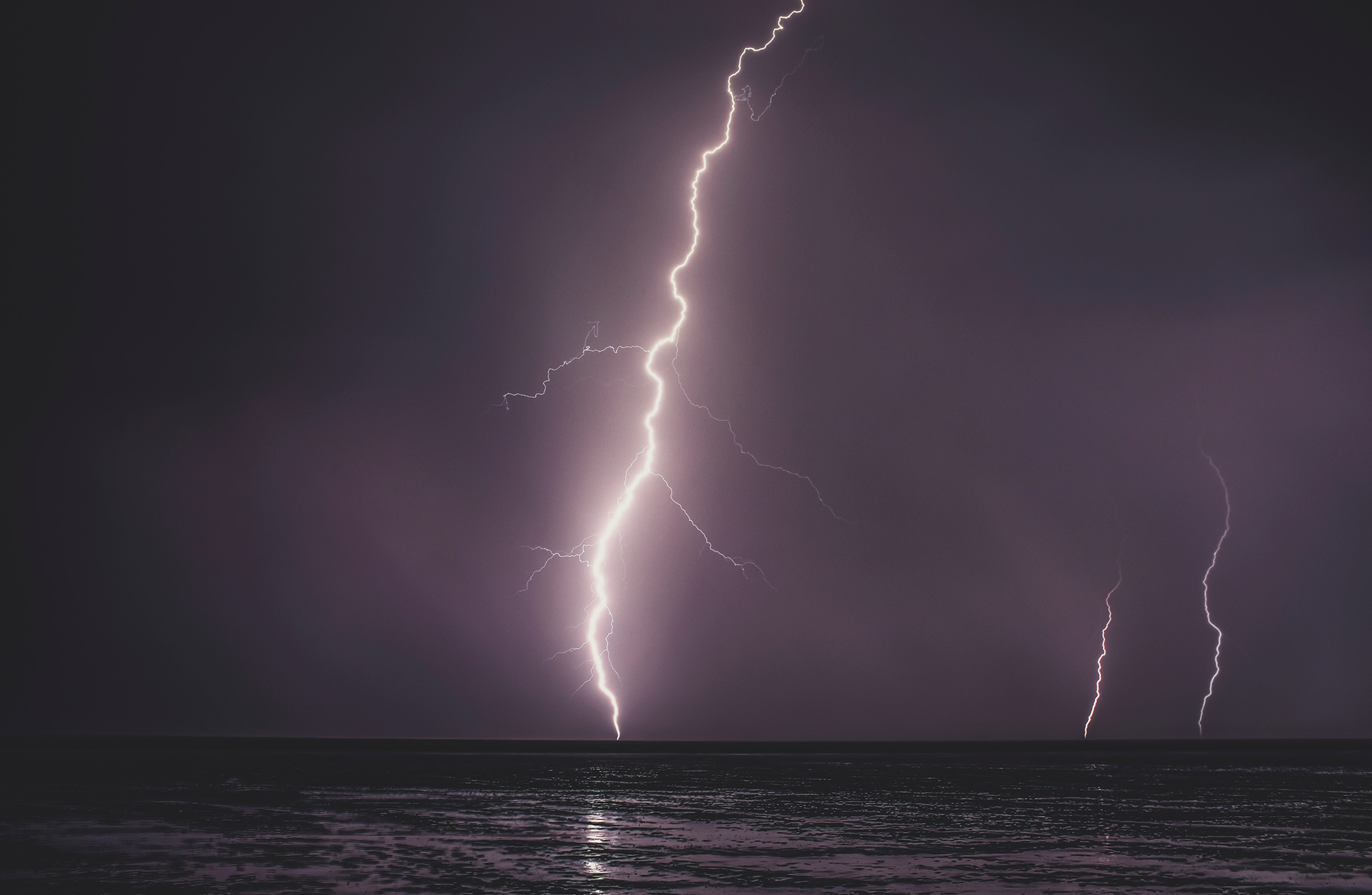
Inhibiting Marine Lightning
Thunderstorms over the ocean have substantially less lightning than a similar storm over land. Scientists wondered whether this difference could be due to lower cloud bases over the ocean or differences in the cloud droplets’ nuclei. But a new study instead implicates coarse sea spray as the deciding factor. By tracking the full lifetime of storm systems through remote sensing, the team found that fine aerosols can increase lightning activity over both land and ocean. But adding coarse sea salt from sea spray reduced lightning by 90% regardless of fine aerosols. With sea salt in the mix, clouds seem to develop fewer but larger condensation droplets, providing less opportunity for the electrification necessary to generate lightning. (Image credit: Z. Tasi; research credit: Z. Pan et al.)