Tag: geology

  • Water Suspected Beneath Mars

    Water Suspected Beneath Mars

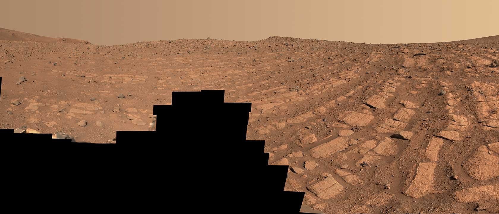
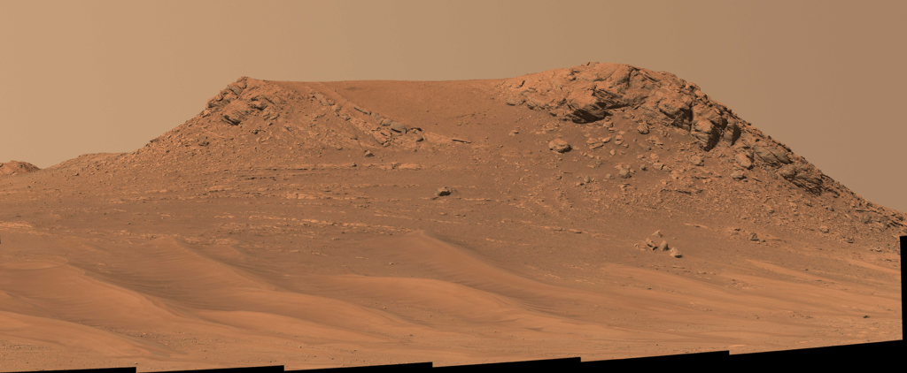
    The surface features of Mars — crossed by river deltas and sedimentary deposits — indicate a watery past. Where that water went after the planet lost its atmosphere 3 – 4 billion years ago is an open question. But a new study suggests that quite a bit of that water moved underground rather than escaping to space.

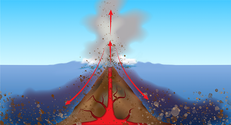
    The research team analyzed seismic data from the Mars InSight Lander. Marsquakes and meteor strikes on the Red Planet send seismic waves through the planet’s interior. The waves’ speed and other characteristics change as they pass through different materials, and by comparing different waves picked up from the same originating source, scientists can back out what the waves passed through on the way to the detector. In this case, the team concluded that the data best fit a layer of water-filled fractured igneous rock 11.5 – 20 kilometers below the surface. They estimate that the water trapped in this subsurface layer is enough to cover the surface of the planet in a 1 – 2 kilometer deep ocean. (Image credit: NASA/JPL-Caltech; research credit: V. Wright et al.; via Physics World)

  • Controlling Finger Formation

    Controlling Finger Formation

    When gas is injected into thin, liquid-filled gaps, the liquid-gas interface can destabilize, forming distinctive finger-like shapes. In laboratories, this mechanism is typically investigated in the gap between two transparent plates, a setup known as a Hele-Shaw cell. In the past, researchers looking to control the instability have explored how surface tension, viscosity, and the elasticity of the gap itself affect the flows. But a new set of studies look at the compressibility of the gas being injected.

    The team found that viscous fingers formed later the higher the gas’s compressibility. That provides a potential control knob for people trying to exploit the mechanism, especially geologists. For geologists trying to extract oil, viscous fingering is detrimental, but, on the flip side, viscous fingers are desirable when injecting carbon dioxide for sequestration. With these results, users can tweak their injection characteristics to match their goals. (Image credit: C. Cuttle et al.; research credit: C. Cuttle et al. and L. Morrow et al.; via APS Physics)

  • Underwater Volcanic Flows

    Underwater Volcanic Flows

    The Hunga Tonga–Hunga Ha’apai volcanic eruption in December 2021 was the most violent in 140 years, and we are still learning from its aftermath. A recent study focuses on the eruption’s incredible underwater flows, which damaged nearly 200 kilometers of underwater cables. From the cables’ locations and the time of service loss, the team calculated that gravity currents hit the cables at speeds as high as 122 kilometers per hour and with run-outs that lasted over 100 kilometers. These fast flows were triggered by material from the volcanic plume falling into the ocean, causing dense flows that swept down the submerged slopes of the volcano and seafloor.

    Illustration of volcanic plume material falling into the ocean and triggering underwater flows.
    Illustration of volcanic plume material falling into the ocean and triggering underwater flows.

    Previously, a landslide broke underwater telegraph cables off Newfoundland and a coastal construction accident severed a cable in the Mediterranean. But neither of those incidents revealed the same level of speed, distance, and destructive capacity as the Tongan eruption. It seems that these underwater gravity currents pose an ongoing threat to submerged infrastructure. As more cables are laid in volcanically-active regions of the Pacific, we will need more extensive mapping and monitoring of the seafloor to protect against future disruptions. (Image credit: eruption – Tonga Geological Services, illustration – APS/C. Cain; research credit: M. Clare et al.; via APS Physics)

  • Fast-Moving Martian Rivers

    Fast-Moving Martian Rivers

    For the first time, scientists have found evidence of deep, fast-flowing ancient rivers on Mars. After examining images taken recently by the Perseverance rover in Jezero Crater, fluvial experts have spotted familiar signs of turbulent river flow. The mosaic above shows an area nicknamed “Shrinkle Haven,” where curved bands of rock mark the landscape. Although scientists are confident that a powerful river deposited these rocks, they’re still debating whether that river was a meandering one like the Mississippi or a braided river like the Platte.

    Nicknamed "Pinestand," this hill's sedimentary layers were likely formed by a deep fast-moving river.
    Nicknamed “Pinestand,” this hill’s sedimentary layers were likely formed by a deep, fast-moving river.

    In another area, known as “Pinestand,” scientists spotted hills as high as 20 meters tall with clear sedimentary layers. Like Shrinkle Haven’s rock bands, formations like this are most often associated with a large, fast-flowing river. (Image credits: NASA/JPL-Caltech/ASU/MSSS; via Gizmodo; see also NASA JPL)

  • A Glimpse of Earth’s Interior

    A Glimpse of Earth’s Interior

    Lava spurts from the Fagradalsfjall volcano in Iceland in this award-winning photo by Riten Dharia. It’s always bizarre to see molten rock flowing in fountains and rivers because it’s so unlike our daily experiences. Some deeply buried areas of the Earth, including the outer part of the core, are often described as liquid rock, which brings to mind lava. But that’s not, in fact, what those regions are like. If you were to visit Earth’s outer core in some super-submersible, you would not find a sea of lava. Instead, you would find yourself surrounded by what seemed to be solid rock. That’s not to say that the outer core is solid — just that it flows on geological timescales that are far longer than any human’s lifetime! (Image credit: R. Dharia; via Gizmodo)

  • Featured Video Play Icon

    Shaping the Earth Through Cataclysm

    Though we often think of the Earth as changing slowly, some events are so catastrophic that they change the landscape irrevocably. Some 15,000 years ago, a massive lake covered what is now Missoula, Montana. Dammed in by a 2,000-foot-tall wall of glacial ice, this lake contained more water than Lakes Ontario and Erie combined. But when the ice dam broke, the lake drained in days, sending a deluge across the Pacific Northwest.

    The floodwaters carved new canyons and waterfalls, left massive ripples in the landscape, and deposited rocks from thousands of kilometers away as they raged their way to the sea. It was one of the most massive floods the Earth has ever seen. And, incredibly, it happened over and over as the lake refilled and broke again. Check out this Be Smart video for even more of this incredible story. (Image and video credit: Be Smart)

  • Vietnam’s Emerald Isles

    Vietnam’s Emerald Isles

    Vietnam’s Hạ Long Bay is home to more than 1,600 islands, many of them made up of mountainous limestone. The area is famous for its karst features, a type of terrain formed from highly porous, water-soluble rock. Over time, water dissolves and fractures the limestone, creating karst landscapes full of caves, springs, sinkholes, and fluted rock outcroppings. The area’s erosion also produces highly fertile soil, leading to a verdant ecosystem with many unique and endemic species. (Image credit: N. Kuring/NASA/USGS; via NASA Earth Observatory)

  • Dripping Impact

    Dripping Impact

    How does water drip, drip, dripping onto stones erode a crater? Water is so much more deformable that it seems impossible for it to wear harder materials away, even over thousands of impacts. To investigate this, a team of researchers developed a new measurement technique: high-speed stress microscopy. In the process, they found that water owes its incredible erosive power to three factors: 1) The drop’s impact creates surface shock waves along the material, which helps increase erosive power; 2) After the shock wave passes, a decompression wave in the material helps loosen surface matter; and 3) The spreading drop sends a non-uniform wave of stress across the material that simultaneously presses and scrubs at the surface. Together, these factors enable simple, repetitive droplet impacts to wear away at hard surfaces. (Image credit: cottonbro; research credit: T. Sun et al.; via Cosmos; submitted by Kam-Yung Soh)

  • Featured Video Play Icon

    Martian Flyover

    Fly over a Martian crater in this incredibly detailed 8K video built from Mars Reconnaissance Orbiter imagery. Like Earth’s deserts, Mars is largely shaped by wind, and we get some fantastic views of sand ripples in this flyover. For reference, the vertical scale covered in the video image is roughly 1 kilometer. It’s pretty astounding to see this kind of detail from a spacecraft 250 kilometers away! (Video and image credit: S. Doran/NASA; via Colossal)

  • Dissolving Pinnacles

    Dissolving Pinnacles

    Limestone and other water-soluble rocks sometimes form sharp stone pinnacles like the ones seen here in Borneo. Scientists have recreated these structures in the laboratory simply by immersing water-soluble substances (essentially blocks of candy) into water. Without any background flow, the blocks will slowly form these pinnacle forests as material dissolves into the nearby water, creating a heavy solute-rich fluid that sinks down the exterior of the block. The convection generated by this dissolution drives the material into these sharp shapes, as shown mathematically in this recent study. (Image credit: N. Naim; research credit: J. Huang and N. Moore; via APS Physics)