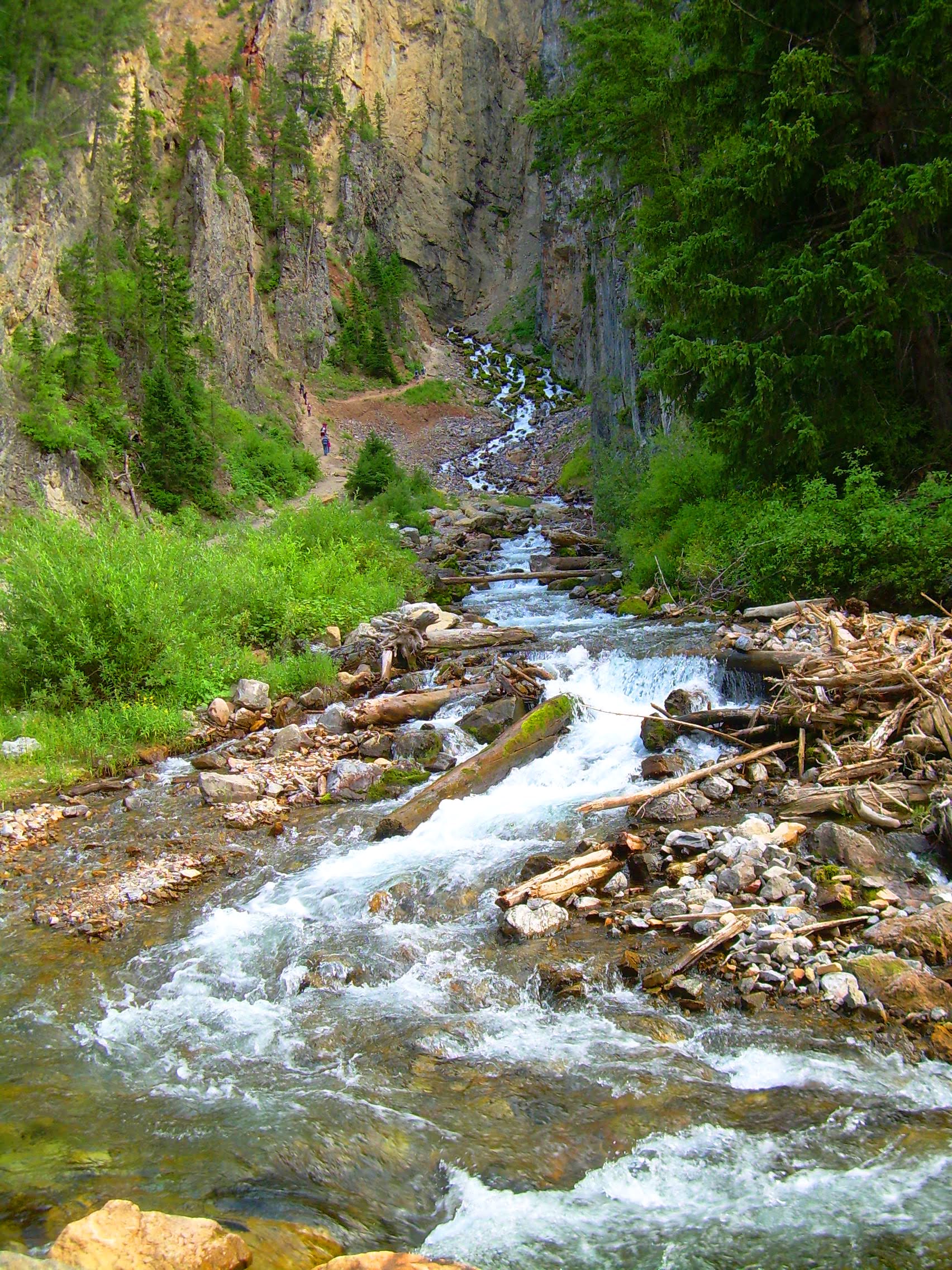
Yellowstone may get top billing, but Wyoming is home to more fluid dynamical wonders, like the world’s largest rhythmic spring. Located a little outside Afton, WY, Intermittent Spring — as the name indicates — runs for roughly 15 minutes, stops for the same length, then starts up again. The leading theory for this periodic flow depends on the siphon effect. Essentially, water runs continuously into a cavern underground, but to get to the surface, it must traverse a narrow tube with a high point that lies above the spring’s eventual exit. When the water level reaches that high point, it creates a siphon, sucking water out of the cavern and making the spring flow. But eventually the water level drops to the point where air rushes in, breaking off the flow until the water level recovers. That’s consistent with the spring’s behavior; it only runs in this intermittent fashion from late summer to fall, when groundwater levels are lower. (Image credit: Wikimedia Commons; video credit: University of Wyoming Extension; submitted by Kam-Yung Soh)
Tag: geology

A Macro View of Weathering
Water constantly weathers sedimentary rock, both physically — through abrasion — and chemically — through dissolution and recrystallization. Now researchers have gotten their first view of this weathering at the Ångstrom level by observing porous rocks with environmental transmission electron microscopy as they interact with both water vapor and liquid water.
As expected, the experiments with liquid water showed that water dissolved the rocks and substantially changed the geometry of the rock’s pores. But the experiments also showed significant weathering from water vapor alone. The researchers found that water vapor formed a film on the surface of the rock’s pores in a process known as adsorption. This film substantially decreased the size of each pore and created strain in the rock. Once the water vapor was removed, the rock’s pores were notably altered, supporting the idea that this adsorption was, itself, a form of weathering. (Image credit: M. Kosloski; research credit: E. Barsotti et al.; via AGU EOS; submitted by Kam-Yung Soh)

Chaotic Mixing in Porous Media
One of the peculiar characteristics of viscous, laminar flows is that they are reversible. Squirt dye into glycerin, stir it one way, then the opposite direction, and the dye returns to its initial position. But this neat trick only works in simple geometries; in a more complex environment, like the pores between packed gravel, flows cannot make their way back to their initial state.
That’s the idea at the heart of this new study of mixing in porous media. Researchers took a bed of packed beads and pushed a slow, steady flow of dye into the bed. Then they steadily withdrew fluid to reverse the flow and observed how the dye they’d injected appeared at the surface of the bed (top image). If the flow were perfectly reversible, we’d expect the dye to return to its injection point. But instead the dye is spread chaotically across the surface, giving researchers a snapshot of the chaotic mixing taking place between beads. (Image and research credit: J. Heyman et al.; via APS Physics)

Uncovering Erosion Patterns
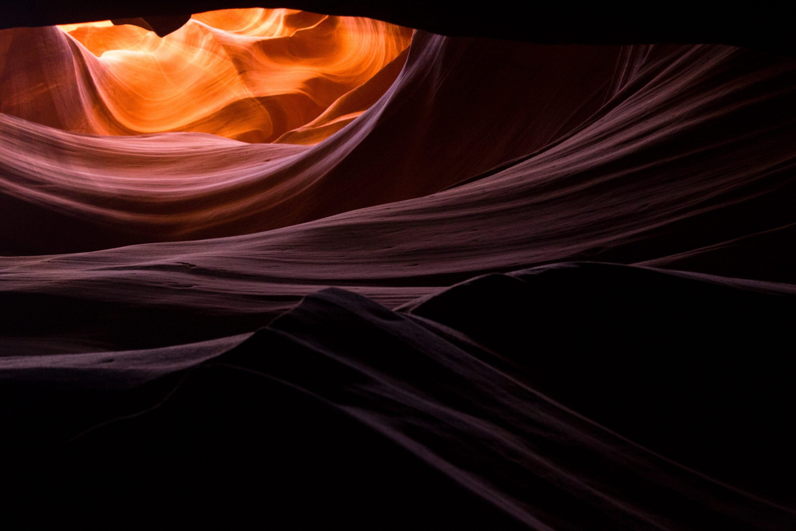
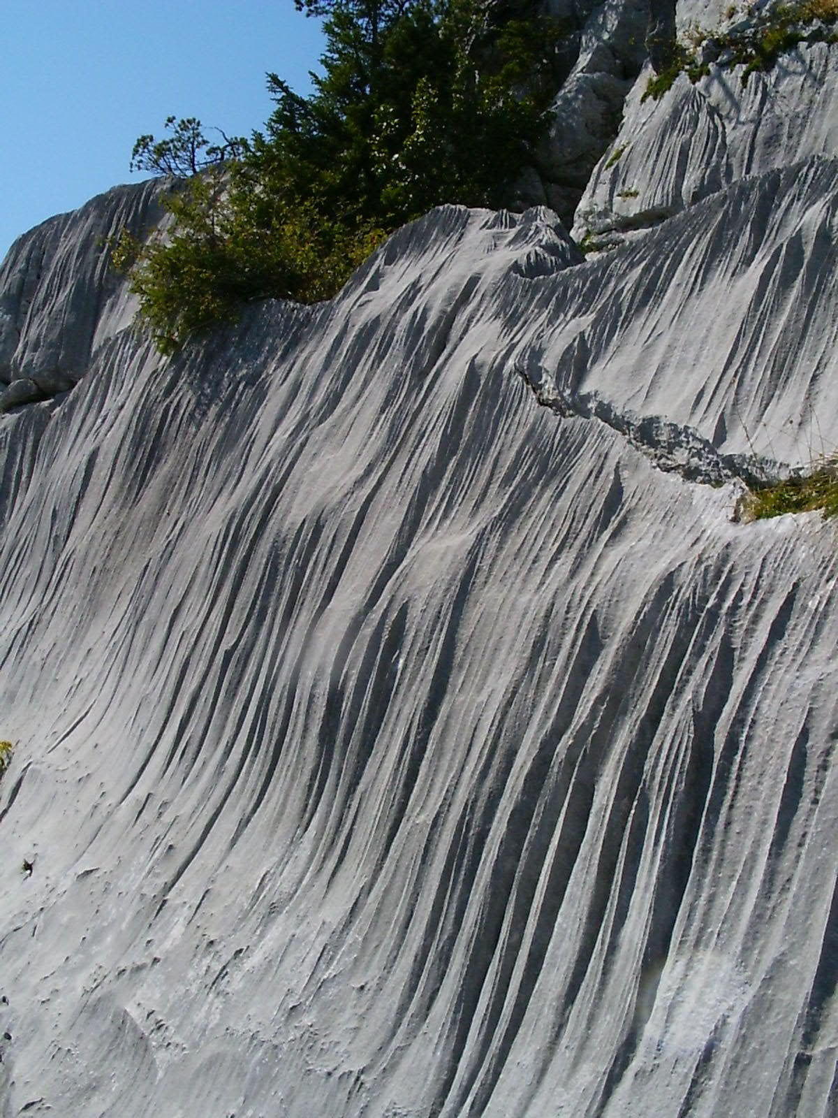
Gypsum and limestone cliffs sometimes form patterns of long, parallel grooves known as rillenkarren. Recent research shows that these patterns form when a thin layer of water flows over a dissolvable surface. As the running water picks up solute, its concentration increases, causing changes in the local hydrodynamics. What begins as a small perturbation in an otherwise flat surface grows into a groove with walls that eventually rise out of the water layer. At that point, the growth mechanism shifts because the flow is restricted to channels in the rock. (Image credit: Ymaup/Wikimedia Commons; research credit: A. Guérin et al.; via APS Physics; submitted by Kam-Yung Soh)

Making a Miniature River


Despite wide differences in ecology and geology, rivers around the world share certain fundamental features. Physicists study these characteristics by creating small-scale rivers in the laboratory, like the experiment featured in this Lutetium Project video. Within these systems, scientists can carefully control variables and discover useful patterns, like the two parameters needed to describe the shape of a river’s profile! (Image and video credit: The Lutetium Project)

Dissolving Caramel


In nature, erosion patterns are driven by the interactions of flow and topography. Here, researchers study that process in the lab by placing an inclined block of caramel in quiescent syrup and watching as it dissolves. Initially, the bottom surface of the block develops regularly-spaced plumes — the dark lines seen in the first image. But because the caramel-laden plumes are heavier than the surrounding fluid, the flow quickly becomes unstable. The plumes cross one another and begin to carve chevrons into the caramel.
The chevrons appear to march their way upward in the video. They slowly grow and change into a distinctly scalloped pattern. Scallops like these are often seen by geologists in caves and icebergs, and the authors argue that their results and modeling indicate the importance of buoyant flow effects on such natural formations. (Image and research credit: C. Cohen et al.)
Exploring Martian Mud Flows


When looking at Mars and other parts of our solar system, planetary scientists are faced with a critical question: if what I’m looking at is similar to something on Earth, did it form the same way it does here? In other words, if something on Mars looks like a terrestrial lava flow, is it actually made of igneous rock or something else?
To tackle this question, a team of researchers explored mud flows in a pressure chamber under both Earth-like and Martian conditions. They found that mud flowed quite freely on Earth, but with Martian temperatures and pressures, the flows resembled lava flows like those found in Hawaii or the Galapagos Islands.
On Mars, mud begins boiling once it reaches the low pressure of the surface. This boiling cools it, causing the outer layer of the mud to freeze into an increasingly viscous crust, which changes how the mud flows. In this regard, it’s very similar to cooling lava, even though the heat loss mechanisms are different. (Video and research credit: P. Brož et al.; image credit: N. Sharp; see also P. Brož; submitted by Kam-Yung Soh)
Tektites and Spinning Fluids


Tektites, like obsidian, are a naturally-occurring glass formed from molten rock. But tektites are often dumbbell or figure-8-shaped because they form in midair from spinning bits of fluid sent skyward after the crash of a meteor. In this video, Steve Mould takes us through the process and discusses some recent work by scientists who’ve created artificial tektites in the lab by levitating and spinning candle wax and other fluids. (Video and image credit: S. Mould; research credit: K. Baldwin et al.)

Where are Titan’s Deltas?


Saturn’s moon Titan is the only other planetary body in our solar system known to have bodies of liquid on its surface. But where Earth has lakes and seas of water, Titan’s are hydrocarbon-based, primarily ethane and methane. As on Earth, these liquids rain from skies and run down rivers and streams into larger bodies. What they do not do, as far as scientists can tell, is form deltas.
On Earth (and ancient Mars), rivers tend to slow and branch out as they run into larger, still bodies. Many of these river deltas — like the Nile, Ganges, and Mississippi — are visible from space. But so far we’ve seen no equivalent formations on Titan, even though the radar resolution of Cassini should have allowed for it.
There are currently two hypotheses to explain this absence. One posits that density differences between hydrocarbon rivers and lakes mean that deltas do not form. On Titan, the larger bodies are warmer and do not absorb as much atmospheric nitrogen, making them lighter overall. That means a cold, dense river might just sink immediately beneath the lake without slowing to deposit sediment.
Another hypothesis is that deltas do form but that the shifting shorelines of Titan’s seas wash them out and make them unrecognizable. There’s evidence that Titan’s northern and southern hemispheres can swap their liquid hydrocarbons back and forth on a 100,000 year timescale. If that’s true, those shifts could obscure any evidence of deltas.
Experiments are underway to test the first hypothesis, but the final answers may have to wait until NASA’s Dragonfly mission reaches Titan in 2034. (Image credit: Titan – NASA/JPL-Caltech/ASI/Cornell, Alaska – NOAA; via AGU Eos; submitted by Kam-Yung Soh)
When the Mediterranean Dried Up


Geological evidence shows that millions of years ago, the Mediterranean Sea nearly dried out. In fluid mechanics, we’d describe this problem using one of our fundamental equations: conservation of mass, also known as continuity.
Imagine a volume containing the entire Mediterranean. To describe the amount of sea water in that volume, you need to keep track of two major quantities: how much water is flowing into the volume and how much is leaving it. For the prehistoric (as well as today’s) Mediterranean, the sources feeding the sea are 1) an inflow from the Atlantic through the Strait of Gibraltar; 2) inflows from rivers; and 3) rainfall. Water is lost primarily to evaporation.
As explained in the video, the Mediterranean’s dry spell was heralded by tectonic changes that sealed the Strait of Gibraltar, depriving it of its largest source of inflow. At the same time, warmer temperatures and less rainfall reduced influx from rivers and the atmosphere while increasing evaporation rates. The result? Water levels in the Mediterranean dropped by hundreds of meters, creating massive salt deposits, wiping out native marine life, and allowing mass migration by land-dwelling animals. Eventually, though, the Strait re-opened, creating what might have been a massive flood. (Video and image credits: PBS Eons)


#/media/File:Periodic_Spring_(from_the_bottom).JPG)