Tag: von Karman vortex street

  • Swirls Above the Southern Ocean

    Swirls Above the Southern Ocean

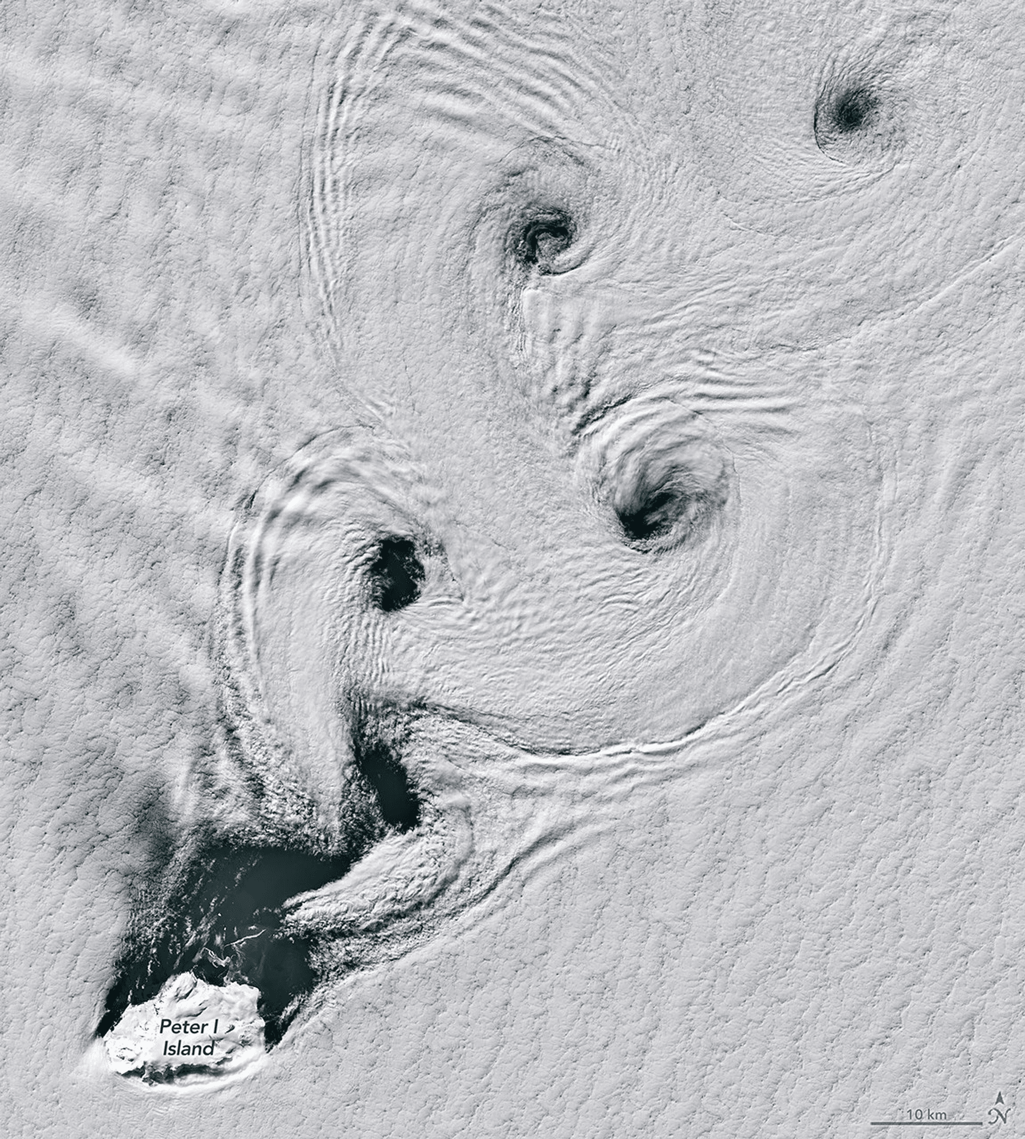
    In the Southern Ocean, obstacles are sparse. But the ice-cloaked volcano of Peter I Island is tall enough at over 1600 meters to disrupt the wind. At steady wind speeds between about 18 to 54 kilometers per hour, flowing past the island creates vortices that shed from one side and then the other. The result is a von Karman vortex street like the one seen here, flowing toward the upper right.

    The overlaid ripple structures in the cloud layer are reminiscent of gravity waves. Perhaps, the wind’s passage made some lee waves that the vortices distorted? (Image credit: M. Garrison; via NASA Earth Observatory)
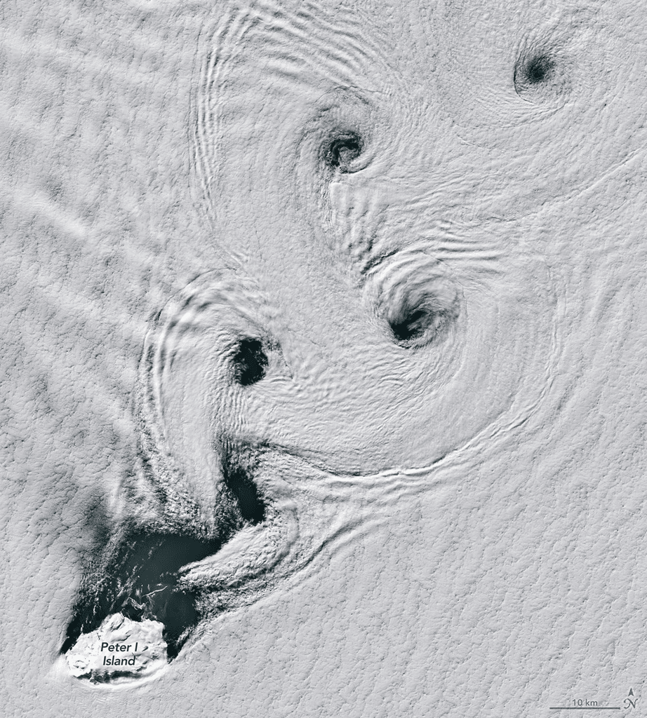
    A von Karman vortex street stretches downstream from Peter I Island.
  • A Special Trio of Clouds

    A Special Trio of Clouds

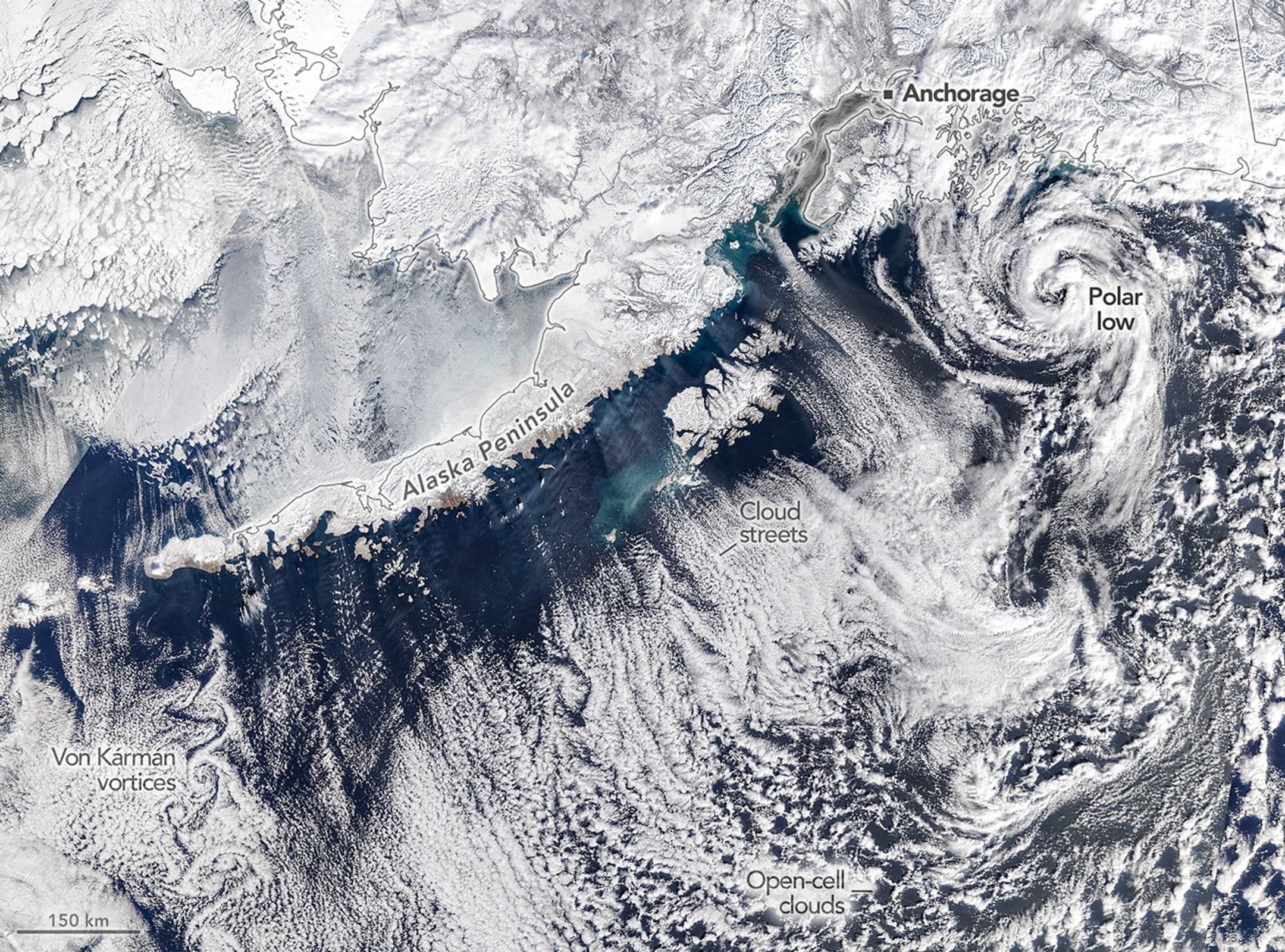
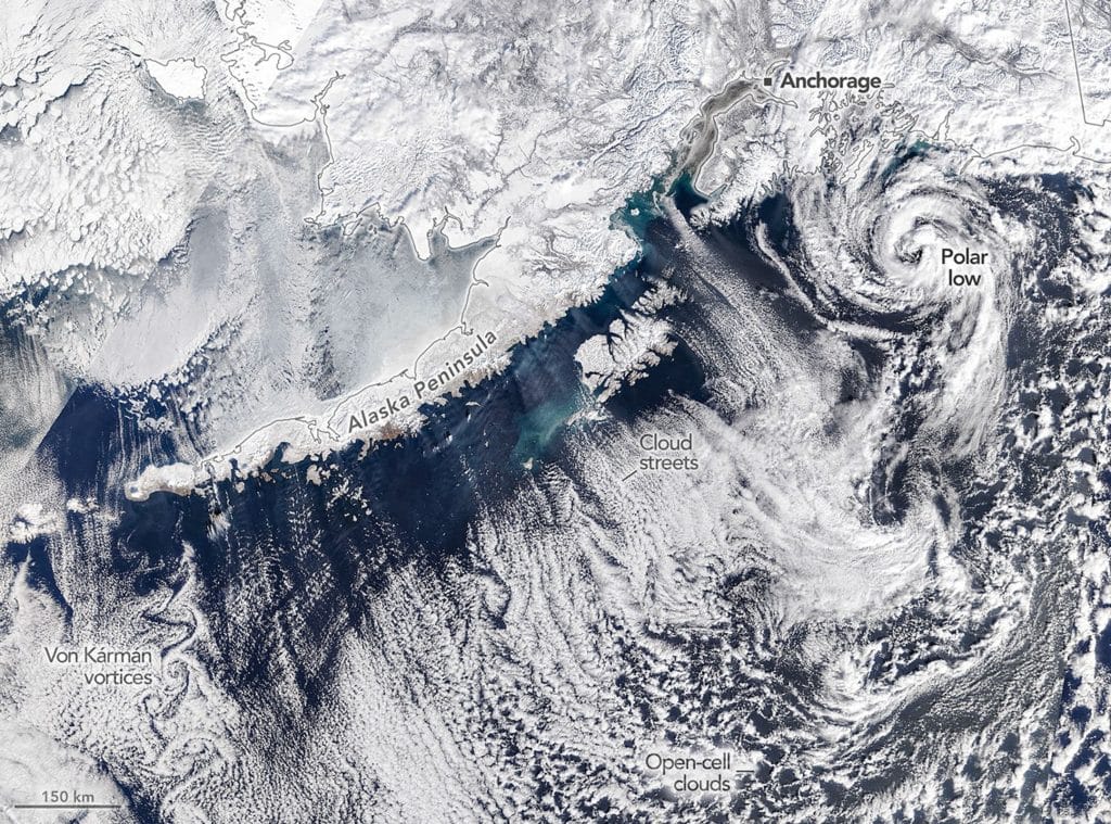
    Off the coast of Alaska, March 19th, 2026 featured a trio of fascinating clouds. Southwest of Anchorage, a cyclonic polar low twisted up from cold polar air centered over warmer waters. This particular storm boasted tropical-storm-force winds and thunderstorms in its center.

    Further west, long cloud streets formed parallel to the wind as cold dry air picked up moisture from warmer polar waters. And, finally, in the bottom left of the image, alternating vortices swirl in the wake of a rocky island, forming a beautiful von Karman vortex street. (Image credit: M. Garrison/NASA Earth Observatory)

    A trio of atmospheric phenomena appear in this satellite image off Alaska: a polar low, cloud streets, and a von Karman vortex street.

  • Viscoelastic Vortex Street

    Viscoelastic Vortex Street

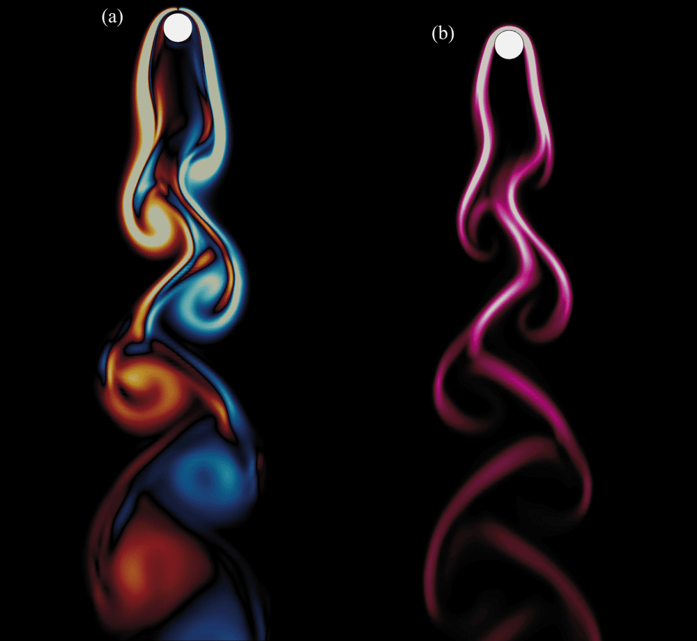
    When flow moves past a cylinder, vortices get shed in its wake. Known as a von Karman vortex street, this distinctive pattern is seen behind flags, islands, and even behind starships. Here, researchers are simulating flow of a viscoelastic fluid, where–unlike water or other Newtonian fluids–elastic stresses can build up.

    As the flow hits the leading edge of the cylinder, the polymers in the fluid compress and then get stretched as the flow moves around the cylinder. The left image shows vorticity in the flow; the right shows elastic stresses. The large swirls are primary vortices–those shed off the cylinder. But look closely and you’ll see smaller secondary vortices curled up beside the primaries. These form when the elastic stresses in the fluid pull some of the shear layer into the wake. (Image and research credit: U. Patel et al.)

    Simulation of a flow around a cylinder in a viscoelastic flow. Left, vorticity; right, elastic stresses.
  • A Variety of Vortices

    A Variety of Vortices

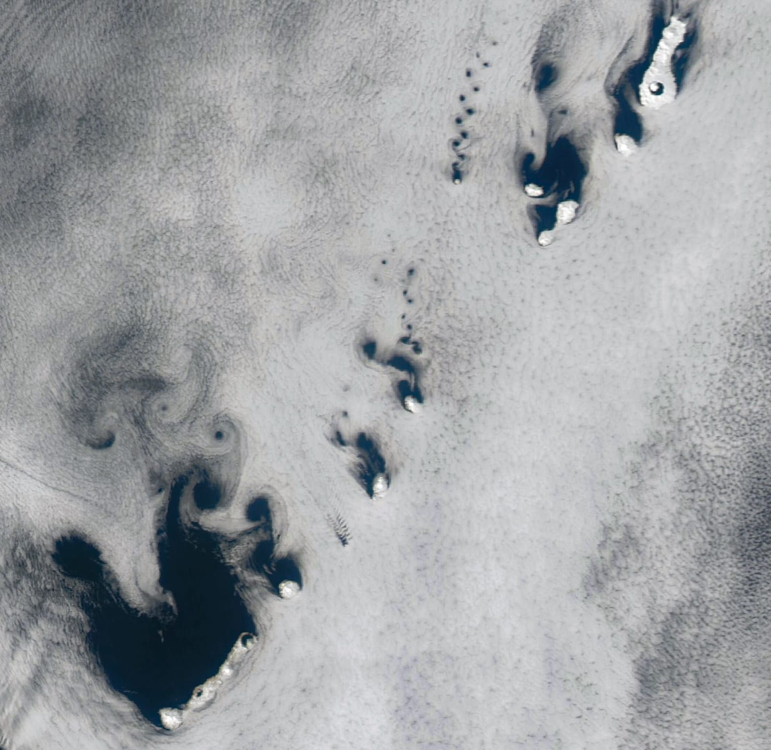
    Winds parted around the Kuril Islands and left behind a string of vortices in this satellite image from April 2025. This pattern of alternating vortices is known as a von Karman vortex street. The varying directions of the vortex streets show that winds across the islands ranged from southeasterly to southerly. Notice also that the size of the island dictates the size of the vortices. Larger islands create larger vortices, and smaller islands have smaller and more frequent vortices. (Image credit: M. Garrison; via NASA Earth Observatory)

    Fediverse Reactions
  • Saharan Dust

    Saharan Dust

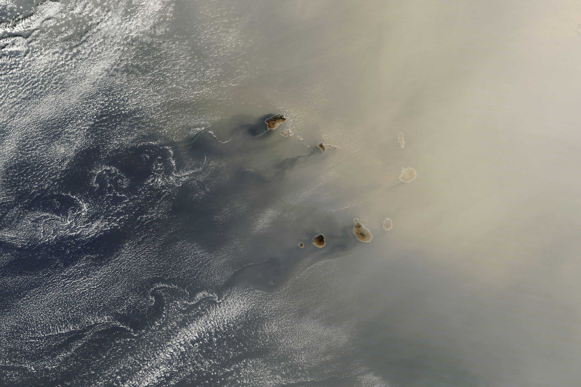
    In late January, dust from the Sahara blew westward toward the Cabo Verde archipelago before turning northward toward Europe. During winter and spring, Saharan dust tends to stay at lower altitudes, where it can be carried by the northeast trade winds. In contrast, from late spring to early fall, dust rises higher, carried westward by the Saharan Air Layer; there, the dust can help suppress both the formation and intensity of the Atlantic’s hurricanes.

    On the left side of the image scant clouds trace von Karman vortex streets behind the archipelago, marking the atmospheric disruption caused by the rocky islands. (Image credit: L. Dauphin; via NASA Earth Observatory)
  • Seeding Clouds

    Seeding Clouds

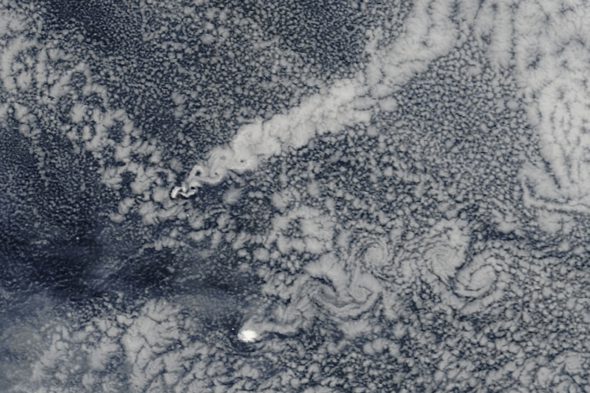
    In the remote South Atlantic, north of the Antarctic Circle, sit the volcanic Zavodovski and Visokoi islands. Though only roughly 500 and 1000 meters tall, respectively, each island disrupts the atmosphere nearby, often generating cloudy wakes. In today’s pair of images, the northerly Zavodovski has a particularly bright cloud wake, thanks to sulfate aerosols degassing from its volcano, Mount Curry. Though it’s hard to pick out the effect in the natural-color image above, the false-color version below shows the bright wake clearly. The filtering on this image turns snow and ice — like that on Visokoi’s peak — red and makes the water vapor of clouds white. The sulfates from Mount Curry act as nucleii for water droplets, forming many small, reflective drops that stand out against the rest of the sky. (Image credit: W. Liang; via NASA Earth Observatory)
    This false-color satellite image highlights the volcanic seeding by filtering snow and ice as red and water vapor in clouds as white.
    This false-color satellite image highlights the volcanic seeding by filtering snow and ice as red and water vapor in clouds as white.
  • Featured Video Play Icon

    Walking in the Wake of a Cylinder

    A cylinder in a flow produces a series of alternating vortices known as a von Karman vortex street. Changing the flow speed and rotating the cylinder both allow researchers to tune the frequency of these shed vortices. What happens to an object in the wake?

    For a simple hydrofoil tethered to the cylinder, the object wends back and forth along the vortices. But when that hydrofoil sits at the end of a double-pendulum, something very interesting happens. The whole apparatus follows a consistent trajectory similar to a human walking gait. Researchers are using this motion to build a robot that will help physical therapy patients regain a natural walking style. (Image and video credit: A. Carleton et al.)

  • Actinoform Clouds

    Actinoform Clouds

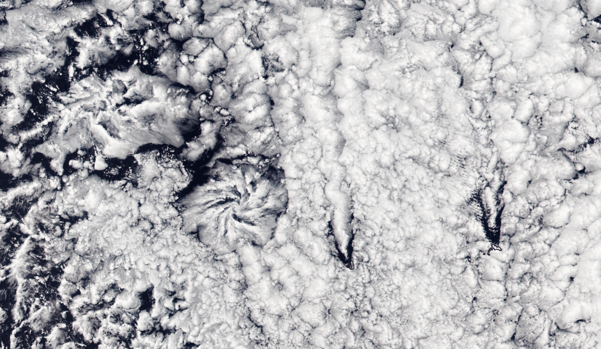
    Flower-shaped actinoform clouds, like those seen on the left side of this satellite image, were only discovered in the 1960s once satellite imagery allowed meteorologists to identify cloud structures that were too large to recognize from the ground. Often appearing over the ocean, these clouds can stretch over hundreds of kilometers, bringing drizzling rain.

    This particular set of actinoform clouds have some distinctive neighbors in the right side of the image, where V-shaped slashes through the cloud cover mark the origins of two von Karman vortex streets. The vortex streets appear downwind of two rocky islands, Alejandro Selkirk Island and Robinson Crusoe Island. (Image credit: L. Dauphin; via NASA Earth Observatory)
  • Tidal Vortices

    Tidal Vortices

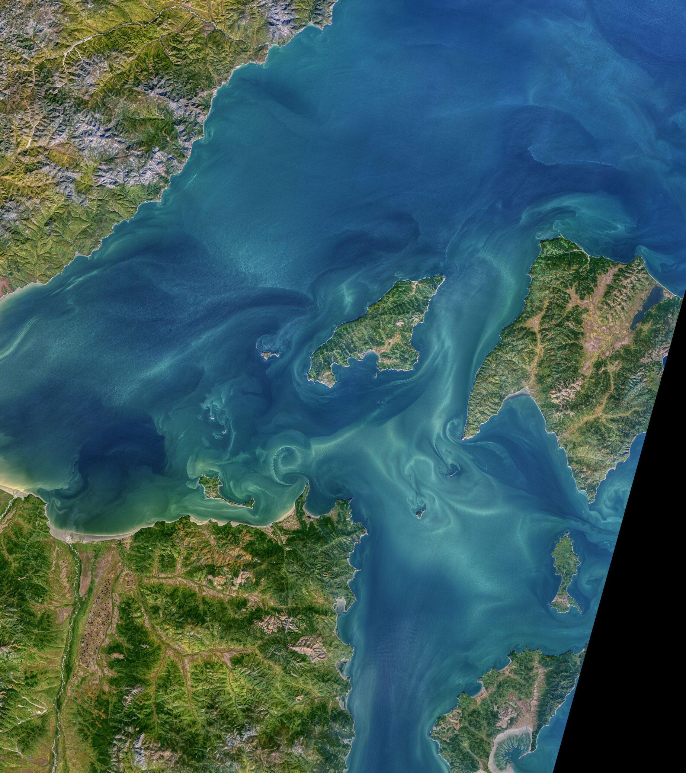
    Local topography in the Sea of Okhotsk funnels water to create some of the largest diurnal tides in the world — nearly 14 meters! The currents rushing past islands and outcrops create swirling vortices like the ones seen in this natural-color satellite image. In some places, you can even see multiple vortices, strung together into a von Karman vortex street. At high tide, the vortex streets stretch westward, but at low tide they point east. (Image credit: N. Kuring/NASA/USGS; via NASA Earth Observatory)

  • Swirls in the Wake

    Swirls in the Wake

    Rocky islands make excellent atmospheric swirls, as seen here around Guadalupe Island. Winds blowing in from the ocean get forced up and around the island’s topography, resulting in vortices that shed alternately from either side of the island. The pattern they form is known as a von Karman vortex street and is easily seen in satellite imagery, thanks to the swirls that can persist for tens of kilometers downstream. Personally, I never get tired of this one! (Image credit: NASA/GSFC/JPL; video credit: NOAA/CIRA; via Dakota Smith; submitted by @SellaTheChemist)