Clouds spiral behind the islands of Tenerife and Gran Canaria in this nighttime satellite imagery. Although it’s not entirely unusual to see these von Karman vortex street clouds in the wakes of islands, this is the first time I’ve seen them at night. They form when winds off the ocean are forced up and around rocky islands. Like air moving past a cylinder, the flow forms a swirling vortex off one side of the island, which separates and moves downstream while another forms on the island’s opposite side. When the resulting flow mixes with a cloud layer, we can see the pattern from space. (Image credit: J. Stevens; via NASA Earth Observatory)
Tag: clouds

Waves on a Supercell
This Colorado supercell thunderstorm features an unusual twist. Notice the sawtooth-like protrusions along the outer cloud wall. These are Kelvin-Helmholtz waves, like these fair-weather clouds we’ve seen before, but instead of occurring vertically, they project horizontally! That implies that the invisible layer of air just outside the cloud wall is moving faster than the wall itself. That creates shear along the outer edge of the cloud wall and causes these waves to form. This is the first time I’ve ever seen this sort of thing. What an awesome photo! (Image credit: M. Charnick; submitted by jpshoer)

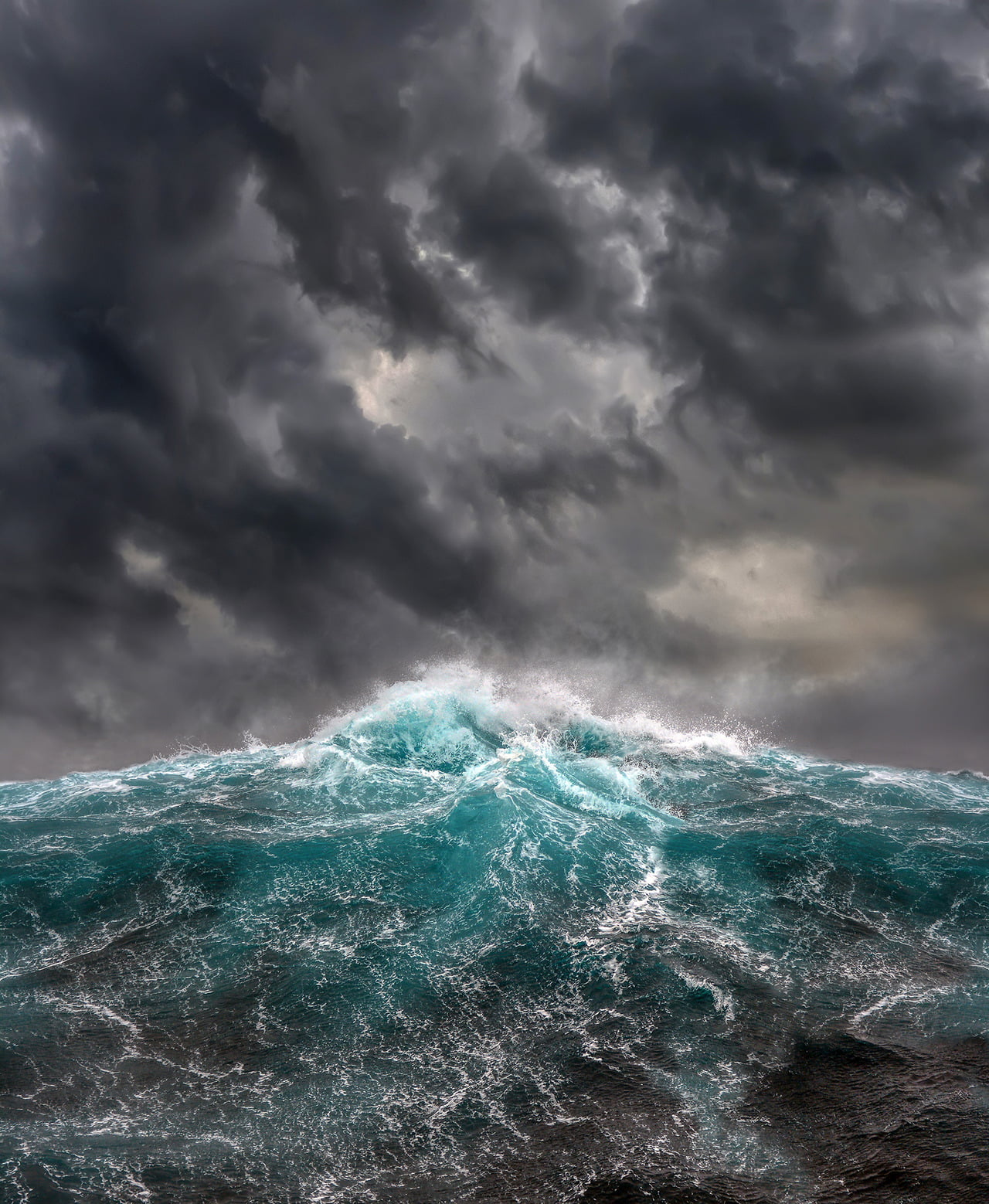
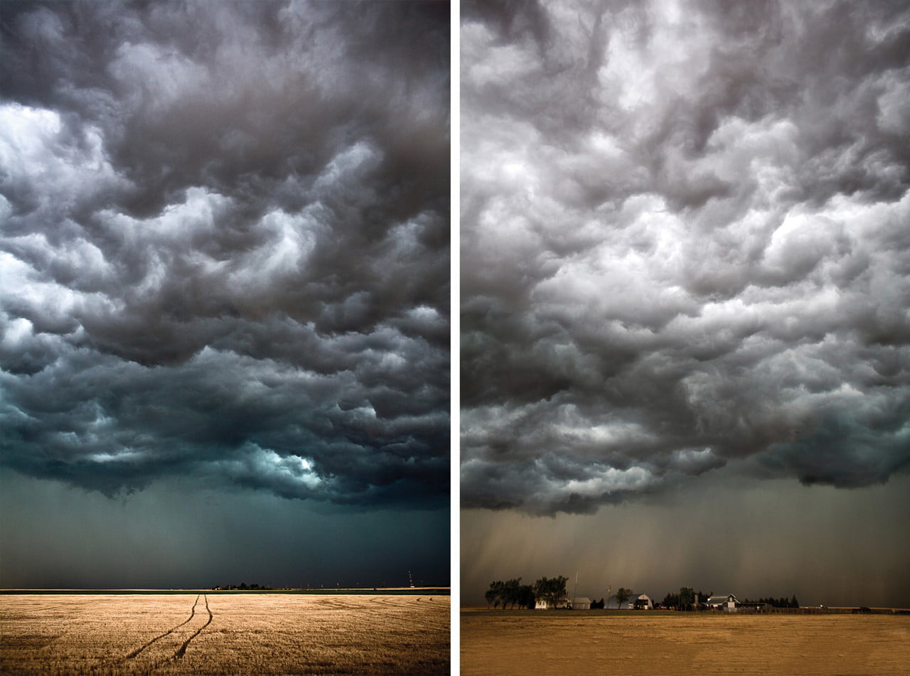
The Drama of Turbulence


Photographer Jason Wright captures dramatic views of Hawaiian landscapes. Moments like these remind us of the spectacular power of the ocean and atmosphere around us. Just look at all that incredible turbulence! See more of Wright’s work on his Instagram and website. (Image credit: J. Wright; via Colossal)

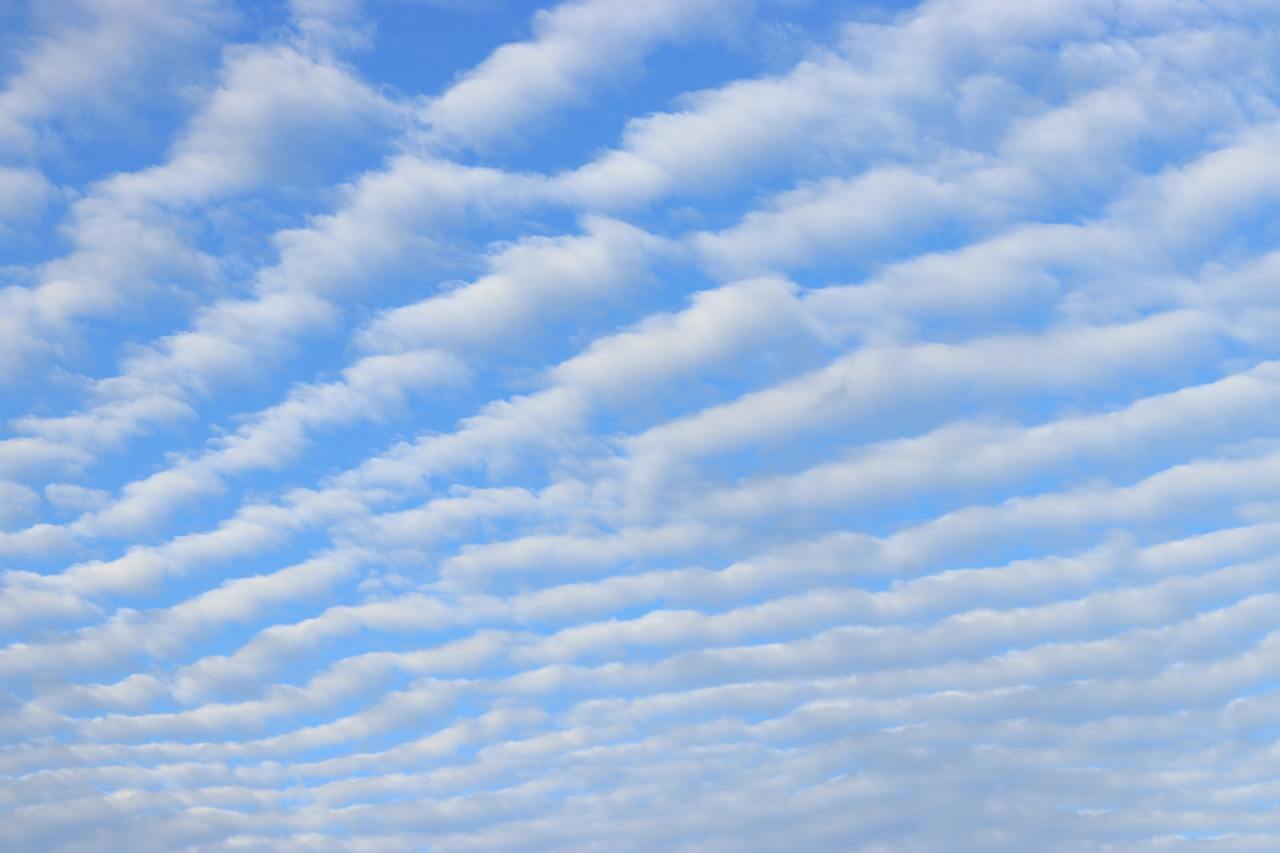
Waves in the Sky
Even when the sky is mostly blue, there’s a lot going on at different altitudes. The winds do not move in a consistent direction or at the same speed, something which becomes apparent when watching clouds move relative to one another. When different layers of air move past one another, there is shear between them, not unlike the friction you feel when running your hand along a table. Under the right circumstances, this shear creates Kelvin-Helmholtz waves like the ones in this image over Helena Valley, Montana. Fast-moving winds (blowing right to left in the image) above a layer of clouds created these breaking wave-like curls. The same phenomenon creates many of the ocean’s waves from the shear caused by wind blowing across water. (Image credit: H. Martin, via EPOD)

“Vorticity 2”


There’s no better way to appreciate our atmosphere than through timelapse, and photographer Mike Olbinski is a master at capturing the beauty and power of nature at work through this medium. In “Vorticity 2″, he highlights two full seasons of storm chasing in an incredible seven-and-a-half minutes. Prepare yourself for dramatic cloudscapes, torrential rains, and even twin tornadoes. This one deserves a watch on the biggest screen you have available. (Image and video credit: M. Olbinski; via Colossal)

Volcanic Plume
Astronauts aboard the International Space Station captured this dramatic image of Raikoke Volcano’s eruption in late June. This uninhabited Pacific Island is part of the Kuril Islands off mainland Russia. The hot plume of ash and volcanic gas rose until its density matched that of the surrounding air, at which point it could only expand horizontally. This is why the plume appears to have such a flat top. It’s similar to the cumulonimbus clouds we associate with severe thunderstorms. Scientists speculate that the white ring around the plume’s base might be water vapor condensed from ambient air pulled in to the plume’s base or a side-effect of magma flowing into the surrounding sea. (Image credit: NASA; via NASA Earth Observatory)

Striped Clouds
Living near the Rocky Mountains, it’s not unusual to look up and find the sky striped with lines of clouds. Such wave clouds are often formed on the lee side of mountains and other topography. But even in the flattest plains, you can find clouds like these at times. That’s because the internal waves necessary to create the clouds can be generated by weather fronts, too.
Imagine a bit of atmosphere sitting between a low-pressure zone and a high-pressure zone. This will be an area of convergence, where winds flow inward and squeeze the fluid parcel in one direction before turning 90 degrees and stretching it in the perpendicular direction. The result is a sharpening of any temperature gradient along the interface. This is the weather front that moves in and causes massive and sudden shifts in temperature.
On one side of the front, warm air rises. Then, as it loses heat and cools, it sinks down the cold side of the front. The sharper the temperature differences become, the stronger this circulation gets. If the air is vertically displaced quickly enough, it will spontaneously generate waves in the atmosphere. With the right moisture conditions, those waves create visible clouds at their crests, as seen here. For more on the process, check out this article over at Physics Today. (Image credit: W. Velasquez; via Physics Today)
“The World Below”
Since the first cosmonauts and astronauts entered orbit around our planet, they’ve held a unique perspective. Thanks to the timelapse photography of recent astronauts aboard the ISS and the editing skills of photographer Bruce W. Berry, Jr, the rest of us can enjoy a taste of that viewpoint. Turn up the volume, fire up the big screen, and enjoy.
I particularly like how several of the sequences show off the depth of the atmosphere. Earth’s atmosphere is incredibly thin compared to the size of our planet – less than one percent of Earth’s radius – but thanks to the shadows that clouds cast on one another, you can really appreciate their height in sequences like the one at 2:26. (Video credit: B. Berry, Jr. using NASA footage)

Turbulent Skies
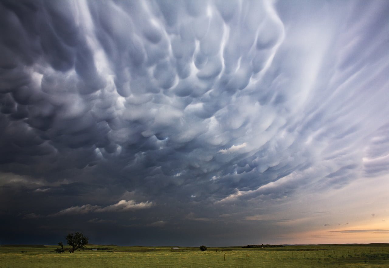
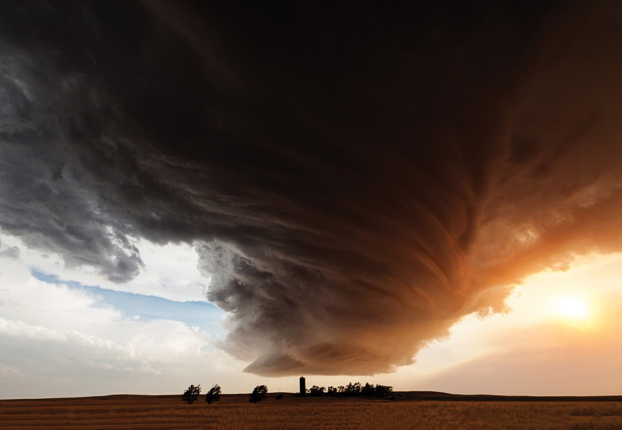
The atmosphere above us is a thin layer enclosing our planet, but it roils with activity and energy. Photographer Camille Seamon captures the grandeur of our turbulent skies in her storm shots. These dramatic atmospheric vistas – including mammatus clouds (top), swirling supercells (middle), and turbulent storm clouds (bottom) – are all driven by the flow of heat and moisture. (Image credit: C. Seaman; via Colossal)
Growing Droplets
The moisture in clouds eventually condenses into droplets that grow into raindrops and fall. Some steps in this process are well understood, but others are not. In particular, scientists have struggled with the problem of how droplets grow from about 30 microns to 80 microns, where they’re big enough to start falling and merging.
Laboratory experiments and numerical simulations (below) have shown that turbulence can help drive small water drops together. When droplets are tiny and light, they simply follow the air flow. But when they’re a little heavier, turbulent eddies (seen in orange below) act like miniature centrifuges, flinging larger water droplets (shown in cyan below) out into clusters, where they’re more likely to collide with one another.
Although this effect has been seen in experiments and simulation, it’s been difficult to capture in clouds themselves. But a new set of test flights (above) confirms that this mechanism is present in the wild as well! (Image credit: UCAR/NCAR Earth Observing Laboratory, P. Ireland et al., source; research credits: M. Larsen et al., P. Ireland et al.; via APS Physics; submitted by Kam-Yung Soh)