The intense heat from wildfires fuels updrafts, lifting smoke and vapor into the atmosphere. As the plume rises, water vapor cools and condenses around particles (including ash particles) to form cloud droplets. Eventually, that creates the billowing clouds we see atop the smoke. These pyrocumulus clouds, like this one over California’s Line fire in early September 2024, can develop further into full thunderstorms, known in this case as pyrocumulonimbus. The storm from this cloud included rain, strong winds, lightning, and hail. Unfortunately, storms like these can generate thousands of lightning strikes, feeding into the wildfire rather than countering it. (Image credit: L. Dauphin; via NASA Earth Observatory)
Tag: cloud formation

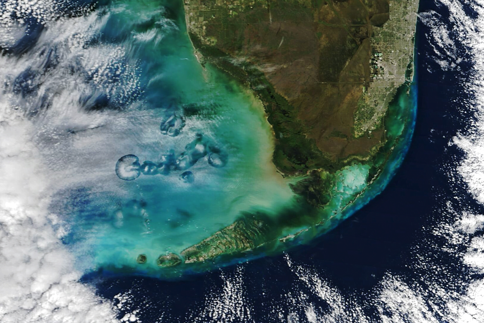
Hole Punch Clouds
At times altocumulus cloud cover is pierced by circular or elongated holes, filled only with the wispiest of virga. These odd holes are known by many names: cavum, fallstreak holes, and hole punch clouds. Long-running debates about these clouds’ origins were put to rest some 14 years ago, after scientists showed they were triggered by airplanes passing through layers of supercooled droplets.
When supercooled, water droplets hang in the air without freezing, even though they are colder than the freezing point. This typically happens when the water is too pure to provide the specks of dust or biomass needed to form the nucleus of an ice crystal. But when an airplane passes through, the air accelerated over its wings gets even colder, dropping the temperature another 20 degrees Celsius. That is cold enough that, even without a nucleus, water drops will freeze. More and more ice crystals will form, until they grow heavy enough to fall, leaving behind a clear hole or wisps of falling precipitation.
In the satellite image above, flights moving in and out of Miami International Airport have left a variety of holes in the cloud cover each of them large enough to see from space! (Image credit: M. Garrison; research credit: A. Heymsfield et al. 2010 and A. Heymsfield et al. 2011; via NASA Earth Observatory)

“Nimbus”
. Photo by Cassander Eeftinck Schattenkerk")

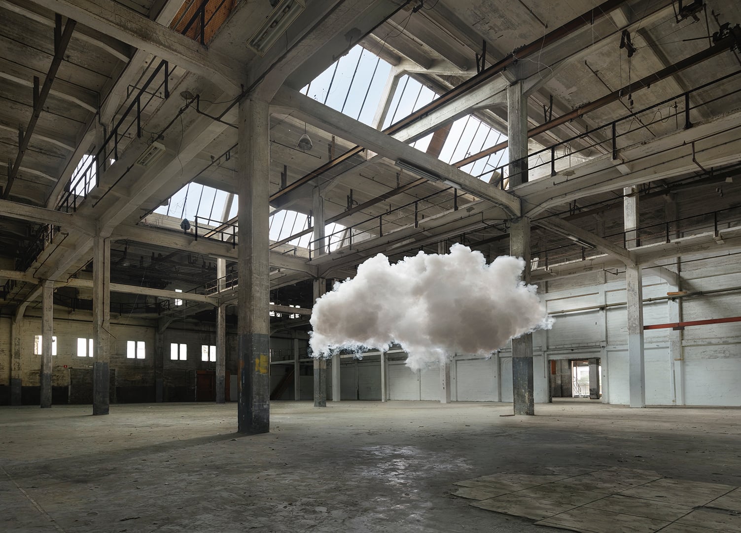
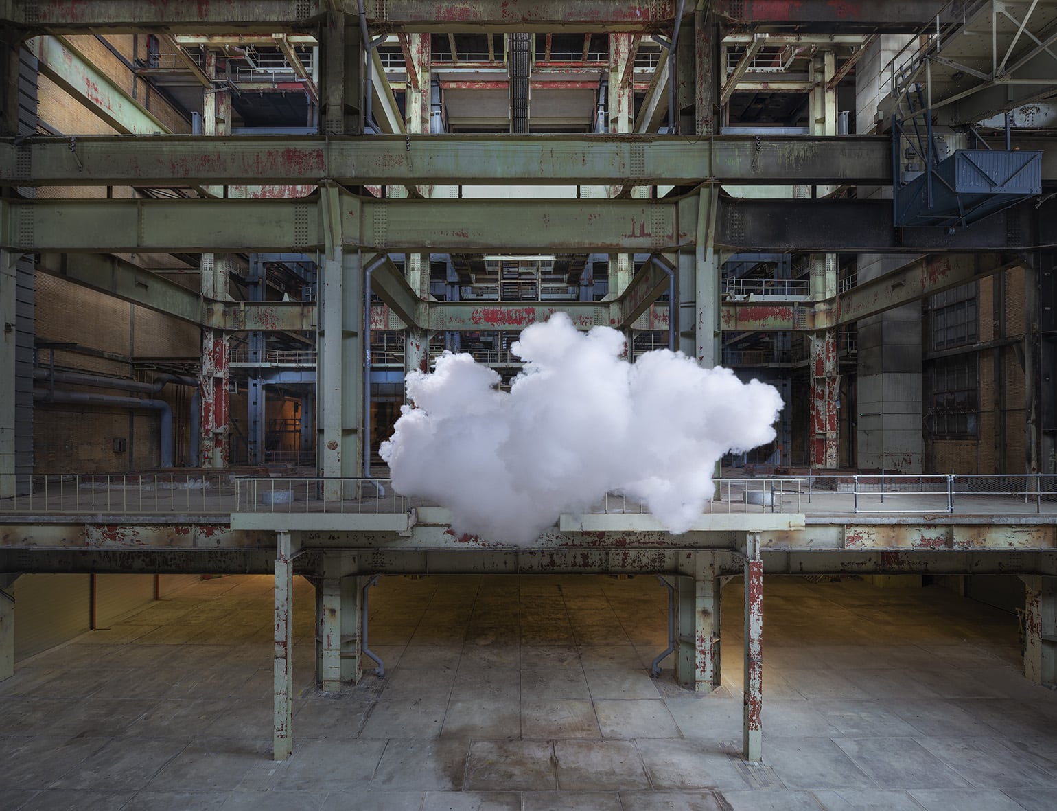
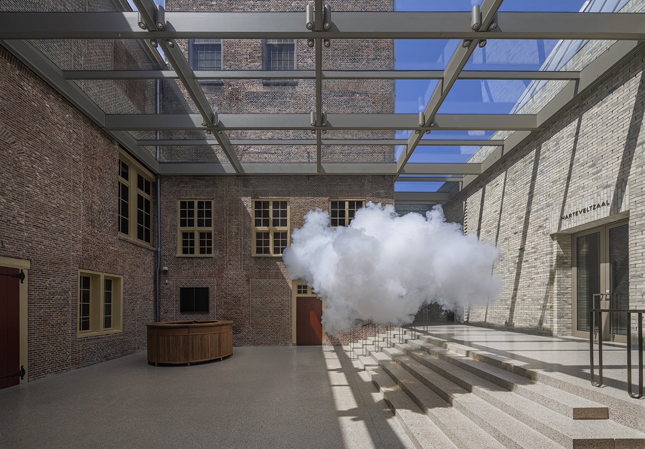
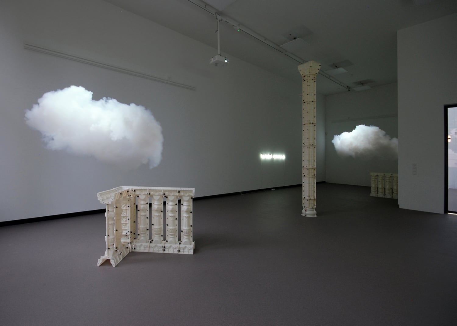
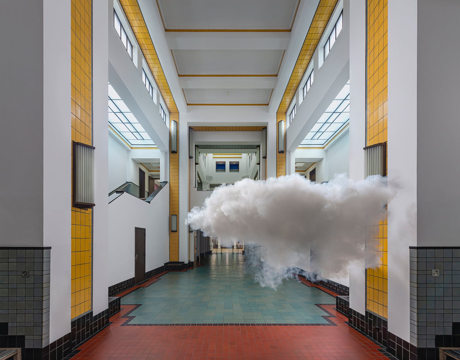
Ephemeral clouds drift through unusual places in artist Berndnaut Smilde‘s works. He creates his clouds from smoke and water, launching them for a matter of seconds before they dissipate. During that time, he and his collaborators take photographs of the clouds, creating a memento of a time already past. Catch more of Smilde’s short-lived weather on his website and Instagram. (Image credit: B. Smilde and collaborators; via Colossal)
Seeding Clouds
In the remote South Atlantic, north of the Antarctic Circle, sit the volcanic Zavodovski and Visokoi islands. Though only roughly 500 and 1000 meters tall, respectively, each island disrupts the atmosphere nearby, often generating cloudy wakes. In today’s pair of images, the northerly Zavodovski has a particularly bright cloud wake, thanks to sulfate aerosols degassing from its volcano, Mount Curry. Though it’s hard to pick out the effect in the natural-color image above, the false-color version below shows the bright wake clearly. The filtering on this image turns snow and ice — like that on Visokoi’s peak — red and makes the water vapor of clouds white. The sulfates from Mount Curry act as nucleii for water droplets, forming many small, reflective drops that stand out against the rest of the sky. (Image credit: W. Liang; via NASA Earth Observatory)

This false-color satellite image highlights the volcanic seeding by filtering snow and ice as red and water vapor in clouds as white. 
Rolling Over Wisconsin
Although they may look sinister, roll clouds like this one are no tornado. These unusual clouds form near advancing cold fronts when downdrafts cause warm, moist air to rise, cool below the dew point, and condense into a cloud. Air in the cloud can circulate around its long horizontal axis, but the clouds won’t transform into a tornado. Roll clouds are also known as Morning Glory clouds because they often form early in the day along the Queensland coast, where springtime breezes off the water promote their growth. The clouds do form elsewhere, though; this example is from Wisconsin in 2007. (Image credit: M. Hanrahan; via APOD)
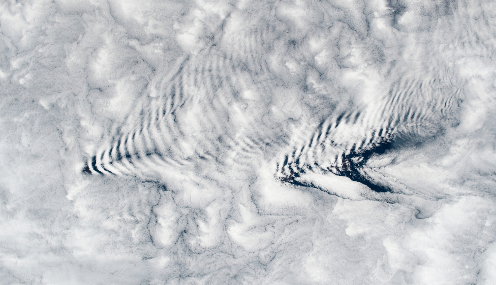
Clouds Down Under
This large and unusual cloud formation was captured one July morning over western Australia. Stretching over 1,000 kilometers, the clouds have interesting features at both the large and small scale. The small-scale ripples within the clouds are gravity waves triggered by the terrain below. The larger, arced features are tougher to explain, though they may also be related to gravity waves and terrain, just on a much larger scale. They also resemble fallstreak clouds where supercooled droplets evaporate from the inside of the cloud out. (Image credit: W. Liang; via NASA Earth Observatory)

Wave Clouds From Space
An astronaut snapped this image of wave clouds formed around the Crozet Islands, which lie between South Africa and Antarctica. Clouds like these form when warm, moist air gets pushed up and over a mountain. As it rises, the air cools and its pressure decreases, causing condensation. Pushed out of equilibrium, gravity then pulls the air back downward in the wake of the mountain. That warms the air, causing evaporation. Like a mass bouncing on a spring, the air continues to yo-yo up and down, forming cloudy stripes and clear ones until the energy from its mountain climb is spent. (Image credit: NASA; via NASA Earth Observatory)

“Níłtsą́”


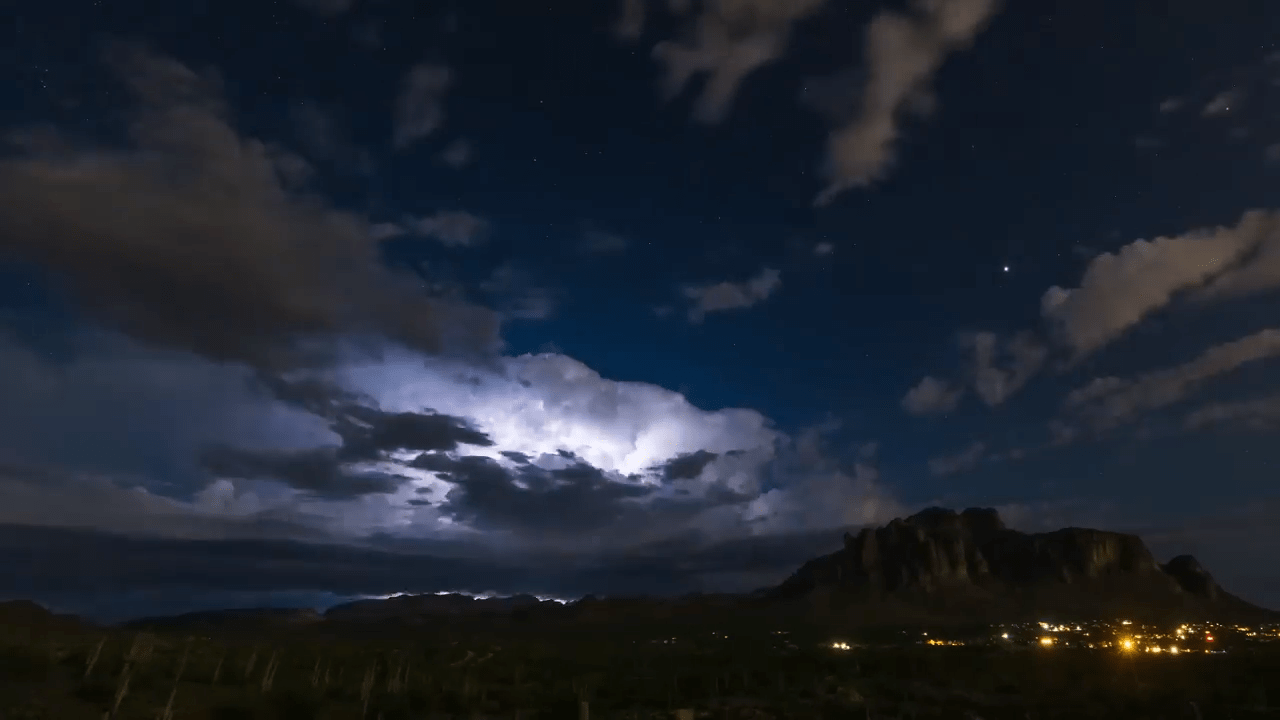
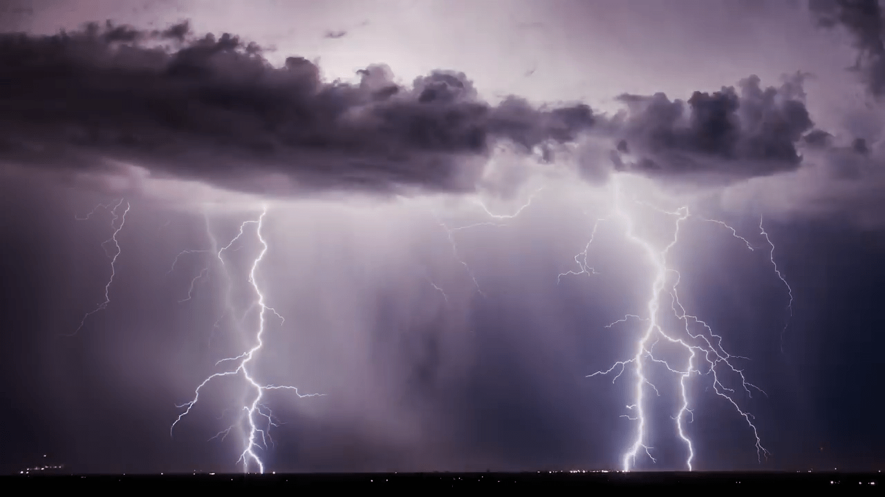
Living in the central and western United States, it’s easy to dismiss summer weather as just another storm, but the truth is that this region sees some of the most majestic and spectacular thunderstorms in the world. And no one captures that grandeur better than storm-chasing photographer Mike Olbinski. His latest film is named for the Navajo word for rain and features over 12 minutes of the best storms from 2021 and 2022. Towering turbulent clouds grow by convection, lightning splits the night sky, and microbursts pour down from above. As always, it’s a stunning depiction of the power of atmospheric fluid dynamics. (Image and video credit: M. Olbinski)

Ominous Mammatus
Mammatus clouds are fairly unusual and often look quite dramatic. Most clouds have flat bottoms, caused by the specific height and temperature at which their droplets condense. But mammatus clouds have bubble-like bottoms that are thought to form when large droplets of water or ice sink as they evaporate. Although they can occur in the turbulence caused by a thunderstorm, mammatus clouds themselves are not a storm cloud. They appear in non-stormy skies, too. The clouds are particularly striking when they’re lit from the side, as in the image above. (Image credit: J. Olson; via APOD)

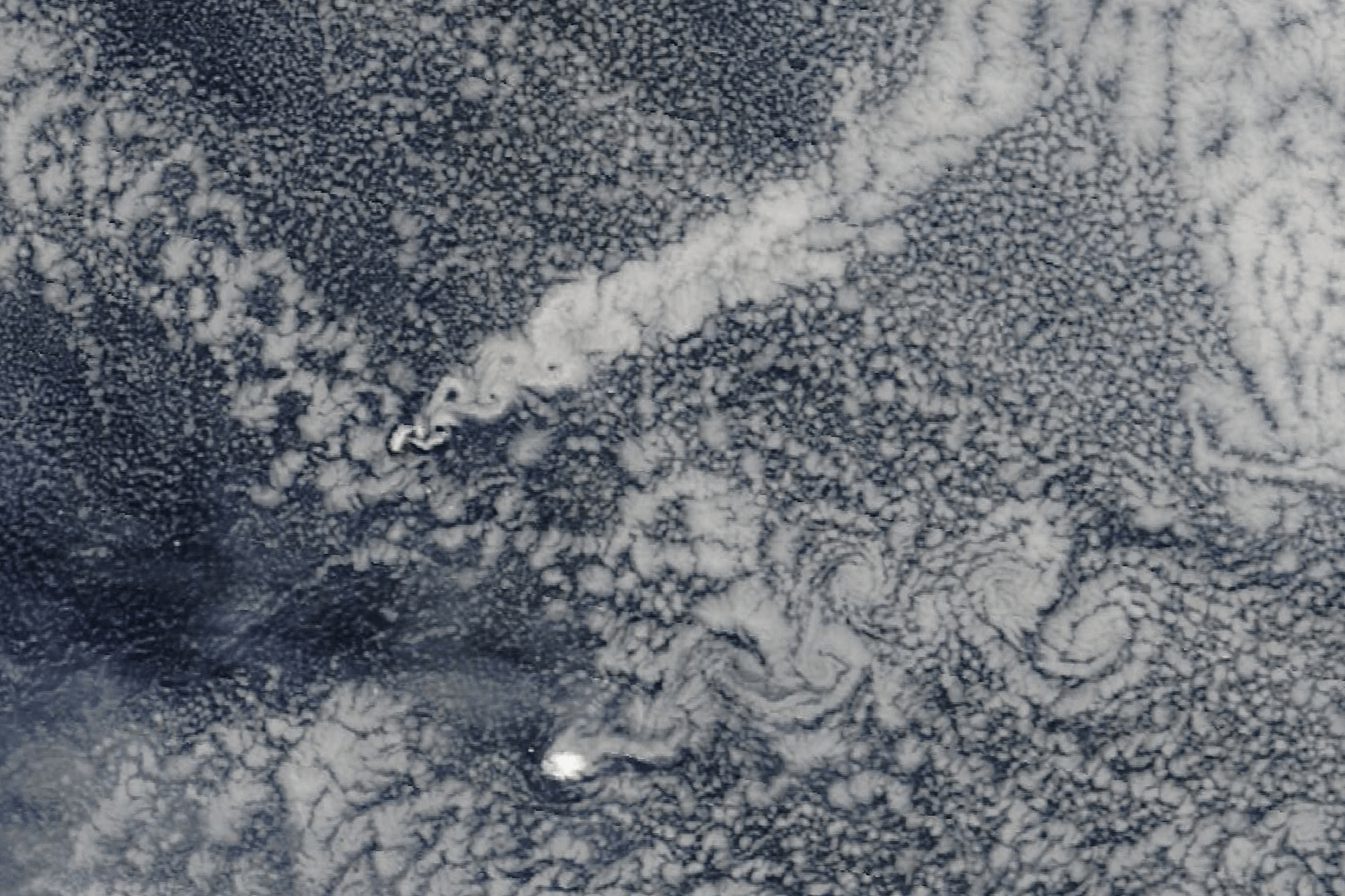
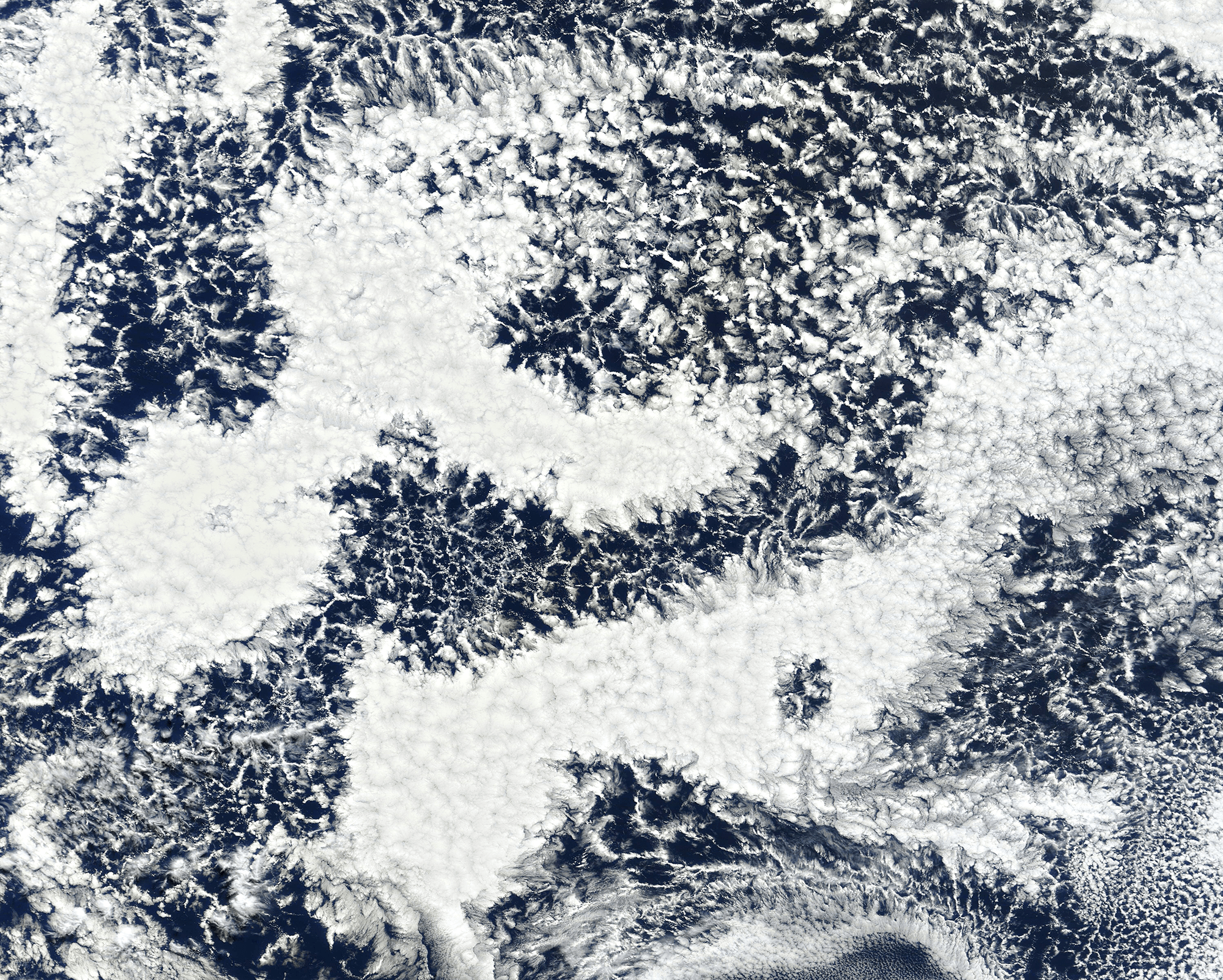
Cellular Clouds
Though tough to make out from the surface, our oceans are often covered by cell-shaped clouds stretching thousands of kilometers. This satellite image shows off two such types of marine stratocumulus cloud. Open-celled clouds appear as thin wisps of vapor around an empty middle; in these clouds, cool air sinks through the center while warm air rises along the edges. Open-celled clouds are good rain producers.
On the flip side, closed-cell clouds have a vapor-filled center and breaks in the cloud cover along each cell’s edge. These clouds don’t produce much rain, but they do lift warm, moist air through their middles and let cool air sink along their edges. Closed-cell clouds tend to last much longer than their open-celled counterparts; they can stick around for half a day, whereas open-celled clouds break up in only a couple hours. (Image credit: J. Stevens; via NASA Earth Observatory)