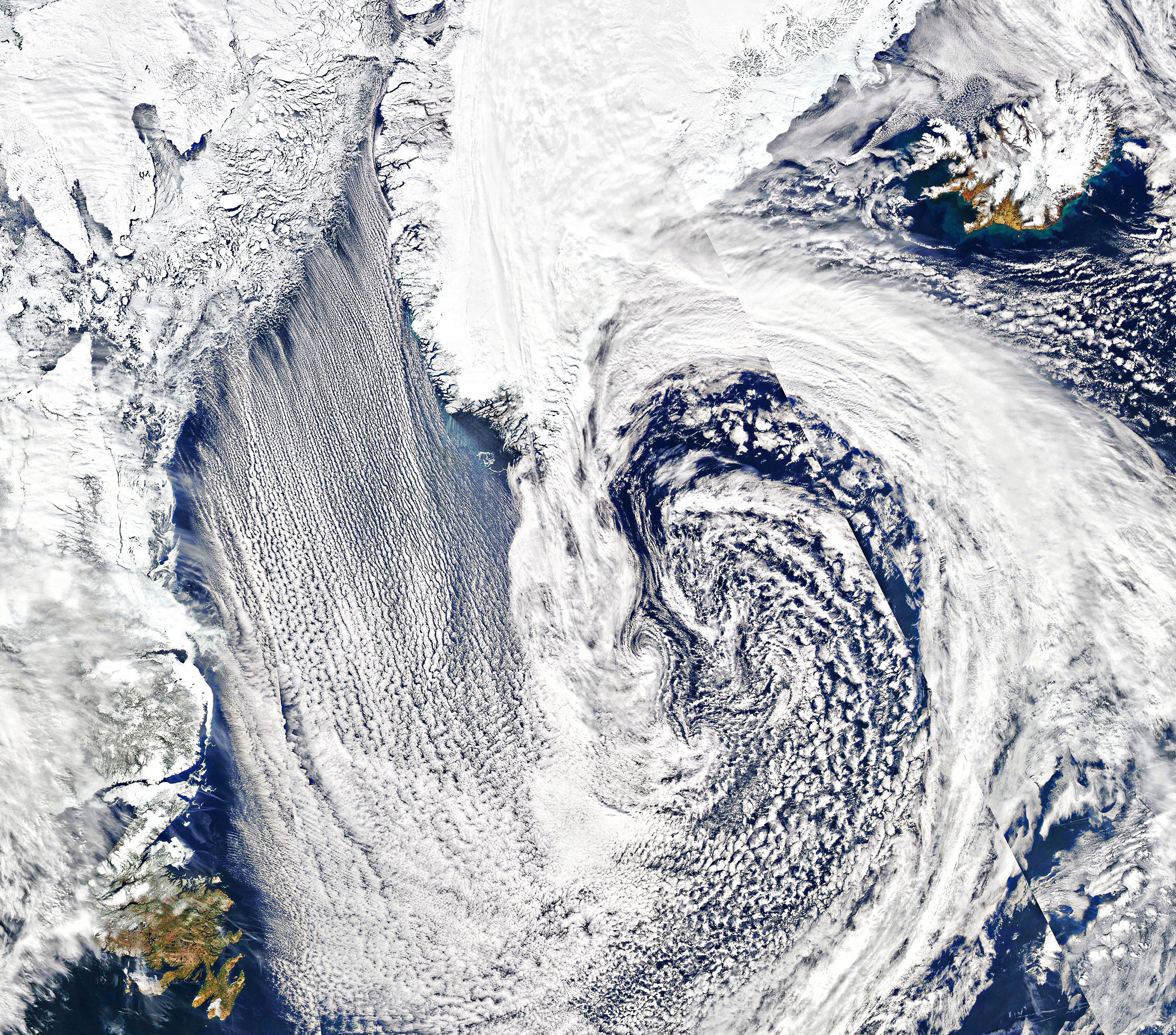
Parallel lines of cumulus clouds stream over the Labrador Sea in this satellite image. These cloud streets are formed when cold, dry winds blow across comparatively warm waters. As the air warms and moistens over the open water, it rises until it hits a temperature inversion, which forces it to roll to the side, forming parallel cylinders of rotating air. On the rising side of the cylinder, clouds form while skies remain clear where the air is sinking. The result are these long, parallel cloud bands. (Image credit: J. Stevens; via NASA Earth Observatory)
Tag: cloud formation

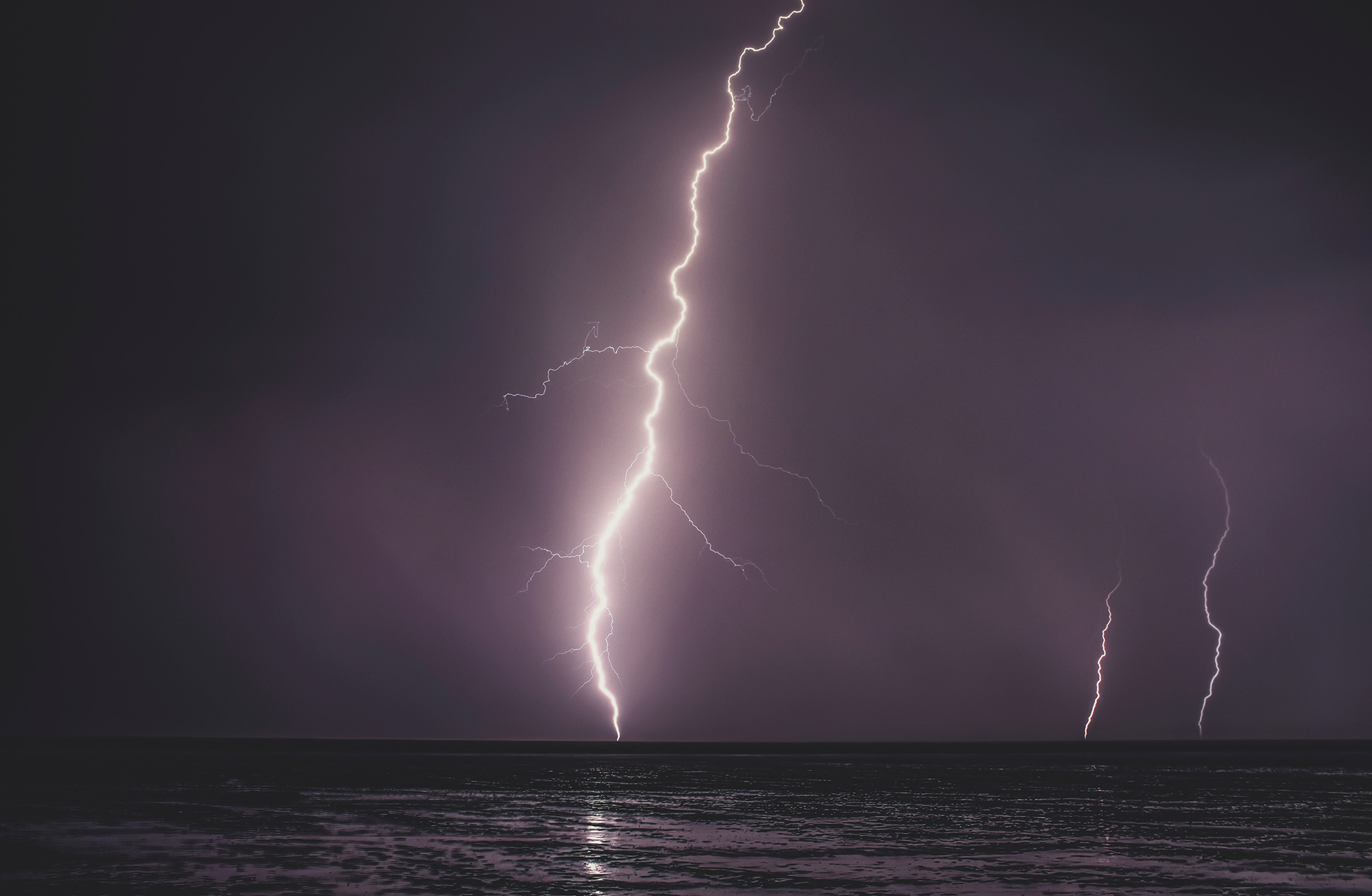
Inhibiting Marine Lightning
Thunderstorms over the ocean have substantially less lightning than a similar storm over land. Scientists wondered whether this difference could be due to lower cloud bases over the ocean or differences in the cloud droplets’ nuclei. But a new study instead implicates coarse sea spray as the deciding factor. By tracking the full lifetime of storm systems through remote sensing, the team found that fine aerosols can increase lightning activity over both land and ocean. But adding coarse sea salt from sea spray reduced lightning by 90% regardless of fine aerosols. With sea salt in the mix, clouds seem to develop fewer but larger condensation droplets, providing less opportunity for the electrification necessary to generate lightning. (Image credit: Z. Tasi; research credit: Z. Pan et al.)

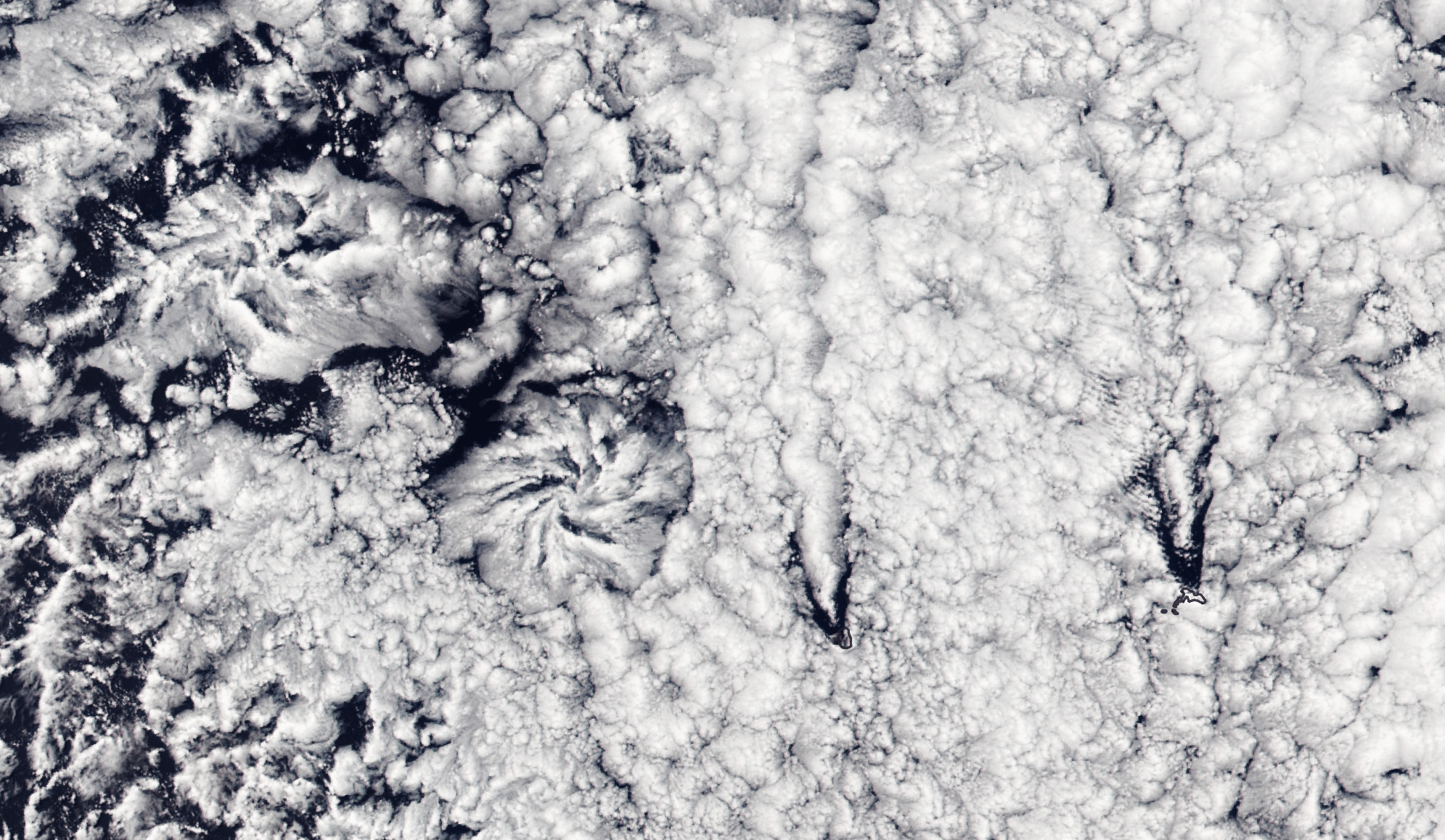
Actinoform Clouds
Flower-shaped actinoform clouds, like those seen on the left side of this satellite image, were only discovered in the 1960s once satellite imagery allowed meteorologists to identify cloud structures that were too large to recognize from the ground. Often appearing over the ocean, these clouds can stretch over hundreds of kilometers, bringing drizzling rain.
This particular set of actinoform clouds have some distinctive neighbors in the right side of the image, where V-shaped slashes through the cloud cover mark the origins of two von Karman vortex streets. The vortex streets appear downwind of two rocky islands, Alejandro Selkirk Island and Robinson Crusoe Island. (Image credit: L. Dauphin; via NASA Earth Observatory)

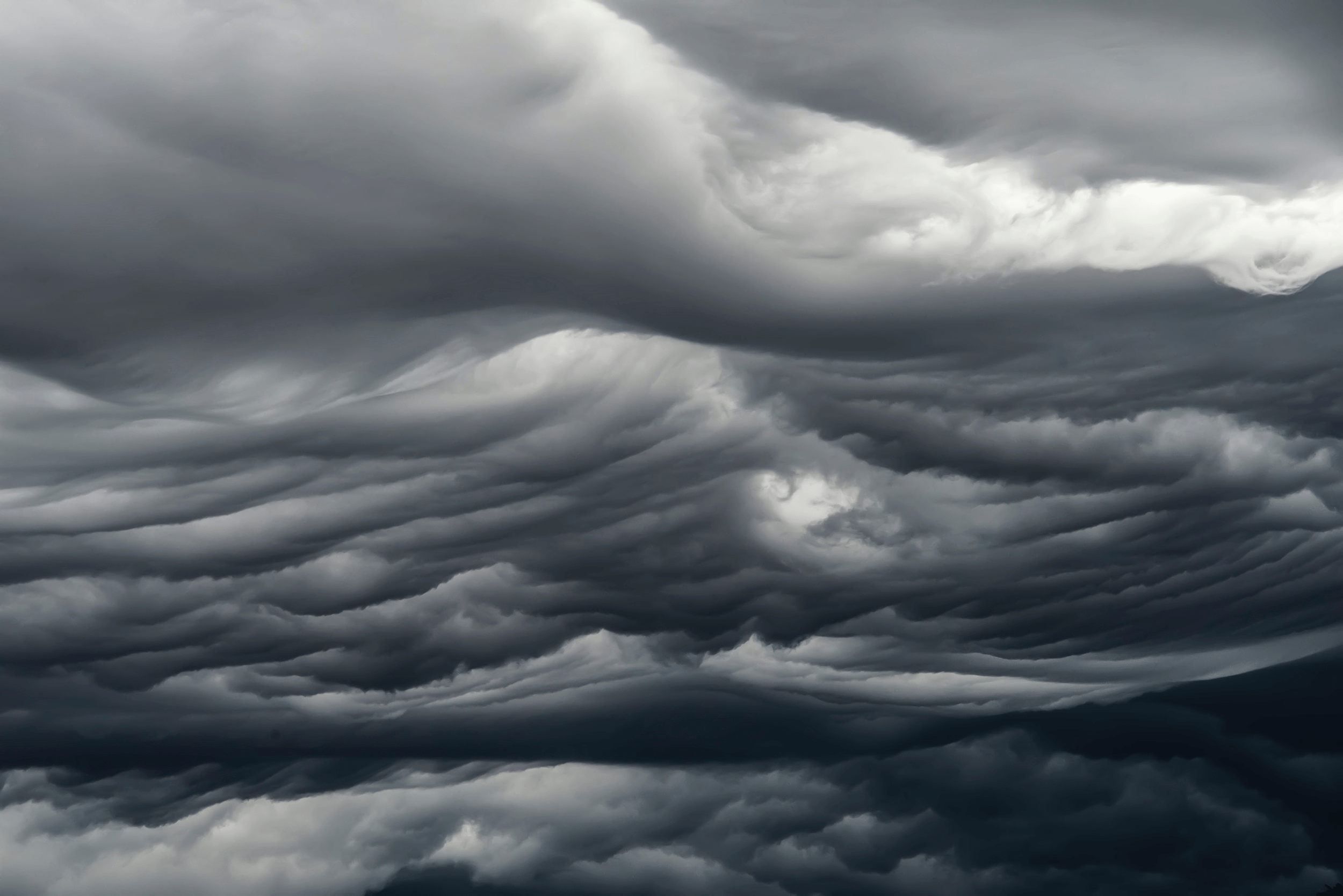
“Timedrift II”


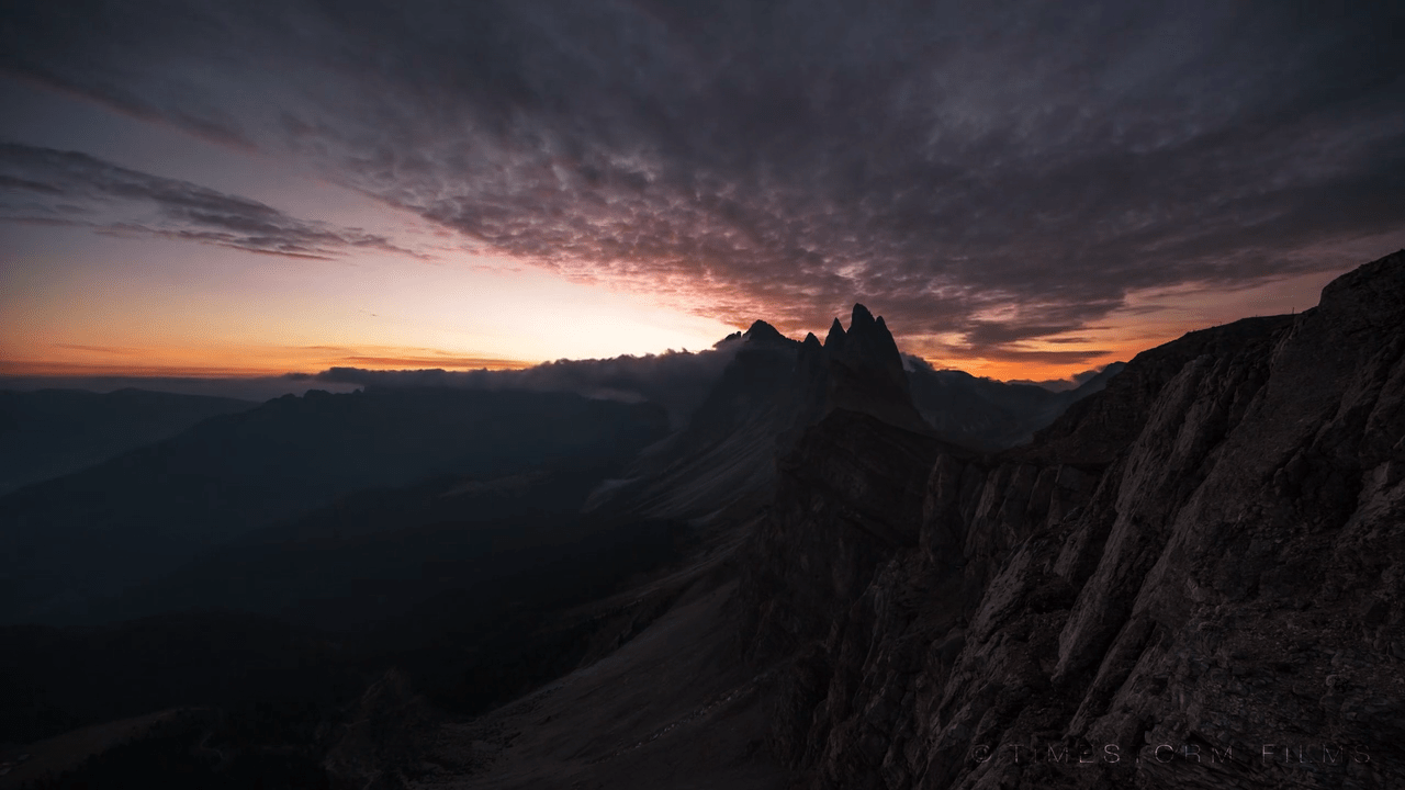


As a teenager, I climbed Mount Kilimanjaro. The final ascent began around midnight, and we climbed through the dark, through sunrise, and into the early morning. I remember pausing at one point, just as the sun was rising, and looking out at the clouds thousands of meters below. From that height, they looked like an ocean, rippled with lavender waves. Timelapse films like this one, by filmmaker Martin Heck, remind me of that morning and the sense that I had of the sky as an ocean, flowing, crashing, and surging in ways we cannot appreciate until we slow down and look closer. (Image and video credit: M. Heck/Timestorm Films)

Asperitas Formation
In 2017, the World Meteorological Organization named a new cloud type: the wave-like asperitas cloud. How these rare and distinctive clouds form is still a matter of debate, but this new study suggests that they need conditions similar to those that produce mammatus clouds, plus some added shear.
Using direct numerical simulations, the authors studied a moisture-filled cloud layer sitting above drier ambient air. Without shear, large droplets in this cloud layer slowly settle downward. As the droplets evaporate, they cool the area just below the cloud, changing the density and creating a Rayleigh-Taylor-like instability. This is one proposed mechanism for mammatus clouds, which have bulbous shapes that sink down from the cloud.
When they added shear to the simulation, the authors found that instead of mammatus clouds, they observed asperitas ones. But the amount of shear had to be just right. Too little shear produced mammatus clouds; too much and the shear smeared out the sinking lobes before they could form asperitas waves. (Image credit: A. Beatson; research credit: S. Ravichandran and R. Govindarajan)

Sunrise Cloudscape
With the low sun angle of dawn, the details of this cloudscape stand out. Captured by an external camera on the International Space Station, this image shows cloud formations over the northwest Atlantic. In the foreground, towering cumuli mark rising plumes of warm, moist air evaporating from the ocean. Beyond those clouds, a flat anvil cloud spreads horizontally after a temperature inversion prevented it from rising any further. (Image credit: NASA; via NASA Earth Observatory)
“Shadows in the Sky”


This moody music video features storm chasing footage from photographer Mike Olbinski. As always, his captures are stunningly majestic. Watch closely and you’ll see everything from bulbous mammatus clouds to powerful microbursts, from horizon-obscuring haboobs to sky-splitting lightning. And if this video isn’t enough, there’s plenty more to enjoy. (Video and image credit: M. Olbinski)

Bullseye
The Cumbre Vieja volcano in the Canary Islands began erupting in mid-September 2021. This satellite image, captured October 1st, shows a peculiar bullseye-like cloud over the volcano. Hot water vapor and exhaust gases rose rapidly from the erupting volcano until colliding with a drier, warmer air layer at an altitude of 5.3 kilometers. The warm upper layer, known as a temperature inversion, prevented the volcanic gases from rising any further, so they instead spread horizontally. The outflow from the volcano varies and is non-uniform, and its fluctuations generated gravity waves that are visible here as the expanding rings of clouds. (Image credit: L. Dauphin; via NASA Earth Observatory)

Fallstreak Holes


Occasionally clouds appear to have a hole in them; these are known as fallstreak holes or hole-punch clouds. To form, the water droplets in the cloud must be supercooled; in other words, they must be colder than their freezing point but still in liquid form. When disturbed — say, by the temperature drop caused by flowing over an airplane wing — the supercooled water droplets will suddenly freeze. This typically kicks off a chain reaction in which many droplets freeze and the heavy ice crystals fall out of the sky, leaving behind a void in the cloud. Because airplanes are particularly good at creating these fallstreak holes, they’re often seen near busy airports. (Image credit: J. Stevens/NASA; via NASA Earth Observatory)

Spiderwebs and Stratocumulus Clouds


Stratocumulus clouds cover about 20% of Earth’s surface at any given time, and they form distinctive patterns of lumpy cells separated by thin slits. Because of their interconnectedness, researchers nicknamed these narrow regions spiderwebs. New simulations show that evaporative cooling along the cloud tops drives the formation of these spiderwebs (Image 2). Without it (Image 3), the cloud pattern looks very different. (Image credits: featured image – L. Dauphin/MODIS, others – UConn ME 3250; research credit: G. Matheou et al.)