Search results for: “art”

  • Actinoform Clouds

    Actinoform Clouds

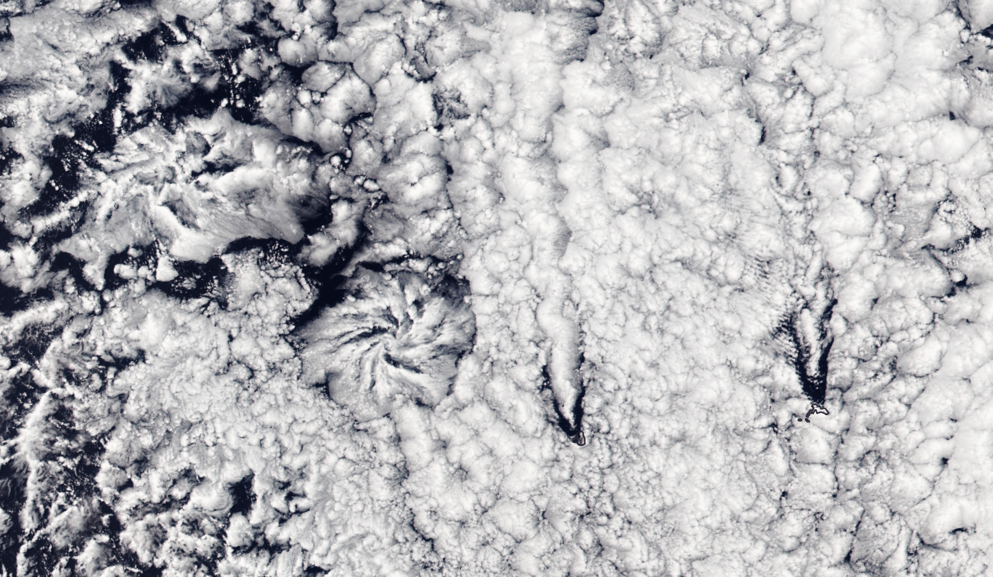
    Flower-shaped actinoform clouds, like those seen on the left side of this satellite image, were only discovered in the 1960s once satellite imagery allowed meteorologists to identify cloud structures that were too large to recognize from the ground. Often appearing over the ocean, these clouds can stretch over hundreds of kilometers, bringing drizzling rain.

    This particular set of actinoform clouds have some distinctive neighbors in the right side of the image, where V-shaped slashes through the cloud cover mark the origins of two von Karman vortex streets. The vortex streets appear downwind of two rocky islands, Alejandro Selkirk Island and Robinson Crusoe Island. (Image credit: L. Dauphin; via NASA Earth Observatory)

  • Featured Video Play Icon

    “Timedrift II”

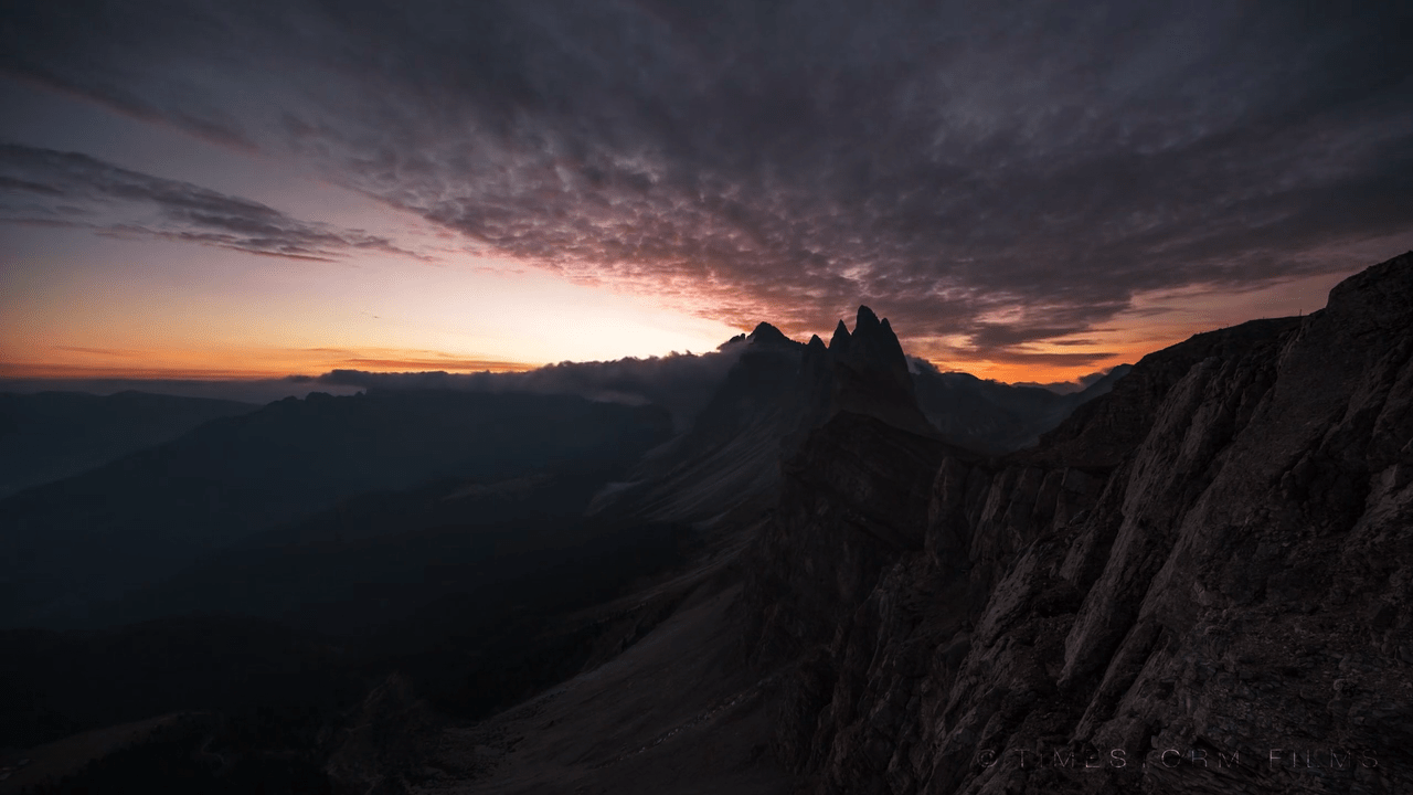
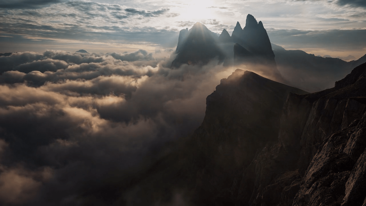
    As a teenager, I climbed Mount Kilimanjaro. The final ascent began around midnight, and we climbed through the dark, through sunrise, and into the early morning. I remember pausing at one point, just as the sun was rising, and looking out at the clouds thousands of meters below. From that height, they looked like an ocean, rippled with lavender waves. Timelapse films like this one, by filmmaker Martin Heck, remind me of that morning and the sense that I had of the sky as an ocean, flowing, crashing, and surging in ways we cannot appreciate until we slow down and look closer. (Image and video credit: M. Heck/Timestorm Films)

  • Neptune’s Seasonal Changes

    Neptune’s Seasonal Changes

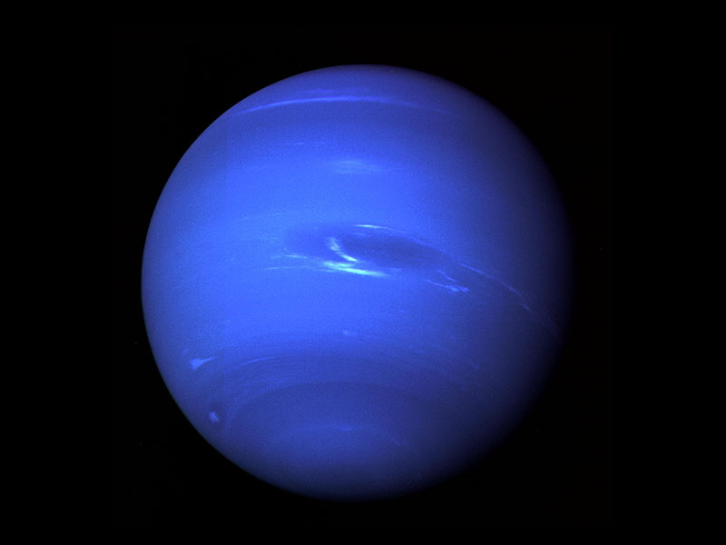
    Ice giant Neptune orbits our sun once every 165 years, meaning that each season on the planet lasts about 41 years here on Earth. Currently, the side of Neptune facing us is entering early summer, but a recent survey of atmospheric measurements show that Neptune’s stratosphere is experiencing some unexpected changes. Between 2003 and 2018, the team found that global stratospheric temperatures actually decreased by 8 degrees Celsius. Even more dramatically, Neptune’s southern pole warmed by a full 11 degrees Celsius between 2018 and 2020. Both results hint that atmospheric patterns on the planet may be far more complex than current models assume. (Image credit: NASA/JPL; research credit: M. Roman et al.; via Physics World)

  • “Metamorphe”

    “Metamorphe”

    A smoke-like haze drifts over surreal landscapes in the “Metamorphe” series by Reuben Wu and Jenni Pasanen. Though fluidic in appearance, these pieces are a merger between Wu’s drone light photography and Pasanen’s AI-assisted digital creations. Even so, the images are extremely evocative of fluid motion, connected as they are to human senses (like smell, hearing, and touch) that often rely directly on fluid dynamics. For more, check out the artists’ sites and Instagram. (Image credits: R. Wu and J. Pasanen; via Colossal)

  • Featured Video Play Icon

    How Dunes Form

    On its face, the idea that sand and wind can come together to form massive mountainous dunes seems bizarre. But dunes — and their smaller cousins, ripples — are everywhere, not just on Earth but on other planetary bodies where fine particles and atmospheres interact. In this video, Joe Hanson gives a great overview of sand dynamics, beginning with what sand is, how it moves, and what it can ultimately form. It’s well worth a watch, even if you know a little about dunes already; I know I learned a thing or two! (Image and video credit: Be Smart)

  • Featured Video Play Icon

    Rifts in Rafts

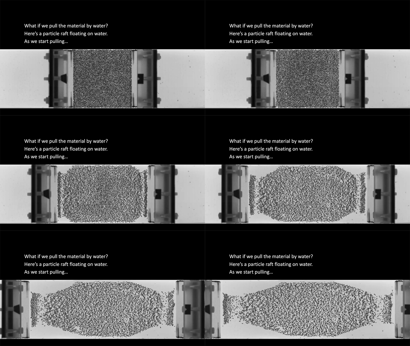
    A raft of particles floating on water has some natural cohesion from particle attraction and capillary action. But when the raft is pulled apart, what happens? Does it break cleanly in one spot? Does it stretch and deform? That’s what this video explores. It turns out that the speed you pull the raft at determines how it holds together. Every particle cluster has a preferred relaxation rate, and by choosing the pulling speed, you determine which relaxation rate — and therefore cluster size — can survive most effectively. (Image and video credit: K. Tô and S. Nagel)

  • Featured Video Play Icon

    Treating Water

    In an ongoing series, Practical Engineering is looking at how civil engineers deal with sewage and wastewater. In this video, Grady looks at how wastewater gets treated to remove contaminants. Where possible, engineers use gravity to do this job, building infrastructure that slows the flow down and lets gravity make heavier particles settle out. Of course, sometimes gravity alone doesn’t act quickly enough, in which case engineers use a little extra help in the form of chemicals that can neutralize particles’ electric charge and help them clump together and settle faster. Check out the full video for a tour of how wastewater gets processed. (Image and video credit: Practical Engineering)

  • Submarine Eruptions

    Submarine Eruptions

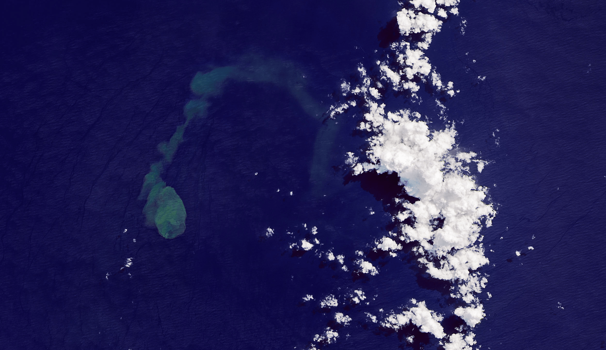
    The green-blue plume on the left of this satellite image is an eruption from Kavachi, an underwater volcano in the Solomon Islands. Kavachi’s crest is currently estimated to lie 20 meters below the surface, with its base at a depth of 1.2 kilometers. Eruptions are quite common at the volcano, but that doesn’t stop wildlife — like hammerhead sharks! — from making the crater their home. Over the last century, Kavachi’s eruptions have repeatedly formed small islands at the surface, but they were quickly eroded away by wave action. (Image credit: J. Stevens/NASA/USGS; via NASA Earth Observatory)

  • Featured Video Play Icon

    “Life and Chaos”

    In “Life and Chaos,” artists Roman Hill and Paul Mignot shot fluid flows live in a 1 cm x 1 cm square, then projected those images across 3,300 square meters. There’s something incredible about art on this immersive scale. It is literally impossible for any one visitor — or even the artists themselves — to experience the full piece; each person, by definition, can only take in a small part of the whole. That makes it all the more incredible to derive such a piece from a tiny, tiny canvas. As venues for this sort of immersive art spread, I can only imagine the amazing art we’ll see! (Image and video credit: R. Hill and P. Mignot)

  • Featured Video Play Icon

    Making Hurricanes

    With oceans warming, there’s more energy available to intensify hurricanes. And while our weather models have gotten better at predicting where hurricanes will go, they’re less good at predicting hurricane intensity, largely because capturing real data from storms is so difficult and dangerous. To address that shortfall, engineers build facilities like the one seen here, which simulates hurricane wind and water conditions so that scientists can study their interaction and better understand storm physics. Check out the full Be Smart video for a tour of the facility and a look at their work. (Image and video credit: Be Smart)