Greenland’s ice sheet holds enough water to raise global sea levels by several meters. Each year meltwater from the sheet percolates through the ice, filling hidden pools and crevasses on its way to draining into the sea. Monitoring this journey directly is virtually impossible; too much goes on deep below the surface and the ice sheet is a precarious place for scientists to operate. So, instead, they’re monitoring the bedrock nearby.
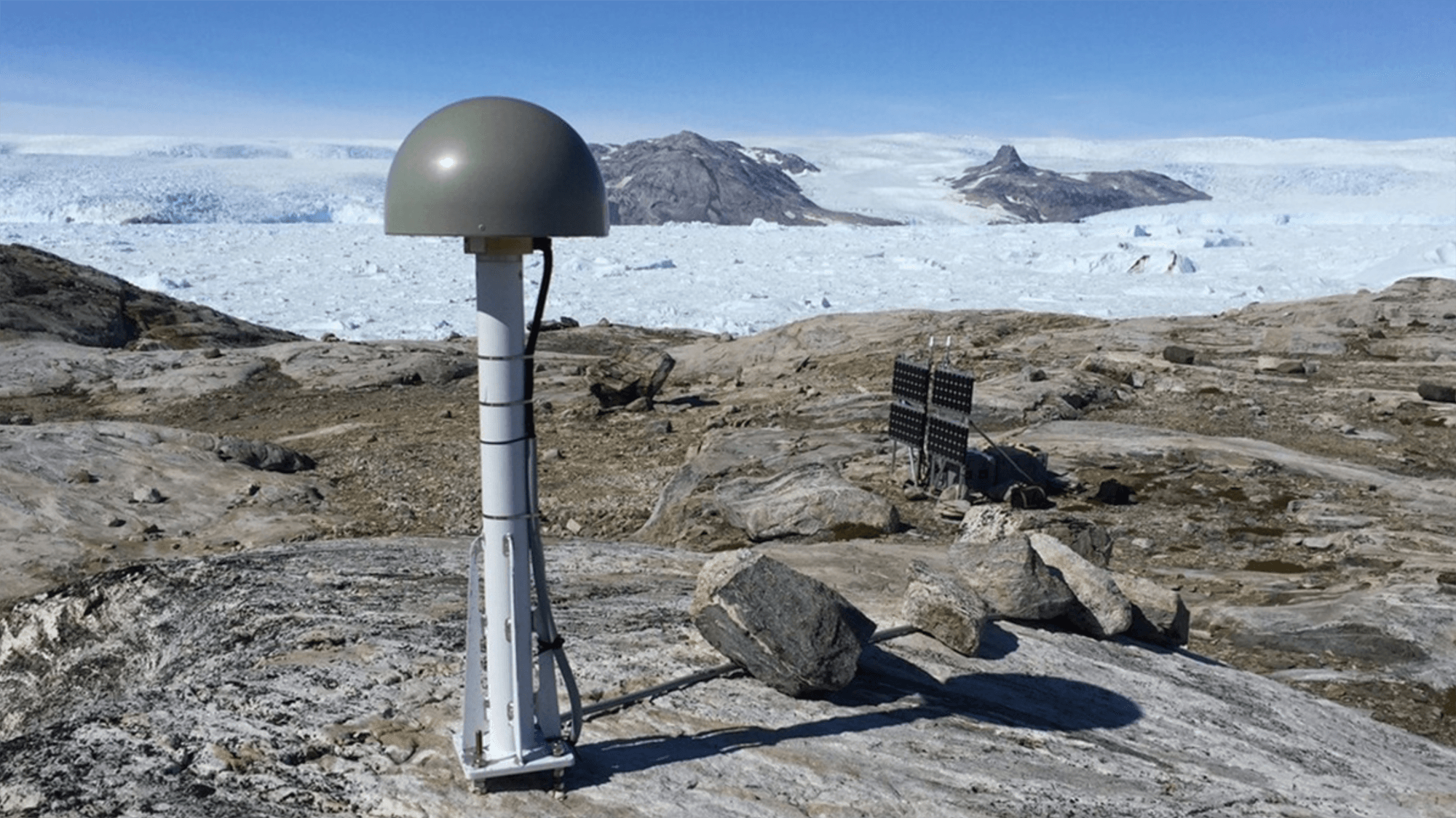
Researchers used a network of Global Navigation Satellite System (GNSS) stations like the one above to track how the ground shifted and flexed as meltwater collected and moved. They found that the bedrock moved as much as 5 millimeters during the height of the summer melt. How quickly the ground relaxed back to its normal state depended on where the water went and how quickly it moved. Their results indicate that the water’s journey is not a short one: meltwater spends months collecting in subterranean pools on its way to the ocean — something that current climate models don’t account for. Overall, the team’s results indicate that there’s much more hidden meltwater than models predict and it spends a few months under the ice on its way to the sea. (Image credit: T. Nylen; research credit: J. Ran et al.; via Eos)
Leave a Reply