Tag: geophysics

  • Modelling Volcanic Bombs

    Modelling Volcanic Bombs

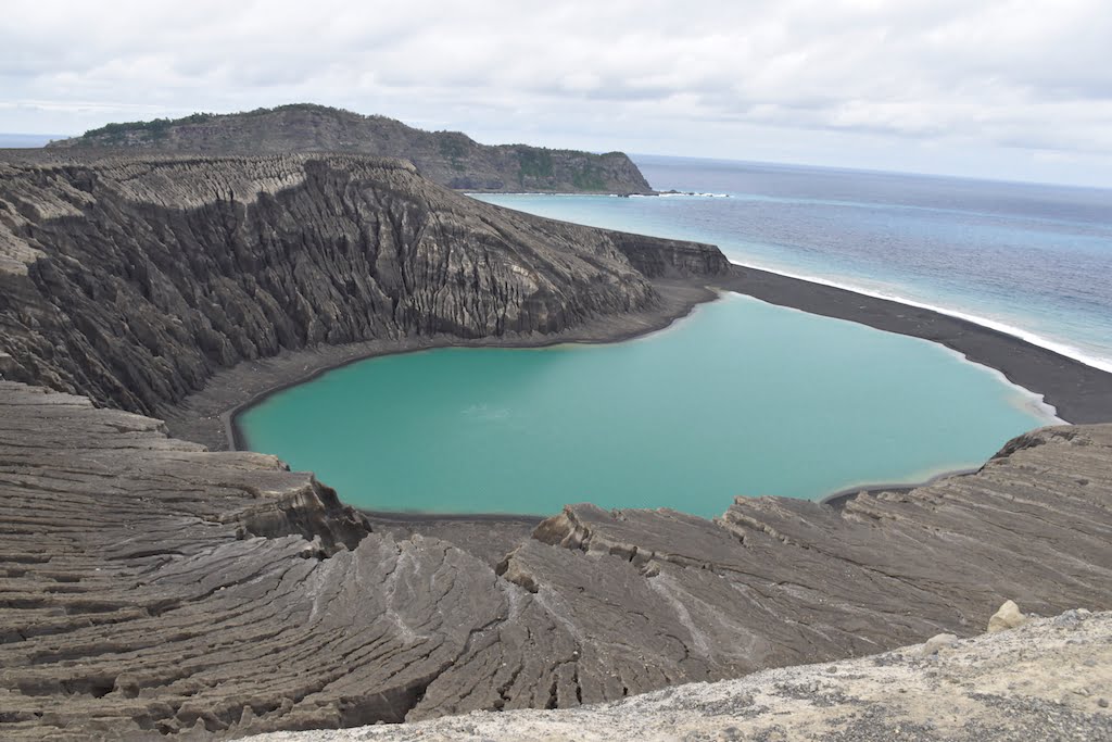
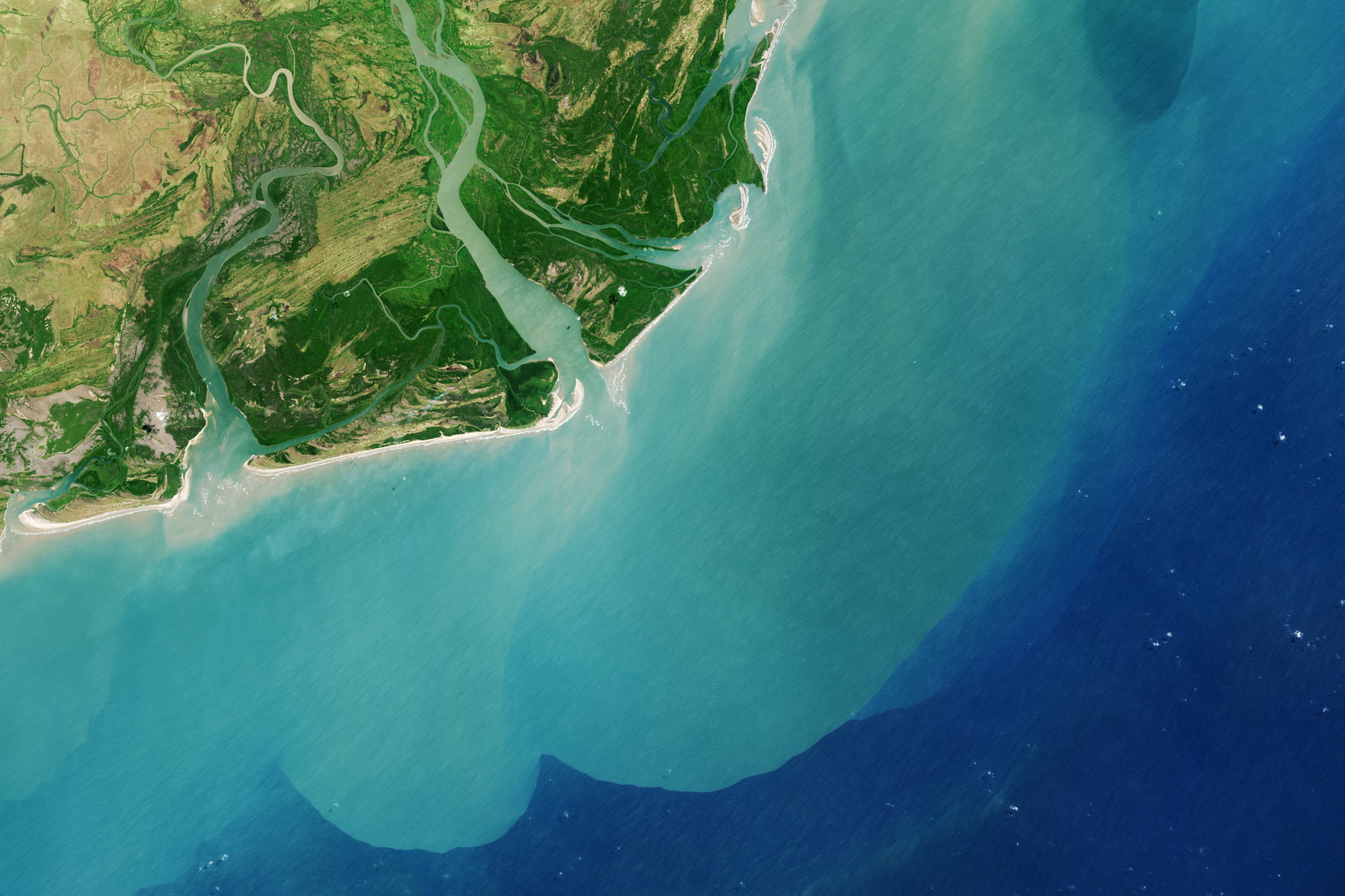
    When magma meets water on its journey to the surface, the two form a large, partially molten chunk known as a volcanic bomb. As you would expect from their name, these bombs can often be explosive, either in the air or upon impact. But a surprising number of these bombs never explode. Since catching volcanic bombs in action is far too dangerous, researchers modeled them instead to determine what makes a dud.

    Examples of porous volcanic bombs.

    The type of volcanic bomb they were most interested in comes from Surtseyan eruptions, where the bombs travel through shallow sea or lake water, collecting moisture along the way. When the water reaches the molten interior of the volcanic bomb, it flashes into steam. That’s where the pressure to explode the bombs comes from. But the team found that the bombs are also extremely porous, thanks to bubbles created as the magma depressurizes on its trip to the surface. If the bomb is porous enough, steam escapes the rock before it can build to explosive pressures. (Image credit: top – NASA, others – E. Greenbank et al.; research credit: E. Greenbank et al.; via NYTimes; submitted by Kam-Yung Soh)

  • Seeking Magma

    Seeking Magma

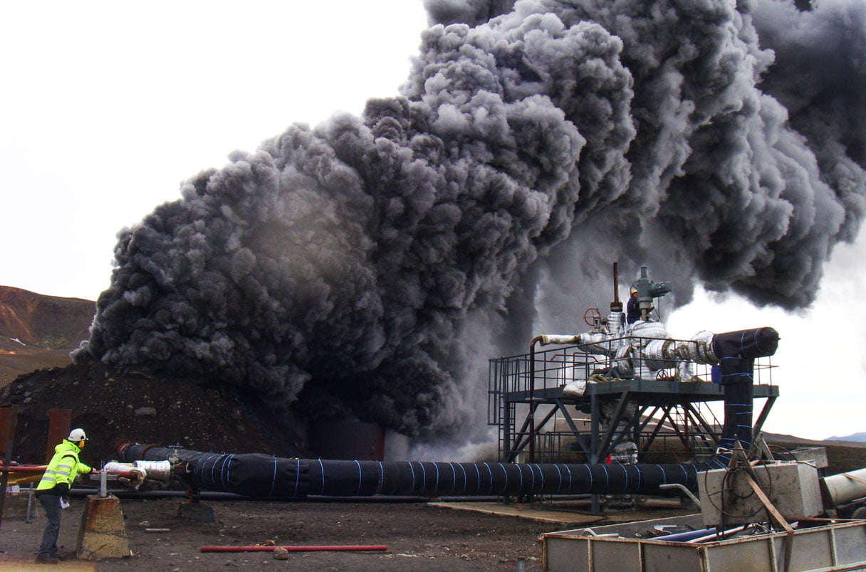
    In 2009, drillers seeking geothermal energy in Iceland accidentally pierced a hidden magma chamber. After a billowing pillar of steam and glass shards poured out from the hole, it created the hottest geothermal well ever, until the casing failed. Now drillers are preparing to return to the area, this time with the intention of reaching magma. Capturing a sample of magma before it rises to the surface (thereby losing its trapped gases) is something of a holy grail for geophysicists, who otherwise rely on seismic wave detections and observations of magma that’s reached the surface. Building a long-term magma observatory will be an enormous engineering challenge, but the technologies developed may help us explore other hellish environments like the surface of Venus. (Image credit: G. Fridleifsson/IDDP; via Science)

  • Megaripples Beneath Louisiana

    Megaripples Beneath Louisiana

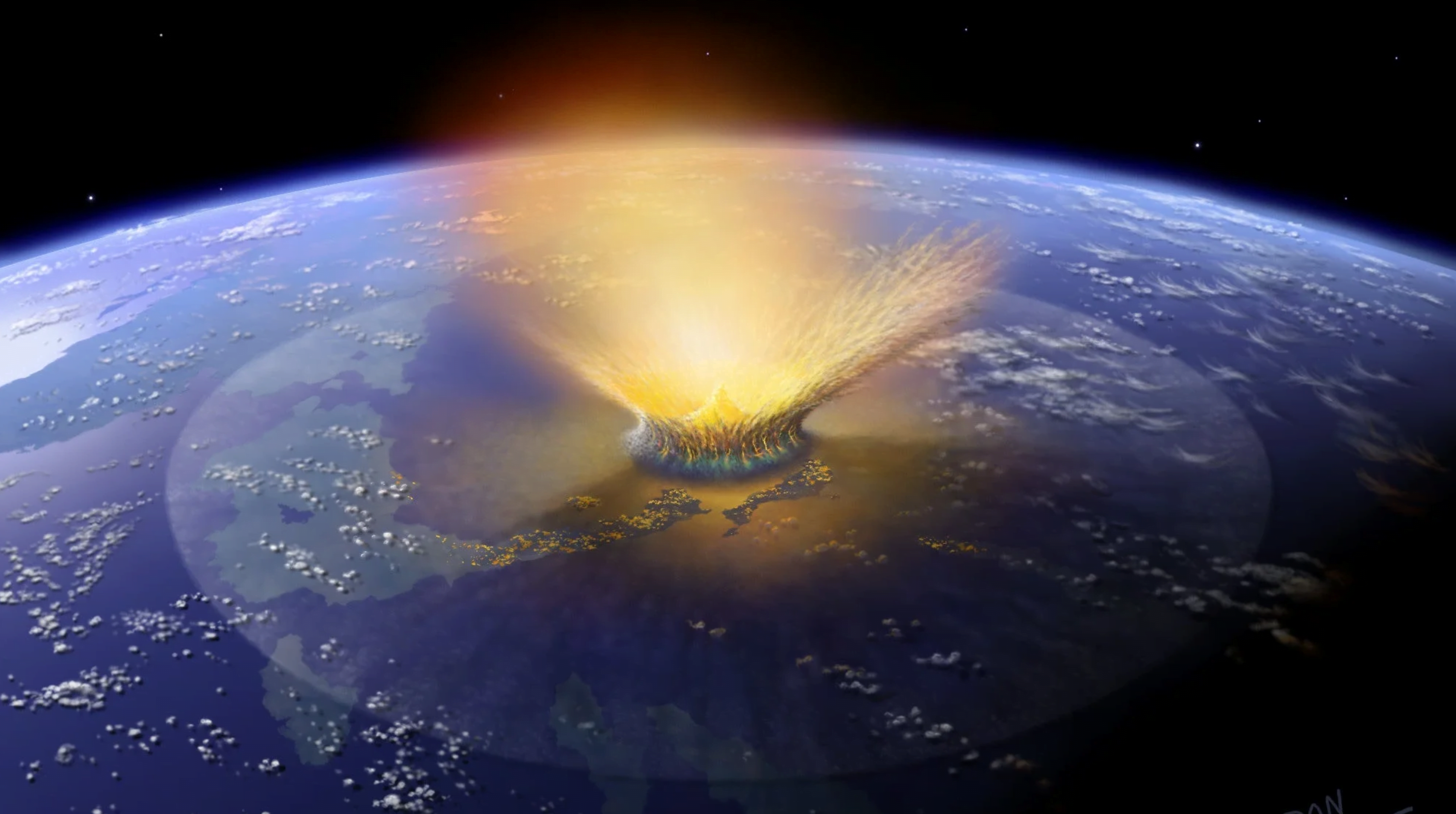
    Approximately 66 million years ago, a 10-km asteroid struck our planet near Chicxulub on the Yucatán Peninsula. The impact was globally catastrophic, causing tsunamis, wildfires, earthquakes, and so much atmosphere-clogging sediment that about 75% of all species on the planet — including the non-avian dinosaurs — died out. A new study points to another remnant of the impact: giant ripples buried in the sediment of Louisiana.

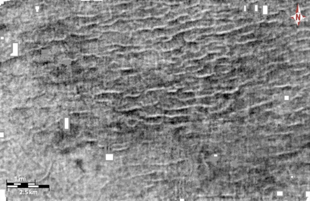
    Seismic data shows giant ripples left behind by the tsunami following the Chicxulub impact.

    Using seismic data collected by petroleum companies, the researchers describe the ripples as approximately 16 meters tall with a spacing around 600 meters, making them the largest known ripples on the planet. Currently, they are buried about 1500 meters underground, just below a layer of fine debris associated with the impact. The ripples show no evidence of erosion from storms or wind, leading the authors to conclude that they were deposited by an impact-associated tsunami and remained unaffected by smaller natural disasters before their burial. It’s very likely, according to the authors, that many other such megaripples exist, hidden away in proprietary petroleum data sets. (Image credits: top – D. Davis/SWRI, ripples – G. Kinsland et al.; research credit: G. Kinsland et al.; via Gizmodo)

  • Featured Video Play Icon

    Ferrovolcanism

    Beyond Earth, scientists expect to find objects formed by a volcanism much different than what we typically see here. Researchers used Syracuse University’s Lava Project apparatus to simulate ferrovolcanism — in this case with a mixture containing both metallic lava and silicate lava. Interestingly, the team found that the two types of lava flow largely independently of one another. The silicate lava is much more viscous but less dense and flows relatively slowly. The metallic lava is far less viscous and flows about 10 times faster, but it’s also denser, so most of it flows beneath the silicate lava, with only a few fingers that burst out atop the other lava or erupt in braided flows from the leading edge of the flow.

    The upcoming Psyche mission will explore a metal asteroid (of the same name) that’s thought to be the remains of an early planet’s nickel-iron core. Studies like this one are giving planetary physicists new insight into the kinds of geological features await us there. (Video and research credit: A. Soldati et al.; via AGU Eos; submitted by Kam-Yung Soh)

  • Featured Video Play Icon

    Breaking Ocean Currents

    Our global ocean currents move enough water to dwarf the flow of all Earth’s rivers. This worldwide circulation is driven largely by density and the movements of cold, salty water versus warmer, fresher water. The pump behind this action lies in the North Atlantic, where cold, salty water sinks down in the Atlantic Meridional Overturning Circulation, or AMOC. Among other things, AMOC is responsible for Western Europe’s relatively mild climate compared to similarly northern lands.

    Unfortunately, as our world warms, AMOC gets weaker. That means less cold water sinking in the North Atlantic and a smaller driving force behind global oceanic circulation. There is even a small but real chance that global warming breaks our ocean current system entirely and drastically changes climates around the world in ways that cannot be easily fixed. Watch the full video to learn more. (Video and image credit: It’s Okay To Be Smart)

  • Meeting Without Mixing

    Meeting Without Mixing

    When bodies of water meet, they don’t always mix right away. Here we see the confluence of the Back and Hayes Rivers in the Canadian Arctic. The Back River appears as a darker blue-green color compared to the light turquoise Hayes River. The different colors reflect the levels of algae and sediment carried in their waters. As seen in both the aerial and satellite photos here, there’s a distinct line where the two waters meet without mixing, and that line persists for kilometers beyond their initial confluence. Typically, this lack of mixing between bodies of water is caused by differences in temperature, salinity, and turbidity (amount of sediment) that make the density of each river’s water different. (Image credit: top – R. Macdonald/Univ. of Manitoba, bottom – J. Stevens/USGS; via NASA Earth Observatory)

    A satellite photo of the Back and Hayes Rivers shows their distinctly different colors persisting for 10+ kilometers after their confluence.
  • Iceberg Melting Depends on Shape

    Iceberg Melting Depends on Shape

    Not all icebergs melt equally. Through a combination of experiment and numerical simulation, researchers have shown that an iceberg’s shape underwater strongly affects how it melts. Specifically, icebergs in a flow melt more quickly on the front and side surfaces and slower on the underside. This means that narrow icebergs that project deep into the water will melt faster than wider, shallow ones. Currently, climate models don’t account for this variation, but the researchers hope their work will help build more accurate models for future studies. (Image credit: iceberg – C. Matias, experiment – E. Hester et al.; research credit: E. Hester et al.; see also APS Physics)

    Snapshots of a model iceberg as it melts.
  • Featured Video Play Icon

    Lava and Life

    Kilauea’s 2018 eruption gave us some of the most stunning volcanic footage ever seen, a tradition carried on in this BBC footage. As powerful and destructive as lava is, it’s also critical to life as we know it here on Earth. Volcanoes are a piece of the tectonic activity on our planet that drives the carbon cycle, without which we’d have no oceans or breathable atmosphere. It’s tough to imagine the geological scales over which these cycles act, but fortunately, there are numerical simulations to help! (Image and video credit: BBC Earth)

  • An Oasis Among Dunes

    An Oasis Among Dunes

    The Saudi Arabian oasis of Jubbah sits in the bed of an ancient lake. It’s protected from the westerly winds that sculpt the surrounding dunes by the wind shadow of the mountain Jabel Umm Sinman. The long, skinny shape of the settlement reveals the shape of the mountain’s wake! (Image credit: NASA; via NASA Earth Observatory)

  • Featured Video Play Icon

    Lava at Night

    Today’s cameras and drones capture volcanic eruptions in ways that were unthinkable in years past. This incredible footage shows the recent eruption in Iceland as it glows in the night. I love the crisp details of the flow. You can clearly see how the hotter, molten lava moves compared to the cooling crust. There’s some great footage of spurting fountains and blocks of lava getting swept along by the river. Enjoy! (Image and video credit: B. Steinbekk; submitted by jpshoer)