This gorgeous photograph of Kelvin-Helmholtz clouds was taken in late December in Slovenia by Gregor Riačevič. The wave-like shape of the Kelvin-Helmholtz instability comes from shear between two fluid layers moving at different relative speeds. Here on Earth, clouds like these are often short-lived, but we see similar structures in the atmospheres of gas giants like Jupiter and Saturn. (Image credit: G. Riačevič; submitted by Matevz D.)
Tag: Kelvin-Helmholtz instability

Colorful Kelvin-Helmholtz Clouds
Like breaking waves at the beach, these wavy clouds curl but only for a moment. The photo was captured near sunset on a late August evening in Arlington, MA. This short-lived cloud shape forms due to the Kelvin-Helmholtz instability, which is driven by shear forces between two layers of air moving at different speeds. The situation is a common one in the atmosphere, where air layers at altitude move in different directions and at different speeds. Most of the time we cannot see the curls that form between these air layers because of air’s transparency. But occasionally the mismatch happens right at a cloud layer and the condensation of the cloud gets pulled into these distinctive curls. (Image credit: B. Bray; submitted by Mark S.)

A Lenticular Cloud With a Curl
Lens-shaped lenticular clouds are not terribly rare in mountainous areas, but observers at Mount Washington caught a very unusual cloud near sunrise in late February. This lenticular cloud had an added curl on top thanks to the Kelvin-Helmholtz instability!
Lenticular clouds form when air is forced to flow up over a mountain in such a way that its temperature and pressure drop and water vapor in the air condenses. The resulting water droplets form a cloud that appears stationary over the mountain, even though the air continues to flow.
To get that added wave-like curl, there needs to be another, faster-moving layer of air just above the cloud. As that air flows past, it shears the cloud layer, causing the interface to curl. Neither of these cloud types is long-lived — Kelvin-Helmholtz formations often last only a few minutes — so catching such a great dual example is lucky, indeed! (Image credit: Mount Washington Observatory; via Smithsonian Magazine; submitted by Kam-Yung Soh)

Wave Clouds in the Front Range
Last Sunday night metro Denver was treated to a rare sight: clouds resembling breaking waves formed near sunset. These are Kelvin-Helmholtz clouds, and the comparison to ocean waves is apt, since the same physics is behind both. Winds were unusually calm near the ground Sunday night, but strong winds blew at the altitude just above the lower cloud layer. That velocity difference created strong shear where the two air layers met. With the cloud layer in place to differentiate the slower-moving air from the faster, we can what’s normally invisible: how the two air layers mix.
The Denver Post has several more views of the wave clouds from around the area, and you can learn lots more about the Kelvin-Helmholtz instability here. (Image credit: R. Fields; via the Denver Post)

Reader Question: Cross Sea
Reader Matt G asks:
[What’s] going on here?
Why’s the pattern square? Just a special case of waves traveling in different directions, and this photo happened to catch some at right angles to one another?
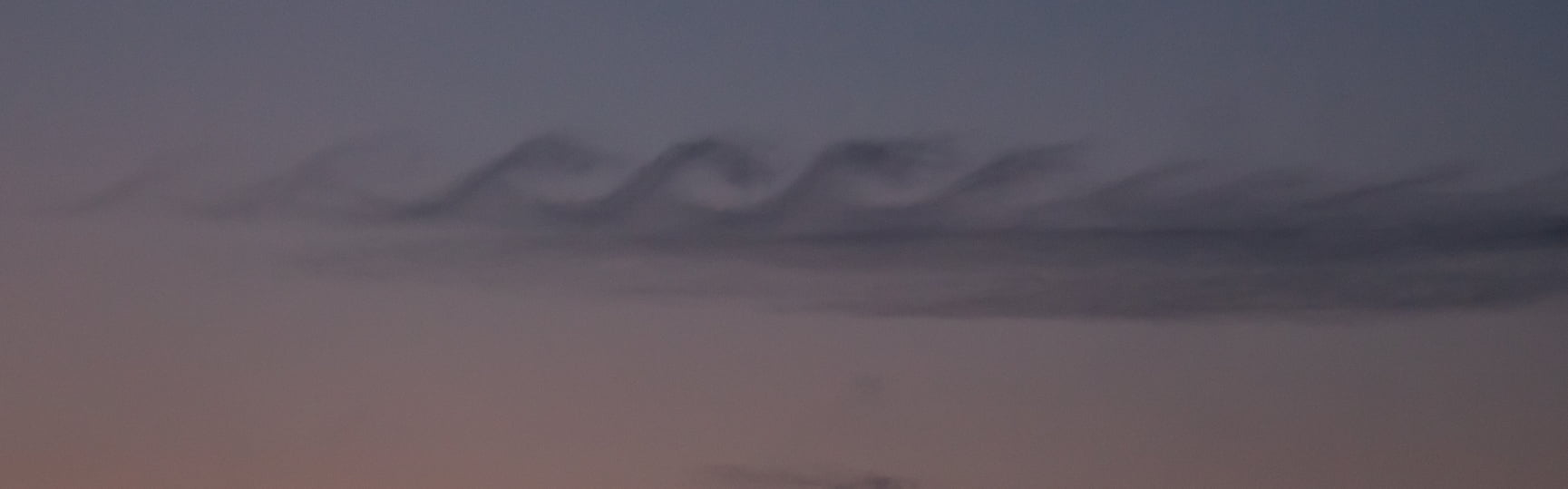
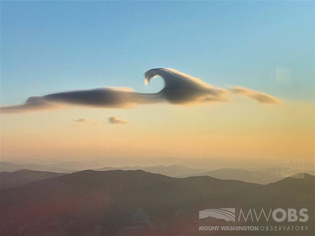
You’re not far off, Matt! This is an example of cross sea, where wave trains moving in different directions meet. Like most ocean waves, these waves originated from wind moving over the water. As the wind blows, it transfers energy to the water, disturbing what would otherwise be a smooth surface and setting up a series of waves. Oftentimes, these waves can outlast the wind that generates them and travel over long distances of open water as a swell.
Cross seas occur when two of these wave systems collide at oblique angles. They’re most obvious in shallow waters like those seen here, where the depth makes their criss-cross pattern clearer. Another name for them is square waves, and although the pattern isn’t a perfect square, it’s usually fairly close. If the waves aren’t separated by a large angle, they’re more likely to merge than to create this sort of pattern.
Neat as cross seas look, they’re quite dangerous, both to ships and swimmers. Ships are built to tackle waves head-on and don’t fare well when they’re forced to take waves from the side. For swimmers, the danger is a little different. Cross seas create intense vorticity under the surface and can generate stronger than usual riptides that sweep the unwary out to sea. (Image credit: M. Griffon)

Waves on a Supercell
This Colorado supercell thunderstorm features an unusual twist. Notice the sawtooth-like protrusions along the outer cloud wall. These are Kelvin-Helmholtz waves, like these fair-weather clouds we’ve seen before, but instead of occurring vertically, they project horizontally! That implies that the invisible layer of air just outside the cloud wall is moving faster than the wall itself. That creates shear along the outer edge of the cloud wall and causes these waves to form. This is the first time I’ve ever seen this sort of thing. What an awesome photo! (Image credit: M. Charnick; submitted by jpshoer)

Waves in the Sky
Even when the sky is mostly blue, there’s a lot going on at different altitudes. The winds do not move in a consistent direction or at the same speed, something which becomes apparent when watching clouds move relative to one another. When different layers of air move past one another, there is shear between them, not unlike the friction you feel when running your hand along a table. Under the right circumstances, this shear creates Kelvin-Helmholtz waves like the ones in this image over Helena Valley, Montana. Fast-moving winds (blowing right to left in the image) above a layer of clouds created these breaking wave-like curls. The same phenomenon creates many of the ocean’s waves from the shear caused by wind blowing across water. (Image credit: H. Martin, via EPOD)

Reader Question: White Caps
Reader eclecticca asks:
I really like the last two posts about waves, and they left me with another question… My dad had a little boat he used to take us ocean fishing on quite a bit. I always noticed that some days we just had big waves (swells) when out from the coastline and in fairly deep water (a hundred feet to hundreds of feet according to the depth sounder) and other days those swells would “break” and curl and foam and crash in on themselves, being what we called “breakers” or “white caps”. There is no shore to create the breakers in this case, so what is happening? Is it due to wind? current a combination of factors? Always been kind of curious about this really…
You’re exactly right: those open ocean white caps are due to wind. Strictly speaking, the wind is what’s causing all* of the waves out in open, deep waters. But once the wind is strong enough, it starts breaking up the crests of waves, creating those foamy white tops.
According to one study, the break-up happens when the wind transfers more energy to the wave than surface tension can withstand. When the wave crest breaks up into a mixture of air, spray, and foam, it effectively gives the wind more surface area to push against and continue transferring energy. (Image credit: M. Moers)
* With a few notable exceptions, like in the case of a tsunami.

Lava Bomb
What you see above is a homemade lava bomb. To systematically study what happens when groundwater meets lava, scientists melted basalt and created their own meter-scale explosion-on-demand. Inside the container, they can inject water and observe the resulting dynamics.
Beneath the lava, the water forms what scientists call a domain. Thanks to the Leidenfrost effect, it can be protected from direct contact with the lava by a thin vapor layer that boils off it. If the water domain is large enough, buoyancy will pull it upward through the lava. Whether the water maintains a spherical shape or begins to distort and break up into smaller domains depends on the speed of its rise.
At some point, though, either naturally or through an external trigger (like the sledgehammer you see above), the water and lava can contact, resulting in explosive vaporization of the water and an explosion. What’s visible at the surface depends on the depth at which the explosion takes place. Scientists are eager to characterize these variations, which will help them better predict the explosive danger of eruptions like Kilauea and Eyjafjallajökull. (Image and research credit: I. Sonder et al.; video credit: NYTimes; submitted by Kam-Yung Soh)

Bringing the Stars Home
One of my favorite aspects of fluid dynamics is the way that the same patterns and phenomena appear over and over again – sometimes in the most unexpected places. That’s the theme of my new article in American Scientist, which focuses on the connections between our daily lives and the stars:
“Solar energy arises from nuclear fusion reactions in the core, but that energy is buried hundreds of thousands of kilometers beneath the surface, and most of the Sun’s overlying gas is nearly opaque; it hinders light from passing through, like a blanket thrown over a flashlight. Clearly the Sun does shine—but how? For the answer, you can simply go to your kitchen, fill a kettle, and flip on a burner.” #
Click-through to read the full article. (Image credit: N. Sharp, Big Bear Solar Observatory, J. Blom, NASA/ESA, J. Straccia, NASA/JPL/B. Jonsson)


