


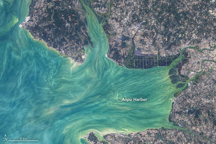

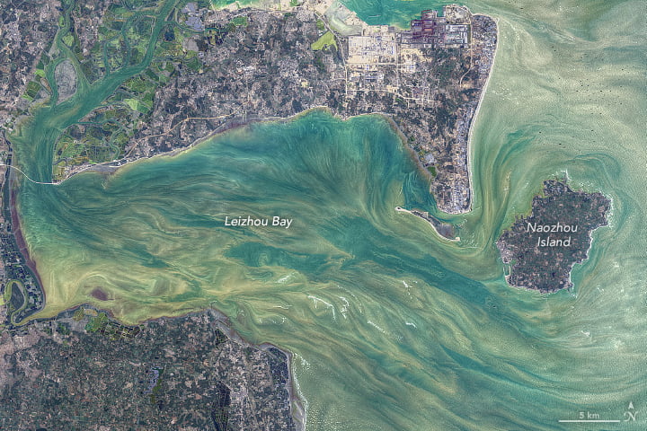
Water and sediments swirl in these enhanced satellite photos of China’s Leizhou Peninsula. Color-filtering algorithms have drawn out the details of the flows, but the patterns themselves are real. Tides, currents, sediment, and human activity combine to form these complex flows along the peninsula’s shores. The straight parallel lines seen off Liusha Bay, for example, are likely the result of a traditional fishing method using nets suspended off poles anchored into the seabed. (Image credit: N. Kuring; via NASA Earth Observatory)
Leave a Reply