Tag: weather

  • Atmospheric Rivers Raise Temperatures

    Atmospheric Rivers Raise Temperatures

    Atmospheric rivers are narrow streams of moisture-rich air running from tropical regions to mid- or polar latitudes. Though relatively short-lived, they are capable of carrying — and depositing — more water than the largest rivers. But researchers have found that their impact is not measured in water content alone. Instead, a survey of 43 years’ worth of data shows that atmospheric rivers also bring unusually warm temperatures. In some cases, the authors found surface temperatures near an atmospheric river climbed to as high as 15 degrees Celsius above the typical. On average, temperatures were about 5 degrees Celsius higher than expected for the region’s climate.

    Several factors raise those temperatures — like the heat released when rising vapor meets cooler air and condenses into liquid — but the biggest effect came from carrying warm tropical temperatures to (usually) cooler regions. (Image credit: L. Dauphin/NASA; research credit: S. Scholz and J. Lora; via Physics Today)

    Fediverse Reactions
  • Feeding Hurricanes

    Feeding Hurricanes

    With the strong hurricane season pummeling the southern U.S. this year, you may have heard comments about how warm oceans are intensifying hurricanes. Let’s take a look at how this works. Above is a map of ocean surface temperatures in late September, as Helene was developing and intensifying. For hurricanes, the critical ocean surface temperature is about 27 degrees Celsius — above this temperature, the warm waters add enough energy and moisture to the storm to intensify it. In this image, the waters colored from medium red to black are at or above this temperature. In fact Helene’s path — shown in a dotted white line — took it across particularly warm (and therefore dark) eddies with temperatures up to 31 degrees Celsius.

    Many factors affect a hurricane’s formation and intensification; understanding and predicting storms, their path, and their strength remains an active area of research. But warmer ocean temperatures are better at sustaining the hurricane’s warm core, and their moisture is easier to evaporate, thereby fueling the storm. Unfortunately, as the climate warms, we have to expect that warmer oceans will help rapidly intensify tropical storms and hurricanes. (Image credit: W. Liang; via NASA Earth Observatory)

  • The Real Butterfly Effect

    The Real Butterfly Effect

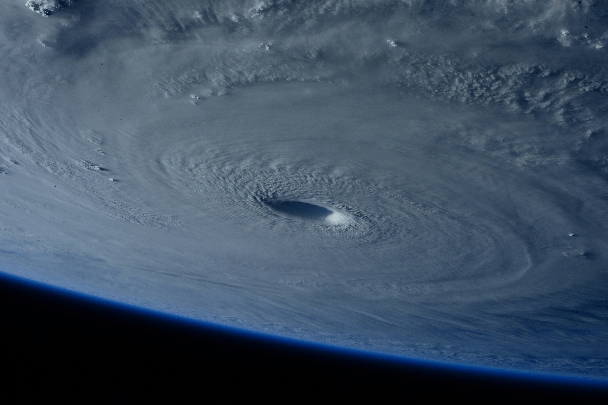
    The butterfly effect — that the flapping of a butterfly’s wings in Brazil can cause a tornado in Texas — expresses the sensitivity of a chaotic system to initial conditions. In essence, because we can’t possibly track every butterfly in Brazil, we’ll never perfectly predict tornadoes in Texas, even if the equations behind our weather forecast are deterministic.

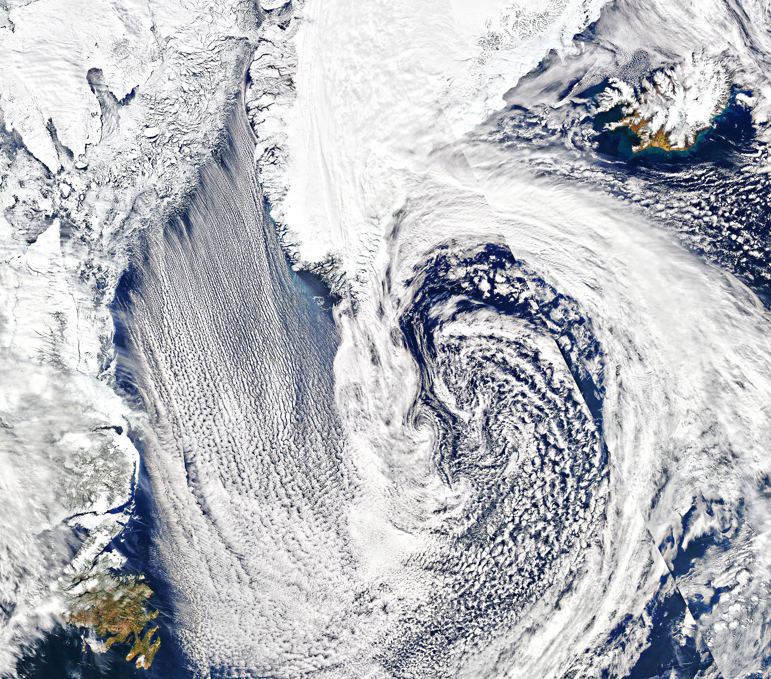
    But this interpretation doesn’t fully capture the subtleties of the situation. With fluid dynamics, the small scales of a flow — like the turbulence in an individual cloud — are linked to the largest scales in the flow — for example, a hurricane. For short times, we’re actually quite good at predicting those large scales; our weather forecasts can distinguish sunny days and cloudy ones a week out. But at smaller scales, the forecast errors pile up quickly. No one can forecast that an individual cloud will form over your house three days from now. And because the small scales are linked to the larger scales, the uncertainties from the small scale cascade upward, limiting how far into the future we can reliably predict the weather.

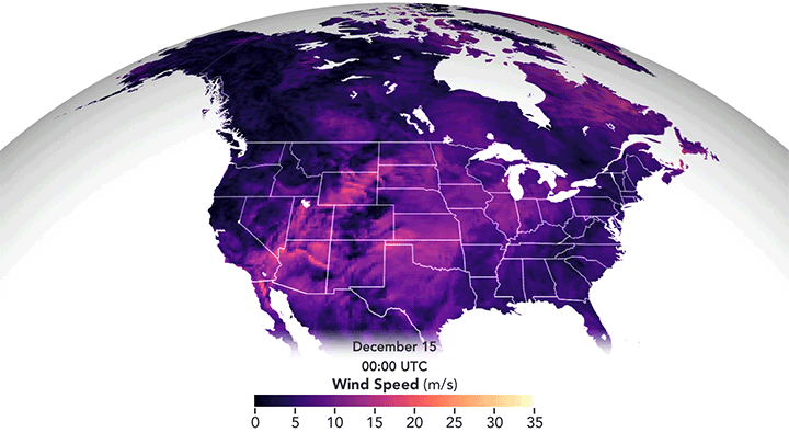
    And, unfortunately, drilling down to capture smaller and smaller scales in our models can’t fix the problem, unless our initial uncertainties are identically zero. To get around this problem, weather forecasters instead use ensemble forecasting, where they run many simulations of the weather with slightly different initial conditions. Those differences in initial conditions let the forecasters play with those initial uncertainties — how accurate is the temperature reading from that station? How reliable is the instrument reporting that humidity? How old is the satellite data coming in? Once all the forecasts are run, they can see how many predicted sunny days versus rainy ones, which ones resulted in severe weather, and so on. Often the probabilities we see in our weather app — like 30% chance of rain — depend on factors including how many of the forecasts resulted in rain.

    Unfortunately, this butterfly effect permanently limits just how far into the future we can predict weather — at least until we fully understand the nature of the Navier-Stokes equations. For much more on this interesting aspect of chaos, check out this Physics Today article. (Image credit: NASA; see also T. Palmer at Physics Today)

    Fediverse Reactions
  • Light Pillars

    Light Pillars

    These lovely pillars of light over the Mongolian grasslands are the result of tiny, suspended ice crystals. With the right weather conditions, ice crystals can align so that their largest faces are roughly parallel to the ground. In this orientation, the crystals collect and reflect artificial lights from the ground into these towering light pillars. It’s worth noting that the pillars aren’t located directly above the light source; instead, the column of crystals will lie roughly halfway between the light source and the observer. Next time you’re out on a cold winter night, see if you can find one! (Image credit: N. D. Liao; via APOD)

  • Cloud Streets

    Cloud Streets

    Parallel lines of cumulus clouds stream over the Labrador Sea in this satellite image. These cloud streets are formed when cold, dry winds blow across comparatively warm waters. As the air warms and moistens over the open water, it rises until it hits a temperature inversion, which forces it to roll to the side, forming parallel cylinders of rotating air. On the rising side of the cylinder, clouds form while skies remain clear where the air is sinking. The result are these long, parallel cloud bands. (Image credit: J. Stevens; via NASA Earth Observatory)

  • Asperitas Formation

    Asperitas Formation

    In 2017, the World Meteorological Organization named a new cloud type: the wave-like asperitas cloud. How these rare and distinctive clouds form is still a matter of debate, but this new study suggests that they need conditions similar to those that produce mammatus clouds, plus some added shear.

    Using direct numerical simulations, the authors studied a moisture-filled cloud layer sitting above drier ambient air. Without shear, large droplets in this cloud layer slowly settle downward. As the droplets evaporate, they cool the area just below the cloud, changing the density and creating a Rayleigh-Taylor-like instability. This is one proposed mechanism for mammatus clouds, which have bulbous shapes that sink down from the cloud.

    When they added shear to the simulation, the authors found that instead of mammatus clouds, they observed asperitas ones. But the amount of shear had to be just right. Too little shear produced mammatus clouds; too much and the shear smeared out the sinking lobes before they could form asperitas waves. (Image credit: A. Beatson; research credit: S. Ravichandran and R. Govindarajan)

  • Featured Video Play Icon

    “Haboob: A Decade of Dust”

    From the right vantage point, an approaching dust storm — known as a haboob — can look downright apocalyptic. In this compilation of clips a decade in the making, photographer Mike Olbinski shows these storms in all their terrifying majesty. I love seeing how the cloud front overhead densifies as the dust below advances. Without these wide perspectives, it’s hard to appreciate an approaching haboob. When one blew through Denver a few years ago, I never saw it coming. My first clue was the tree in front of my office window whipping wildly back and forth just before the sky turned brown! I much prefer Olbinski’s versions. Congratulations, Mike, on a decade of haboob-chasing! (Image and video credit: M. Olbinski; submitted by jpshoer)

  • December’s Derecho

    December’s Derecho

    I confess I’d never heard the term derecho before moving to Colorado, but I’ve experienced a few of these wind storms now. They’re intense! Last December’s derecho formed when a high-pressure system in the western United States met a strong low-pressure system over the northern plains. In fluids, flow moves preferentially from areas of high pressure to those with low pressure, and that’s no different when it comes to weather. The strong pressure gradient drove high winds from the Rocky Mountains to Minnesota. The animation above shows the strongest winds in in yellow-white but even the “weaker” pink areas saw winds comparable to a fast-moving car in speed. The visualization is constructed from data reported by ships, buoys, aircraft, satellites, and other sources, all processed through a NASA weather algorithm. (Image credit: J. Stevens/NASA; via NASA Earth Observatory)

  • Featured Video Play Icon

    Chasing Tornadoes

    Tornadoes are some of the most powerful storms on Earth. Their difficult-to-predict nature means that we still have a relatively scant understanding of exactly how they form. We know the conditions that promote their development — warm, moist rising air, wind shear, and rotation — but how and when those translate into a dangerous funnel cloud is harder to pin down. In this video, we hear from one of National Geographic’s storm researchers, Anton Seimon, who chases these storms in search of answers. (Image and video credit: National Geographic)

  • Featured Video Play Icon

    The Great Haboob Chase

    Few sights look as apocalyptic as the leading edge of an incoming dust storm. Known as a haboob, these storms form when a downdraft spreads along the ground, picking up loose dust as the storm front advances. Winds inside the haboob can be severe; when one swept through Denver last year, my first clue was the trees outside my window whipping back and forth wildly, followed by the sky going dark and brownish. Photographer Mike Olbinksi’s short film offers a far better vantage, letting viewers appreciate the towering cloud as it bears down. (Video and image credit: M. Olbinski)