
A calm, sunny day erupted into a thunderstorm off the coast of Scotland for photographer Brian Matthews. Turbulent clouds streak the sky, and a downpour on the left releases a stream of precipitation. Storms like these were once uncommon in the United Kingdom, but with increasingly hot weather due to climate change, more water vapor and more energy in the atmosphere create conditions for storms like these. (Image credit: B. Matthews; via Wildlife POTY)
Tag: thunderstorm

How Squall Lines Form
Summertime in the middle U.S. means thunderstorms, many of which can form long lines of storms known as squall lines. Complex convective dynamics feed such storms. Here is an illustration of one part of a squall’s lifecycle:

As rain falls and evaporates, it fuels the formation of a cold pool of air below the cloud. Incoming wind (gray arrows) blocks the cold pool from spreading. In turn, the cold pool acts as a ramp that redirects this warm, moist air upward. The vertical variation in wind speed (wind shear, shown with pink arrows) creates a positive vorticity. Together with the negative vorticity in the cold pool, this induces a vorticity dipole that lifts air and moisture, feeding the growing line of storms. As it falls, rain evaporates, cooling air near the ground and forming a cold pool. If incoming winds block the cold pool from spreading, the pool will act instead as a ramp that redirects the wind upward, carrying any warmth and moisture up into the storm cloud. Wind shear — a vertical variation in wind strength with altitude — creates positve vorticity that opposes the negative vorticity inherent to the cold pool. Together these two regions of opposing vorticity lift more air and moisture into the squall, generating more clouds and more rainfall. (Image credit: top – J. Witkowski, illustration – C. Muller and S. Abramian; see also C. Muller and S. Abramian)

Inhibiting Marine Lightning
Thunderstorms over the ocean have substantially less lightning than a similar storm over land. Scientists wondered whether this difference could be due to lower cloud bases over the ocean or differences in the cloud droplets’ nuclei. But a new study instead implicates coarse sea spray as the deciding factor. By tracking the full lifetime of storm systems through remote sensing, the team found that fine aerosols can increase lightning activity over both land and ocean. But adding coarse sea salt from sea spray reduced lightning by 90% regardless of fine aerosols. With sea salt in the mix, clouds seem to develop fewer but larger condensation droplets, providing less opportunity for the electrification necessary to generate lightning. (Image credit: Z. Tasi; research credit: Z. Pan et al.)

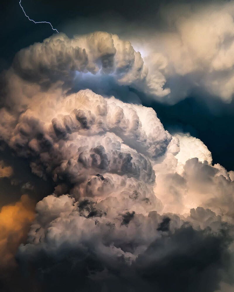
Stormy Skies


Photographer Mitch Dobrowner captures the majestic and terrifying power of storms in his black and white images. Towering turbulence, swirling vortices, and convective clouds abound. See more of his work at his website and Instagram. (Image credit: M. Dobrowner; via Colossal)

“Shadows in the Sky”


This moody music video features storm chasing footage from photographer Mike Olbinski. As always, his captures are stunningly majestic. Watch closely and you’ll see everything from bulbous mammatus clouds to powerful microbursts, from horizon-obscuring haboobs to sky-splitting lightning. And if this video isn’t enough, there’s plenty more to enjoy. (Video and image credit: M. Olbinski)

Mountains in the Sky
Our skies can sometimes presage the weather to come. In thunderstorms, a cirrus plume above an anvil cloud will often appear (visible by satellite) about half an hour before severe conditions are reported on the ground. A new study delves into the origins of these plumes and finds that they result from an internal hydraulic jump in the storm that acts a bit like an artificial mountain, driving air — and the moisture it contains — higher in the stratosphere than normal. Once the jump is established, the authors found it could drive 7 tonnes per second of water vapor into the stratosphere! (Image credit: jplenio; research credit: M. O’Neill et al.; via Science)

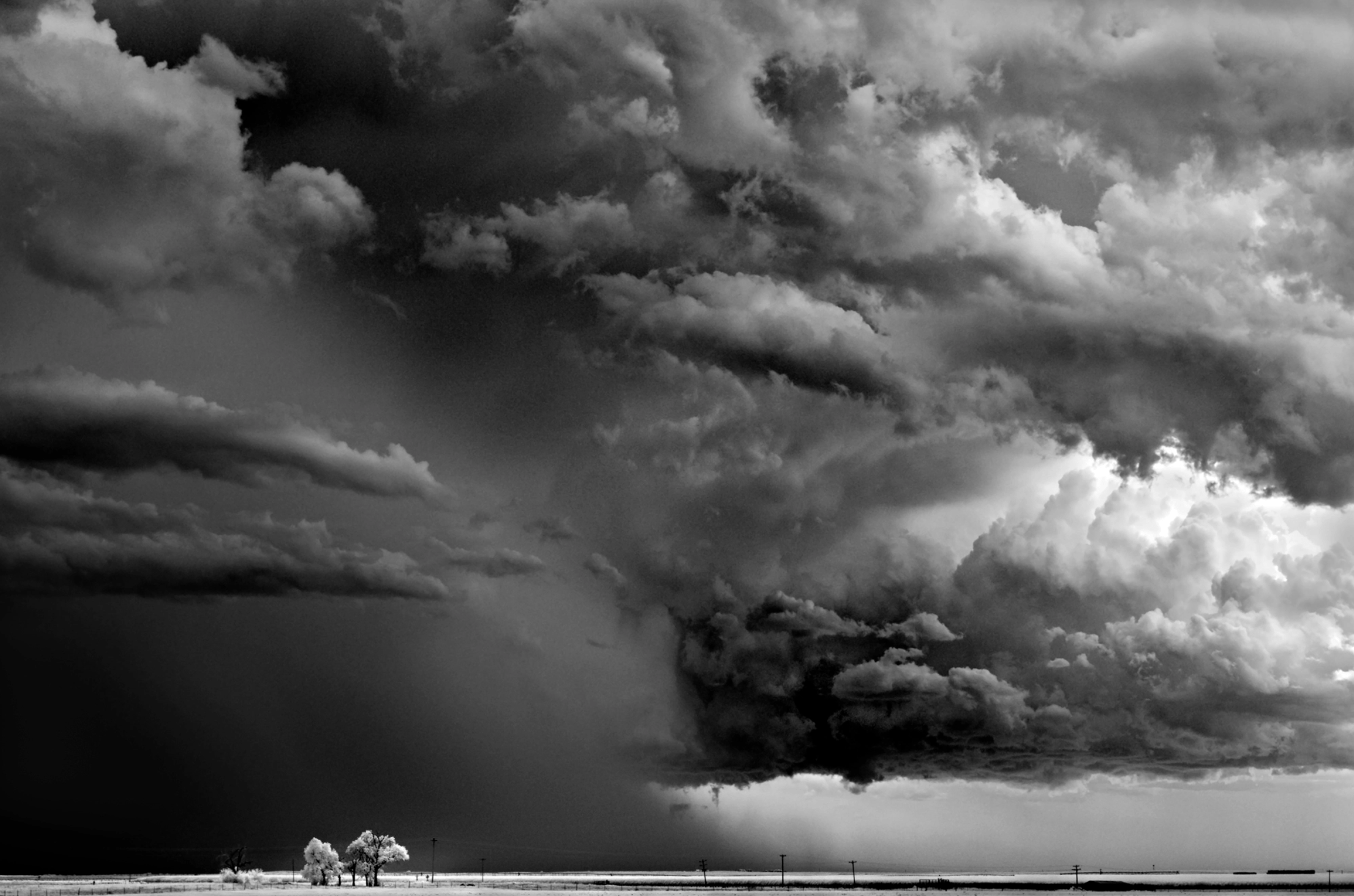
Stormy Landscapes


Photographer Mitch Dobrowner captures the power of major storm systems across the western United States and Canada in these dramatic black-and-white images. Misty clouds, massive downpours, bulbous mammatus clouds, and lonely landscapes abound. You can find more of his work on his website and Instagram. (Image credit: M. Dobrowner; via Colossal)

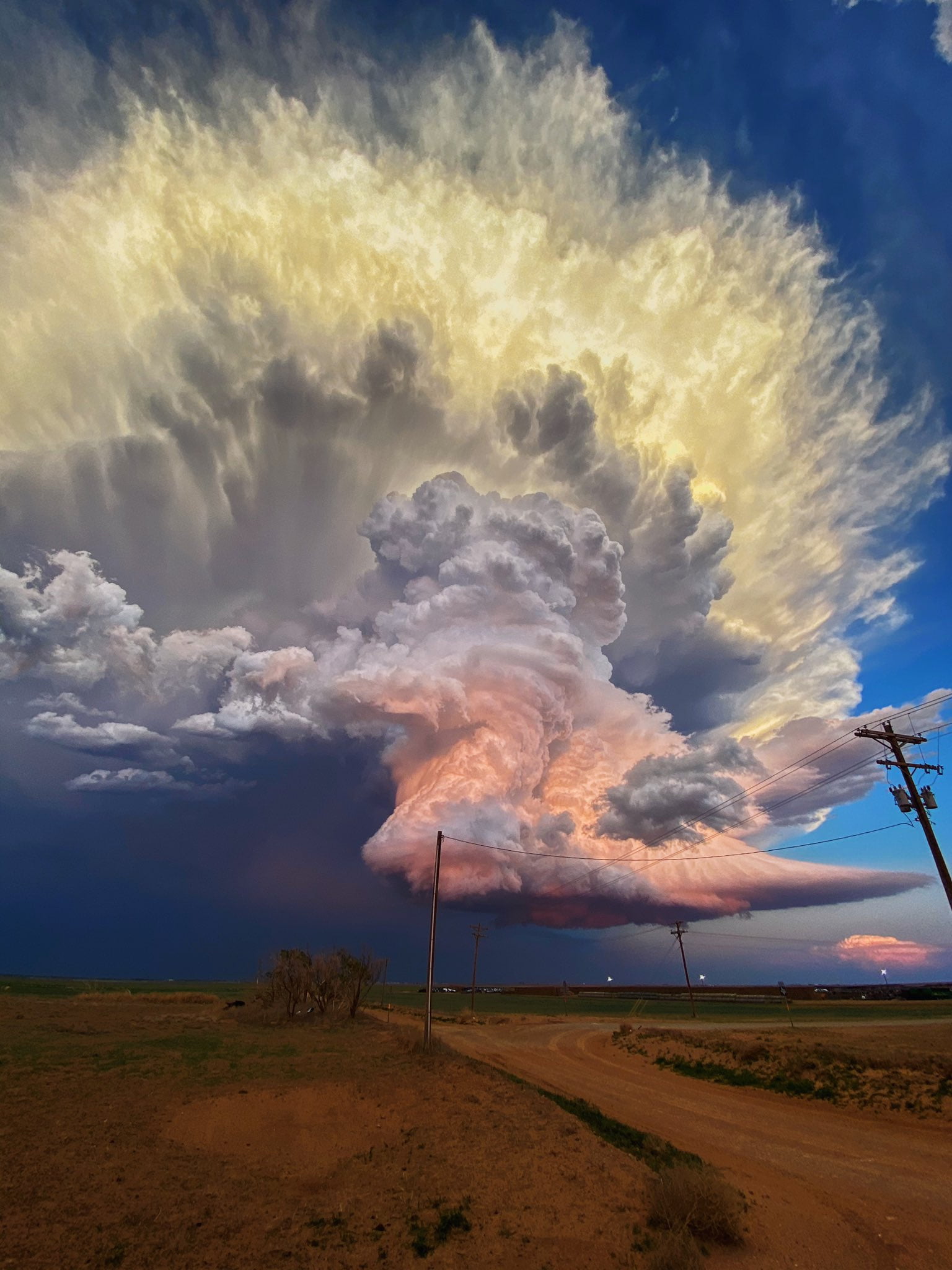
Candy Clouds Mid-Storm
There’s nothing quite like a towering storm cloud to showcase nature’s power. This gorgeous photo by Laura Rowe shows pastel clouds over West Texas in the middle of a thunderstorm. Despite the dusk at ground level, the height of the cloud keeps it lit by direct sunlight, giving its turbulent convection that colorful glow. Rowe, as it happens, is not a professional photographer, which is a good reminder to us all: it’s always worth looking up! You never know what beauty you’ll miss if you don’t. (Image credit: L. Rowe; via Colossal)

Chasing the Storm


Towering mountains of convection and ominous colors are staples of Adam Kyle Jackson’s storm photography. His dramatic portraits of supercell thunderstorms highlight the majesty and power of these turbulent phenomena. Make sure to follow him on Instagram for lots more! (Image credit: A. Jackson; via Nat Geo)
“Monsoon 6”


The stunning power and beauty of our atmosphere comes to life in Mike Olbinski’s latest short film, “Monsoon 6”. Over the years, I’ve probably watched dozens of Olbinski’s videos, yet he still captures sequences that make me exclaim aloud as I watch. In this one, some of my favorites are the microburst at 2:17 and the development of mammatus clouds at 3:20. How mammatus clouds form is still very much an area of active research; I don’t know if Olbinski’s footage sheds light on their formation, but it is supremely awesome to watch! (Image and video credit: M. Olbinski)


.")
.")
.")
.")


