Look beneath the waves on a beach or in a bay, and you’ll find ripples in the sand. Passing waves shape these sandforms and can even build them to heights that require dredging to keep waterways passable to large ships. To better understand how the sand interacts with the flow, researchers build computer models that couple the flow of the water with the behavior of individual sand grains. One recent study found that sand grains experienced the most shear stress as the flow first accelerates and then again when a vortex forms near the crest of the ripple. (Image credit: D. Hall; research credit: S. DeVoe et al.; via Eos)
Tag: sediment transport

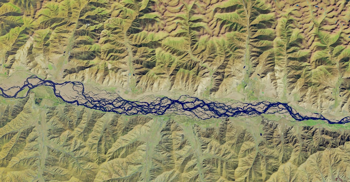
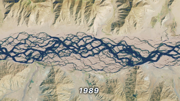
A Braided River
The Yarlung Zangbo River winds through Tibet as the world’s highest-altitude major river. Parts of it cut through a canyon deeper than 6,000 meters (three times the depth of the Grand Canyon). And other parts, like this section, are braided, with waterways that shift rapidly from season to season. The swift changes in a braided river’s sandbars come from large amounts of sediment eroded from steep mountains upstream. As that sediment sweeps downstream, some will deposit, which narrows channels and can increase their scouring. The river’s shape quickly becomes a complicated battle between sediment, flow speed, and slope. (Image credit: M. Garrison; animation credit: R. Walter; via NASA Earth Observatory)

Fediverse Reactions
-

Smoke Bomb
With a flurry of motion along its pectoral fin, a sting ray lifts the sand nearby and disappears into the turbid cloud. This tactic helps the animal both hide and escape. In a similar move, sting rays and other bottom-dwelling fish can bury themselves in sand.(Image credit: Y. Coll/OPOTY; via Colossal)
Fediverse Reactions
-

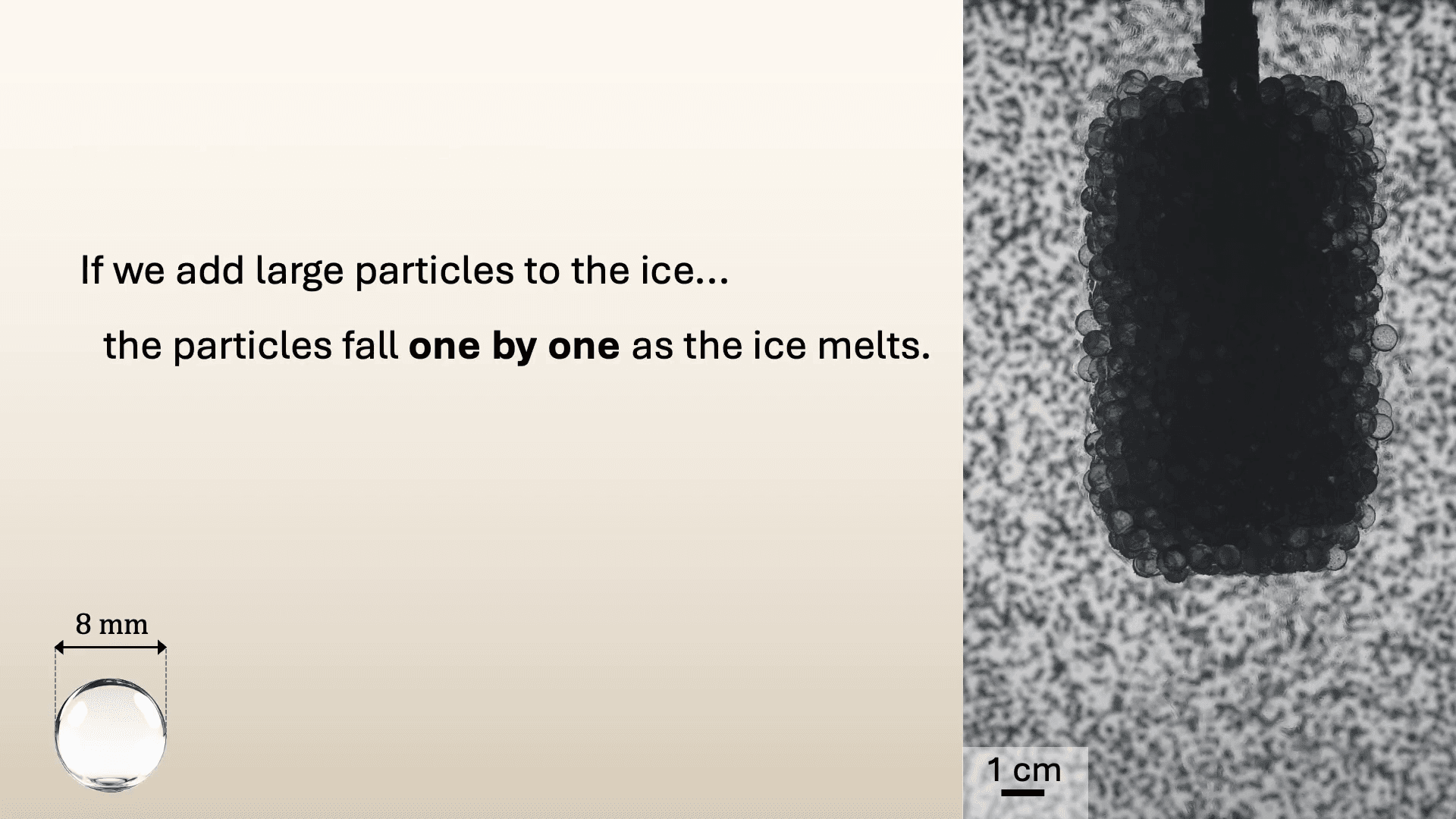
How Particles Affect Melting Ice

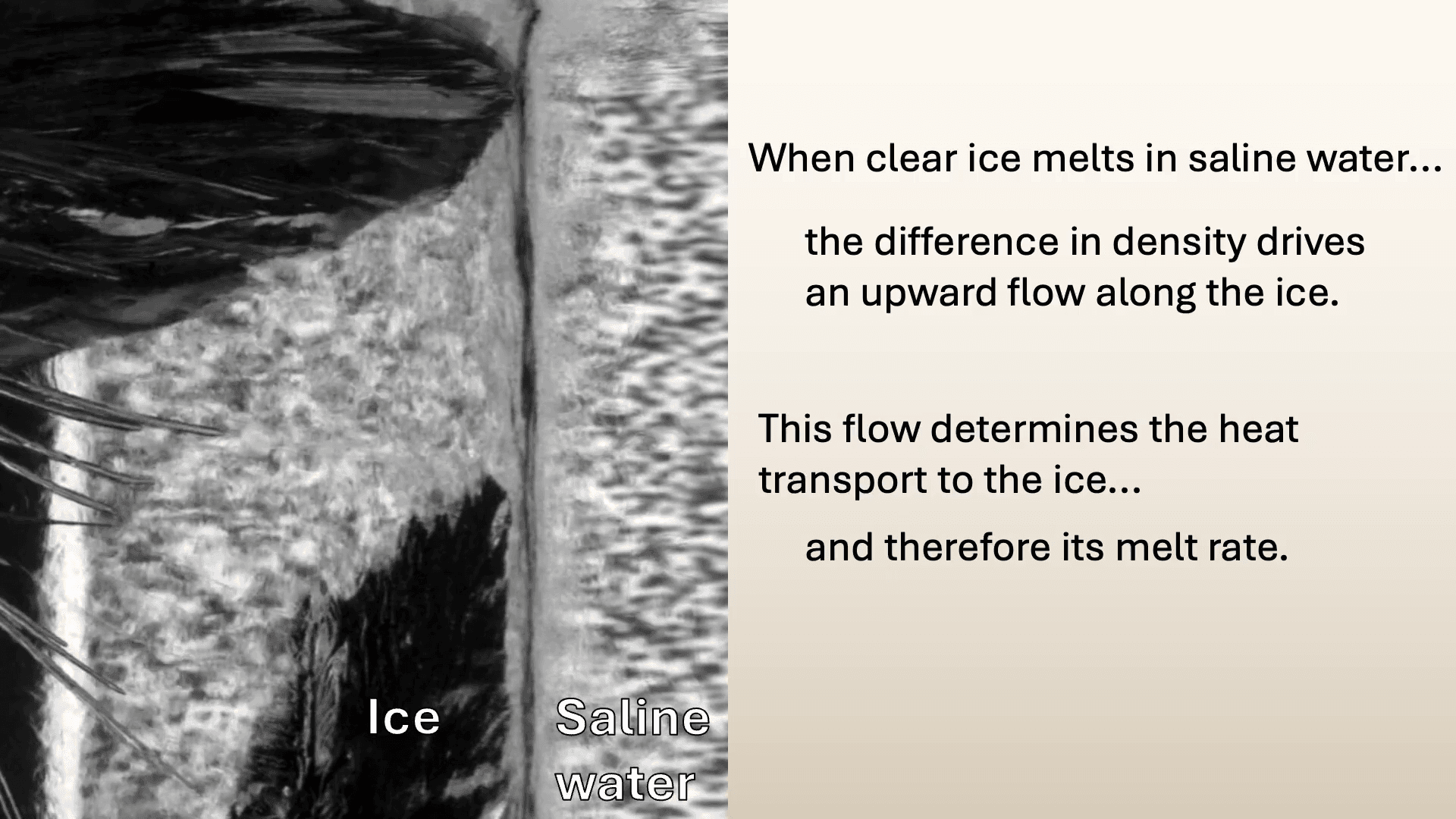
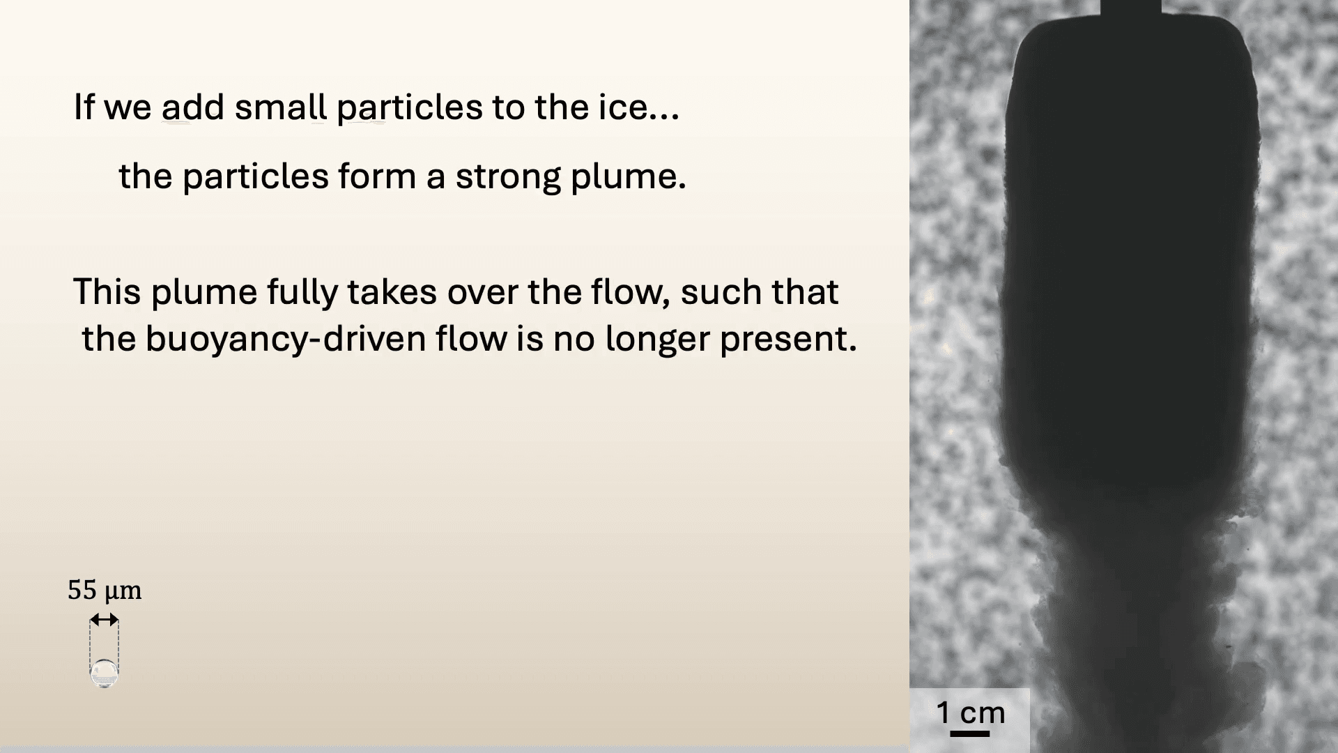
When ice melts in salt water, there’s an upward flow along the ice caused by the difference in density. But most ice in nature is not purely water. What happens when there are particles trapped in the ice? That’s the question this video asks. The answer turns out to be relatively complex, but the researchers do a nice job of stepping viewers through their logic.
Large particles tend to fall off one-by-one, which doesn’t really affect the buoyant upward flow along the ice. In contrast, smaller particles fall downward in a plume that completely overwhelms the buoyant flow. That strong downward flow makes the ice ablate even faster. (Video and image credit: S. Bootsma et al.)
Fediverse Reactions
-

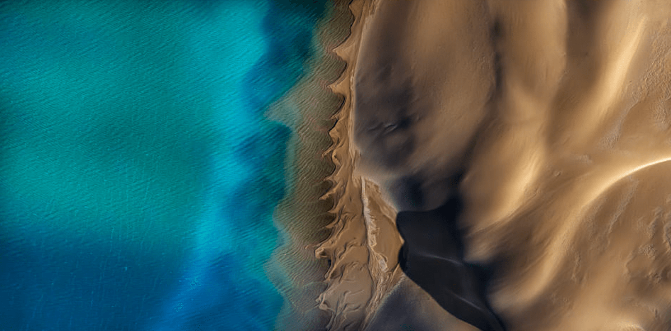
A Sandy Spine
Where sea and sand meet, Gaia’s spine rises. Photographer Satheesh Nair captured this striking image in western Australia, where wind and wave action have dragged a dune into vertebrae-like cusps. Notice how the size and shape of the curves differs between the under- and above-water sections. Those differences reflect the differing forces that shape them — just water for one set, water and air for the other. (Image credit: S. Nair/IAPOTY; via Colossal)
Fediverse Reactions
-

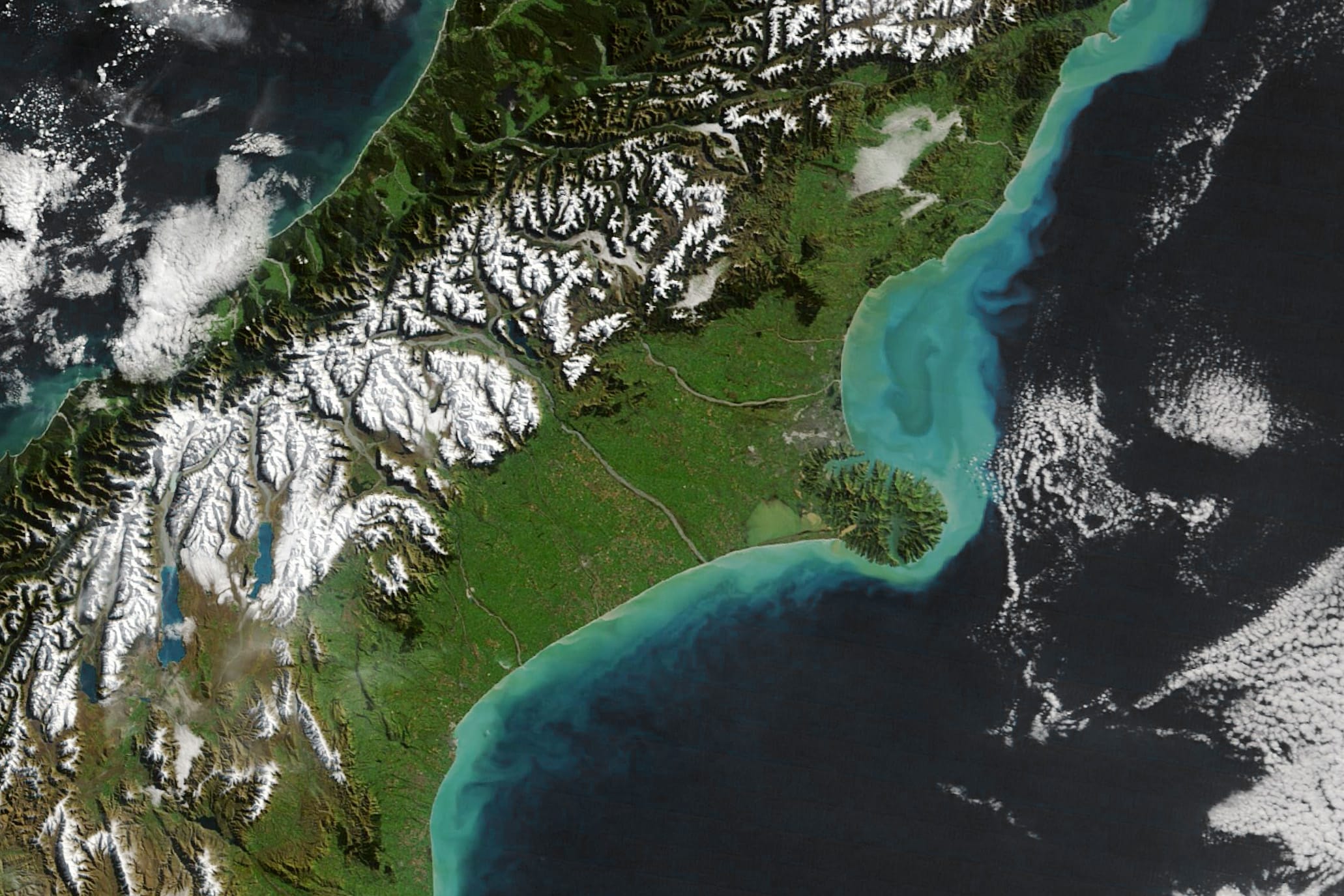
South Island Sediments
In April and May late autumn storms ripped through Aotearoa New Zealand. This image shows the central portion of South Island, where coastal waters are unusually bright thanks to suspended sediment. We typically think of storm run-off as water, but these flows can carry lots of sediment as well. Here, the large amount of sediment is likely a combination of increased run-off from rivers and coastal sediment stirred up by faster river flows. (Image credit: W. Liang; via NASA Earth Observatory)
Fediverse Reactions
-
Dams Fill Reservoirs With Sediment


Dams are critical pieces of infrastructure, but, as Grady shows in this Practical Engineering video, they are destined to be temporary. The reason is that they naturally fill with sediment over time. Rivers carry a combination of water and sediment; the latter is critical to healthy shorelines and stable ecology. But while sediment gets carried along by a fast-flowing river, slower flow rates allow sediment to fall out of suspension, as demonstrated in Grady’s tabletop flume. As his river transitions to a deeper, slower-flowing reservoir, sand falls out of the flow, building up colorful strata. The sand and water even create dynamic feedback loops, as seen with the dunes that form in his timelapse and march toward the dam.
Any long-term plan for a dam has to deal with this inevitable build-up of sediment, and, unfortunately, it’s not a simple or cheap problem to address, as discussed in the video. (Video and image credit: Practical Engineering)
Fediverse Reactions
-

Tracking Coastal Sediment Loss
Shorelines rely on an influx of sediment to counter what’s lost to erosion by waves and currents. But tracking that sediment flux is challenging in coastal regions where salt, waves, and storms batter delicate instruments. Instead, researchers have turned to remote sensing through high-resolution satellites like Landsat to monitor these areas. Researchers built an algorithm to analyze coastal imagery, validated with local sediment measurements; once built, they deployed it in a free tool that lets anyone build a 40-year timeline of a coastal area’s sediment history.
Looking at thousands of sites around the world, the team found coastal sediment is on the decline, especially along sandy and muddy coastlines. Where has the sediment gone? It’s likely that human-built infrastructure — both on coasts and upstream along rivers — is disrupting the natural flow of sediments that would replenish these regions. (Image credit: NASA; research credit: W. Teng et al.; via Eos)

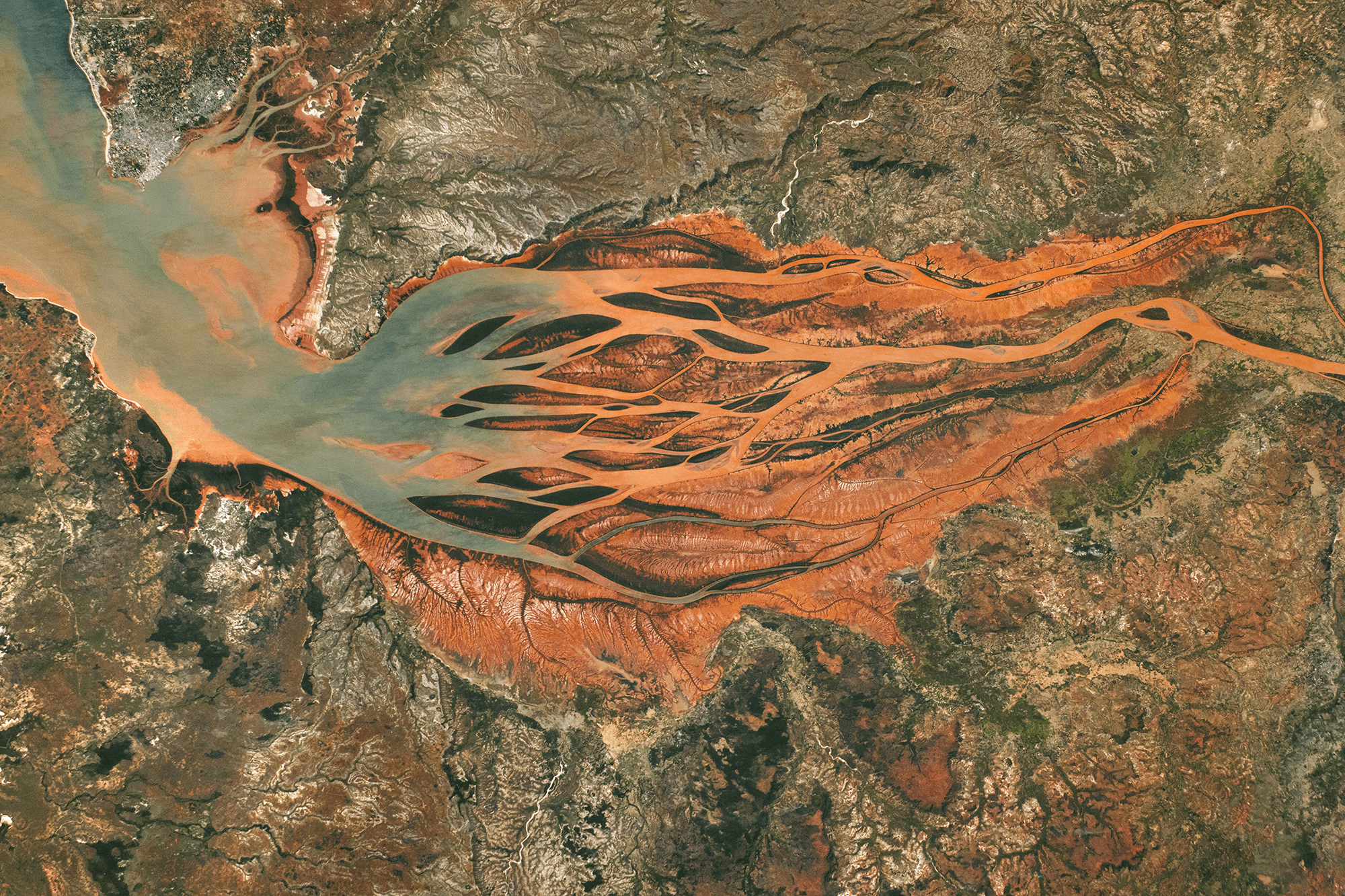
Growing Downstream
This astronaut photo shows Madagascar’s largest estuary, as of 2024. On the right side, the Betsiboka River flows northwest (right to left, in the image). Less than 100 years ago, most of the estuary was navigable by ships, but now more than half of it is taken up by the river delta. Upstream on the river, extensive logging and expansions to farmland have caused severe soil erosion; the river carries that sediment downstream, dyeing the waters reddish-orange. As the river branches and the flow slows, that sediment falls out of suspension, building up islands and seeding new sand bars further downstream.

A difference of 40 years. A 2024 astronaut photo of the Betsiboka River delta compared with one from 1984 (inset). Several islands are labeled in both images. Notice how new islands have formed upstream of the ones seen in 1984. In the image above, you can compare the 2024 delta to the way it looked in 1984. Letters A, B, C, and D mark the downstream-most islands from 1984. Today newer islands and sand bars sit even further downstream. (Image credit: NASA; via NASA Earth Observatory)
“Colors of Glacial Rivers”


As glaciers flow, they grind down rock, creating fine sediment that dyes waterways a milky color. In Jan Erik Waider’s aerial film, we get a bird’s eye view of the result, watching pockets of sediment move downstream in pulsating waves and swirls. Along the coast, ocean waves pass over the internal ones, creating a mesmerizing crisscrossed wavescape. You can also compare Waider’s aerial footage to Roman De Giuli’s tabletop-scale films and be amazed by their similarities. (Image and video credit: J. Waider; via Colossal)