Tag: glacier

  • Martian Viscous Flow

    Martian Viscous Flow

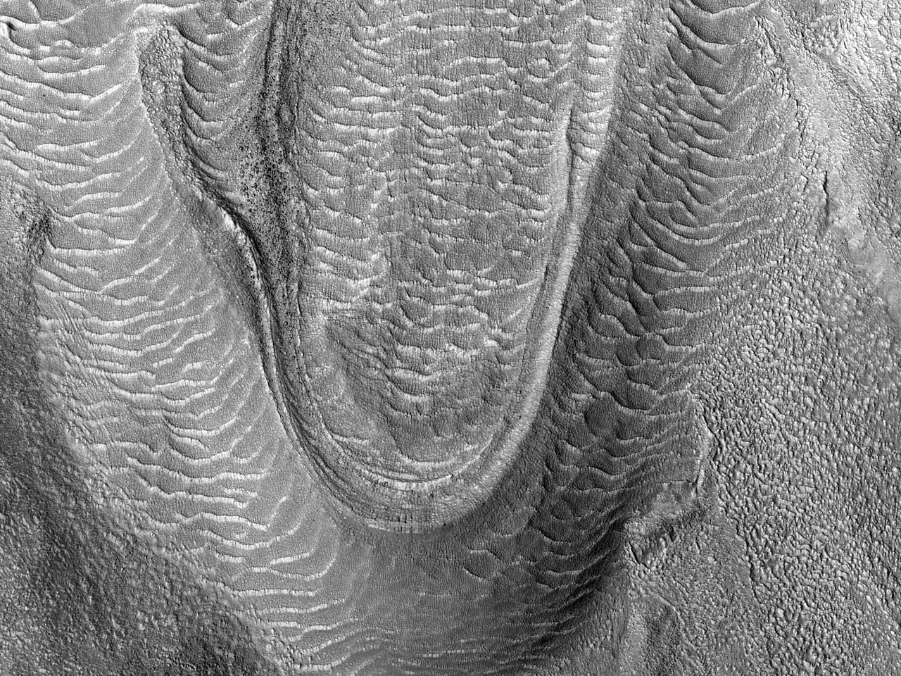
    These images from the Mars Reconnaissance Orbiter show what are called viscous flow features. They are the Martian equivalent of glacial flow. Such features are typically found in Mars’ mid-latitudes.

    Ground-penetrating radar studies of Mars have shown that some of these features contain water ice covered in a protective layer of rock and dust, making them true glaciers. Another study of similar Martian surface features found that their slope was consistent with what could be produced by a ~10 m thick layer of ice and dust flowing superplastically over a timescale equal to the estimated age of the surface features. Superplastic flow occurs when solid matter is deformed well beyond its usual breaking point and is one of the common regimes for glacial ice flow on Earth. (Image credit: NASA/JPL/U. of Arizona; via beautifulmars)

  • Glaciers in Motion

    Glaciers in Motion

    To the naked eye, glaciers don’t appear to move much, but appearances can be deceiving. Like avalanches and turbidity currents, glaciers flow under the influence of gravity. They typically move at speeds around 1 meter per day, but some glaciers, like those shown above in Pakistan’s Central Karakorum National Park, can briefly surge to speeds a thousand times higher than their usual. The animation above shows 25 years worth of Landsat satellite imagery, enabling one to more easily observe the motion of these slow giants. Try picking out a feature along one of the glaciers and watch it move year-by-year. The glaciers just right of the image centerline are some of the best!  (Image credit: J. Allen; via NASA Earth Observatory; submitted by Vince D)

    Enjoy FYFD? Consider becoming a patron to help support the site!

  • Featured Video Play Icon

    Melting Ice Sheets From Below

    A new study of ice sheets in West Antarctica has made major news this week with the announcement that the ice melt in this region is unstoppable and may raise sea levels by more than 1.2 meters. Part of what makes the ice sheet so unstable is the local topography, shown schematically in the animation above. The land on which the glacier sits lies well below sea level, and the grounding line marks where the ice, sea, and land meet. Part of the glacier projects outward as a sheet, with seawater between it and the land; this is not unusual, but it can encourage melting if the water under the ice sheet is warmer. A major problem for this region, though, is that the slope of the underlying land tilts downward. This means that, as warmer water begins circulating under the ice sheet, it causes the grounding line to retreat and expose a greater volume for warm water to fill beneath the ice. More warm water melts more ice and the process continues unabated. (Video credit: NASA/JPL; h/t to jtotheizzoe, jshoer)

  • Glacier Flows

    Glacier Flows

    These astronaut photos show Patagonian glaciers as seen from space. Glaciers form over many years when snow accumulates in larger amounts than it melts or sublimates. Over time the snow collects and is compacted into a dense ice which slowly flows downslope due to gravity. Many of the dark streaks in the photos are moraines, sediment formations deposited by the movement of the ice. Lateral moraines often line the edges of a glacier, and when two or more glaciers flow together, like in the lower left corner of both photos, the lateral moraines of each of the glaciers combine to form a medial moraine running through the combined glacial flow.  (Photo credits: M. Hopkins and K. Wakata)

  • Featured Video Play Icon

    Lakes Upon Glaciers

    Supraglacial lakes–ephemeral bodies of water that form atop glaciers–can form and empty in a matter of hours. The lakes typically empty either by overflowing their banks or by discharging through a moulin, a well-like crevasse in the ice. When this happens, the water from the lake drains into the bed beneath the glacier, acting like a lubricant between the ice and the land and thus accelerating the glacier’s movement. The team in the video studied the draining of two different lakes, one which voided within 2 hours and the other slower one which drained over 45 hours. The faster of the two accelerated the glacier’s movement to a maximum of 1600 meters/year, far higher than its baseline velocity of 90-100 meters/year. For more see Laboratory Equipment and this post on ice flow. (Video credit: City College of New York)

  • Featured Video Play Icon

    Iceberg Calving

    When sections of glaciers break off to create icebergs, scientists call it calving. Usually large sections of ice will break off and immediately capsize, with an energy equivalent to up to 40 kilotons of TNT. These large events are sufficient to cause measurable seismic signals. How hydrodynamic forces impact the contact and pressure forces between the calving iceberg and the glacier are still being researched, though recent laboratory experiments and numerical models suggest that hydrodynamics substantially increase these forces. The video above shows one of the largest calving events ever caught on camera, and the scale of the process is just stunning. (Video credit: Chasing Ice; additional information from J. C. Burton et al. 2012; submitted by jshoer)