The intense heat from wildfires fuels updrafts, lifting smoke and vapor into the atmosphere. As the plume rises, water vapor cools and condenses around particles (including ash particles) to form cloud droplets. Eventually, that creates the billowing clouds we see atop the smoke. These pyrocumulus clouds, like this one over California’s Line fire in early September 2024, can develop further into full thunderstorms, known in this case as pyrocumulonimbus. The storm from this cloud included rain, strong winds, lightning, and hail. Unfortunately, storms like these can generate thousands of lightning strikes, feeding into the wildfire rather than countering it. (Image credit: L. Dauphin; via NASA Earth Observatory)
Tag: pyrocumulus
Pyrocumulus on the Horizon
The Cranston wildfire in California is intense enough that it’s creating its own weather. This timelapse video shows the formation and growth of a pyrocumulus cloud, also associated with volcanoes, over the wildfire. In both instances, the extreme heat causes a massive column of hot, turbulent air to rise. Because ash and smoke are carried upward as well, there are many places for any moisture in the atmosphere to nucleate, forming the cloud we see. In timelapse, the roiling nature of the air’s motion is especially apparent. This turbulence can be dangerous, as it may contribute to high winds and even lightning, both of which can spread the fire further. (Video credit: J. Morris; via James H.)

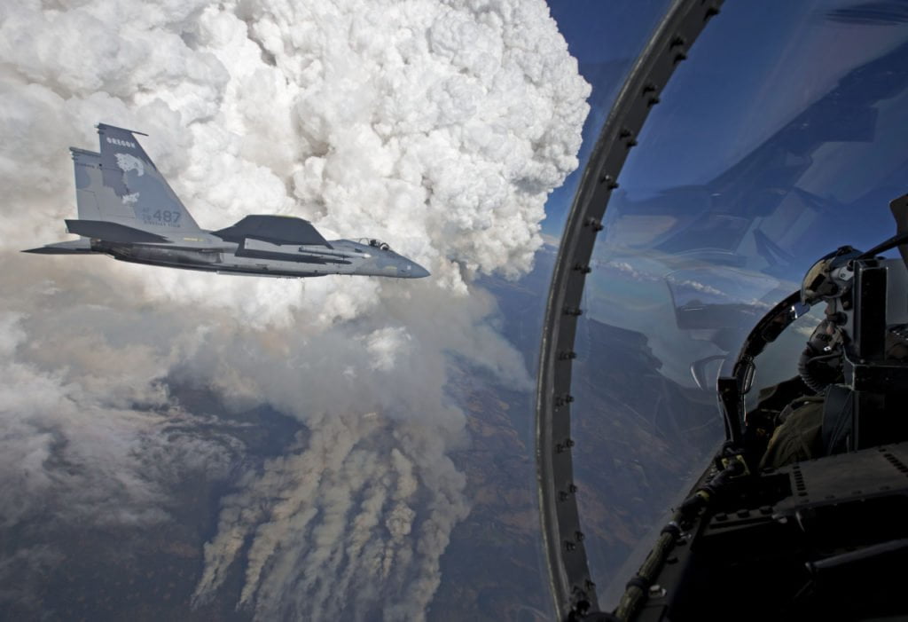
Pyrocumulus Clouds

Pyrocumulus clouds tower tall above a wildfire in these photos taken last week from an Oregon National Guard F-15C. Most cumulus clouds form when the sun-warmed surface heats air, causing it to rise and carry moisture upward where it condenses to form clouds. In pyrocumulus clouds, the driving heat is supplied by a forest fire or volcanic eruption. The hot, rising air carries smoke and soot particles upward, where they become nucleation sites for condensation. Pyrocumulus clouds can be especially turbulent, and the gusting winds they produce can exacerbate wildfires. In some cases, the clouds can even develop into a pyrocumulonimbus thunderstorm with rain and lightning. (Photo credit: J. Haseltine; via NASA Earth Observatory)