Tag: meander

  • Review: “ABCs From Space”

    Review: “ABCs From Space”

    For me, one of the most fun aspects of studying science is seeking out examples of it in the world around us. Adam Voiland – who writes for NASA Earth Observatory, one of FYFD’s favorite sources for excellent fluids in action – takes this a step further with his children’s book “ABCs From Space: A Discovered Alphabet”. Voiland has sought out satellite imagery from around the world to illustrate all twenty-six letters, creating a lovely book for budding scientists of all sorts.

    Each letter has its own full-page image with no added text, like the G and H shown above. Younger children will have fun identifying and tracing out each letter. The back of the book provides more detail for older kids and adults, including brief descriptions of where and what each image shows, a map of all image locations, and some FAQs about satellite imagery and the geology, meteorology, and earth science on display. There are enough specifics to satisfy casual interest, but I suspect that science-inclined adults will find the book a fun springboard for more in-depth discussions with curious kids.

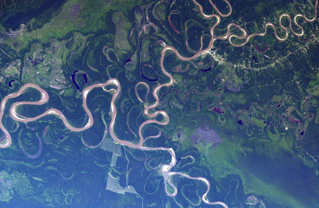
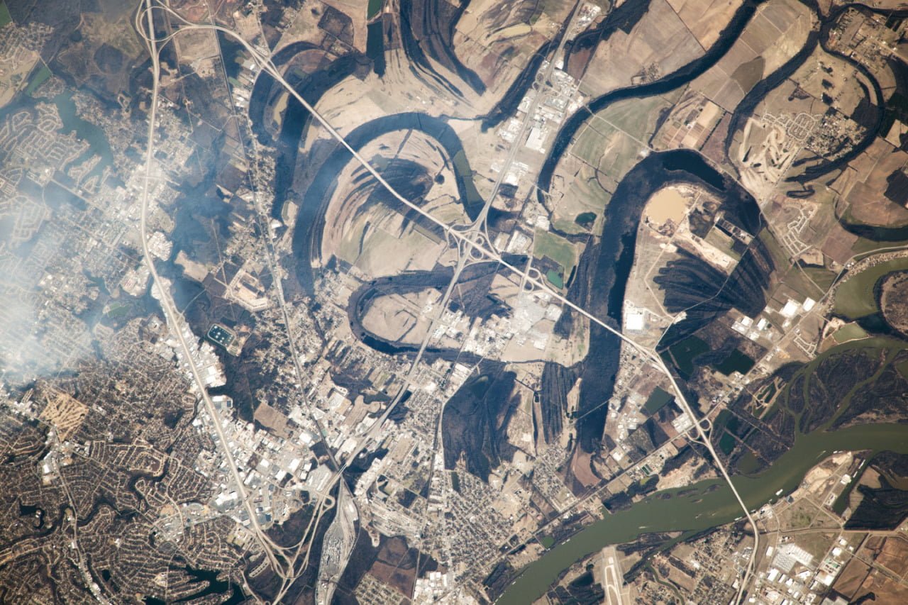
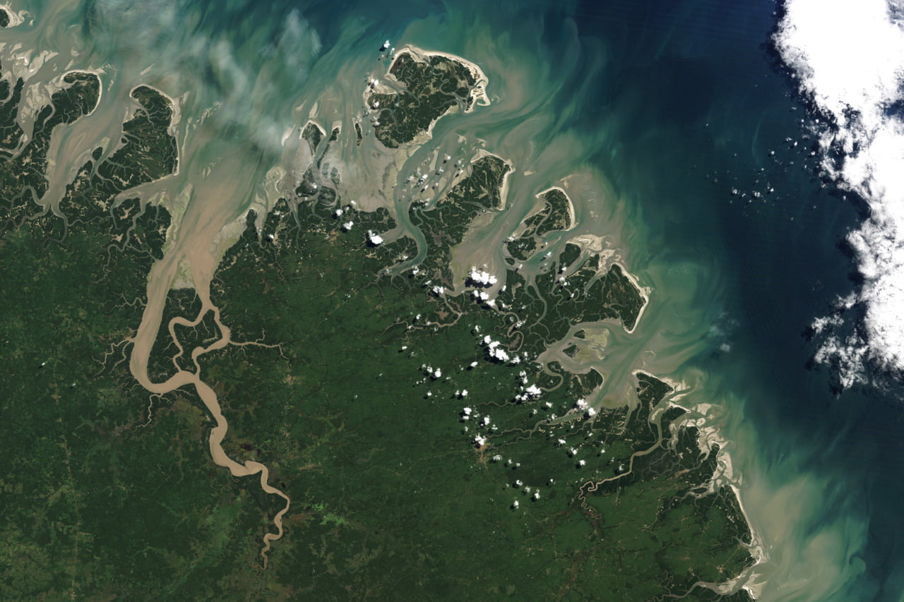
    Fluid dynamics itself makes a solid showing in the book. Several letters are formed by vortices (like G above) and various types of clouds, including the ship track clouds (like H) that form when water condenses on aerosols released by ship exhaust. There are also meandering rivers, creeping glaciers, and erosion features among the letters.

    I’m often asked about resources for teaching kids about fluid dynamics, and Voiland’s book is a great option for introducing that subject, as well as many other fields of science. (Image credits: A. Voiland/Simon & Schuster)

    Disclosure: I received a review copy of this book but was not otherwise compensated by the author or publisher. All opinions are my own. Additionally, this post contains affiliate links. Purchases made using these links do not cost you anything extra but may provide FYFD with a commission. Thanks!

  • Meandering Colorado

    Meandering Colorado

    Sometimes the meandering of a river is best seen from above. Because of the way water moves to negotiate a bend in the river, any curvature of a river will get carved into a more extreme curve over time. Eventually the river’s course becomes so exaggerated that a loop can bend almost back on itself. At this point, the river often pinches off the bend and shortens its course, as the Colorado River did several thousand years ago with the abandoned meander labeled The Rincon near the bottom of this satellite photo. Left to its own devices, the Colorado would eventually cut away the loop west of Lake Powell, too. (Image credit: NASA/Expedition 47; via NASA Earth Observatory)

  • Meander from Above

    Meander from Above

    This photo of the Amazon River taken by Astronaut Tim Kopra reveals the many meandering changes of the river’s course. Left untouched by human intervention, rivers tend to get more curvy, or sinuous, over time, simply due to fluid dynamics. Imagine a single bend in a river. Due to conservation of angular momentum, water flows faster around the inside curve of the bend than the outside – just like an ice skater spins faster with her arms pulled in. From Bernoulli’s principle, we know there is an accompanying pressure gradient caused by this velocity difference – with higher pressure near the outer bank and lower pressure on the inner one. This pressure gradient is what guides the water around the bend, keeping the bulk of the fluid moving downstream rather than bending toward either bank.

    At the bottom of the river, though, viscosity slows the water down due to the influence of the ground. This slower water, still subject to the same pressure gradient as the rest of the river, cannot maintain its course going downstream. Instead, it gets pushed from the outer bank toward the inner bank in what’s known as a secondary flow. This secondary flow carries sediment away from the outer bank and deposits it on the inner bank, which, over time, makes the river bend more and more pronounced. (Image credit: T. Kopra/NASA; submitted by jshoer)

    Do you enjoy FYFD and want to help support it? Then please consider becoming a patron!

  • Featured Video Play Icon

    River Paths

    As a follow-up to this recent post about river meander, check out this video from Numberphile about some of the mathematics behind the path of rivers. A river’s course is typically much longer than the direct distance between its origin and outlet; the ratio of these two distances is the river’s sinuosity. The fluid dynamics of a river’s bend tend to create stronger bends, but, once a bend reaches an extreme point, it will often be cut off, thereby straightening the river’s path. A model of unconstrained rivers suggests that, on average, the sinuosity of rivers should be about pi. As noted in the video, it would be very interesting to see how this theory holds up next to real rivers. But, given the way humans have fixed the course of rivers to prevent flooding, their current sinuosity is probably far from natural or unconstrained. (Video credit: Numberphile; research credit: H. Stølum; submitted by haxpaxmax)

  • Meandering River

    Meandering River

    When unconstrained by the local topography, rivers tend to meander, as shown in this astronaut photograph of the Arkansas River near Little Rock, AR. The current course of the river is visible in green in the lower right hand corner of the image, but numerous lakes and curved banks show some of the former paths the river took. When rivers develop a bend, flow is faster on the inner bank than around the outer bank. This speed difference causes a vortical secondary flow inside the river that removes sediment from the outer bank and deposits it on the inner side. The end result is that the bend in the river gets sharper and the river meanders further. Sometimes the bends get so sharp they pinch off, leaving behind lakes. (Photo credit: Exp. 38/NASA Earth Observatory)

  • Brazilian Barrier Islands

    Brazilian Barrier Islands

    Barrier islands are in a constant state of flux due to the currents, tides, and winds that surround and shape them. This satellite image of islands off the Brazilian coast shows meandering waterways and the mixing of sediment from the land into the sea. Often, secondary flows are responsible for shaping of these sorts of geographic features. #