Tag: geology

  • Sand Dikes Can Date Earthquakes

    Sand Dikes Can Date Earthquakes

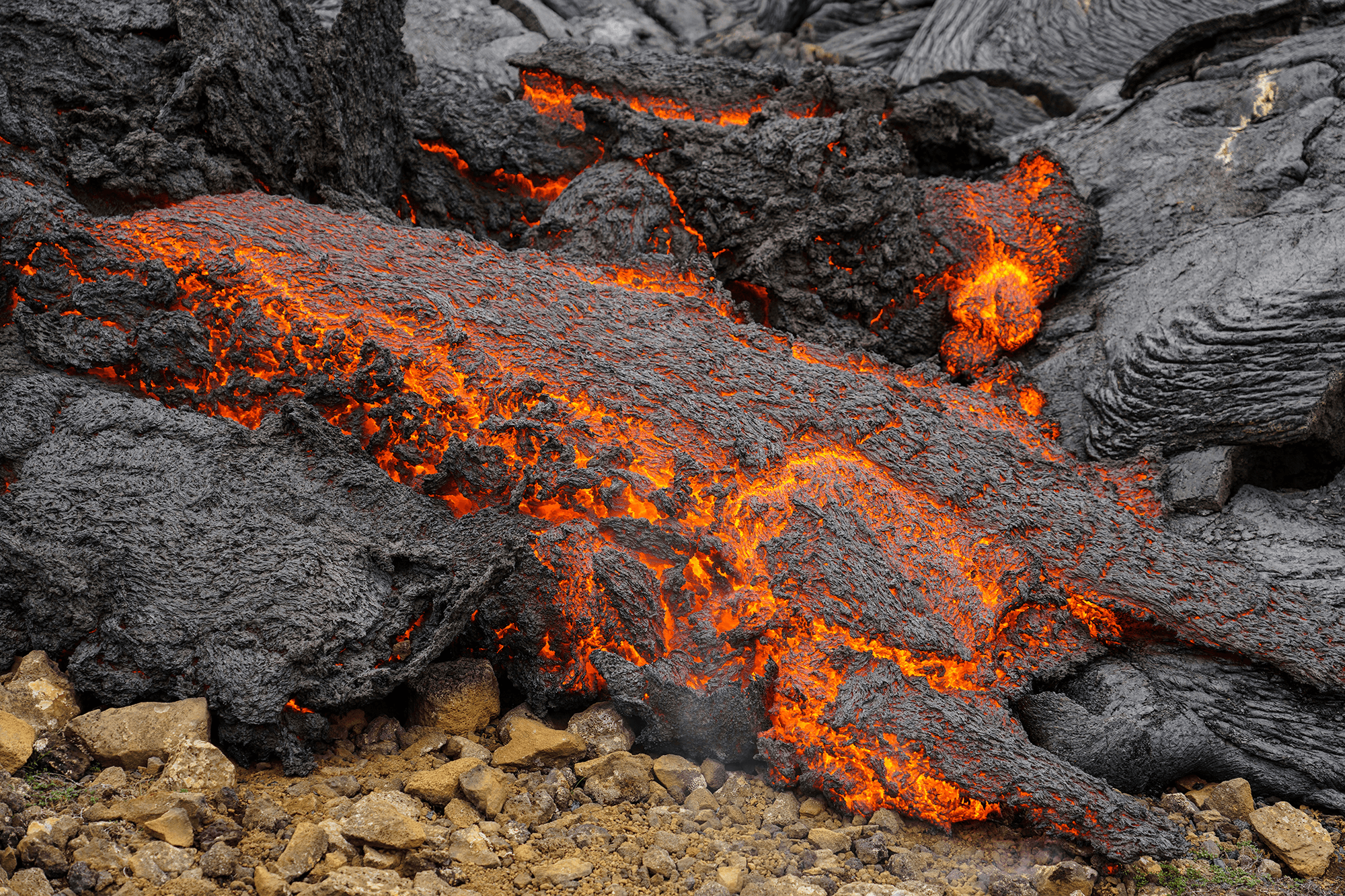
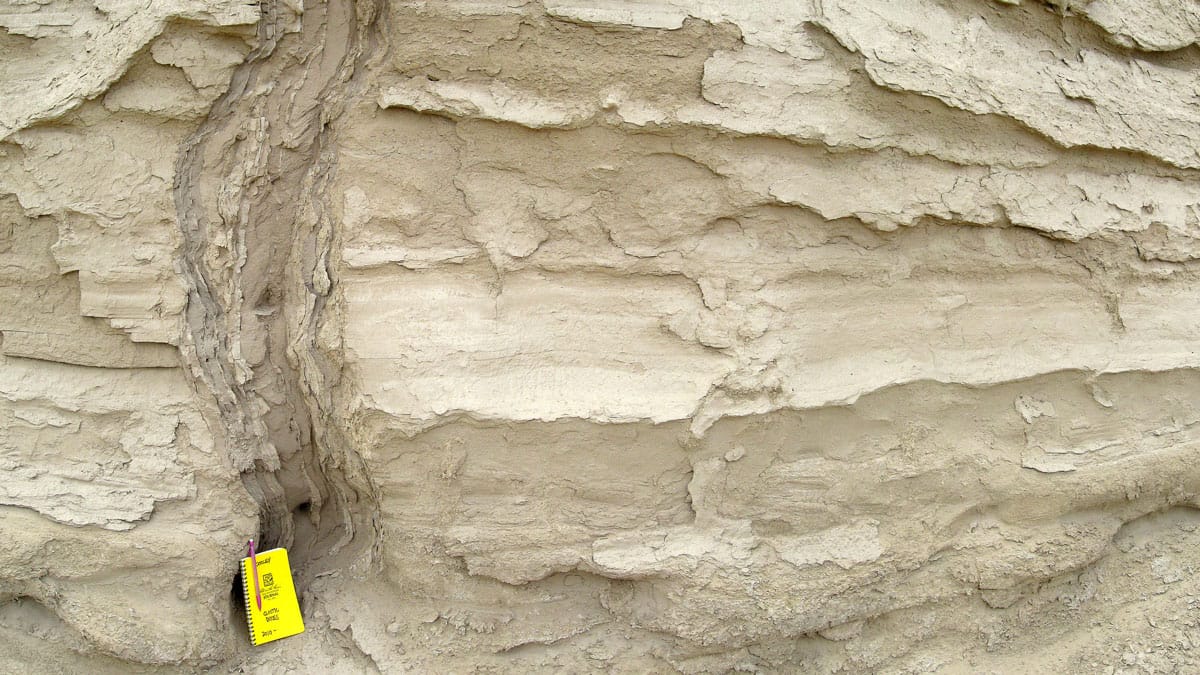
    When a strong earthquake causes liquefaction, sand can intrude upward, leaving behind a feature that resembles an upside-down icicle. Known as a sand dike, researchers suspected that these intrusions could help us date ancient earthquakes. A new study shows how and why this is possible.

    Using optically stimulated luminescence, researchers had already dated quartz in sand dikes and found that it appeared to be younger than the surrounding rock formations. But that information alone was not enough to tie the sand dike’s age to the earthquake that caused it.

    The final puzzle piece fell into place when researchers showed that, during a sand dike’s formation, friction between sand grains could raise the temperature higher than 350 degrees Celsius. That temperature is high enough to effectively “reset” the age that luminescence dates the quartz to. Since the quartz likely wouldn’t have had another reset since the earthquake that put it in the sand dike, this means scientists can date the sand dikes themselves to determine when an earthquake occurred. (Image credit: Northisle/Wikimedia Commons; research credit: A. Tyagi et al.; via Eos)

    Fediverse Reactions
  • Featured Video Play Icon

    Liquefaction in Earthquakes

    In an earthquake, sand and soil particles get jostled together, forcing any water between them up toward the surface. The result is liquefaction, a state where once-solid ground starts to behave much like a liquid. Buildings can tip over and pipelines get pushed toward the surface. In this video, a geologist shows off some great demonstrations of the effect, including ones that can be easily done in a classroom with younger kids. (Video credit: California Geological Survey)

    Fediverse Reactions
  • Earth’s Core is Leaking

    Earth’s Core is Leaking

    In Earth’s primordial days, liquid iron fell through the ball of magma that was our planet, collecting elements–like ruthenium-100–that are attracted to iron. All of that material ended up in Earth’s outer core, a dense sea of liquid metal that geoscientists assumed was unable to cross into the lighter mantle. But recent observations suggest instead that core material is making its way to the surface.

    Measurements from volcanic rocks in the Galapagos Islands, Hawai’i, and Canada’s Baffin Island all contain ruthenium isotopes associated with that primordial core material, indicating that that magma came from the core, not the mantle. Separately, seismic analyses suggest that this material could be crossing through continent-sized blobs of warm, large-grained crystals caught deep below Africa and the Pacific, at the boundary between the mantle and the outer core. For more, check out this Quanta Magazine article. (Image credit: B. Andersen; research credit: N. Messling et al. and S. Talavera-Soza et al.; via Quanta)

    Fediverse Reactions
  • Cutting Out Canyons

    Cutting Out Canyons

    Over the millennia, the Colorado River has carved some of the deepest and most dramatic canyons on our planet. This astronaut photo shows the river near its dam at Lake Powell. The strip of white edging the lake is the “bathtub ring” that shows how the water level has varied over the years. The deep canyons — over 400 meters from the Horn in the center of the photo to the river beside it — throw shadows across the landscape. To reach these depths, the Colorado River incised its path into bedrock that was tectonically uplifted. (Image credit: NASA; via NASA Earth Observatory)

    Fediverse Reactions
  • Branching Dendrites

    Branching Dendrites

    This award-winning aerial image by photographer Stuart Chape shows a tidal creek in Lake Cakora, New South Wales, Australia. At first glance, it looks much like any river delta, with branching dendritic paths that split into smaller and smaller waterways. That’s deceptive, though, because very different forces shape this creek. Because tides move in and out, a tidal creek is home to flows that move both directions — toward and away from the branches. That also means that flow speeds can change rapidly as the tides shift, which in turn changes which sediments get lifted, dropped, and moved around the creek bed. (Image credit: S. Chape/IAPOTY; via Colossal)

    Fediverse Reactions
  • Lava Meets Leidenfrost

    Lava Meets Leidenfrost

    Drop water on a surface much hotter than its boiling point, and the liquid will bead up and skitter over the surface, levitated on a cushion of its own vapor. In addition to making the drop hypermobile, this vapor layer insulates it from the heat of the surface, allowing it to survive longer than it would at lower temperatures. Known as the Leidenfrost effect, this phenomenon can show up in lava flows, as well.

    Pillow lava is a smooth, bulbous rock formed when lava breaks out underwater. The exiting lava is incandescent and, therefore, incredibly hot — hot enough to vaporize a layer of water surrounding it. The lava can continue to expand until it cools too much to sustain the vapor layer. An elastic skin builds up over the cooling lava. Eventually, a new pillow will bud off, possibly due to a surge in the lava flow or a weak point in the developing skin. (Image credit: J. de Gier; research credit: A. Mills; via LeidenForce)

    Fediverse Reactions
  • “Visions in Ice”

    “Visions in Ice”

    The glittering blue interior of an ice cave sparkles in this award-winning image by photographer Yasmin Namini. The cave is underneath Iceland’s Vatnajokull Glacier. Notice the deep scallops carved into the lower wall. This shape is common in melting and dissolution processes. It is unavoidable for flat surfaces exposed to a melting/dissolving flow. (Image credit: Y. Namini/WNPA; via Colossal)

    Fediverse Reactions
  • Slipping Ice Streams

    Slipping Ice Streams

    The Northeast Greenland Ice Stream provides about 12% of the island’s annual ice discharge, and so far, models cannot accurately capture just how quickly the ice moves. Researchers deployed a fiber-optic cable into a borehole and set explosive charges on the ice to capture images of its interior through seismology. But in the process, they measured seismic events that didn’t correspond to the team’s charges.

    Instead, the researchers identified the signals as small, cascading icequakes that were undetectable from the surface. The quakes were signs of ice locally sticking and slipping — a failure mode that current models don’t capture. Moreover, the team was able to isolate each event to distinct layers of the ice, all of which corresponded to ice strata affected by volcanic ash (note the dark streak in the ice core image above). Whenever a volcanic eruption spread ash on the ice, it created a weaker layer. Even after hundreds more meters of ice have formed atop these weaker layers, the ice still breaks first in those layers, which may account for the ice stream’s higher-than-predicted flow. (Image credit: L. Warzecha/LWimages; research credit: A. Fichtner et al.; via Eos)

    Fediverse Reactions
  • Flooding the Mediterranean

    Flooding the Mediterranean

    Nearly 6 million years ago, the Mediterranean was cut off from the ocean and evaporated faster than rivers could replenish it. This created a salty desert that persisted until about 5.3 million years ago. One hypothesis — the Zanclean megaflood — suggests that the Mediterranean refilled rapidly through an erosion channel near the Strait of Gilbraltar. A new study bolsters the concept by identifying geological features near Sicily consistent with the megaflood.

    The team point to a grouping of over 300 ridges near the Sicily Sill, once a land bridge dividing the eastern and western Mediterranean and now underwater. The ridges are layered in debris but aren’t streamlined, suggesting they were rapidly deposited by turbulent waters, and date to the period of the proposed flooding. For more on the Zanclean Flood, check out this older post. (Image credit: R. Klavins; research credit: A. Micallif et al.; via Gizmodo)

    Fediverse Reactions
  • Glacial Tributaries

    Glacial Tributaries

    Just as rivers have tributaries that feed their flow, small glaciers can flow as tributaries into larger ones. This astronaut photo shows Siachen Glacier and four of its tributaries coming together and continuing to flow from the top to the bottom of the image. The dark parallel lines running through the glaciers are moraines, where rocks and debris are carried along by the ice. Those seen here are medial moraines left by the joining of tributaries. When glaciers retreat, moraines are often left behind, strewn with sediment that ranges from the fine powder of glacial flour all the way to enormous boulders. (Image credit: NASA; via NASA Earth Observatory)

    Fediverse Reactions