Tag: earthquake

  • Sand Dikes Can Date Earthquakes

    Sand Dikes Can Date Earthquakes

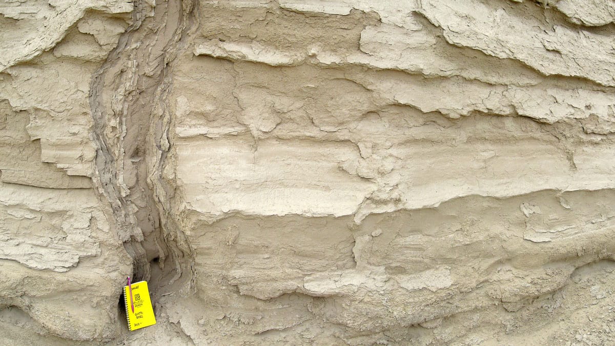
    When a strong earthquake causes liquefaction, sand can intrude upward, leaving behind a feature that resembles an upside-down icicle. Known as a sand dike, researchers suspected that these intrusions could help us date ancient earthquakes. A new study shows how and why this is possible.

    Using optically stimulated luminescence, researchers had already dated quartz in sand dikes and found that it appeared to be younger than the surrounding rock formations. But that information alone was not enough to tie the sand dike’s age to the earthquake that caused it.

    The final puzzle piece fell into place when researchers showed that, during a sand dike’s formation, friction between sand grains could raise the temperature higher than 350 degrees Celsius. That temperature is high enough to effectively “reset” the age that luminescence dates the quartz to. Since the quartz likely wouldn’t have had another reset since the earthquake that put it in the sand dike, this means scientists can date the sand dikes themselves to determine when an earthquake occurred. (Image credit: Northisle/Wikimedia Commons; research credit: A. Tyagi et al.; via Eos)
    Fediverse Reactions
  • Featured Video Play Icon

    Liquefaction in Earthquakes

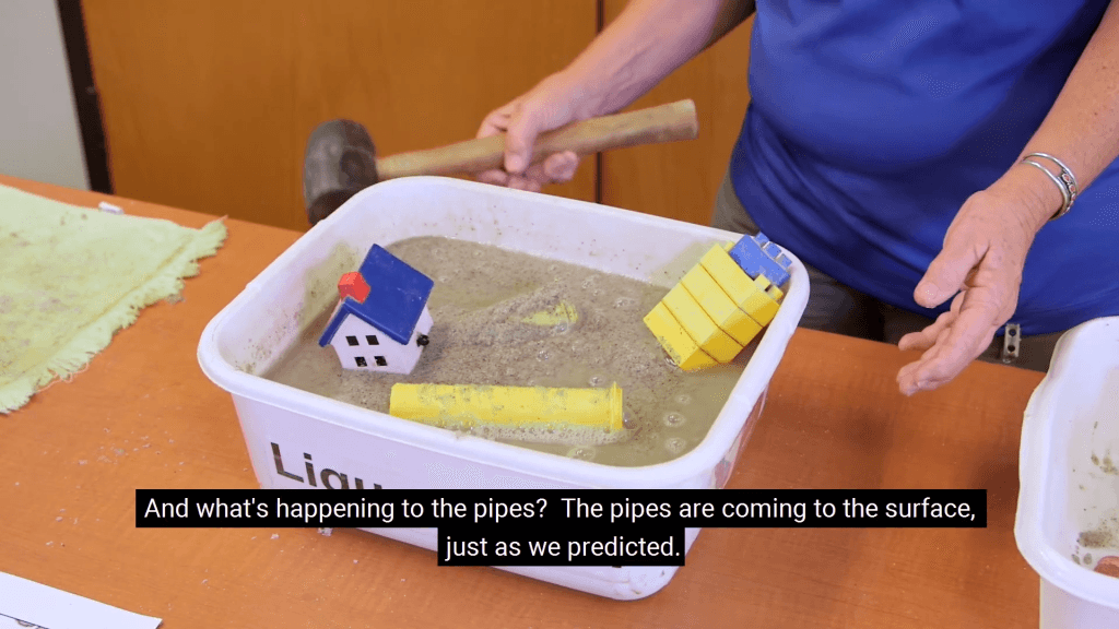
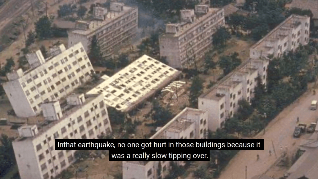
    In an earthquake, sand and soil particles get jostled together, forcing any water between them up toward the surface. The result is liquefaction, a state where once-solid ground starts to behave much like a liquid. Buildings can tip over and pipelines get pushed toward the surface. In this video, a geologist shows off some great demonstrations of the effect, including ones that can be easily done in a classroom with younger kids. (Video credit: California Geological Survey)

    Fediverse Reactions
  • Featured Video Play Icon

    Studying Earth’s Interior

    The Earth’s interior is almost entirely inaccessible to humanity, so how do we know what it consists of? As explained in this video, our knowledge of the planet’s interior is based on measuring waves sent out by earthquakes and nuclear blasts. Both produce two kinds of waves — pressure waves (P-waves) and shear waves (S-waves) that travel through the earth and get picked up by seismometers. Scientists noticed that pressure waves travel through the center of the planet while shear waves — which get dissipated in liquids — do not. This led them to conclude that part of Earth’s interior is a liquid. The idea of a solid inner core came from observations of pressure waves scattering in a way that only made sense if they’d hit something solid. (Video and image credit: Science)

  • Underwater Landslides

    Underwater Landslides

    Turbidity currents are a gravity-driven, sediment-laden flow, like a landslide or avalanche that occurs underwater. They are extremely turbulent flows with a well-defined leading edge, called a head. Turbidity currents are often triggered by earthquakes, which shake loose sediments previously deposited in underwater mountains and canyons. Once suspended, these sediments make the fluid denser than surrounding water, causing the turbidity current to flow downhill until its energy is expended and its sediment settles to form a turbidite deposit. By sampling cores from the seafloor, scientists studying turbidites can determine when and where magnitude 8+ earthquakes have occurred over the past 12,000+ years!  (Video credit: A. Teijen et al.; submitted by Simon H.)

    Do you enjoy FYFD and want to help support it? Then please consider becoming a patron!

  • Featured Video Play Icon

    How Tsunamis Cross the Ocean

    Last week an earthquake in Chile raised concerns over a possible tsunami in the Pacific. This animation shows a simulation of how waves would spread from the quake’s epicenter over the course of about 30 hours. In the open ocean, a tsunami wave can travel as fast as 800 kph (~500 mph), but due to its very long wavelength and small amplitude (< 1 m), such waves are almost unnoticeable to ships. It’s only near coastal areas, when the water shallows, that the wave train slows down and increases in height. Early in the video, the open ocean wave heights are only centimeters; note how, at the end of the video, the wave run-up heights along the coast are much larger, including the nearly 2 meter waves that impacted Chile. The power of the incoming waves in a tsunami are not their only danger, though; the force of the wave getting pulled back out to sea can also be incredibly destructive. (Video credit: NOAA/NWS/Pacific Tsunami Warning Center; via Wired)

  • Featured Video Play Icon

    Soil Liquefaction

    Soil liquefaction is a rather unsettling process in which apparently solid ground begins moving in a fluid-like way after agitation. It occurs in loose sediments when the spaces between individual particles become nearly saturated with water. This can happen, for example, after heavy rains or in a place with inadequate drainage. Such cases are typically very localized, though, and require some significant agitation of the surface, like pressing with heavy machinery or jumping in a single spot. Soil liquefaction becomes a greater danger, however, in an earthquake. Even in a dry area, the earth’s shaking can force groundwater up into the surface sediment and vibrate the soil sufficiently to liquify it, causing whole buildings to sink or tip and wreaking havoc on manmade infrastructure. (Video credit: jokulhlaups)