Over the millennia, the Colorado River has carved some of the deepest and most dramatic canyons on our planet. This astronaut photo shows the river near its dam at Lake Powell. The strip of white edging the lake is the “bathtub ring” that shows how the water level has varied over the years. The deep canyons — over 400 meters from the Horn in the center of the photo to the river beside it — throw shadows across the landscape. To reach these depths, the Colorado River incised its path into bedrock that was tectonically uplifted. (Image credit: NASA; via NASA Earth Observatory)
Tag: river bend

Forming an Oxbow
Without human intervention, meandering rivers become more sinuous over time. This is driven by the flow around a river bend, which tends to push sediment from the outer bank of the curve to the inner, making the bend more pronounced. Eventually, loops in the river can pinch off and form a separate oxbow lake, as seen in the animation above and video below.
By studying many photo sequences like this one, researchers have concluded that how quickly a river bend meanders depends on its curvature. In general, the higher the curvature, the faster the river bend will migrate. When rivers deviate from this rule of thumb, it’s typically because part of a river bank is tougher to erode than other sections. (Image and video credit: Z. Sylvester/Geolounge; research credit: Z. Sylvester; via Landsat; submitted by Aatish B.)

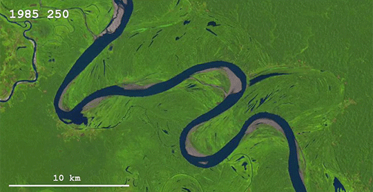
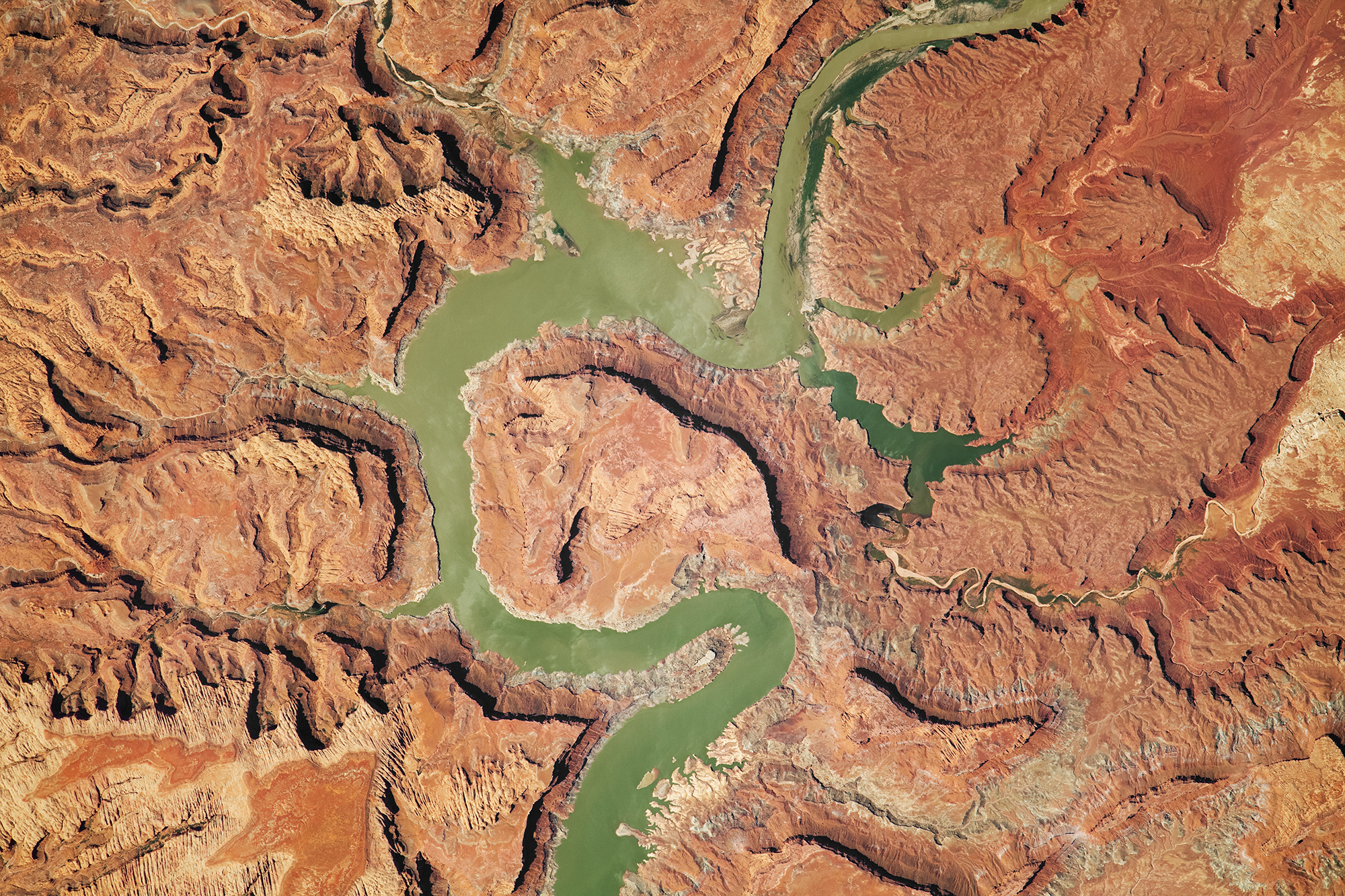
Meandering Colorado

Sometimes the meandering of a river is best seen from above. Because of the way water moves to negotiate a bend in the river, any curvature of a river will get carved into a more extreme curve over time. Eventually the river’s course becomes so exaggerated that a loop can bend almost back on itself. At this point, the river often pinches off the bend and shortens its course, as the Colorado River did several thousand years ago with the abandoned meander labeled The Rincon near the bottom of this satellite photo. Left to its own devices, the Colorado would eventually cut away the loop west of Lake Powell, too. (Image credit: NASA/Expedition 47; via NASA Earth Observatory)

River Paths
As a follow-up to this recent post about river meander, check out this video from Numberphile about some of the mathematics behind the path of rivers. A river’s course is typically much longer than the direct distance between its origin and outlet; the ratio of these two distances is the river’s sinuosity. The fluid dynamics of a river’s bend tend to create stronger bends, but, once a bend reaches an extreme point, it will often be cut off, thereby straightening the river’s path. A model of unconstrained rivers suggests that, on average, the sinuosity of rivers should be about pi. As noted in the video, it would be very interesting to see how this theory holds up next to real rivers. But, given the way humans have fixed the course of rivers to prevent flooding, their current sinuosity is probably far from natural or unconstrained. (Video credit: Numberphile; research credit: H. Stølum; submitted by haxpaxmax)

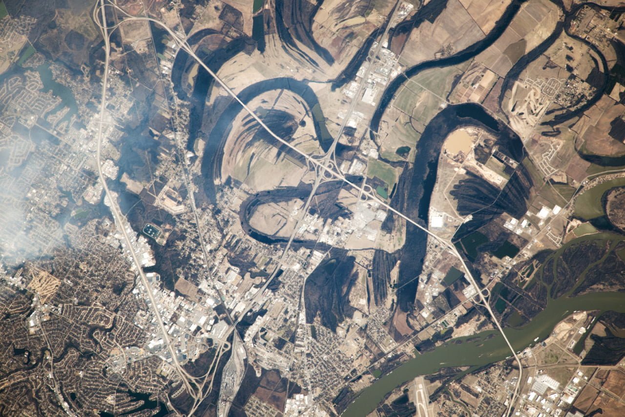
Meandering River
When unconstrained by the local topography, rivers tend to meander, as shown in this astronaut photograph of the Arkansas River near Little Rock, AR. The current course of the river is visible in green in the lower right hand corner of the image, but numerous lakes and curved banks show some of the former paths the river took. When rivers develop a bend, flow is faster on the inner bank than around the outer bank. This speed difference causes a vortical secondary flow inside the river that removes sediment from the outer bank and deposits it on the inner side. The end result is that the bend in the river gets sharper and the river meanders further. Sometimes the bends get so sharp they pinch off, leaving behind lakes. (Photo credit: Exp. 38/NASA Earth Observatory)
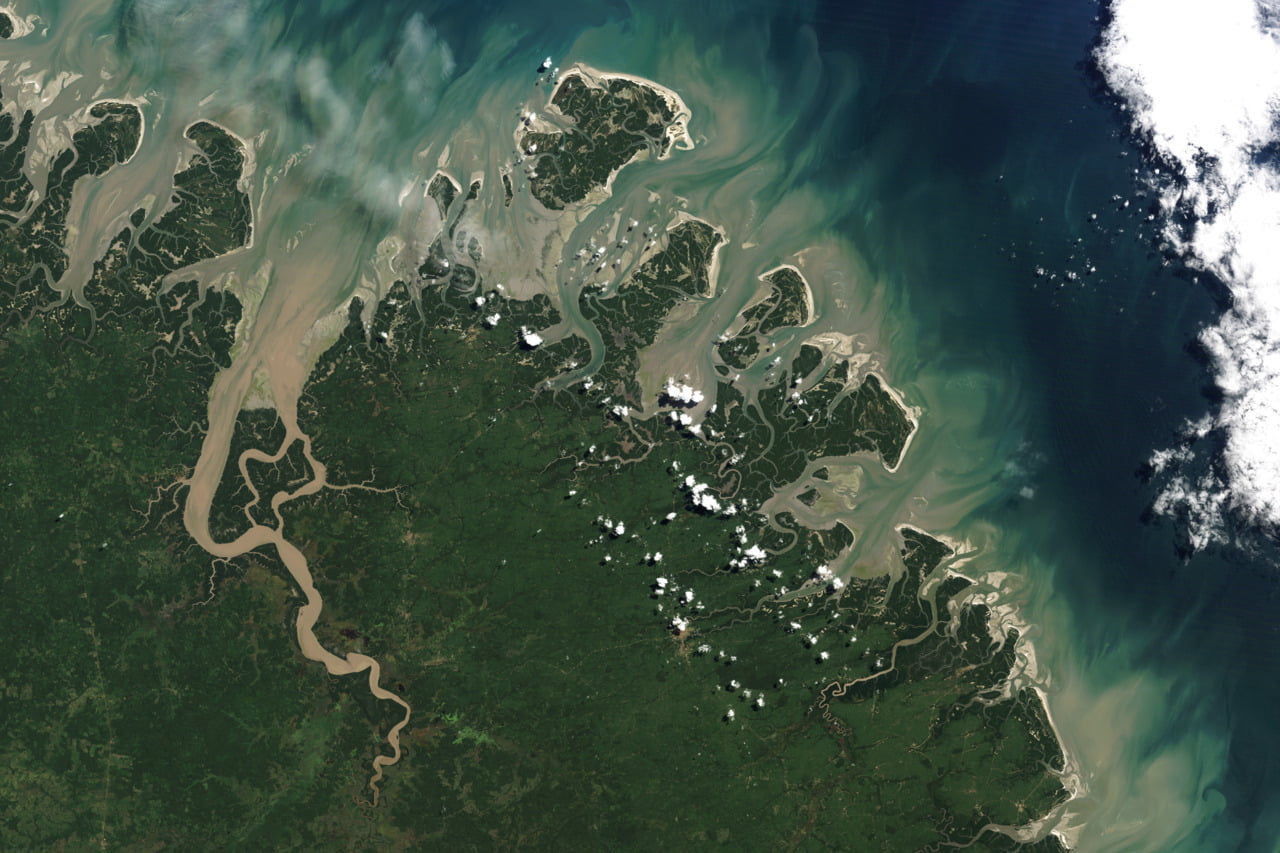
Brazilian Barrier Islands
Barrier islands are in a constant state of flux due to the currents, tides, and winds that surround and shape them. This satellite image of islands off the Brazilian coast shows meandering waterways and the mixing of sediment from the land into the sea. Often, secondary flows are responsible for shaping of these sorts of geographic features. #

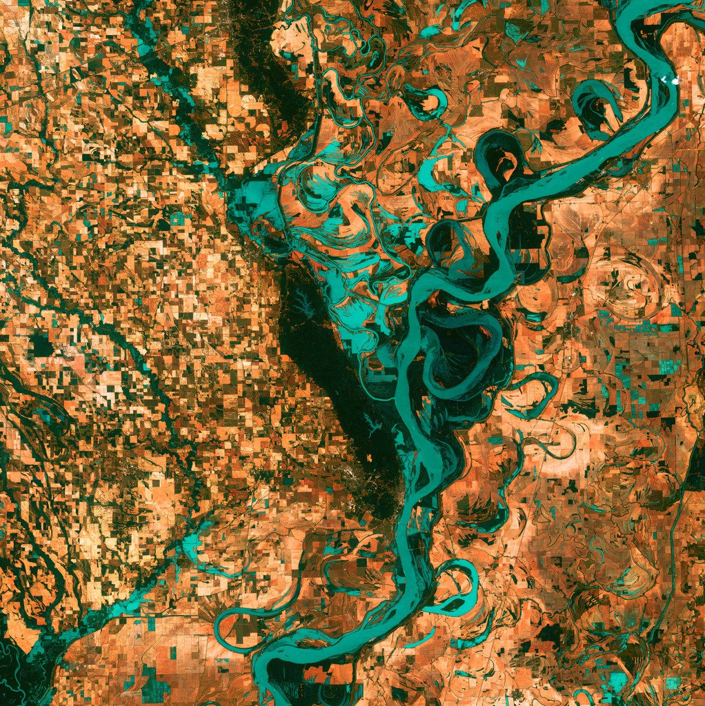
Meandering Mississippi
This satellite photo of the Mississippi River south of Memphis, TN shows how the river’s course has changed over time. When a river bends, the water near the inner bank flows faster than the water by the outer bank. This difference in speeds actually creates a vortical secondary flow in the boundary layer of the river that erodes sediment from the outer bank and deposits it on the inner bank. This increases the meander of the river bend. If this continues long enough, the river bend can get pinched off into an oxbow lake, like the ones scattered to either side of the current river path.