Tag: haboob

  • Featured Video Play Icon

    “Monsoon IV”

    It’s a cliché to claim that the sky is bigger in the American West, but the wide, open views in that region do offer a very different perspective on weather. Photographer Mike Olbinski’s works give viewers a taste of that perspective of far-off thunderstorms, towering anvil clouds, and massive downpours in the distance. At the same time, many of his sequences illustrate the birth and death of these massive storms. As warm, moist air rises, a puffy cumulus cloud (below) swells upward as fresh moisture condenses. When it reaches a thermal cap and can rise no further, precipitation begins to fall, dragging surrounding air with it. This is the mature stage of a storm, when both updrafts and downdrafts exist simultaneously.

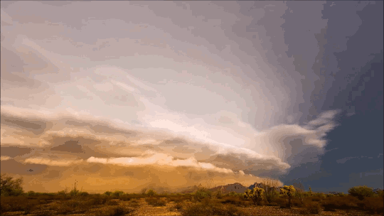
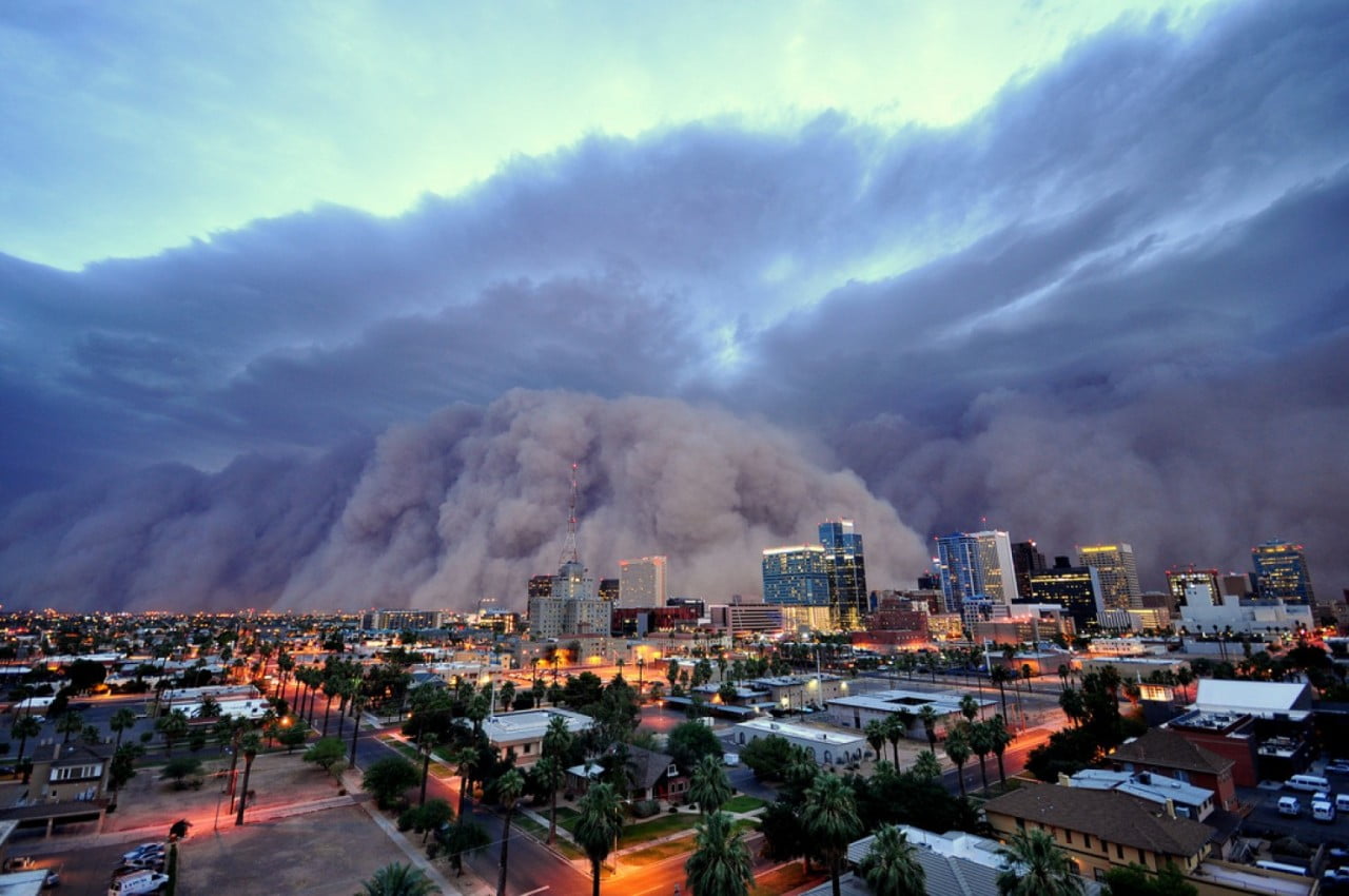
    Eventually, the storm’s power begins to wane as the downdrafts cut off the updrafts that feed the storm. Sometimes this occurs in a massive downdraft where cool air sinks straight down and, upon encountering the ground, spreads radially outward. In dry regions, this outward burst of ground-level winds can pick up dirt, dust, and sand, forming a wall-like haboob (below) that advances past the remains of the storm. Watch the entire video to see some examples in their full glory! (Video and image credit: M. Olbinski, source; via Rex W.)

    image
  • As the Dust Blows In

    As the Dust Blows In

    This towering cloud of dust is known as a haboob, and while it appears apocalyptic, it is a relatively common occurrence in parts of the world, including the U.S. southwest and the Middle East. Haboobs often form when a collapsing thunderstorm releases a downburst of cold air. That wind picks up loose dust along the ground and creates a wall of sediment that may be as much as 100 kilometers wide and several kilometers tall. Inside the haboob, winds can reach speeds as high as 100 kph and visibility can be reduced to nearly zero. Because of this, the storms can be quite dangerous, especially to anyone who attempts to drive during one. (Image credit: D. Bryant)

  • Dust Storm in Texas

    Dust Storm in Texas

    This aerial photo shows the leading edge of a haboob–an intense dust storm–sweeping across Texas last week. Although dust can be stirred up under many circumstances, haboobs are a specific meteorological phenomenon with winds as high as 100 kph and towering clouds of dust kilometers high. This particular storm swept through five US states last week along an incoming cold front. The winds accompanying the cold front swept up silt, dirt, and dust from the drought-ridden Southwest and carried it along to envelope towns and cities along the way. Although the term is Arabic in origin, haboobs occur throughout the world, typically at the leading edge of a cold front or thunderstorm.  (Photo credit: R. Scott)