Tag: cloud streets

  • A Special Trio of Clouds

    A Special Trio of Clouds

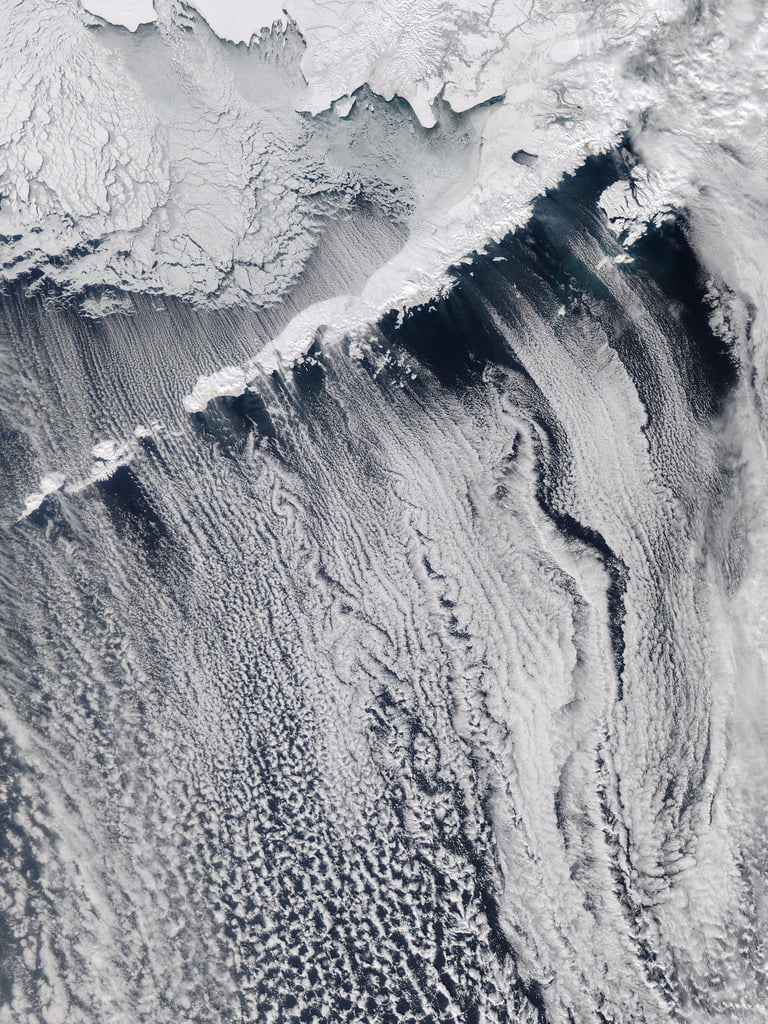
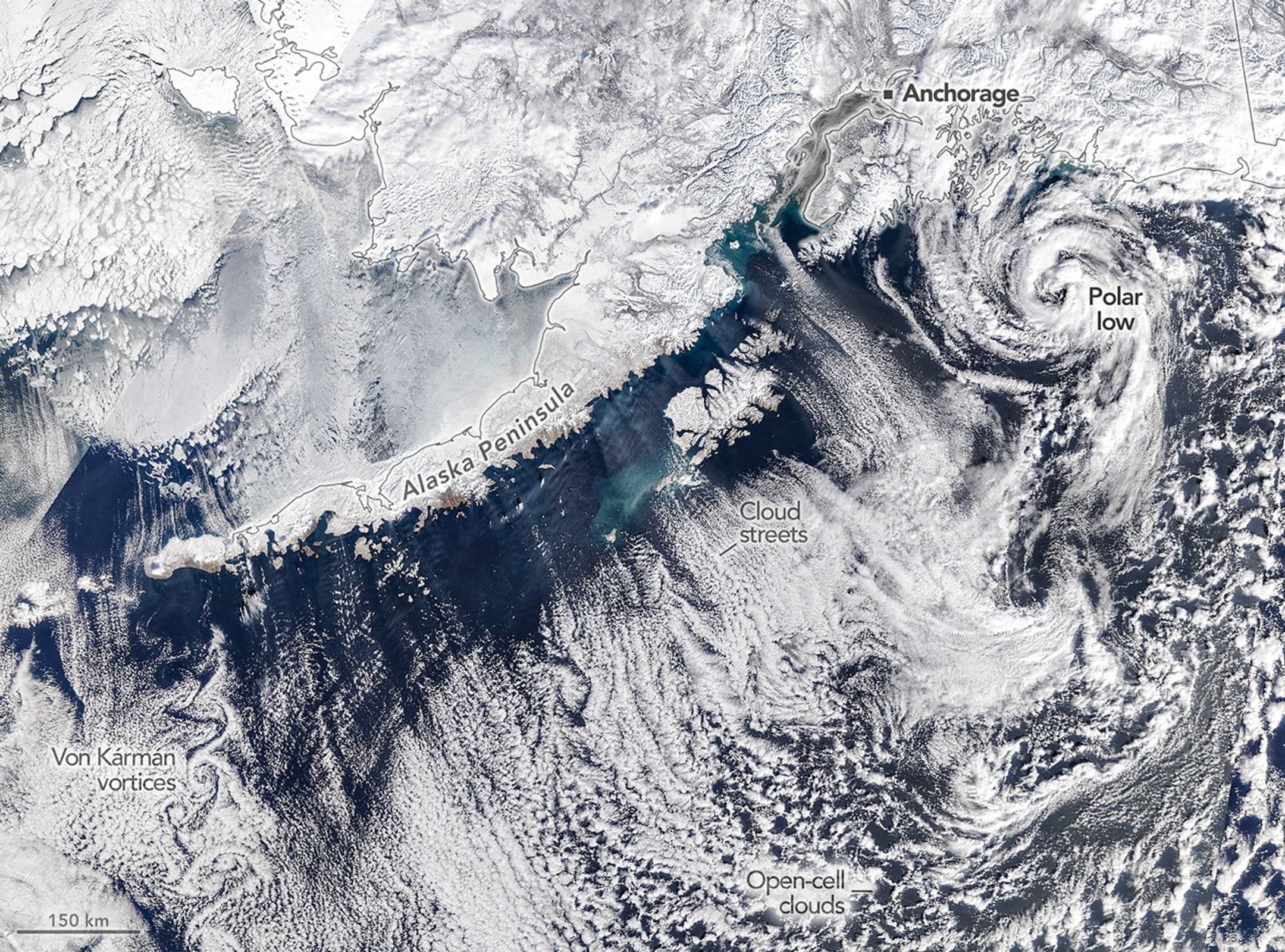
    Off the coast of Alaska, March 19th, 2026 featured a trio of fascinating clouds. Southwest of Anchorage, a cyclonic polar low twisted up from cold polar air centered over warmer waters. This particular storm boasted tropical-storm-force winds and thunderstorms in its center.

    Further west, long cloud streets formed parallel to the wind as cold dry air picked up moisture from warmer polar waters. And, finally, in the bottom left of the image, alternating vortices swirl in the wake of a rocky island, forming a beautiful von Karman vortex street. (Image credit: M. Garrison/NASA Earth Observatory)
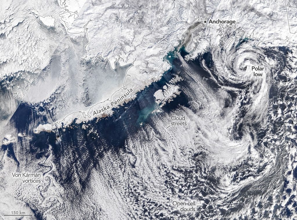
    A trio of atmospheric phenomena appear in this satellite image off Alaska: a polar low, cloud streets, and a von Karman vortex street.

  • Cloud Streets

    Cloud Streets

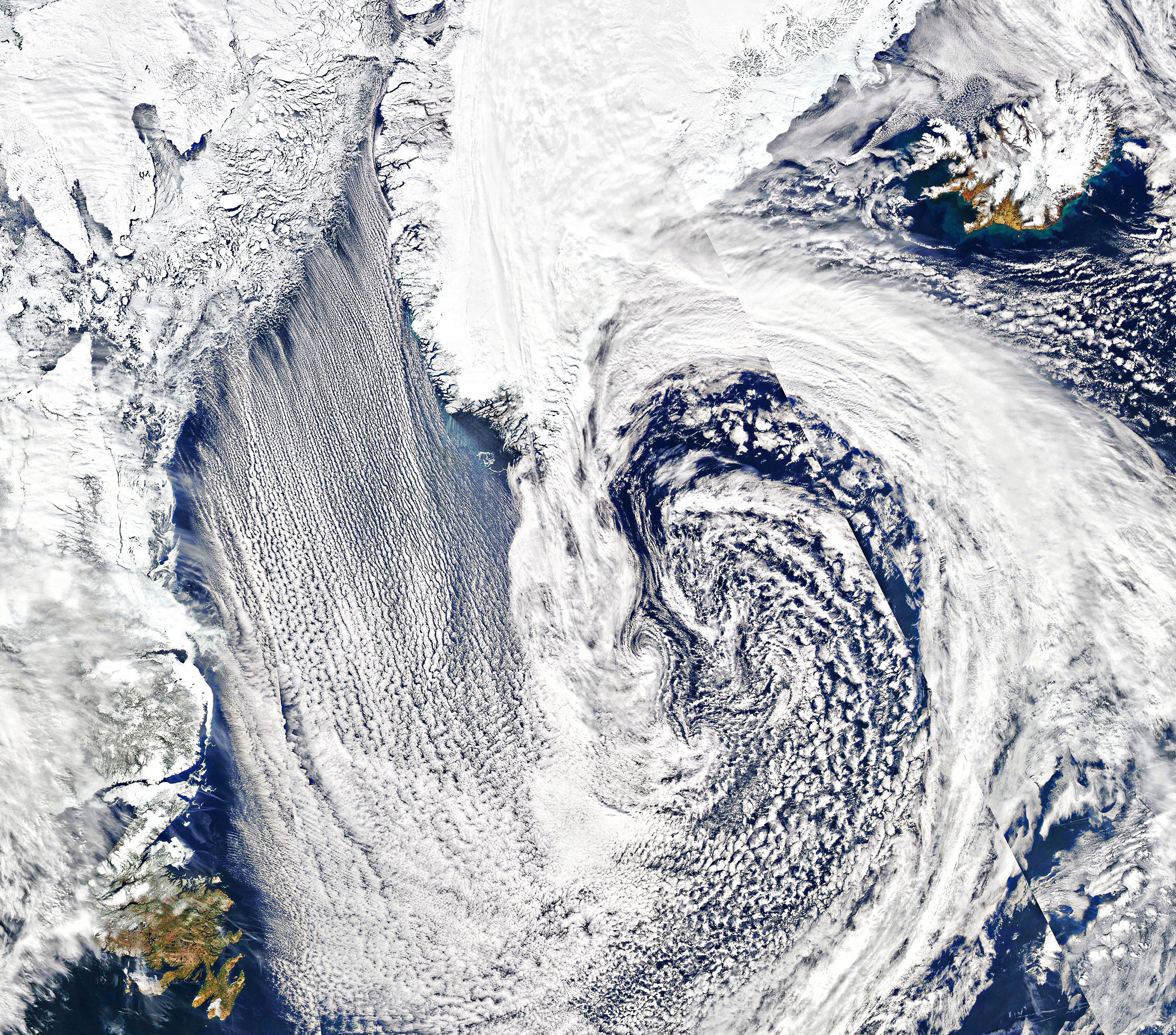
    Parallel lines of cumulus clouds stream over the Labrador Sea in this satellite image. These cloud streets are formed when cold, dry winds blow across comparatively warm waters. As the air warms and moistens over the open water, it rises until it hits a temperature inversion, which forces it to roll to the side, forming parallel cylinders of rotating air. On the rising side of the cylinder, clouds form while skies remain clear where the air is sinking. The result are these long, parallel cloud bands. (Image credit: J. Stevens; via NASA Earth Observatory)

  • Cloud Streets from Space

    Cloud Streets from Space

    Cloud streets flowing south across Bristol Bay hit the Shishaldin and Pavlof volcanoes, which part the air flow into distinctive swirls called von Karman vortex streets. As air flows around the volcano, a vortex is shed first on one side, then the other. Although the usual example for this type of flow is the wake of a cylinder, vortex streets can extend behind any non-aerodynamic body immersed in a flow. The same phenomenon is responsible for the singing of power lines in the wind.  As astronaut Dan Burbank observes, “It’s classic aerodynamics, but on a thousands of miles scale.” (Photo credit: Dan Burbank, NASA)

  • Cloud Streets

    Cloud Streets

    Cloud streets–long rows of counter-rotating air parallel to the ground in the planetary boundary layer–are thought to form as a result of cold air blowing over warm waters while caught beneath a warmer layer of air, a temperature inversion. As moisture evaporates from the warmer water, it creates thermal updrafts that rise through the atmosphere until they hit the temperature inversion. With nowhere to go, the warmer air tends to lose its heat to the surroundings and sink back down, creating a roll-like convective cell. (Photo credits: NASA Terra, NASA Aqua, and Tatiana Gerus)