
The intense heat from wildfires fuels updrafts, lifting smoke and vapor into the atmosphere. As the plume rises, water vapor cools and condenses around particles (including ash particles) to form cloud droplets. Eventually, that creates the billowing clouds we see atop the smoke. These pyrocumulus clouds, like this one over California’s Line fire in early September 2024, can develop further into full thunderstorms, known in this case as pyrocumulonimbus. The storm from this cloud included rain, strong winds, lightning, and hail. Unfortunately, storms like these can generate thousands of lightning strikes, feeding into the wildfire rather than countering it. (Image credit: L. Dauphin; via NASA Earth Observatory)
Tag: pyrocumulonimbus

Stratospheric Effects of Wildfires
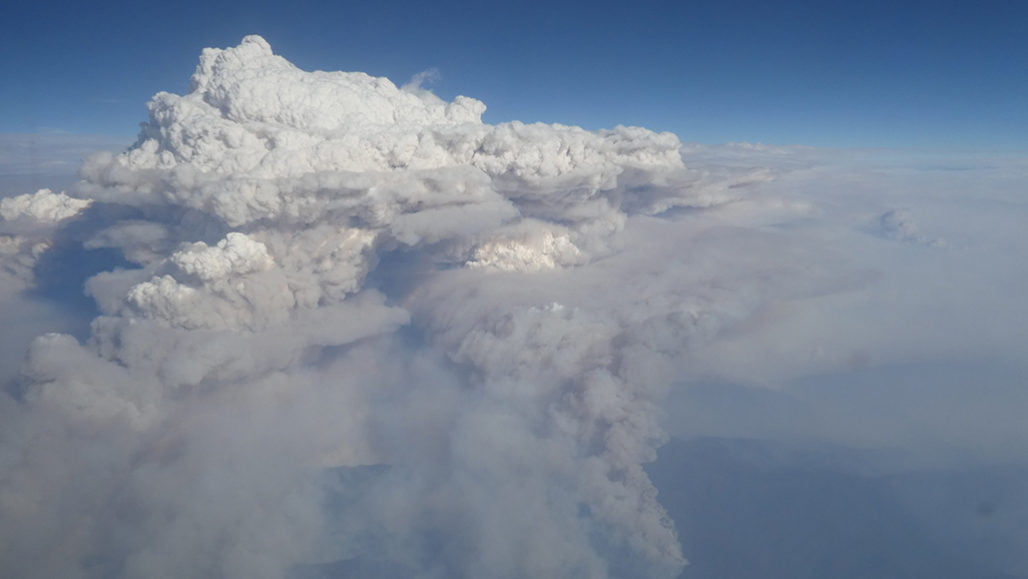
Australia’s bushfires from earlier this year are offering new insights into how pyrocumulonimbus clouds can affect our stratosphere. A massive, uncontrolled blaze between December 29th and January 4th generated a towering, turbulent cloud of smoke like the one shown above.
Using meteorological data, a new study shows this enormous cloud initially rose to 16 km in altitude, then began a months-long trek that circled the globe. The smoke plume ultimately stretched to over 1,000 km wide and reached a record altitude of over 31 km. Inside the plume, concentrations of water vapor and carbon monoxide were several hundred percent higher than normal stratospheric air.
Researchers found the plume extremely slow to dissipate, possibly due to strong rotational winds surrounding it. This is the first time scientists have observed these shielding winds, and work is still underway to determine how and why they formed. (Image credit: M. Macleod/Wikimedia Commons; research credit: G. Kablick III et al.; via Science News; submitted by Kam-Yung Soh)